168 results
Geography posters for Microsoft Word
5th Grade State Report and Poster (Google Slides)
This is a complete packet for 5th grade State Reports. A parent letter is included, as well. Students will use Google Slides to create their report and a hand made poster (directions included) is required.
Grades:
5th
Types:
Features of the Ocean Floor Creative Illustration Activity
Wish I would have thought of this idea years ago because I always had a hard time teaching the features of the ocean floor without it being boring. Hope you enjoy! Did it this year for the first time-loved the results. 11/11/2015
Includes very creative ideas for visuals relevant to each feature of the ocean floor...For example, students may draw NEMO going to touch the "butt" (boat) at the drop off (continental slope)
I have provided several very cool examples for each feature of the ocean fl
Subjects:
Grades:
1st - 6th
Types:
The Water Cycle Worksheet and Answers
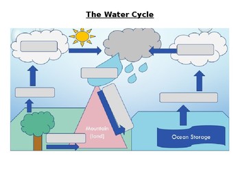
This activity works well when projected onto a whiteboard and writing in the answers together with the class while discussing the purpose of each part of the Water Cycle. Answer sheet is included.
Activity can also be used for assessment of knowledge of the Water Cycle.
Answers sheet can be printed out and used as a poster for the classroom.
Subjects:
Grades:
4th - 12th, Adult Education
Types:

Planning A Road Trip Project
This project requires students to plan a road trip within the United States. It covers many aspects of Geography (using roads, directions, finding attractions, etc.) and requires use of Mathematics for budgeting.
Students will plot out the cities they plan to go to, the hotels they will stay at, the attractions they will visit, and miles driven. They will also write journal entries and create a postcard from one of their cities.
They will use actual prices (computers will be needed for resear
Subjects:
Grades:
7th - 8th
Create Your Own Map! Project & Rubric
In this project students get to become Map Makers! They use their knowledge of Maps to create their own unique map. Included in this product is a "Creating a Map: Rubric", a "Map Brainstorming & Planning Sheet", project directions for students to follow, and photos of students' work to use as a guide/example. This product was made in a Microsoft Word document and is easy to edit in order to meet your individual classroom needs. 5 Essentials of a map include (in no particular order):1. Title
Grades:
4th - 7th
Types:
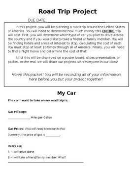
ROAD TRIP PROJECT
This Road Trip Project is meant for middle school math students, but can be changed for younger or older.
In this project, students must choose ten places to stop at around the United States of America. At each stop, they need to go to at least one attraction and stay at a hotel. They need to calculate the cost to visit each location and the cost of travel, keeping in mind the mileage for the vehicle they choose.
This purchase includes a full description of the project, tables for students to
Subjects:
Grades:
5th - 10th
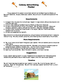
Colonial Region Advertising Poster Project
Need an engaging culminating project for a study of Colonial Regions? This project allows students to present their learning in a creative manner. They present their research on colonial regions by creating an advertising poster for that region. Can be used an a individual or group project. Score sheet is included.
Grades:
5th - 8th
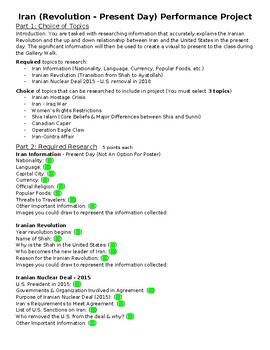
Iran Research Project w/ Poster (Revolution - Present)
Iran research project with poster requirements included. Steps 1-2 are required research. Step 3 has topics for students to choose from to research. Step 4 is the poster requirement. Step 5 is a Gallery walk with questions attached for student feedback.Include examples of finished poster.
Subjects:
Grades:
9th - 10th
Also included in: Geography & History of the World Research Projects (4 Total)
Ancient World History Timeline
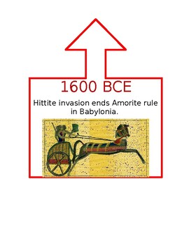
This timeline was created for a 6th Grade Ancient World History class that utilized DBQs as part of instruction. Dates in CE are blue, BCE are red, and when the event spanned both they are purple. An arrow is at the top of the box to help signal where on the line the event took place. I used duct tape to create my line and pinned the events as we learned them during the school year. This was a great visual display for my students and helped them understand how different parts of the world were c
Subjects:
Grades:
5th - 12th
Wall-E Re-Storation Overpopulation Pollution Project - Editable
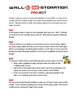
This project was designed to meet part of the C3 framework for Social Studies. After watching the movie Wall-E, and filling out the movie guide, students worked on this project. It is a great way to bring together population, climate change, and environmental sections in World Geography. This document is editable.
Grades:
6th - 8th
Latin Language Project - States' Mottos
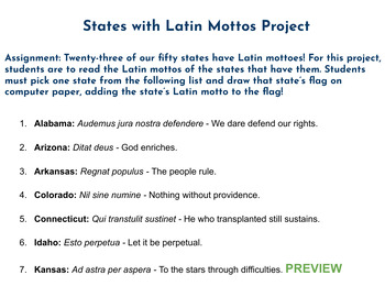
Assignment: Twenty-three of our fifty states have Latin mottoes! For this project, students are to read the Latin mottos of the states that have them. Students must pick one state from the list and draw that state’s flag on computer paper, adding the state’s Latin motto to the flag!This product comes with a downloadable word document with a list of all the states that have Latin mottos. Images of state flags can easily be found online and printed out, if desired. This is a great, fun assignment
Subjects:
Grades:
4th - 8th
AP Human Geography Agriculture Project
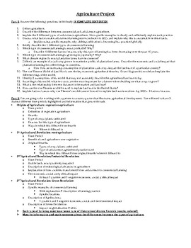
This is a project that aligns with the Agriculture unit of AP Human Geography. This traces the evolution of agriculture through the different time periods, assessing the positives and negatives and specific types of farming included.
Subjects:
Grades:
9th - 12th
Types:
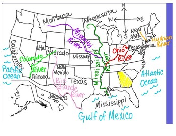
U.S. Rivers and Mountains Map
This is a diagram using a U.S. map with each different U.S. river and mountain range taught in 3rd grade Social Studies labeled and color-coded. The corresponding border states and oceans are labeled as well, along with a compass rose to help practice the important skill of compass directions . This is ideal to project on a Smart Board during a lesson.
Subjects:
Grades:
3rd
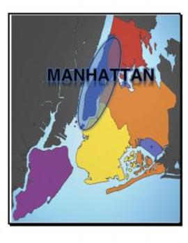
Map, New York, 5 Boroughs
Each page of this document includes a map of NY with a variety of places highlights:
- 5 Boroughs
- Hudson River
- East River
- Atlantic Ocean
Great for labeling student tables for a unit and/or handing out to study maps.
Grades:
K - 12th, Higher Education
Types:
America and Texas Symbols test {large pictures of each included}
This is a test for Texas and American symbos. This includes...
-Test
-Answer Key
-American Symbols enlarged to print out for a poster for American Symbols
-Texas Symbols enlarged to print out for a poster for Texas Symbols
Grades:
1st - 5th
Types:
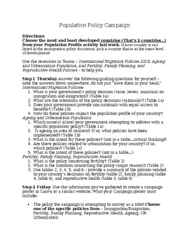
AP Human Geography - Demographics - Population Policy Campaign Poster/Video
Students study population policies of countries and create a campaign poster (or video) using a graphic design tool of their choice (adobe spark, word, etc.). Students used the following resources from the United Nations Department of Economic and Social Affairs to do research: World Population Policies 2019: International Migration PoliciesWorld Population Policies 2019: Population Ageing and Urbanization PoliciesWorld Population Policies 2019: Fertility, Family Planning, and Reproductive Healt
Subjects:
Grades:
9th - 12th
Types:
World History Imperialism Acoustic Poem Project Rubric and example
World History Imperialism Acoustic Poem Project Rubric and 3 student examples that is fully editable.Please email me with any questions at ReadySetLearnSocialScience@yahoo.comIf you would like to get updates on NEW and CURRENT resources...►FOLLOW Me on Teachers Pay Teachers►FOLLOW Me on Pinterest►FOLLOW Me on InstagramTERMS OF USE - This item is a paid digital download from My TPT StoreAs such, it is for use in one classroom only. This item is also bound by copyright laws. Redistributing, editin
Subjects:
Grades:
7th - 11th
Types:
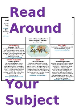
READ AROUND YOUR SUBJECT - Geography
Students are expected to "read around a subject" to help make sense of the topics they are studying in class, keep up-to-date with current information about that subject, and be informed, inspired and challenged to find out more.This poster can guide students to appropriate and useful resources, including books, podcasts, online lectures and even online games.This resource is a word document, therefore, all aspects of the document can be changed to suit your needs.
Subjects:
Grades:
9th - 12th
Types:
Also included in: READ AROUND YOUR SUBJECT
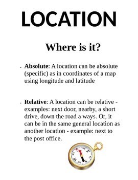
5 Themes of Geography Poster Pack
This product includes five separate posters about the 5 Themes of Geography (Location, Place, Region, Movement, and Human-Environment Interaction) Each poster has a title, definition, and picture for students to use as a resource. Print them on 8.5"x11" paper or cardstock and laminate for yearly use.
Grades:
3rd - 8th
Types:
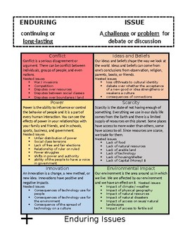
6th Grade Enduring issues poster
This is an enduring issues poster that I created. I feel that these enduring issues (with nested issues included) are perfect for the 6th grade NYS curriculum. This will help your students when they enter high school and need to write an enduring issues essay.
Subjects:
Grades:
6th, Higher Education
Also included in: Enduring issues poster and bookmarks
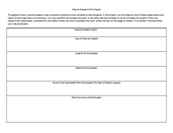
Natural Disasters Mini Project
This short project can typically be completed in one or two days. In it, students research a major natural disaster and complete an informational chart. Once they have completed the chart, they create a "mini-poster" on the back that describes their natural disaster.
Grades:
4th - 12th, Higher Education, Adult Education
Types:
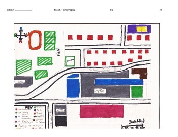
How to Create a Map Project: Activity to Connect Students through Maps
Use the guidelines and the example to help students create maps that tell the story of themselves. Be sure to cover the key terms before you have them create the maps. Their "My Map of Me" project is intended to help them establish connections with other students in class while learning basic map skills such as: using a compass rose to show the cardinal directions, working with scale, and creating and reading map keys. The lesson can be accompanied with a write up that answers the question: "How
Grades:
6th - 9th
Types:

Block Play - Structures from around the world
A great addition to your block play area. The front cover can be left black for children to write their own title or you can use the map of the world. Some notable structures from around the world.
Subjects:
Grades:
Not Grade Specific
Types:
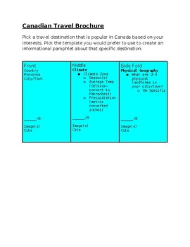
Canadian Travel Brochure
Teaching the themes of geography through activities is a great way to gain knowledge based on student interests. My geography students loved creating brochures/pamphlets to SHOW what they learned throughout the lesson.
Subjects:
Grades:
6th - 12th
Showing 1-24 of 168 results


