45 results
Geography posters for Easel Activities
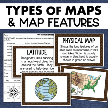
Types of Maps Map Features Skills Geography Posters Social Studies Assessment
Students will learn about different types of maps and common map features with this social studies resource. It includes 17 visuals/posters plus a worksheet/assessment.MAPS POSTERSThese can be kept together as a single page or cut apart into separate cards for display or a matching activity. The top of each card has the title and definition, and the bottom has a full-color illustration. WORKSHEETThis activity requires students to match the types of maps to their purpose, know the function of var
Subjects:
Grades:
3rd - 6th
Types:
Also included in: Geography Landforms & Bodies of Water Types of Maps Map Elements Posters
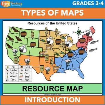
Types of Maps Anchor Charts (Posters), Cards, and Worksheet
Support your map skills unit with anchor charts, cards, and a worksheet. You can project them for instruction, print 8.5 x 11" versions as posters for your classroom bulletin board, or use the smaller set (1/4 page) for activities.Open the preview to take a closer look.Eight maps are included in two sizes. You can use the full-sized pages as anchor charts or posters. The smaller set work well for kids to use in social studies activities.ClimateElevationPhysicalPoliticalResourceRoadWeatherSpecial
Subjects:
Grades:
3rd - 5th
Types:
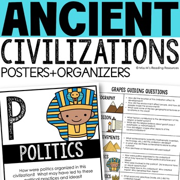
Ancient Civilizations GRAPES Posters Ancient Greece Ancient Rome Ancient China
Help your students learn and organize info about ancient civilizations with these G.R.A.P.E.S. posters, guiding questions, and graphic organizers! The GRAPES Ancient Civilizations Poster and Graphic Organizer Set is an easy acronym to organize information for the basic traits of ancient civilizations. G.R.A.P.E.S. is an acronym for:G- GeographyR- ReligionA- AchievementsP- PoliticsE- EconomicsS- Social StructureGRAPES is an effective way to learn and organize information about different civilizat
Grades:
6th - 8th
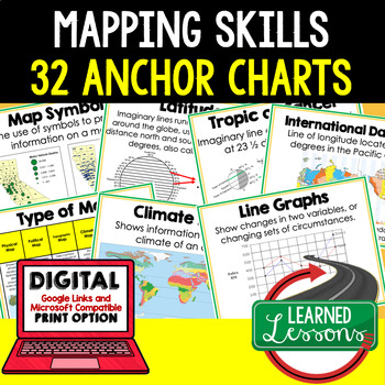
Mapping Skills Anchor Charts (World Geography Anchor Charts), Posters, Google
Mapping Skills Anchor Charts (Great as Bellringers, Word Walls, and Concept Boards), Mapping Skills Posters, Geography Review Pages, Digital Activity via Google Classroom This bundle will take your through the entire Geography curriculum. It will include all components of Geography. This is perfect for traveling around the world in style. THIS IS ALSO PART OF World Geography MEGA BUNDLE, Mapping Skills BUNDLE, Geography ANCHOR CHART BUNDLE Anchor charts are great for representing the topics
Grades:
6th - 12th
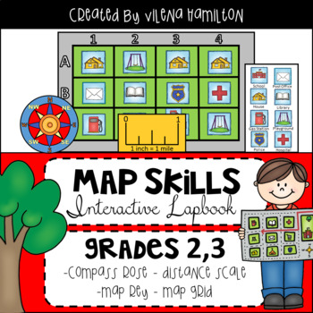
Maps. Map Skills. Compass Rose. Distance Scale. Map Key. Map Grid.
Social Studies Map Skills. Compass Rose. Map Scale. Map Key. Map GridThis resource includes Informational Posters, Lapbook Activities, Quiz, and Answer Keys for everything. Please download the Preview for a better view. Here is what’s included:1) 6 Full Page Lesson Posters:-All About Maps- Types of Maps- Compass Rose- Map Scale- Map Key- Map Grid2) Fun Interactive Lapbook Activities: -Detailed 2-page Lapbook Instructions with photos- Vocabulary: match the words with their definitions - Compass R
Subjects:
Grades:
2nd - 3rd
Types:
Also included in: Social Studies Bundle
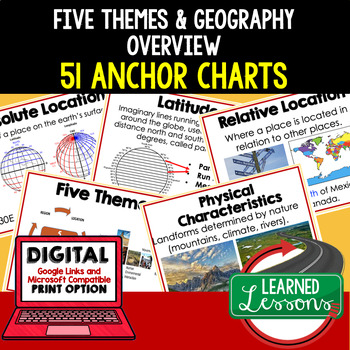
Five Themes of Geography Anchor Charts (World Geography Anchor Charts), Posters
Five Themes and Geography Anchor Charts (Great as Bellringers, Word Walls, and Concept Boards), Five Themes Posters, Geography Review Pages, Google Classroom, Print & Digital Distance Learning This bundle will take your through the entire Geography curriculum. It will include all components of Geography. This is perfect for traveling around the world in style. THIS IS ALSO PART OF World Geography MEGA BUNDLE, Five Themes BUNDLE, Geography ANCHOR CHART BUNDLE Anchor charts are great for
Grades:
6th - 12th
Types:
Geography: Who's The Boss? Comparing World Government Types (Easel Activity)
Students will have a blast with this assignment! As students put their thoughts together to decide which world government types and systems — democracy, direct democracy absolute monarchy, consituational monarchy, oligarchy, etc — work best in various scenarios, they will become familiar with how government systems work. Encourage your students to think outside the box to problem solve and to do their best! Acquiring higher-level thinking skills is a process and a skill that has to be developed
Grades:
6th - 10th
Also included in: NEW! Geography: Types of World Governments Bundle + FREE RESOURCE
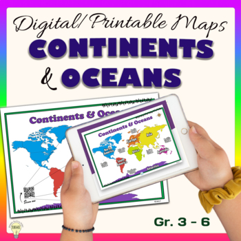
Continents and Oceans World Maps Poster Digital & Printable Handouts+ Boom Cards
"Continents and Oceans" is a set of digital and printable world maps and the individual continent maps: Europe, Asia, Africa, Australia, North America, South America, and Antarctica maps. It is perfect for traditional classroom settings, 1:1 schools, or distance learning in your Science and/ or Social Studies classrooms. These diverse maps are an excellent way to supplement your existing Science and/ or Social Studies curriculum. In no way it is intended or designed to replace it. It is about gi
Subjects:
Grades:
1st - 12th
Types:
Also included in: Social Studies United States Geography US History Growing BUNDLE
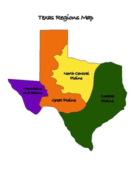
Texas History: Regions of Texas Map
This is a must have resource for teaching the regions of Texas. Great visual aid with multiple uses in your Texas History classroom.Includes:-Map that is colored and labeled-Map that is blank for students to label and/or color-Map that is colored with blanks for students to label, with answer keyMultiple Uses:-Two different worksheet options-Interactive Notebook-PosterPlease leave a review and earn TpT credits ;)
Subjects:
Grades:
4th - 7th
Also included in: Texas History: Regions of Texas Bundle
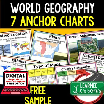
Geography Anchor Charts Sampler Free, World Geography Posters
Geography Free Anchor Charts (Great as Bellringers, Word Walls, and Concept Boards)(Great as Bellringers, Word Walls, and Concept Boards), Mapping Skills Posters, Geography Review Pages, Digital Activity via Google Classroom This bundle will take your through the entire Geography curriculum. It will include all components of Geography. This is perfect for traveling around the world in style. Sign up for email updates and follow me on TPT for updates.Anchor charts are great for representing
Grades:
6th - 12th
Types:
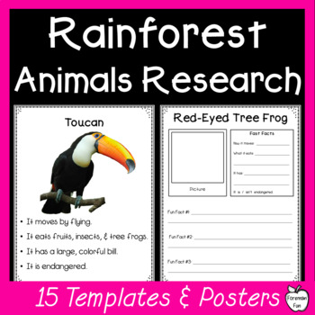
Animal Research Project - Amazon Rainforest Animals - Research Graphic Organizer
Looking for a student-friendly Amazon rainforest animal research project? These easy to follow animal research template sheets and class posters with basic information are perfect for young students. Complete them as a class, in groups, or independently. They are also a fun early finisher or enrichment activity for students during social studies. What's Included: Research report template sheet and information poster for 15 Amazon Rainforest Animals.AnacondaGiant AnteaterBlue Morpho ButterflyCapy
Subjects:
Grades:
1st - 3rd
Types:
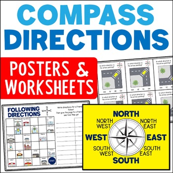
Directional Terms Compass Posters & Ordinal & Cardinal Directions Worksheets
Do your students need help with learning directional terms and following directions? These compass rose posters and ordinal and cardinal directions worksheets included can help! The range of compass direction activities include cut and paste compass roses, task cards, and town map activities. This is a great resource for Grades 2 and 3.Learning about the compass rose and ordinal and cardinal directions is an important skill for students. It opens up the chance for lots of fun and engaging mappin
Subjects:
Grades:
2nd - 4th
CCSS:
Spain A Research Project
26.7.2020As digital activities does not support zip file I have transferred the poster and answer with the preview. I then can list the resource as individual PDF in order to convert it to digital activities.Spain - A research project is a 13 pages study on Spain. Use it as a class test or research project.Download Preview File - Please view Spain preview file prior to purchasing as the preview is all the resources in this pack. Please ensure that the resource is appropriate for your grade level
Grades:
6th - 8th, Adult Education, Staff
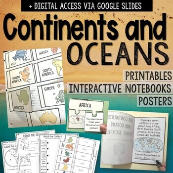
Continents and Oceans Printables, Activities, Interactive Notebooks and Posters
No prep needed for this pack of continents and oceans. Keep your students engaged with these printables, activities, interactive notebook, and posters. Digital access via Google Slides is included. What is included: Labeling the continents and oceans (differentiated versions)Using keys to color and label the map Matching the continent to its factContinents “Research Flaps” Mini Fact Flaps Interactive Notebook Puzzles ActivityContinents Fact worksheetVocabulary Sheet – Words Included: Continent,
Grades:
3rd - 5th
Mexico A Research Project
26.7.2020As digital activities does not support zip file I have transferred the poster and answer with the preview. I then can list the resource as individual PDF in order to convert it to digital activities.Mexico A Research project is a 15 pages study on Mexico . Use it as a class test or research project.Download Preview File - Please view the preview file prior to purchasing as the preview is all the resources in this pack. Please ensure that the resource is appropriate for your grade level
Grades:
5th - 7th
Types:
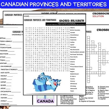
Canadian Provinces and Territories PUZZLE, Word Scramble, Crossword & Wordsearch
❤️️Canadian Provinces and Territories WORKSHEETS , Word Scramble , Crossword & Wordsearch.This comprehensive resource includes a variety of activities like word scramble, crossword, and word search, designed to educate and entertain students about the diverse regions of Canada. From British Columbia to Newfoundland and Labrador, students will unravel the geography, capitals, and unique features of each province and territory. Perfect for classrooms, homeschooling, or anyone interested in Can
Grades:
5th - 8th
Also included in: Canadian History-Geography BUNDLE
India - A Research Project
26.7.2020As digital activities does not support zip file I have transferred the poster and answer with the preview. I then can list the resource as individual PDF in order to convert it to digital activities.India - A research project is a 14 pages study on India. Use it as a class test or research project.Download Preview File - Please view India preview file prior to purchasing as the preview is all the resources in this pack. Please ensure that the resource is appropriate for your grade level
Subjects:
Grades:
6th - 8th, Adult Education, Staff
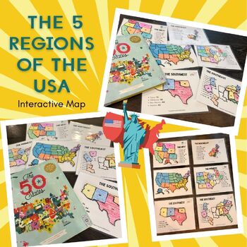
5 Regions of the United States - USA Geography
Embark on a fun-filled geographical journey with our Interactive USA Regions Learning Packet! This engaging resource is designed to help young learners explore the five regions of the United States in a hands-on and memorable way.The packet includes:Detailed regional maps for coloring and labeling. These pages can be used in multiple ways, from simple coloring activities to creating reusable learning tools with laminated pieces and Velcro circles.A comprehensive USA map broken down by regions. C
Subjects:
Grades:
Not Grade Specific
Types:
Indonesia A Research project
26.7.2020As digital activities does not support zip file I have transferred the poster and answer with the preview. I then can list the resource as individual PDF in order to convert it to digital activities.Indonesia - A research project is a 13 pages study on Indonesia. Use it as a class test or research project.Download Preview File - Please view Indonesia preview file prior to purchasing as the preview is all the resources in this pack. Please ensure that the resource is appropriate for your
Subjects:
Grades:
6th - 8th, Adult Education, Staff
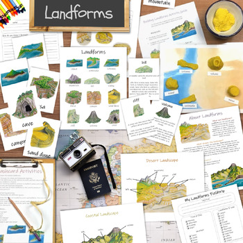
Landforms unit: learning activities for kids, classroom posters, and flashcards
Everything you'll need for your next landforms unit study! You will receive a collection of printable educational resources including posters, three-part Montessori-inspired flashcards, activities, and more! Great for homeschool and mixed-age group classrooms from preschool through elementary school!*** Materials Included ***(26-page PDF file total)Common Landforms poster12 three-part cardsField trip worksheetsFlashcard activities guideCoastal Landscape posterDesert Landscape posterCoastal Lands
Subjects:
Grades:
2nd - 4th
Types:
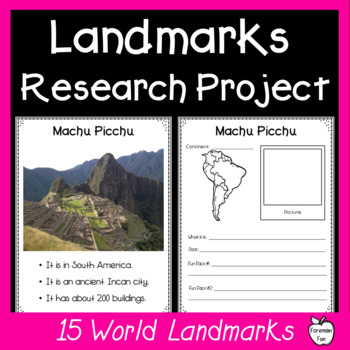
Famous Landmarks Research - World Landmarks Posters - Famous Places Research
Looking for a student-friendly famous world landmarks research project? These easy to follow landmarks research template sheets and class posters with basic information are perfect for young students. Complete them as a class, in groups, or independently. They are also a fun early finisher or enrichment activity for students during social studies. What's Included: Research report template sheet and information poster for 15 world landmarks:Statue of LibertyGolden Gate BridgeChichen ItzaMachu Pic
Subjects:
Grades:
2nd - 4th
Types:
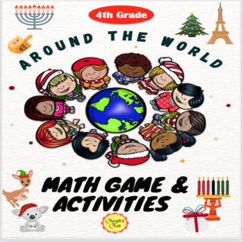
Holidays/ Christmas Around the World Math Task Card Game and Activities for 4th
Engaging and integrated Holiday, Christmas Math Word Problem Task Card Game using 10 countries that span The Western and Eastern Hemispheres. 20 self-checking word problems give students math practice as well as some interesting facts about the country during the winter holiday season. Resource Includes 20 Task Cards in color and bl&wh10 Introductory Cards for each Country in color and bl&whWorld Map Game Board with Game Pieces in color and bl&wh10 Colorful Travel Posters with infor
Grades:
4th - 5th
Types:
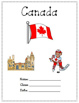
Canada A Research Project
25.7.2020As digital activities does not support zip file I have transferred the poster and answer with the preview. I then can list the resource as individual PDF in order to convert it to digital activities.Canada - A research project is a 17 pages study on Canada. Use it as a class test or research project.Download Preview File - Please view Canada preview file prior to purchasing as the preview is all the resources in this pack. Please ensure that the resource is appropriate for your grade le
Grades:
6th - 8th, Adult Education, Staff
Types:
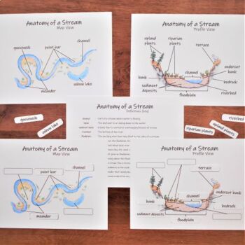
Parts of a Stream: labeled & unlabeled diagrams. River map and profile views
This set includes labeled and unlabeled diagrams of the parts of a stream or river. Diagrams for map and profile views are included. This makes a good activity for studying rivers and streams.Note: this is a subset of materials from my complete Science on the River Unit. Included MaterialsMap view diagram (key)Unlabeled map view diagram Profile view diagram (key)Unlabeled profile view diagramReusable label tilesVocab list with definitionsPlease note→ You are purchasing a PDF download.→ Printing
Subjects:
Grades:
Not Grade Specific
Types:
NGSS:
2-ESS2-2
Showing 1-24 of 45 results


