337 results
Geography laboratories for GATE
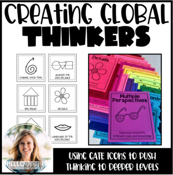
Creating Global Thinkers with Depth and Complexity Icons
Do you want your students learning globally, using higher level thinking, and learning geography... all in twenty minutes a day? I did too so I created this easy way to challenge your students from the moment they walk in the door.This product is easy to print and can be seamlessly implemented into your morning routine. It is recommended that you use the icons of depth and complexity (included) to push and extend student thinking.Included in this product:-Explanation, sample lesson plan, real
Subjects:
Grades:
3rd - 6th
Types:
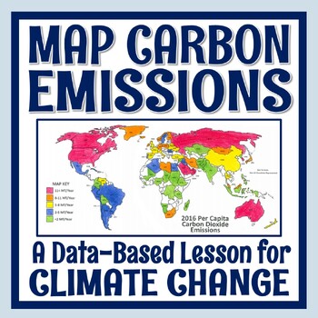
Climate Change Activity Mapping Carbon Emissions NGSS MS-ESS3-5 ESS3-4
Students use real data to color-code a map of 68 countries based on their per capita carbon emissions. In this activity, students will:READ a 1-page article about greenhouse gases, carbon dioxide, what per capita means, and the activity directions. CONSTRUCT a World Map by attaching 2 provided pages (it's easy!).COLOR CODE countries on the map according to their per capita carbon emissions. ANSWER 11 analysis questions focusing on the greenhouse effect, sources of carbon emissions, and how de
Subjects:
Grades:
7th - 10th
Types:
NGSS:
MS-ESS3-5
, MS-ESS3-4
, HS-ESS3-5
, HS-ESS3-4
Also included in: Global Warming Climate Change Activity Bundle NGSS MS-ESS3-5 ESS3-4
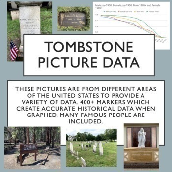
Tombstone Pictures for Cemetery Lab. Human Population Studies
This google drive contains a curated collection of original pictures of 400+ grave markers including some famous people in history, movies and music. I developed this collection over several months of travel. Students will discover historically accurate trends from this data about survivorship for people born before 1900 and after 1900. I have carefully created the collection to provide interest for students and also good data for students to discover trends through inquiry. Use these pictures w
Subjects:
Grades:
9th - 12th, Higher Education
Types:
Also included in: AP Environmental Science Unit 3 Bundle
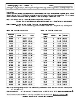
Ocean Currents - Rescue Lab Activity
Ocean Currents - Rescue Lab Activity
This is a fun little Latitude/Longitude Ocean Current activity.
Students plot the path of 2 current buoys to determine the location of a lost ship crew in the Indian Ocean.
This is a crossover science activity - Oceanography - Geography - Graphing.
Usually takes between 30 - 40 minutes.
-----------------------------------------------------------------------------
Other GES Ocean Activity
Ocean Current Introduction
Subjects:
Grades:
6th - 9th
Types:
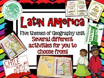
Latin America (Mexico, Central/South America) Geography Research Unit
This Latin America unit includes:
Several different activities/project layouts for you to chose from or use all! :)
As you teach about the geography of Latin America and all the countries in it, use these in their interactive notebooks!
Perfect for students to research and discover information about all of Latin America or just a country there on their own!
GREAT mini research project for GT students or early finishers to work on!
Grades:
2nd - 8th
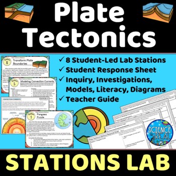
Plate Tectonics Lab Stations - Student-Led Stations Lab
⭐ ⭐ ⭐ ⭐ Student-led lab stations are a great way to get your kids moving and interacting with content in a variety of fun ways! Students will learn, interact, investigate, analyze, and engage with plate tectonics and continental drift! These eight stations focus on plate tectonics, convection currents, sea-floor spreading, continental drift, plate boundaries, types of crust, and tectonic plates. All stations are neatly presented, have easy to understand directions, and require minimal prep from
Subjects:
Grades:
8th - 12th
Types:
NGSS:
MS-ESS2-3
, HS-ESS2-3
, HS-ESS2-1
, MS-ESS2-2
, HS-ESS1-5
Also included in: Earth Science Stations Labs Growing Discount Bundle
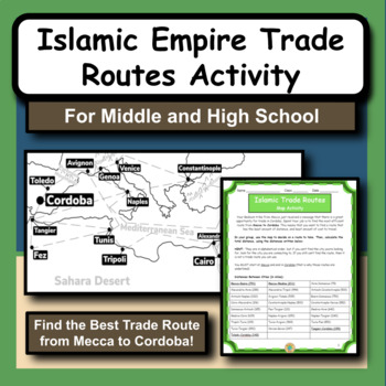
Islamic Empire Trade Routes Map Activity for Social Studies and History
The Islamic Empire is arguably one of the most prominent and influential times of history in the Middle East. As we study the Islamic culture and the rise of the empire, we notice that geography has a huge role in many different aspects.This product gives students the opportunity to practice map and math skills as they try to figure out the best trade route to take from Mecca to Cordoba, Spain. Their goal is to spend the least amount of money possible. The provided maps have all the city locatio
Subjects:
Grades:
5th - 12th
Types:
Also included in: Social Studies and History Large Bundle of 20 Activities and Worksheets
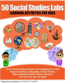
50 Social Studies Labs - Geography History Cultural Studies Economics Government
PREVIEW AVAILABLE!LIKE WHAT YOU SEE? CHECK OUT OTHER STEM RESOURCES IN MY SHOP!FROM THE CREATOR OF 50 STEM LABS & 50 MORE STEM LABS comes this collection of 50 Social Studies Activities for kids. Recommended for grades K to 6 and up! Each one has a snappy title, a brief set of instructions, recommended materials list, and space for notes. These are very adjustable for your classroom, home, or homeschool needs. Do projects for concepts like: Geography, Cultural Studies, Economics, History, G
Grades:
K - 8th
Types:
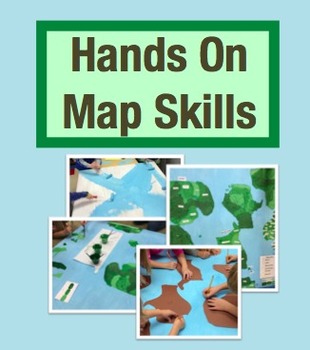
Hands On Map Skills: Cross Curricular Project to Teach Map Skills (Grades 2-4)
Tired of using worksheets to teach map skills? I used worksheets for years but something didn't feel right. I knew my students weren't learning map skills deeply when I was teaching this way. That was when the Hands on Map Skills project was born!
This is a social studies project that has cross-curricular connections to reading and math. In this project students use real maps to study their important features, all while refining their map skills. Then they get the chance to put all of this kno
Grades:
2nd - 4th
Travel Agent Research Project | No Prep | Digital & Printable
This open-ended research project turns students into travel agents as they plan a trip! They will conduct research and select a destination, then use the internet to figure out flights, hotels, activities, and more! Students will also use addition, and maybe a bit of multiplication, to determine the total cost of their trip!This Resource Includes:Digital PowerPoint VersionDigital Google Slides VersionPrintable Black & White PDF VersionCompleted in 6 Steps!1. Location Research2. Select a Loca
Subjects:
Grades:
4th - 6th
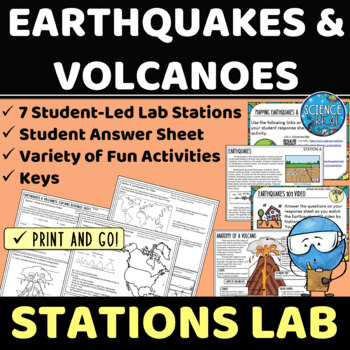
Earthquakes and Volcanoes Lab Stations
⭐ ⭐ ⭐ ⭐ Student-led lab stations are a great way to get your kids moving and interacting with content in a variety of fun and engaging ways! Students will learn, interact, and engage with new content of earthquakes and volcanoes! These seven stations focus on volcanic and earthquake activity, parts of a volcano and earthquake, seismic waves, types of volcanoes, mapping volcanoes and earthquakes, and more! All stations are neatly presented, have easy to understand directions, and require minimal
Subjects:
Grades:
8th - 12th
Types:
NGSS:
MS-ESS3-2
, HS-ESS2-1
Also included in: Earth Science Stations Labs Growing Discount Bundle
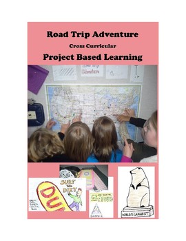
Road Trip Adventure PROJECT BASED LEARNING for GATE and 3rd - 8th Grades
Come along on a fun project-based adventure as students practice different forms of writing, geography skills, computer and internet technology skills, engineering and design skills, math skills, public speaking, creativity, and art.
Here is your Gold Medal Standard project based learning unit ready to go. Because this project-based unit relies heavily on student creativity and invention, the key knowledge, understanding, and success skills can be scaffolded across many grade levels. This un
Grades:
3rd - 8th
Types:
Also included in: SIMULATIONS Real-World Projects GATE Bundle Gifted
Glacial Erosion and Deposition | Digital & Editable Lab Activity | NGSS
In this Google Slides™ digital lab activity, the students will explore the effects of glaciers on landscapes. They will learn about the characteristic erosional and depositional landforms formed by glaciers such as striations on the bedrock, U-shaped valleys, drumlins, glacial erratics, finger lakes, moraines, kettle lakes, and outwash plains. This resource focuses on evidence of glacier erosion and deposition in New York State. This is an interactive lab activity with drag & drop features,
Subjects:
Grades:
8th - 10th
Types:
CCSS:
NGSS:
MS-ESS2-2
, HS-ESS2-2
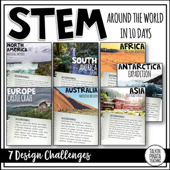
STEM Around the World in 10 Days
This product is included in a bundle with an Around the World in 10 Days Travel Journal. Check it out HERE!
Looking for an engaging way to teach geography? Why not have students solve a STEM challenge that relates to each continent? There is STEM challenge for each of the 7 continents in this product.
This product includes:
•STEM Challenge Background information pages
•STEM Challenge Problem pages
•STEM Challenge Criteria & Materials pages
•Student STEM journal pages (Includes background i
Subjects:
Grades:
1st - 4th
Types:
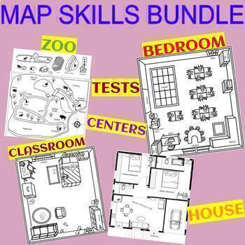
MAP SKILLS BUNDLE - CLASSROOM, BEDROOM, HOUSE, ZOO, TEST, AND CENTER
These are engaging and fun projects to teach basic mapping skills. The students learn how to use a compass, place objects using the four cardinal directions, and follow multi-step directions. Describe the location of objects relative to other locations in the classroom. (Over, near, far, left, right, north, south, east, west).- Students create an interactive house map placing pictures of the house furniture on the assigned spots. Or/and they create their own house!- Blank map for your own additi
Subjects:
Grades:
1st - 4th
Types:
Mapping Earth & Landforms Unit Bundle | Printable, Digital & Editable Components
Save 40% by purchasing ALL my Mapping Earth teaching materials!Important Notes:• Download a FREE Unit Bundle to learn more about all my products.• Save $$$ with the Earth Science Complete Curriculum• Save $$$$ with the Integrated Science Complete Curriculum• Consider Daily Lessons as an economical alternative to this unit bundle (see below)• This product includes FREE downloads of ALL future Mapping Earth products.**********************************************************************************
Subjects:
Grades:
3rd - 9th
Types:
NGSS:
4-ESS2-2
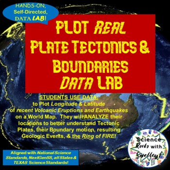
Plate Tectonics & Boundaries PLOT real Earthquakes & Volcanoes DATA LAB
This DATA LAB connects Plate Tectonics and Boundary motion to the ACTUAL Geologic Events they cause-- especially around the Ring of Fire, or Pacific Plate! Students can LABEL the Major PLATES on a World MAP (or Differentiate for ESL/Special Needs students by giving them the MAP with the Plates already labeled- several Included for YOU!) Then, PLOT 18 Latitude & Longitude Points of recent Earthquakes in one color and 18 significant Volcanic Eruptions in another color. They can then-- Color Co
Subjects:
Grades:
5th - 8th
NGSS:
MS-ESS2-2
BUNDLE Around the World in 10 Days {STEM & Target Book}
Looking for an engaging way to teach geography and letter writing? Go cross-curricular and teach both simultaneously! Students start by 'Packing up their questions' about geography by creating an anchor chart with their teacher. Then model letter writing skills and off you go! Spend one day in each of the continents and complete a STEM Challenge! On the last day of your travels create a world map to document your experience!
This product is a BUNDLE, which is at a discounted price! These are th
Subjects:
Grades:
1st - 4th
Types:
Plate Tectonics 5E Unit Plan - Secondary Science
⭐ ⭐ ⭐ ⭐ Save over 30% off! After completing this 5E Plate Tectonics unit, students will be able to describe and demonstrate how plate tectonics causes major geologic features such as volcanoes, mid-ocean ridges, trenches, and mountains, types of plate boundaries, and how convection currents move and shape the lithosphere. This lesson plan follows the 5E method: Engagement, Exploration, Explanation, Elaboration, and Evaluation, and facilitates student-led learning with minimal prep time. This uni
Subjects:
Grades:
8th - 12th
Types:
NGSS:
HS-ESS2-3
, HS-ESS2-1
, MS-ESS2-2
, HS-ESS1-5
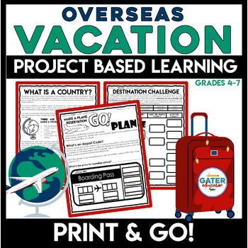
Life Skills | Plan a Vacation PBL | Project Based Learning
This PROJECT-BASED LEARNING resource is a great way to have students use real-life reading and writing skills as they plan their own overseas vacation.In this unit, students will have the opportunity to plan a trip and persuade others to join along and make memories with them!This is an easy and enriching End of Year Project. Grab basic materials, PRINT, and GO!What's the challenge? Students must find and research a foreign city to travel to. The exciting twist is that the city must start with t
Subjects:
Grades:
4th - 7th
Types:
Also included in: Project Based Learning | Design Process | Life Skills Travel Planning
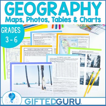
Geography Activities Geographer's Tools Upper Elementary Social Studies
Looking for an engaging upper-elementary geography lesson? This resource is chock-full of activities you can use to teach the geographer's tools of maps, tables, photographs, and charts! You'll get four activities that explore the different tools geographers use to organize geographic information. You'll love the quality graphics and original articles. Your students will love how interesting geography can be!You'll get four low-prep activities that can be used together or individually. Each acti
Subjects:
Grades:
3rd - 6th
Types:
Also included in: Geography Lessons and Activities | Critical and Creative Thinking BUNDLE
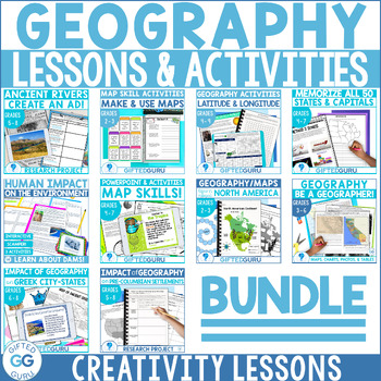
Geography Lessons and Activities | Critical and Creative Thinking BUNDLE
If you're looking for fabulous lesson plans about many aspects of geography, this bundle is for you! They're the perfect way to build geography skills, critical thinking skills, and creativity skills, all at once! You'll love the super high quality graphics, original articles, and the super clear teacher instructions for every single lesson.Ten different lessons/activities are included, and all of them align with National Geography Standards. Every resource has more than one activity, so this is
Subjects:
Grades:
2nd - 9th
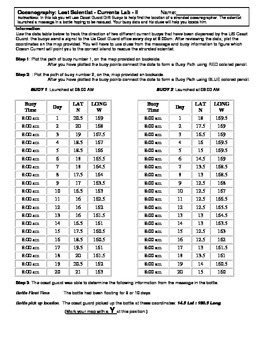
Ocean Currents - Lost Scientist - Current Lab II
Ocean Currents - Lost Scientist - Current Lab II
Updated 5-5-16
This is a fun little Latitude/Longitude Ocean Current activity.
Students plot the path of 2 current buoys to determine the location of a lost scientist in the Pacific Ocean.
This is a crossover science activity - Oceanography - Geography - Graphing.
Usually takes between 30 - 40 minutes.
This activity is similar to "Ocean Currents - Rescue Lab Activity"
-Seen Here-
Subjects:
Grades:
6th - 9th
Types:
Travel Agent Project- A Geography PBL
Incorporate authentic learning into your classroom by having your students complete this PBL as you teach geography content for your state or country. The project is organized around the central question: How can you as a travel agent plan a trip to a state or country for a family?
Students will plan a trip with stops in different regions or cities, mark their trip on a map, keep within a budget, and create a persuasive presentation to share their plan. They will not only practice geography con
Subjects:
Grades:
3rd - 8th
Showing 1-24 of 337 results


