
Glacial Erosion and Deposition | Digital & Editable Lab Activity | NGSS


- PDF
- Google Apps™

What educators are saying
Also included in
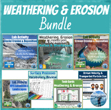 This 3-week-long weathering, erosion & deposition bundle covers everything your students need to know about physical & chemical weathering, rates of weathering, soil formation, erosional & depositional features formed by gravity, wind, waves, glaciers & streams, landscape formation,Price $34.00Original Price $42.50Save $8.50
 These digital Earth and Space Science lab activities are ideal for topics where hands-on lab activities may be difficult to complete. They are aligned with NGSS and the New York State (NYS) Earth Science curriculum to prepare the students for the Regents exam. All the labs are editable and interactiPrice $43.50Original Price $57.50Save $14.00
Description
In this Google Slides™ digital lab activity, the students will explore the effects of glaciers on landscapes. They will learn about the characteristic erosional and depositional landforms formed by glaciers such as striations on the bedrock, U-shaped valleys, drumlins, glacial erratics, finger lakes, moraines, kettle lakes, and outwash plains. This resource focuses on evidence of glacier erosion and deposition in New York State. This is an interactive lab activity with drag & drop features, videos, maps, and Regents questions. The key is included.
NYS teachers: The students will practice using page 2 of the Earth Science Reference Tables (ESRT).
ESL Strategies: This lab activity is scaffolded for English Language Learners (ELLs):
- Each slide contains a “Translate” hyperlink button to translate the text into any language supported by Google Translate.
- It includes sentence starters to help ELLs structure their answers. The document is editable so you can remove the sentence starters if your students don’t need them.
- The videos are available in English and Spanish to help the ELLs understand the concepts and build background knowledge.
Editable: You can edit this lab activity by clicking on “View” → “Theme Builder”.
Digital: This digital lab activity was created with Google Slide™. It can be used in person or for distance learning. Share the Google Slides with your students via your Google Classroom. Make sure you select “Make a Copy for Each Student” while you are creating the assignment.
Standards: The level of this lab is perfect for 8th grade or high school. This lab activity aligns with:
- NGSS MS-ESS2-2: Construct an explanation based on evidence for how geoscience processes have changed Earth’s surface at varying temporal and spatial scales.
- New York State Physical Setting/Earth Science Earth Science Core Curriculum:
- 2.1t – Natural agents of erosion, generally driven by gravity, remove, transport, and deposit weathered rock particles. Each agent of erosion produces distinctive changes in the material that it transports and creates characteristic surface features and landscapes. In certain erosional situations, loss of property, personal injury, and loss of life can be reduced by effective emergency preparedness.
- 2.1u – The natural agents of erosion include: Streams (running water): Gradient, discharge, and channel shape influence a stream’s velocity and the erosion and deposition of sediments. Stream features include V-shaped valleys, deltas, flood plains, and meanders.
- 2.1v – Patterns of deposition result from a loss of energy within the transporting system and are influenced by the size, shape, and density of the transported particles. Sediment deposits may be sorted or unsorted.
- NYS Regents Skills/Content: The students will use the “Generalized Landscape Regions of New York State” map on ESRT page #2.
⭐ My store is new, follow me for notifications about new digital and interactive activities that will be coming soon! ⭐
You may also like the Stream Erosion and Deposition digital lab activity.
