185 results
Geography assessment images
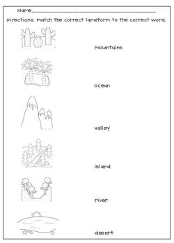
Landforms Matching Worksheet
My Landforms worksheet goes along with the Landform picture cards. After studying and learning about the cards, this is a great way to see if your students grasped the concept, a good formative assessment.
Thank you to Scrappin Doodles for the adorable clipart.
Subjects:
Grades:
K - 6th
Types:
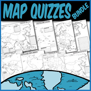
*QUIZZES BUNDLE* Political Maps **Coloring Book Quiz Series**
**MAP QUIZZES**Included:Africa Map QuizAsia Map QuizEast Asia Map QuizWestern Asia Map QuizEurope Map QuizN. America/C. America Map QuizS. America Map QuizOceania Map QuizThese blank political map quizzes are ready for students to label. Each independent country is labeled with a letter than corresponds to a blank space.These are particularly great for AP Human Geography, AP European History, AP World History, any social science, or physical science course.The formats are .PNG to allow for you t
Grades:
Not Grade Specific
Types:
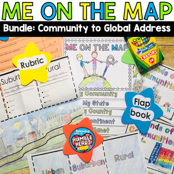
Me on the Map Bundle: 3 Kinds of Communities to Global Address
Intorduce Social Studies and Map Skills to your students as they learn about community in the classroom and in your town and move on their global address. First, teach your students about urban, suburban, and rural communities with this engaging flap book. Students will use the road in the flap book to create a map that begins in an urban community and continues through the suburbs before winding out to a rural community. Students will define and list 3 characteristics of each kind of community
Subjects:
Grades:
1st - 3rd
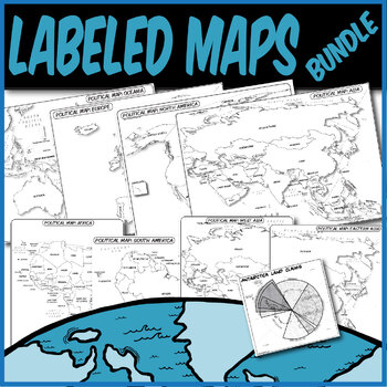
*LABELED POLITICAL MAP BUNDLE* **Coloring Book Series**
**LABELED MAPS**Included:Labeled Africa Map Labeled Asia Map Labeled East Asia Map Labeled Western Asia Map Labeled Europe Map Labeled N. America/C. America Map Labeled S. America Map Labeled Oceania Map Labeled Antarctica Claims MapThese labeled political maps are ready for students to use. Each independent country and state is pre-labeled. Students can use these to create choropleth maps, practice rote memorization, or annotate along with your lecture.These are particularly great for AP Human
Grades:
Not Grade Specific
Types:
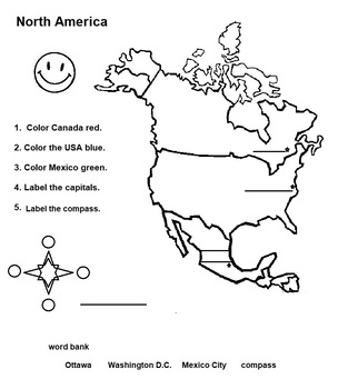
North America Map of Countries with Capitals and Flags
Great activity for younger learns who are studying the countries, capitals and flags of North America.
Subjects:
Grades:
1st - 3rd
Types:
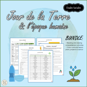
Jour de la Terre & l'époque humaine | Earth Day, Climate change
Jour de la Terre or Earth Day is April 22! Have you thought about what you would like to do with your students? This BUNDLE is full of cross-curricular lessons and projects en français! Using visual art, we can raise awareness about climate change, learn about what communities around the world are doing to live greener lives, and to make a difference in the world!Students will use digital media to make a poster, take photographs, and to watch films on human activities and their impacts on our pl
Subjects:
Grades:
6th - 12th
Types:
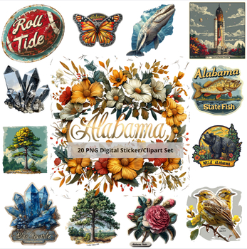
Diverse Alabama: 30-Image Clip Art Set
Product Description:Dive into the heart of Alabama with our meticulously curated 30-image clip art set, "Diverse Alabama." This collection is a vibrant celebration of Alabama's rich cultural heritage, natural beauty, and iconic symbols. Each image has been thoughtfully designed to reflect the unique spirit and charm of Alabama, making this set an invaluable resource for educators, scrapbookers, and sticker enthusiasts alike.What’s Included:A total of 30 high-quality PNG images with transparent b
Subjects:
Grades:
Not Grade Specific
Types:
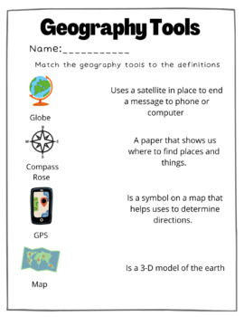
Geography Tools Matching Worksheet
This is a great resource to teach or check for understanding. Students will match the geography tools to the correct definition. I absolutely loved utilizing this resource to first teach andthen assess to check for understanding!
Grades:
Not Grade Specific
Types:
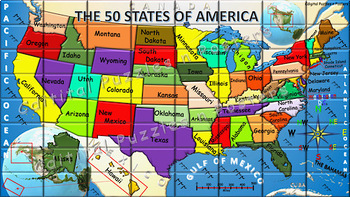
The 50 States of America Puzzle Bundle
In this bundle is the Student Version of the puzzle, the Teacher Version of the puzzle with added instructions, and Puzzle questions for the completed puzzle. *To see other bundles: https://www.teacherspayteachers.com/My-Products/Type:Bundle How to video is included On Slide 5 of All Puzzles as a link. To preview click link below.https://www.loom.com/share/4d4d431a7435488b9bc89c8c38bbb00f?sid=b7220b0a-fe7f-4272-bb22-95be40c197eb Are you looking for a fun way to use and create maps on the comp
Grades:
Not Grade Specific
Types:
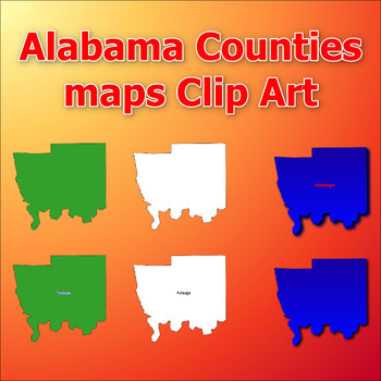
Maps of Alabama Counties Clip Art map Color, Black and White Commercial Use
Click Here>>> click here to subscribe to our storeThis comprehensive collection of clip art gives you the opportunity to discover and add engaging and informative visual elements to your projects. With a total of 403 clip arts, you'll receive 6 choices for each of the all counties in the state of Alabama. Each clip art is in PNG format with a transparent background, giving you the flexibility to easily integrate them into custom designs or educational materials.Color and black and white
Subjects:
Grades:
Not Grade Specific
Types:
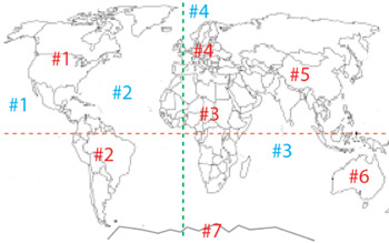
Blank World Map - identify continents, oceans, equator and prime meridian
This can be used for assignments or as part of an assessment.
Subjects:
Grades:
K - 7th
Types:
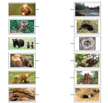
Match the animal with the shelter / nest in which it lives
Draw arrows and match the animals with the shelter in which they live. In the left column are represented the animals, and in the right column their shelters. Correctly matches the 2 columns by drawing arrows from the right column to the left column.
Subjects:
Grades:
PreK - 5th
Types:
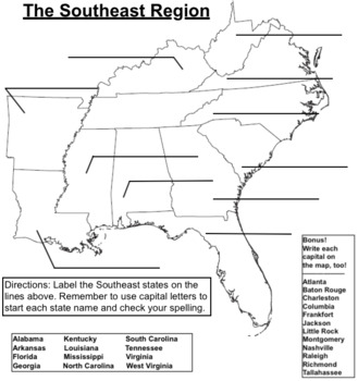
Southeast Region Blank Map - Label the States
Use this blank map for practice or assessment of the 12 Southeast states. As a bonus, have students label the capitals as well.I have one map for each of the five regions listed on TpT: NE, SE, MW, SW, W.
Subjects:
Grades:
3rd - 6th
Types:
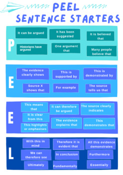
PEEL Paragraph Sentence Starters
Are you teaching PEEL in your classroom? Do your students struggle to get things started? This is the poster for you! It will guide students on how to begin each sentence, the point, the evidence, the explanation and the link. Great colours and accessible language!
Subjects:
Grades:
5th - 12th, Higher Education, Staff
Types:

Russia and Ukraine Notes and Quiz
Learn and quiz the importance of geography in the Russia and Ukraine conflictResourcesPortsTradeAgricultureIndustry NATOAll have a part
Grades:
9th - 12th
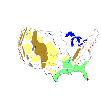
Blind map of the United States with rivers, cities and relief units
Blind map of the United States with rivers, cities and relief unitsStudents will need to complete this map with the correct names. They will complete the names of rivers, cities and relief units. They can also be helped by the school atlas with the map of the United States
Subjects:
Grades:
5th - 12th
Types:
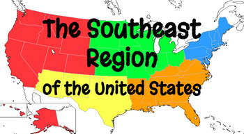
Southeast Region Google Form Quiz Bundle
In this bundle you will find the 25 question Google Form Southeast Region States & Postal Codes quiz. This form is the location and postal codes (abbreviations) for all the Southeast states. The 20 question All About the Southeast Google Form quiz is all the features of the Southeast Region, including Land/Water, Climate, Products/Natural Resources, Landmarks, and Culture sections are all covered in this Google form. Finally, the Southeast Region States & Capitals 12 question Google Form
Grades:
3rd - 6th
Types:
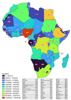
The Africa map classified by the number of inhabitants of the countries
The Africa map classified by the number of inhabitants of the countriesThis download contains files that may be printed and copied or used digitally.World City MapsBooksPinterestInstagramFacebookTikToK
Subjects:
Grades:
5th - 12th, Higher Education
Types:
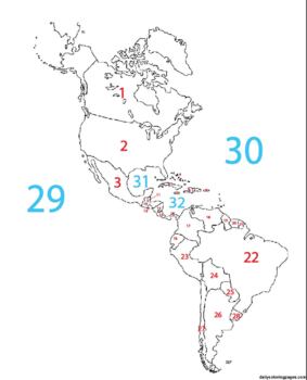
Blank Western Hemisphere Map with #'s for countries and major bodies of water
This map can be used as part of a digital assignment or can be used as an assessment where students have to identify the name of the place being identified by number.
Subjects:
Grades:
4th - 9th
Types:
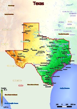
Physical map of Texas with mountains, plains, bridges, rivers, lakes, mountains,
Physical map of Texas with mountains, plains, bridges, rivers, lakes, mountains, citiesThis download contains files that may be printed and copied or used digitally.World City MapsBooksPinterestInstagramFacebookTikToK
Subjects:
Grades:
5th - 11th, Higher Education, Adult Education
Types:
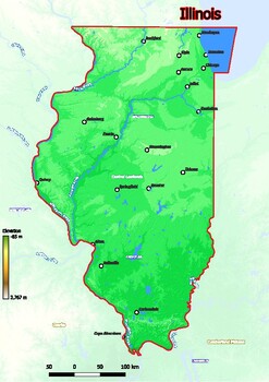
Physical map of Illinois with mountains, plains, bridges, rivers, lakes, mountai
Physical map of Illinois with mountains, plains, bridges, rivers, lakes, mountains, citiesThis download contains files that may be printed and copied or used digitally.World City MapsBooksPinterestInstagramFacebookTikToK
Subjects:
Grades:
5th - 12th, Higher Education, Adult Education
Types:
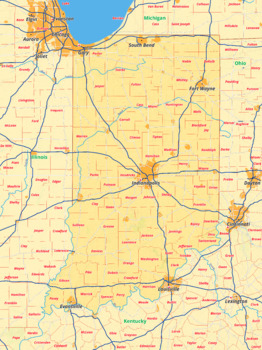
Indiana map with cities township counties rivers roads labeled
Indiana map with cities township counties rivers roads labeledThis download contains files that may be printed and copied or used digitally.___________________________________________________________________World City MapsBooksPinterestInstagramFacebookTikToK
Grades:
5th - 12th, Higher Education
Types:
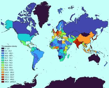
World map with countries classified by population density
World map with countries classified by population densityThis download contains files that may be printed and copied or used digitally.World City MapsBooksPinterestInstagramFacebookTikToK
Subjects:
Grades:
3rd - 12th, Higher Education
Types:
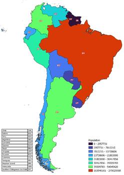
The South America map classified by the number of inhabitants of the countries
The South America map classified by the number of inhabitants of the countriesThis download contains files that may be printed and copied or used digitally.World City MapsBooksPinterestInstagramFacebookTikToK
Subjects:
Grades:
5th - 12th, Higher Education
Types:
Showing 1-24 of 185 results


