24 results
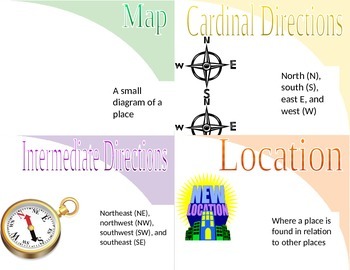
Geography word wall images
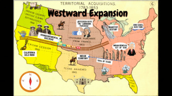
Westward Expansion Visualizer GIF
GIF (moving animated picture) showcasing major topics during the Westward Expansion unit. Based on NYS Social Studies standards, topics in GIF include Gold Rush, Indian Removal Act, Trail of Tears, Transcontinental Railroad, Louisiana Purchase, Erie Canal, and Manifest Destiny.Totally FREE for YOU!
Grades:
5th - 12th
Types:
CCSS:
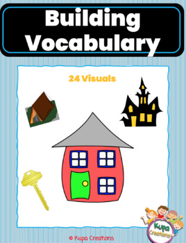
Creative Curriculum Buildings Study Vocbulary Pictures
This is part of the Buildings Bundle. 24 building theme vocabulary pictures:tentcastleiglootree housemetalhaunted housecavefire departmentstrawdoor knoblog cabinkeycircus tenthousedoghouseskyscraperstadiumtee-peebricksbarnfireplacelogsgingerbread housecity
Subjects:
Grades:
PreK - K
Types:
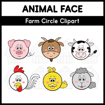
Animal Face - Farm Circle Clipart
Ideal for a myriad of applications, including posters, flash cards, worksheets, and more. The possibilities are limitless – let your creativity run wild as you incorporate these charming faces into your designs. ANIMAL FACE Farm Circle Clipart - Color and Black & White Pig Goat Cow Chicken Duck Sheep PNG Format - Approximate Size : 0.76 - 1.00 MP SWEETINAR M CUPCAKE Freebie Follow TPT Store Pinterest Terms of Use
Subjects:
Grades:
1st - 4th
Types:
Also included in: Animal Face - Circle Clipart - Bundle
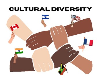
Culture + USA/Canada Word Wall Terms (Unit 2 World Cultures)
Ready to print (8.5x11 landscape) word wall terms with the term and graphics. Includes 19 terms covering culture and Unit 2 (USA/Canada) in World Cultures. LAMINATE AND GO!
Grades:
Not Grade Specific
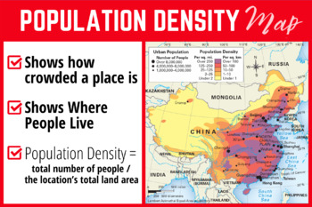
Types of Maps (Population Density Map)
This purchase includes ONE (Population Density Map) of five posters in the "Types of Maps" poster bundle, with each poster describing the characteristics of each type of map and an example map. Excellent resource for a middle or high school classroom. To purchase all five maps and SAVE, click here:The maps included in the bundle are:PoliticalPhysical EconomicClimatePopulation Density (this map)The format of this poster is a PNG image (18x12 in.), making it simple to scale up or down to the size
Grades:
4th - 12th
Types:
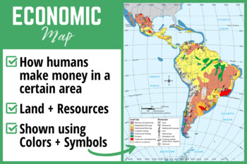
Types of Maps (Economic Map)
This purchase includes ONE (Climate Map) of five posters in the "Types of Maps" poster bundle, with each poster describing the characteristics of each type of map and an example map. Excellent resource for a middle or high school classroom. To purchase all five maps and SAVE, click here:The maps included in the bundle are:PoliticalPhysical EconomicClimate (this map)Population DensityThe format of this poster is a PNG image (18x12 in.), making it simple to scale up or down to the size you desire.
Grades:
4th - 12th
Types:
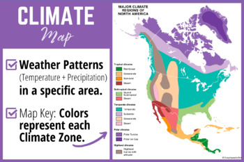
Types of Maps (Climate Map)
This purchase includes ONE (Climate Map) of five posters in the "Types of Maps" poster bundle, with each poster describing the characteristics of each type of map and an example map. Excellent resource for a middle or high school classroom. To purchase all five maps and SAVE, click here:The maps included in the bundle are:PoliticalPhysical EconomicClimate (this map)Population DensityThe format of this poster is a PNG image (18x12 in.), making it simple to scale up or down to the size you desire.
Grades:
4th - 12th
Types:
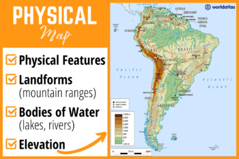
Types of Maps (Physical Map)
This purchase includes ONE (Physical Map) of five posters in the "Types of Maps" poster bundle, with each poster describing the characteristics of each type of map and an example map. Excellent resource for a middle or high school classroom. To purchase all five maps and SAVE, click here:The maps included in the bundle are:PoliticalPhysical (this map)EconomicClimatePopulation Density
Grades:
4th - 12th
Types:
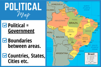
Types of Maps (Political Map)
This purchase includes ONE (Political Map) of five posters in the "Types of Maps" poster bundle, with each poster describing the characteristics of each type of map and an example map. Excellent resource for a middle or high school classroom. To purchase all five maps and SAVE, click here:The maps included in the bundle are:PoliticalPhysicalEconomicClimatePopulation Density
Grades:
4th - 12th
Types:
Ohio Geography Word Wall
Word wall words, with word and illustration, for Ohio's geography.
Subjects:
Grades:
3rd - 6th
Types:
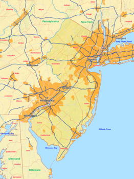
New Jersey map with cities township counties rivers roads labeled
New Jersey map with cities township counties rivers roads labeledThis download contains files that may be printed and copied or used digitally.___________________________________________________________________World City MapsBooksPinterestInstagramFacebookTikToK
Grades:
5th - 12th, Higher Education
Types:
Being a Historian Word Wall - with pictures!
This file contains 6 descriptive words with a picture for each. These 6 words are the baseline for all of your social studies and history lessons throughout the school year! Word wall vocabulary includes: EraChronology Credibility Point of View Primary SourceSecondary Source This word wall is geared towards primary and ESL students to help them expand their vocabulary so that they may speak and write with more style and precision.
Grades:
4th - 7th
Also included in: Exploring Social Studies- Complete Word Wall!
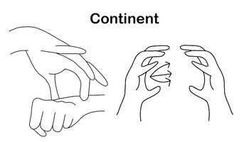
ASL Vocab - Continent
ASL sign for ContinentThis is an informal sign combining the sign for EARTH with the classifiers showing the location of the continents around the globe.EARTH: Dominant 8 handshape touches wrist of non-dominant S handshape and wiggles. CL: Non- dominant hand holds a C handshape to show the shape of the earth. Dominant open C handshape then places a continent on about 3 places on the globe bouncing slightly.
Grades:
Not Grade Specific
Types:
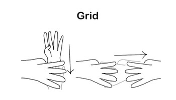
ASL Vocab - Grid
ASL sign for GridGRID: Both 4 handshapes. Non-dominant hand palm faces toward your body. Dominant hand palm starts facing away from body. The 4 handshape moves down behind the non-dominant hand. Then the hand twists so dominant palm is facing the body as well and fingers are pointed to ward non-dominant. Lastly, pull dominant hand sideways away from non-dominant hand. Your fingers should be tracing graph lines.Synonyms: Graph, Chart
Subjects:
Grades:
Not Grade Specific
Types:
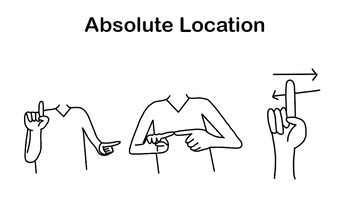
ASL Vocab - Absolute Location
ASL for Absolute Location. Created by showing the longitude lines and latitude lines with your index finger and then signing WHERE.Part 1: Dominant 1 starts palm out at the top corner of an imaginary box. Non-Dominant 1 starts palm toward dominant side at the opposite corner of the imaginary box. Follow the vertical and horizontal sides of the box until your fingers meet at the bottom dominant side of the box. This should look like tracing lines of latitude and longitude to a specific location.
Grades:
Not Grade Specific
Types:
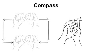
ASL Vocab - Compass
ASL sign for Compass. It is formed with the sign MAP and a visual representation of a compass.MAP: Both M handshape start together then make a rectangle meeting again at the bottom.Part 2: Non- dominant C handshape acts as the compass while dominant 1 handshape, palm facing out, acts as the needle going back and forth.
Grades:
Not Grade Specific
Types:
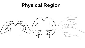
ASL Vocab - Physical Region
ASL sign for Physical Region (Note: PHYSICAL as show above is an initialized English sign not native to ASL)PHYSICAL: Both P handshapes, palms facing in, tap the chest then move down in a parallel line and tap the stomach. REGION: Dominant 5 handshape, palm touching top of non-dominant S handshape, makes small circles.
Grades:
Not Grade Specific
Types:
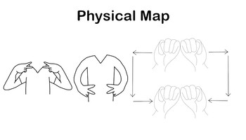
ASL Vocab - Physical Map
ASL sign for Physical Map (Note: the sign PHYSICAL is an initialized English sign not native to ASL)PHYSICAL: Both P handshapes, palms facing in, tap the chest then move down in a parallel line and tap the stomach. MAP: Both M handshape start together then make a rectangle meeting again at the bottom.
Grades:
Not Grade Specific
Types:
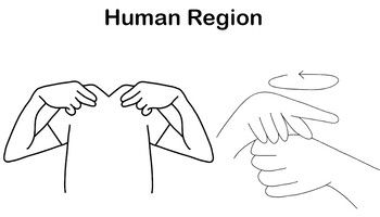
ASL Vocab - Human Region
ASL sign for Human Region (Note: the sign HUMAN as shown is an initialized English sign not native to ASL)HUMAN: Both H handshapes, palms facing in, start at top of chest then move down touching the stomach in a parallel motion. REGION: Dominant 5 handshape, palm touching top of non-dominant S handshape, makes small circles.
Grades:
Not Grade Specific
Types:
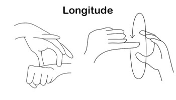
ASL Vocab - Longitude
ASL Sign for LongitudeThis sign is formed with 2 signs, EARTH and VERTICAL. EARTH: Dominant open 8 handshape touches wrist of non-dominant S handshape and moves back and forth slightly.VERTICAL: Non- dominant C handshape is circled by I handshape pointing toward non-dominant hand.
Grades:
Not Grade Specific
Types:
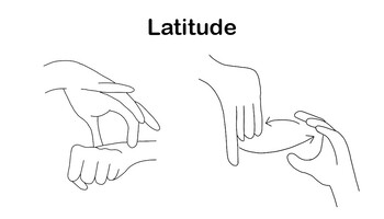
ASL Vocab - Latitude
ASL Sign for LatitudeThis sign is formed with 2 signs, EARTH and HORIZONTAL. EARTH: Dominant open 8 handshape touches wrist of non-dominant S handshape and moves back and forth slightly.HORIZONTAL: Non- dominant C handshape is circled by I handshape pointing down.
Grades:
Not Grade Specific
Types:
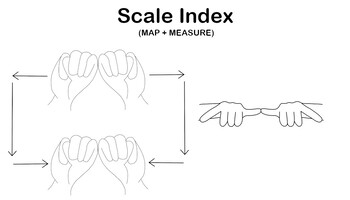
ASL Vocab - Scale Index
ASL sign for Scale Index (MAP + MEASURE)MAP: Both M handshape start together then make a rectangle meeting again at the bottom.MEASURE: Both Y handshapes, palms down, touch thumbs.
Grades:
Not Grade Specific
Types:
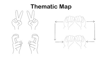
ASL Vocab -- Thematic Map
ASL sign for Thematic Map (THEME + MAP)THEME: Air quotes. Both V handshape moved to curved V handshapeMAP: Both M handshape start together then make a rectangle meeting again at the bottom.
Grades:
Not Grade Specific
Types:
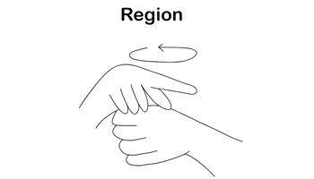
ASL Vocab - Region
ASL Sign for RegionREGION: Dominant 5 handshape, palm touching top of non-dominant S handshape, makes small circles. Synonyms: Area, location
Grades:
Not Grade Specific
Types:
Showing 1-24 of 24 results


