85 results
Not grade specific geography study guides
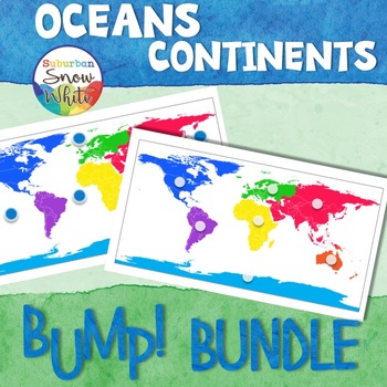
Continents and Oceans Bump Game Bundle
These geography continent and ocean game printables teach students the names and locations of the world continents and oceans. All you need are connecting cubes (or other playing pieces) and paperclips. Print and play these bump games today and be amazed at how quickly your kids master the content.
Each product comes in two versions with both color and greyscale versions of each, giving you choices in differentiation and aesthetics. (See product previews to view the gameboard choices. The Tabl
Grades:
Not Grade Specific
Types:
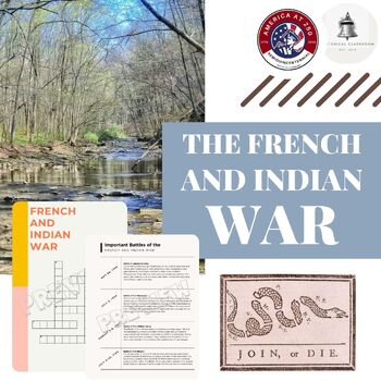
The French and Indian War
The French and Indian War----Suitable for grades 6 and up, this 28-page guide will introduce students to The French and Indian War, giving them the opportunity to explore this topic by examining the parties involved, the reasons for the conflict, and how the outcome set the stage for another impending war. Additionally, this war led to fractures in alliances among Native American tribes. Students will analyze their roles, goals for the outcome, and the effects on their communities. Geographicall
Subjects:
Grades:
Not Grade Specific
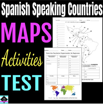
Maps: Spanish Speaking Countries and Regions
Great for any Spanish learners studying where in the world Spanish is spoken. Included:Rock the Capitals graphic organizer (by region)* 1 page: Identify and color the region - North, Central, South America, Caribbean, Europe, Africa* 3 pages of maps to label the Spanish Speaking Countries (with word banks) - Norteamerica, Centroamerica, & el Caribe - Sudamerica - Africa & Europa * 1 page geography/nationality assessment* link to slides (with more stuff like Quizlet Li
Subjects:
Grades:
Not Grade Specific
Also included in: Spanish Speaking Countries Bundle
Geography Country Location Practice
This is a tool that can be used with any grade of students in a geography class. It is a great way to help students study the locations of all the countries in the world. It is broken down into continents (Africa, Australia, North America, South America, Asia, and Europe). For Australia, it is divided into its regions instead of countries. On each continent map, there is a dot for each country or region, and when students click on that dot, it will take them to the slide with the name of the cou
Subjects:
Grades:
Not Grade Specific
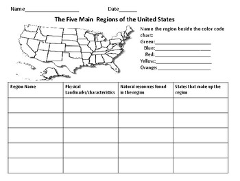
The Five Regions of The United States
This page includes a map of the U.S. in which students color-code the different regions of the U.S. There is also a chart in which students can take notes about the landforms/ characteristics of each region as well as other important information.
Grades:
Not Grade Specific
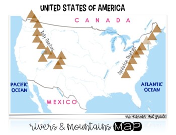
U.S. Rivers & Mountains Map - 3rd Grade Social Studies
I couldn't find a map reflecting the rivers & mountains that my students needed to learn so I made one for our 3rd Grade Map and Globe Skills Standards. 1 page PDF map reflecting the following:Hudson RiverColorado RiverSt. Lawrence RiverRio Grande River Ohio RiverMississippi RiverRocky MountainsAppalachian MountainsPacific OceanAtlantic OceanCandaMexico
Subjects:
Grades:
Not Grade Specific
AP Human Geography Study Guides/Outlines - Units 1-7
Full content review based on CED , AP Daily Videos , Princeton Review.
Subjects:
Grades:
Not Grade Specific
Types:
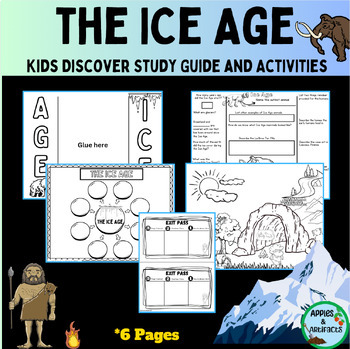
Ice Age Kids Discover Study Guide
This resource is a foldable study guide for the Kids Discover Ice Age magazine. Also included in the packet are review questions, a coloring page, a bubble map, and an exit pass. Teacher keys are provided.
Subjects:
Grades:
Not Grade Specific

AP Human Geography Class Website via Google Sites - Year Long Resource | APHG
Support your APHG students this year by creating a class site. This google site is ready to be customized to meet your unique students' needs. The site is organized into 11 different sections - Course Overview Unit Zero (pre-resources) Unit OneUnit TwoUnit Three Unit FourUnit FiveUnit Six Unit Seven Exam PrepAdditional Resources Each section is filled with supplemental videos to help student review, or provide real world context, each section also has Quizlet vocabulary links. The site is easil
Subjects:
Grades:
Not Grade Specific
Types:
Also included in: Everything AP Human Geography Bundle
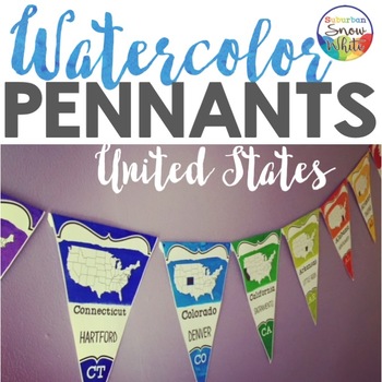
5 Regions of the United States Map | Pennants Banners | Capitals Abbreviations
Brighten you classroom or hallway with these instructive banners that let your students master the U.S. states throughout the day! Feast your eyes on the Preview to see all the goodies you get ...Ways to use♦ Bulletin Board♦ Celebrations of United States holidays♦ LGBT pride!♦ Hallway Display♦ Library Walls♦ International Festival♦ Classroom Decor♦ PTO FundraisersEASY to assemble1) Print on white copy paper or cardstock. 2) Cut out and fold on top.3) Staple onto string and display! Included:★ Di
Subjects:
Grades:
Not Grade Specific
Geographic Landforms Interactive Thinglink Activity
Geographic Landforms Interactive Thinglink ActivityEmbark on an interactive journey through the world's most captivating geographic landforms with our engaging and educational Thinglink Activity. Designed to align with the 6th and 9th-grade social studies curriculum, this immersive experience enables students to explore and comprehend the significance of landforms in the development of early civilizations.Includes a student-facing worksheet, a Google slide deck, a Thinglink interactive image, an
Grades:
Not Grade Specific
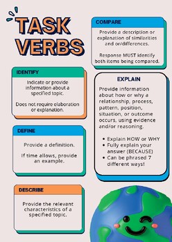
AP Free Response Question TASK VERBS
Use this poster in your classroom to remind students what is expected of them when writing Free Response Questions.I use this in both my AP African American Studies and AP Human Geography courses. My students also like having a copy that I allow them to use during practice timed writing!This product was made with input from an AP Chief Reader, I have 8 years as a scorer/reader for the AP program.*Advanced Placement® and AP® are trademarks registered and/or owned by the College Board, were not in
Subjects:
Grades:
Not Grade Specific
Types:
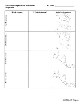
Spanish Speaking Countries Notes Sheet
Use this guided notes sheet or study guide as you teach your students the Spanish-speaking countries and capitals. There is a column for students to write the country, the capital and also color in the country in reference. I have included a space for the United States on this document as well. At the end of the packet, there is a space for your students to write the acronym you choose to remember the order of the countries in Central America and South America.
Subjects:
Grades:
Not Grade Specific
Types:
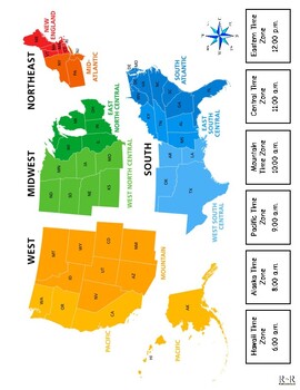
States, Capitals and Time Zones Study Guide
States, Capitals, and Time Zones study guide. Includes 6 printable pages of a comprehensive list of states, capitals, and time zones, accompanied by a map.
Subjects:
Grades:
Not Grade Specific
Types:
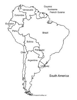
Spanish-Speaking World Maps & Quiz
You are viewing a bundle of 5 different BLANK maps that show all 21 Spanish-speaking countries. A list of the 21 countries is also included. These maps are all BLACK & WHITE.
In this bundle you will also find a quiz on all 21 Spanish-speaking countries. Your students can use the maps to learn the countries and then you can use the quiz to assess their knowledge.
Maps include:
1. Central America
2. South America
3. Europe
4. The Carribean
5. Africa
Students used these maps to fill in the
Subjects:
Grades:
Not Grade Specific

How to Get Good Grades!
A helpful tool for students on how to study. This guide is already formatted to be printed in a booklet form. The guide covers strategies on how to succeed in the classroom, study tips, managing time, math tips, test-taking tips.
Subjects:
Grades:
Not Grade Specific
Types:
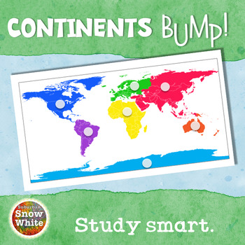
Continents Activity Game
These geography continent game printables teach students the names and locations of the world continents. All you need are connecting cubes (or other playing pieces) and paperclips. Print and play this bump game today and be amazed at how quickly your kids master the continents.
Comes in two versions with both color and greyscale versions of each, giving you choices in differentiation and aesthetics. (See preview to view the gameboard choices. The Table of Contents within the Preview shows you
Grades:
Not Grade Specific
Types:
Also included in: Continents and Oceans Bump Game Bundle
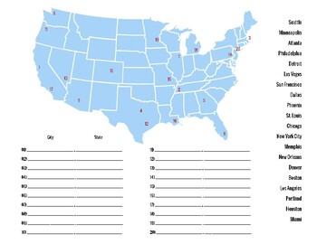
Major U.S. Cities Quizzes
Master your geography knowledge of the biggest American cities with this study guide and quiz sheet! Two completely different quizzes are included, covering 40 cities all over the continental United States. Both the blank quizzes and answer keys are included.
Subjects:
Grades:
Not Grade Specific
Types:
Canada - A Study Guide *
A forty five page study guide teaching basic information on the nation of Canada.The study guide includes the following information:Page 3 – First ImpressionsPage 4 – The History of CanadaPages 5-6 – The Geography of CanadaPages 7 – The Government of CanadaPages 8-9 – The Prime Ministers of CanadaPage 10 – The Economy of CanadaPage 11 – The Transportation of CanadaPages 12-14 – The Military of CanadaPage 15 – The Climate of CanadaPage 16 – National Parks of CanadaPage 17 – Historic Sites of Cana
Subjects:
Grades:
Not Grade Specific
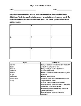
Magic Square Activity: Bodies Of Water
This 3x3 magic square activity can be used to help students learn about bodies of water.
Subjects:
Grades:
Not Grade Specific
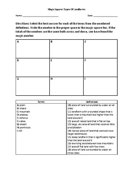
Magic Square Activity: Types Of Landforms
This 3x3 magic square activity can be used to help students learn the basic types of landforms, such as mountains, plains, and plateaus.
Subjects:
Grades:
Not Grade Specific
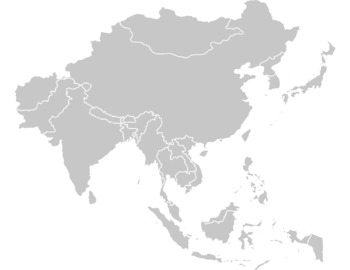
Blank World Region Maps
Digital download of blank world regional maps, North American, Central, South, Europe, South Asia, etc. Black and white and full color options included. Blank world map, all of the regions, and blank US states. Great for map quizzes/study guides/assignments.
Grades:
Not Grade Specific
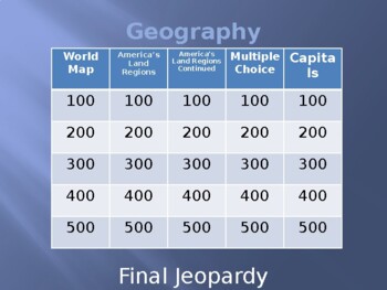
Geography Jeopardy Game
This is such a fun, engaging Geography Jeopardy game. There's over 25 questions including a Final Jeopardy and Daily Double! The categories are World Map, Americas Land Regions, America's Land Regions Continued, Multiple Choice and Capitals. This is a PowerPoint and I usually break my class up into teams. I also like to find the Jeopardy music on YouTube to accompany the game. I also use Jeopardy games like a study guide.This game features the following terms:oceancontinentsequatorlatitude
Grades:
Not Grade Specific
Types:
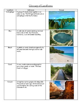
Glossary of Landforms
This is a resource guide for students studying landforms. It includes pictues and definitions for the following landforms: Archipelago, Bay, Beach, Canal, Canyon, Cape, Delta, Desert, Fjord, Glacier, Gulf, Hill, Isthmus, Lagoon, Lake, Mesa, Mountain, Oasis, Peninsula, Plain, Plateau, Reef, Reservoir, River, Sea, Strait, Swamp, Valley, Volcano, and Waterfall.
Subjects:
Grades:
Not Grade Specific
Showing 1-24 of 85 results


