112 results
Not grade specific geography word walls
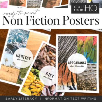
Information Text Writing Word Wall Cards + Posters - BUNDLE
Grab all three sets of our beautiful animal non-fiction word wall cards! Perfect for creating a word wall for learning to write information or informative texts. This set of over 110 different word wall cards focuses on where animals live, what they look like and what they eat. Real life photos have been used throughout to creating this gorgeous resource.Download also includes our three Information Text Posters - Habitat/Appearance/Diet, to help tie the concept together.Use our animal posters to
Subjects:
Grades:
Not Grade Specific
Types:
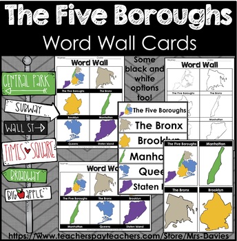
Five Boroughs of New York City Picture Word Walls
This file contains picture word wall cards of the the Five Boroughs of New York City. The Bronx, Brooklyn, Manhattan, Queens, and Staten Island. Word Walls come in different formats and orientations on letter paper 8.5 x 11". Great to accompany any unit on the five boroughs of New York City. These word wall cards focus on the shapes/ outlines of each of the boroughs. These shapes are not to scale and are hand drawn. Some options are color and black and white. See preview for more details. This f
Grades:
Not Grade Specific
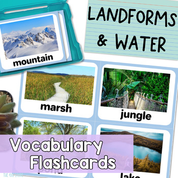
Landforms and Bodies of Water Vocabulary Flashcards with Real Pictures
Are you looking for landform and bodies of water flash cards with realistic pictures or photos for your students? Do you find clipart flashcards unappealing to your older or adult English leaners?These 28 realistic flash cards work perfectly for English language learners, speech therapy students, students with special needs, and more! Give your students REAL, context-driven learning experiences that provide plenty of opportunity for all kinds of extended conversations and discussions.All flash
Subjects:
Grades:
Not Grade Specific
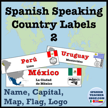
Spanish Speaking Countries Labels
3 versions of labels for all 21 Spanish Speaking Countries.Version 1: Measures 2.5" x 10"Country NameCapitalOutline of CountryFlagVersion 2: Measures 2.5 x 10"Country NameCapitalCountry on MapFlagLogoVersion 3: Measures 2.5" x 8.25"Country NameCapitalCountry on MapFlagMakes for a great bulletin board material for Hispanic Heritage Month, a great way to label maps, or highlight different Hispanic countries around your Spanish classroom. Laminate these and they will last for years! Version 1 is ou
Subjects:
Grades:
Not Grade Specific
Also included in: Spanish Speaking Countries Bundle
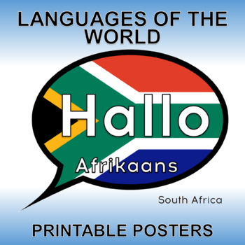
World Language Posters - Hello in 155 Languages with Flags - Global Education
Updated in 2023 ! An additional 51 Languages now included !Discover the diverse languages and cultures of the world with this comprehensive Flags and Languages of the World Bundle. This set includes 155 colorful and printable posters that showcase the word "HELLO" in all of the languages of the world, accompanied by the flag of the country that has the highest speaking population and the name of the language. Perfect for multicultural classrooms or homeschooling, this bundle also includes clipar
Subjects:
Grades:
Not Grade Specific
Types:
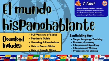
Chat Deck: The Spanish Speaking World
Sometimes all students need to get them talking is a little scaffolding. This chat deck supports chatting about the Spanish speaking world by presenting each country along with a bit of cultural information and a peak at traditional clothing from that nation.Whether you teach a geography lesson all at one time OR you present the Spanish speaking world one country at a time, this Chat Deck will have your room buzzing with students' conversations.
Subjects:
Grades:
Not Grade Specific
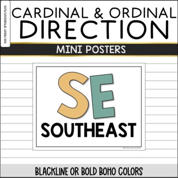
Boho Cardinal and Ordinal Direction Signs / Mini Posters
CLASSROOM CARDINAL DIRECTION SIGNS! Are your students learning about cardinal and ordinal directions, or would you just like to label the directions in your room? Then this set of mini posters in a soothing Boho color scheme is for you! Each cardinal and ordinal direction is featured on its own 11 x 8.5" mini poster so it is easily visible from across the room.Included in this product:*Set of posters in which the initial letter of each direction is in color.*Set of mini posters in black letters
Subjects:
Grades:
Not Grade Specific
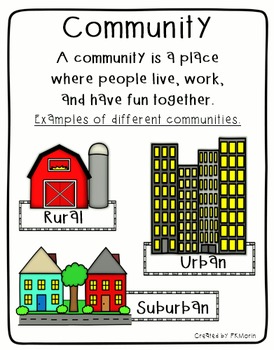
Rural, Urban, Suburban Communities Poster
Social Studies poster includes the definition of Community, plus image samples of 3 types of communities (Rural, Urban and Suburban). Also includes mini-posters with Rural, Urban and Suburban definitions.
By Patricia Morin
Subjects:
Grades:
Not Grade Specific
Types:
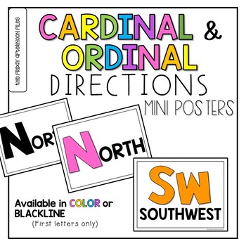
Cardinal & Ordinal Direction Posters
Are your students learning about cardinal and ordinal directions, or would you just like to label the directions in your room? Then this set of mini posters is for you! Each cardinal and ordinal direction is featured on its own 8.5” x 11’ mini poster so it is easily visible from across the room. Included in this product:*Set of posters in which the initial letter of each direction is in color. *Set of mini posters in black letters on white background—perfect for printing out on the colored paper
Subjects:
Grades:
Not Grade Specific
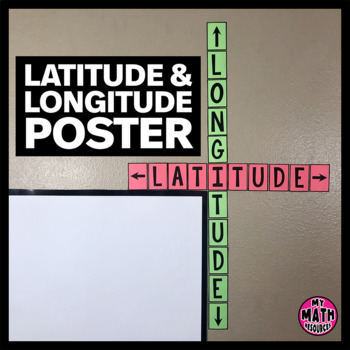
FREE Latitude & Longitude Poster - Classroom Decor
These simple latitude and longitude posters are a cute addition to ANY classroom! Wrap them around the corner of your whiteboard or bulletin board and they hardly take up any space at all.These posters will help your students remember the difference between latitude and longitude. And they are free!This is a black & white DIY poster. Print the pieces you want to use, cut them out, and assemble your poster. If you want your poster to look like mine, you'll need to print it on Astrobrights
Subjects:
Grades:
Not Grade Specific
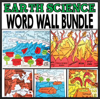
Earth Science Natural Disasters - Word Wall BUNDLE
Our Earthquake, Flood, Tsunami, Volcano, Bushfire/Wildfire puzzle word walls will brighten your classroom, challenge your students and create a great display to complement your unit on Earth Sciences. We've included both AUS/UK and US spelling and paper sizes to ensure they're perfect for your classroom.We've provided a helpful printing key with suggested paper colours to recreate the poster shown in the photograph or you might like to ask your students to colour them in or paint them before lam
Subjects:
Grades:
Not Grade Specific
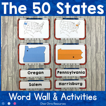
50 States Word Wall Words and Activities
Learning the 50 states of the USA can be an insurmountable task. With this word wall you will get a beautiful classroom display that will help your students remember the shapes, names, capitals, abbreviations of the 50 states and where they are on the US map! You can also use it as a matching activity to engage your students. They will enjoy manipulating the labels and matching all the elements together for of each state: its shape, its location on the US map, its name and its phonetic transcr
Subjects:
Grades:
Not Grade Specific
Types:
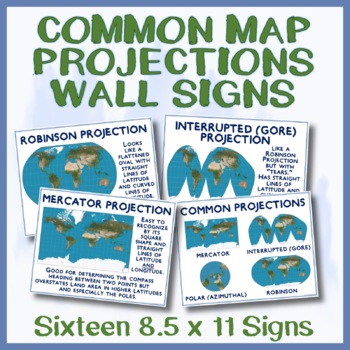
16 Map Projection Mini-Posters for Geography / Lat and Long - 8.5 x 11
Helping students understand common map projections (Mercator, Robinson, Polar, Interrupted) is a key goal for every world geography and social studies teacher. These 8.5 x 11 inch (same product available in 11 x 17 here) map projection posters are a great way to teach or remind students about distortion, map projections, and common uses for each projection clearly, accurately, and visually. Two "challenge posters" are included so that teachers can can use them as a prop for teaching or review.
Grades:
Not Grade Specific
WORLD GEOGRAPHY & SOCIAL STUDIES MINI-POSTERS - Big Savings on Bundle
Oh, my. If you were teaching tectonic plates and earthquakes as part of your Geography or Geology unit, you might say that this is the Big One!After getting lots of sales and lots of interest in my printable 11 x 17 poster products (which also look great when printed on 8.5 x 11) , the time had clearly come to combine them into one rather large World Geography and Social Studies posters mega-bundle!With this great bundle, you get 13 products (for a total of 26 posters!) that cover a wonderfull
Grades:
Not Grade Specific
![Preview of 10 Carteles: Causas de Clima y Zonas Climáticas [Dual, Spanish, Immersion]](https://ecdn.teacherspayteachers.com/thumbitem/10-Carteles-Causas-de-Clima-y-Zonas-Clim-ticas-Dual-Spanish-Immersion--6872217-1634828884/original-6872217-1.jpg)
10 Carteles: Causas de Clima y Zonas Climáticas [Dual, Spanish, Immersion]
Las zonas climáticas son un concepto clave en ciencias de la tierra, geografía, historia, estudios sociales y más. Este paquete de diez carteles imprimibles de 11 x 17 pulgadas muestra claramente estos conceptos clave y es una excelente opción para tableros de anuncios, gráficos de anclaje, y tapetes para colorear.Estos carteles se han diseñado cuidadosamente para que los estudiantes comprendan el clima y las zonas climáticas; y progresan secuencialmente desde las líneas de latitud relacionadas
Subjects:
Grades:
Not Grade Specific
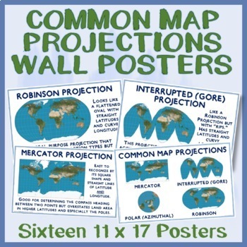
11" x 17" MINI-POSTERS OF COMMON MAP PROJECTIONS (Mercator, Gore, Polar, etc.)
Helping students understand common map projections (Mercator, Robinson, Polar, etc.) is a key goal for every world geography and social studies teacher. These 11 x 17 map projection posters (also available in 8.5 x 11 here) are a great way to remind or teach students about map projections and the tradeoffs that they present clearly, accurately, and visually. And, since two "challenge posters" are included they can also be used as a prop for teaching or review.Be sure to look at the Product Pre
Grades:
Not Grade Specific
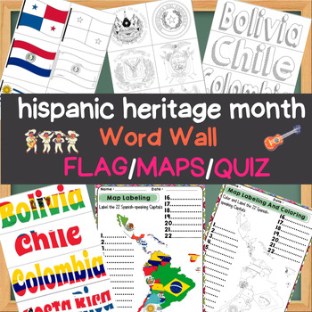
Spanish Speaking Countries of the Caribbean Map Labelin word wall Flag and quizz
Explore the rich tapestry of Spanish-speaking cultures during Hispanic Heritage Month with our comprehensive educational resource. This package features a Word Wall, Flag Maps, and a Quiz that celebrates the diversity and history of Spanish-speaking countries.The Hispanic Heritage Month - Spanish-Speaking Countries Word Wall, Flag Maps, and Quiz include:Word Wall: A collection of vocabulary words related to Spanish-speaking countries, complete with clear definitions and visual aids. Learn about
Grades:
Not Grade Specific
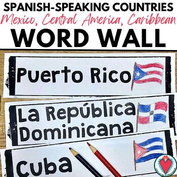
Spanish Speaking Countries Flags Bulletin Board Mexico Central America Caribbean
Need to label a map so students can see the names of the countries? Post the names and flags of Spanish-speaking countries of Central America, the Caribbean, & Mexico on your walls for instant support. Fun for Hispanic Heritage Month! Have students color the flags for each country for a beautiful bulletin board display. Includes two versions: the names of 10 countriesnames and blackline outline of flag of the country Use the text-only version to label a map, post on a bulletin board, to grou
Subjects:
Grades:
Not Grade Specific
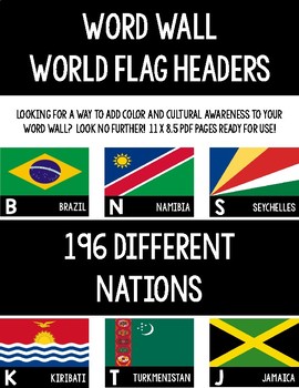
Word Wall World Flag Headers
Have you been looking for a way to add both color and global awareness to your word wall? Look no further!
196 national flags are represented in this product! You will find one flag per 11 x 8.5 sheet of paper in this PDF file. Perfect if you are teaching about a specific area, want to make your students aware of countries they do not typically hear of, or if you just want to add some color to your walls. These are not limited to history and geography classrooms!
Each letter has an indiv
Grades:
Not Grade Specific
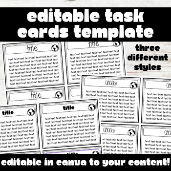
EDITABLE History/Social Studies Task Cards - Social Studies Center Activities
Engage students with task cards by using this editable template!Task cards can be used for a variety of lessons from small groups to word walls to study tools for students. These task cards are completely EDITABLE in Canva and can easily be differentiated to your subject and students! Please note- these templates are for personal use only!What will you receive?You will receive a PDF document with a link to the editable Canva page. Click on the link, and you will be taken to Canva where you can e
Grades:
Not Grade Specific
Types:
Also included in: EDITABLE Unit Plan Activities Templates - Editable Unit Plan Packet
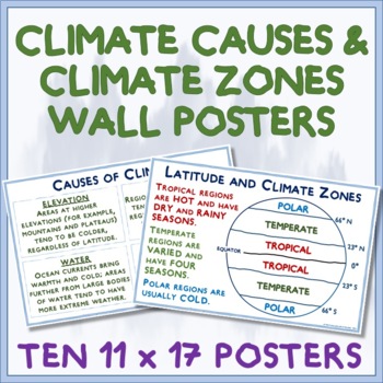
CLIMATE, CLIMATE ZONES AND VEGETATION ZONES - 10 EASY-TO-PRINT MINI-POSTERS
Climate zones are a key concept in earth science, geography, history, social studies, and more. This pack of ten printable 11 x17 posters show these key concepts clearly and are a great choice for bulletin board, anchor charts, and coloring mats.These posters have been carefully designed for students to understand climate and climate zones; and, they progress sequentially from climate-related lines of latitude (Equator, Tropics of Cancer and Capricorn, Arctic and Antarctic Circle), to causes of
Subjects:
Grades:
Not Grade Specific
Also included in: WORLD GEOGRAPHY & SOCIAL STUDIES MINI-POSTERS - Big Savings on Bundle
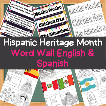
Hispanic Heritage Month - Wonders of Spanish Speaking Countris Word Wall E/S
Create an interactive and educational display for Hispanic Heritage Month with our bilingual Word Wall Bulletin Board. This resource features key terms and vocabulary words related to Hispanic culture, history, and heritage, presented in both English and Spanish for inclusivity and language learning.The Hispanic Heritage Month - Wonders of the Hispanic World Word Wall Bulletin Board includes:Word Wall Cards: A comprehensive collection of essential vocabulary words related to Hispanic heritage, e
Grades:
Not Grade Specific
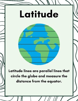
Map Skills Classroom Posters
Help your students with their map reading skills by hanging these visually-pleasing 8.5 x 11 posters. Simply print and hang on your walls!With your purchase you get 10 posters with the following words and definitions:LongitudeLatitudePhysical MapsPolitical MapsCompass RoseOceansCountriesContinentsMap KeyMap Scale
Subjects:
Grades:
Not Grade Specific
Types:
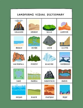
Landforms Picture Dictionary
Free picture dictionary (also included in thematic unit on Cultural Development)This visual dictionary covers common landforms and bodies of water. My students loved the illustrations and found them to be helpful visuals as they looked for real-life counterparts in their region! This graphic is perfect for:- Interactive Notebooks- Supplementing Social Studies Units- Visual LearnersLandforms covered include:- Volcanoes - Glaciers- Deserts - Icebergs- Hills - Lakes- Canyons
Grades:
Not Grade Specific
CCSS:
NGSS:
5-ESS2-1
, 4-ESS2-2
, 2-ESS2-2
Showing 1-24 of 112 results


