155 results
4th grade geography classroom forms
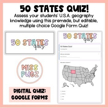
50 States Quiz: Google Forms!
Assess your students’ U.S.A. geography knowledge using this pre-made, but editable, multiple choice Google Form quiz! Students will see an image of the United States map and will be asked to identify the state that is colored in. This quiz is:Multiple Choice Has points already inputtedCorrect answers are pre-selected: NO grading for YOU! Google Forms will grade each quiz for you and you can easily upload students' scores to Classroom. Just upload to Google Classroom and use it as a review, a fin
Grades:
1st - 5th
Types:
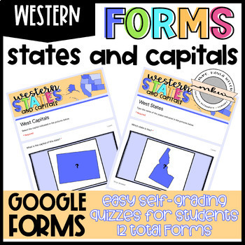
Western States and Capitals Quizzes
After your students have studied their states and capitals, test their knowledge with these Google Forms. Assign these on Google Classroom to easily collect student data. These are perfect for distance learning!Why Should you use Google Forms?Self-Grading/Checking Automatically Collects & Organizes DataFully Editable (add/delete/edit questions)Online Testing PracticeWhat’s Included:This resource includes 12 West Region Google Forms - 6 Multiple Choice and 6 Fill In. See the Instructions PDF
Grades:
2nd - 12th
Types:
Also included in: Western States and Capitals BUNDLE!
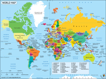
Google Form Map Tests/Assignments Bundle! 8 Different Maps and Tests!
This is a bundle of 8 quizzes/assignments, all on Google Forms. These include:Continents and OceansNorth and Central AmericaCaribbeanSouth AmericaAfricaAsiaEurope25 Countries I want my students to knowThese are all done on Google Forms. They are editable if you want to change them. I have included the answer key, a copy of the map, and a blank copy of the map for each if you want to prepare a study guide. You can access these through Google Drive. Please let me know if you have any question
Grades:
3rd - 12th
Types:
Northeast States and Capitals Quizzes
After your students have studied their states and capitals, test their knowledge with these Google Forms. Assign these on Google Classroom to easily collect student data. These are perfect for distance learning!Why Should you use Google Forms?Self-Grading/Checking Automatically Collects & Organizes DataFully Editable (add/delete/edit questions)Online Testing PracticeWhat’s Included:This resource includes 12 Northeast Region Google Forms - 6 Multiple Choice and 6 Fill In. See the Instructions
Grades:
2nd - 12th
Types:
Also included in: States and Capitals MEGA BUNDLE!
The Great Lakes Worksheets
The Great Lakes Worksheets includes a Great Lakes Map (and key), Great Lakes Animals, and a Great Lakes Fun Facts page (and key). These can be used separately within a curriculum study of the Great Lakes or as a small unit. There are 3 worksheets with answer keys. They can be used in the classroom or in a home study. Best for grades 3-5.
Subjects:
Grades:
3rd - 5th
States and Capitals MEGA BUNDLE!
Help your students achieve states and capitals mastery with these cute, fun, flashcard style slides! After your students have studied their states and capitals, test their knowledge with these Google Forms. This BUNDLE includes Google Slides and Google Forms - both of which can easily be posted to Google Classroom, Canvas, etc. Once posted, your students can access the slides whenever they have free time. The quizzes allow you to easily collect student data. These are perfect for distance learni
Grades:
2nd - 12th
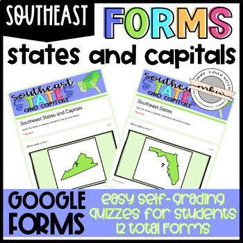
Southeast States and Capitals Quizzes
After your students have studied their states and capitals, test their knowledge with these Google Forms. Assign these on Google Classroom to easily collect student data. These are perfect for distance learning!Why Should you use Google Forms?Self-Grading/Checking Automatically Collects & Organizes DataFully Editable (add/delete/edit questions)Online Testing PracticeWhat’s Included:This resource includes 12 Southeast Region Google Forms - 6 Multiple Choice and 6 Fill In. See the Instructions
Grades:
2nd - 12th
Types:
Also included in: States and Capitals MEGA BUNDLE!
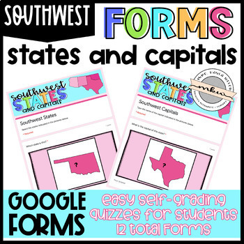
Southwest States and Capitals Quizzes
After your students have studied their states and capitals, test their knowledge with these Google Forms. Assign these on Google Classroom to easily collect student data. These are perfect for distance learning!Why Should you use Google Forms?Self-Grading/Checking Automatically Collects & Organizes DataFully Editable (add/delete/edit questions)Online Testing PracticeWhat’s Included:This resource includes 12 Southwest Region Google Forms - 6 Multiple Choice and 6 Fill In. See the Instructions
Grades:
2nd - 12th
Types:
Also included in: Southwest States and Capitals BUNDLE!
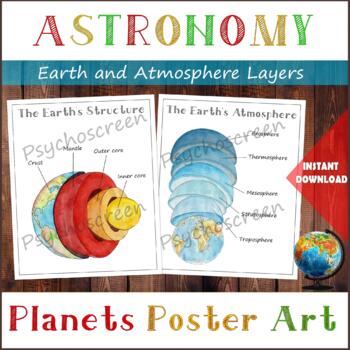
Earth Structure and The Earth's Atmosphere • Layers of the Earth • Posters
֎ ABOUT THE PRODUCT ֎Handmade watercolor print, instant download. Great material for learning about the layers of the Earth and about Atmosphere in homeschooling or in classroom. The product includes:· The Earth's Structure - poster + diagram + parts (labels)· The Earth's Atmosphere - poster + diagram + parts (labels)֎ DIGITAL DOWNLOAD ֎· PDF file in Letter size, with 5 pages. Size: Letter - 2550px x 3300px, 8.5" x 11", 21,59cm x 27,94cm. You can fit it on A4 size. Lamination extends the duratio
Subjects:
Grades:
PreK - 5th
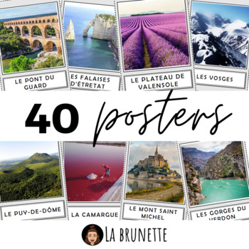
40 posters de décoration sur la France - 40 posters for display about France
40 incredible French sites to display in your classroom !Bring some cultural and colourful elements to your French classroom or MFL corridor with these 40 beautiful pictures of France. This resource includes :This resource includes 40 pictures (PDF format) of the best and most incredible cities, regions and landscapes to visit in France. Each PDF page has a picture in a frame and its name in a separate frame, below. Check the VIDEO PREVIEW to view ALL pictures ! These French touristic sites are
Subjects:
Grades:
PreK - 12th, Staff
Also included in: POSTERS MEGA BUNDLE - 280 PRINTABLE PAGES - France and Francophonie
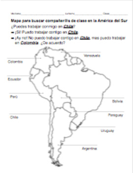
PACK of 4 partner maps for Spanish: Central and South America COUNTRIES/CAPITALS
This PACK includes 4 partner maps for the price of 3 !!
This .zip file includes 4 separate partner maps for Spanish-speaking countries in the Americas:
- South America: countries
- South America: capitals
- Mexico/Central America: countries
- Mexico/Central America: capitals (and countries)
Each sheet includes an outline map of South America or Mexico/Central America, with the Spanish-speaking countries and/or capitals labeled. Each student will use a map to keep track of who will be their par
Subjects:
Grades:
4th - 12th
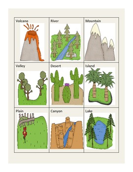
Landforms
This awesome packet incorportates geography and bits of writing. Students will really enjoy the following worksheets and activities...
1. A cut, glue, and stick landform clip art matching activity.
2. Draw a picture to match the definition of landforms.
3. Make a list of natural resources and write about what you know about them.
4. Rock hunt page where students hunt for 3 different rocks, write their observations, and illustrate their rocks.
5. Matching page with 10 different landfor
Subjects:
Grades:
PreK - 9th
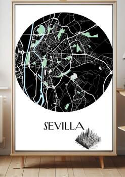
Elegant Minimalist Map of Sevilla 2024
Sevilla Map, Minimalist Design, Monochromatic Art, High Resolution, PNG File, Golden Gate City, Elegant Map, White Background, Educational Tool, Classroom Decor, Office Art, Home Decor, Digital Download, TPT Store, Geography, Travel, American DecorThis meticulously crafted minimSevilla in stunning detail. The high-resolution PNG file ensures that every street and landmark is clearly visible, making it a perfect piece for educators, travelers, or anyone with an affinity for the Golden Gate City.
Subjects:
Grades:
PreK - 12th, Higher Education, Adult Education, Staff
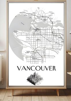
Elegant Minimalist Map of Vancouver 2024
Vancouver Map, Minimalist Design, Monochromatic Art, High Resolution, PNG File, Golden Gate City, Elegant Map, White Background, Educational Tool, Classroom Decor, Office Art, Home Decor, Digital Download, TPT Store, Geography, Travel, American DecorThis meticulously crafted minimalist map, with dimensions of 3087x4371 px, captures the intricate layout of Vancouver in stunning detail. The high-resolution PNG file ensures that every street and landmark is clearly visible, making it a perfect pie
Subjects:
Grades:
PreK - 12th, Higher Education, Adult Education, Staff
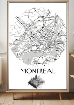
Elegant Minimalist Map of Montréal 2024
Montréal Map, Minimalist Design, Monochromatic Art, High Resolution, PNG File, Golden Gate City, Elegant Map, White Background, Educational Tool, Classroom Decor, Office Art, Home Decor, Digital Download, TPT Store, Geography, Travel, American DecorThis meticulously crafted minimalist map, with dimensions of 3087x4371 px, captures the intricate layout of Montréal in stunning detail. The high-resolution PNG file ensures that every street and landmark is clearly visible, making it a perfect piece
Subjects:
Grades:
PreK - 12th, Higher Education, Adult Education, Staff
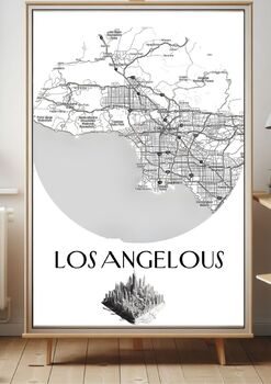
Elegant Minimalist Map of LOS ANGELOUS 2024
Los Angelous Map, Minimalist Design, Monochromatic Art, High Resolution, PNG File, Golden Gate City, Elegant Map, White Background, Educational Tool, Classroom Decor, Office Art, Home Decor, Digital Download, TPT Store, Geography, Travel, American DecorThis meticulously crafted minimalist map, with dimensions of 3087x4371 px, captures the intricate layout of Los Angelous in stunning detail. The high-resolution PNG file ensures that every street and landmark is clearly visible, making it a perfe
Subjects:
Grades:
PreK - 12th, Higher Education, Adult Education, Staff
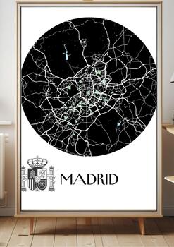
Elegant Minimalist Map of Madrid 2024
Madrid Map, Minimalist Design, Monochromatic Art, High Resolution, PNG File, Golden Gate City, Elegant Map, White Background, Educational Tool, Classroom Decor, Office Art, Home Decor, Digital Download, TPT Store, Geography, Travel, American DecorThis meticulously crafted minimMadrid in stunning detail. The high-resolution PNG file ensures that every street and landmark is clearly visible, making it a perfect piece for educators, travelers, or anyone with an affinity for the Golden Gate City. Th
Subjects:
Grades:
PreK - 12th, Higher Education, Adult Education, Staff
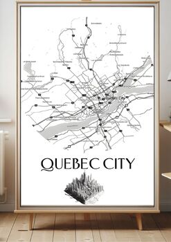
Elegant Minimalist Map of Quebec City 2024
Quebec City Map, Minimalist Design, Monochromatic Art, High Resolution, PNG File, Golden Gate City, Elegant Map, White Background, Educational Tool, Classroom Decor, Office Art, Home Decor, Digital Download, TPT Store, Geography, Travel, American DecorThis meticulously crafted minimalist map, with dimensions of 3087x4371 px, captures the intricate layout of Quebec City in stunning detail. The high-resolution PNG file ensures that every street and landmark is clearly visible, making it a perfect
Subjects:
Grades:
PreK - 12th, Higher Education, Adult Education, Staff
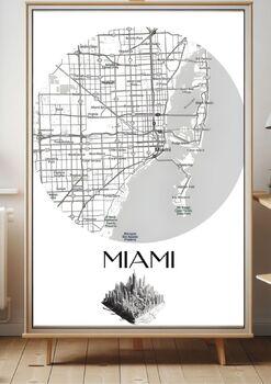
Elegant Minimalist Map of Miami 2024
Miami Map, Minimalist Design, Monochromatic Art, High Resolution, PNG File, Golden Gate City, Elegant Map, White Background, Educational Tool, Classroom Decor, Office Art, Home Decor, Digital Download, TPT Store, Geography, Travel, American DecorThis meticulously crafted minimalist map, with dimensions of 3087x4371 px, captures the intricate layout of Miami in stunning detail. The high-resolution PNG file ensures that every street and landmark is clearly visible, making it a perfect piece for ed
Subjects:
Grades:
PreK - 12th, Higher Education, Adult Education, Staff
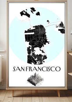
Elegant Minimalist Map of San Francisco 2024
San Francisco Map, Minimalist Design, Monochromatic Art, High Resolution, PNG File, Golden Gate City, Elegant Map, White Background, Educational Tool, Classroom Decor, Office Art, Home Decor, Digital Download, TPT Store, Geography, Travel, American DecorThis meticulously crafted minimalist map, with dimensions of 3087x4371 px, captures the intricate layout of San Francisco in stunning detail. The high-resolution PNG file ensures that every street and landmark is clearly visible, making it a perf
Subjects:
Grades:
PreK - 12th, Higher Education, Adult Education, Staff
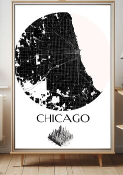
Elegant Minimalist Map of Chicago City 2024
Chicago City Map, Minimalist Design, Monochromatic Art, High Resolution, PNG File, Windy City, Elegant Map, White Background, Educational Tool, Classroom Decor, Office Art, Home Decor, Digital Download, TPT Store, Geography, Travel, American Decor”This meticulously crafted minimalist map, with dimensions of 3087x4371 px, captures the intricate layout of Chicago City in stunning detail. The high-resolution PNG file ensures that every street and landmark is clearly visible, making it a perfect pie
Subjects:
Grades:
PreK - 12th, Higher Education, Adult Education, Staff
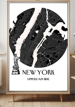
Elegant Minimalist Map of New York City’s East Side
New York City East Side Map, Minimalist Design, Monochromatic Art, High Resolution, PNG File, City that Never Sleeps, Elegant Map, White Background, Educational Tool, Classroom Decor, Office Art, Home Decor, Digital Download, TPT Store, Geography, Travel, American Decor”This meticulously crafted minimalist map, with dimensions of 3087x4371 px, captures the intricate layout of New York City’s East Side in stunning detail. The high-resolution PNG file ensures that every street and landmark is clea
Subjects:
Grades:
PreK - 12th, Higher Education, Adult Education, Staff
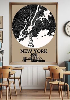
Elegant Minimalist Map of New York City 2024
New York City Map, Minimalist Design, Monochromatic Art, High Resolution, PNG File, City that Never Sleeps, Elegant Map, White Background, Educational Tool, Classroom Decor, Office Art, Home Decor, Digital Download, TPT Store, Geography, Travel, American Decor”Description: This meticulously crafted minimalist map, with dimensions of 3087x4371 px, captures the intricate layout of New York City in stunning detail. The high-resolution PNG file ensures that every street and landmark is clearly visib
Subjects:
Grades:
PreK - 12th, Higher Education, Adult Education, Staff
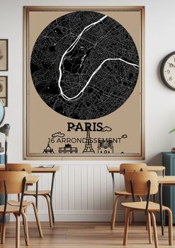
Elegant Minimalist Map of Paris 16 Arrondissements
Paris Map, Minimalist Design, Monochromatic Art, High Resolution, PNG File, 16 Arrondissements, City of Lights, Elegant Map, White Background, Educational Tool, Classroom Decor, Office Art, Home Decor, Digital Download, TPT Store, Geography, Travel, French DecorThis meticulously crafted minimalist map, with dimensions of 3087x4371 px, captures the intricate layout of Paris’ 16 arrondissements in stunning detail. The high-resolution PNG file ensures that every street and landmark is clearly visib
Subjects:
Grades:
PreK - 12th, Higher Education, Adult Education, Staff
Showing 1-24 of 155 results


