3,687 results
Adult education geography pdfs
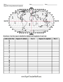
Latitude and Longitude Worksheet & Answer Key
This worksheet is an awesome way to teach Latitude and Longitude. The way that it is structured reinforces that Latitude measures North and South of the Equator, and that Longitude measures East and West of the Prime Meridian. This worksheet features a World Map with an Answer Key.
Subjects:
Grades:
3rd - 12th, Higher Education, Adult Education
Types:
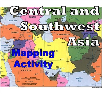
Central and Southwest Asia (Middle East) - Mapping Activity
Map Activity – Central and Southwest AsiaIn this activity, students must locate and identify the countries (and capital cities if so desired) of Central and Southwest (or Middle Eastern) Asia. When students are finished with this, time can be spent coloring in the various countries.Included in this package is a ready-to-copy blackline master map of Central and Southwest Asia along with a separate answer key.This product can also easily be used as a test or quiz.Preview file is available for down
Subjects:
Grades:
4th - 12th, Higher Education, Adult Education
Types:
Also included in: Map Activity Bundle
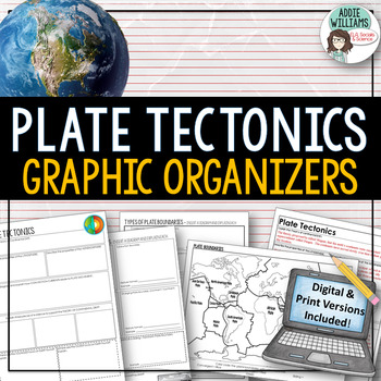
Plate Tectonics / Boundaries Graphic Organizers - PRINT & DIGITAL
Teaching about plate boundaries and plate tectonics? -These graphic organizers are a great way for students to review different plate boundaries, learn about the Theory of Plate tectonics and organize their notes /ideas. Excellent for review or for group work. Includes 3 graphic organizers to mix and match, a Review/Challenge Activity Summary Activity, Mapping Worksheet, and Extension / Lesson Ideas. Includes answer keys for the graphic organizers.This resource also includes a link to a digita
Subjects:
Grades:
7th - 10th, Adult Education
Types:
Also included in: Plate Tectonics / Earthquakes / Volcanoes Organizers | PRINT & DIGITAL
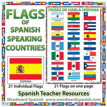
Flags of Spanish-speaking Countries
Flags of the 21 Spanish-speaking countries.
These flags are perfect for decorating the Spanish classroom. You may also want to laminate the flags and use them as large flashcards.
There are 21 individual flags of the following Spanish-speaking countries: Argentina, Bolivia, Chile, Colombia, Costa Rica, Cuba, Ecuador, El Salvador, España, Guatemala, Guinea Ecuatorial, Honduras, México, Nicaragua, Panamá, Paraguay, Perú, Puerto Rico, República Dominicana, Uruguay, Venezuela.
Each flag is on its
Subjects:
Grades:
1st - 12th, Adult Education
Also included in: Spanish Bundle – Spanish-speaking Countries and Capitals
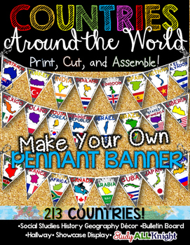
Countries Around the World Classroom Decor Make Your Own Pennant Banner
Worldwide Countries Classroom Decor Make Your Own Pennant BannerGrades K-12 social studies, history, geography, Model UN, global studies, world history Celebrate our world! Teachers can decorate their classrooms, hallway, gymnasium, media center, or anywhere in their building. You'll get 213 pennants to choose from. Pick pennants that represent your student's heritage, ethnicities, backgrounds, ancestry. They are colorful and awesome to look at. The countries pennant will bring enthusiasm and un
Grades:
PreK - 12th, Higher Education, Adult Education, Staff
Also included in: English Teacher Activities and Fun Bundle

Geography—World Religions: A Comparison Study on Judaism, Christianity, & Islam
An engaging and interesting comparison of the three great present-day monotheistic world religions: Judaism, Christianity, and Islam. (INCLUDES EASEL ACTIVITY)Bundle & Save Here World Religions BundleTHIS LESSON INCLUDES:World Religions Chart (Student Notes)World Religions Chart (Teacher Guide)Venn Diagram (Student Notes)Venn Diagram (Teacher Guide)Aesthetic & Interesting Informational Handouts on Judaism, Christianity, and IslamTeacher Instructions (Lesson detail Introduction and Proced
Grades:
5th - 12th, Higher Education, Adult Education
Also included in: Bundle for Katrina- World Religions
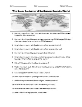
Web Quest: Geography of the Spanish-Speaking World (emergency sub plan)
This activity contains 40 questions in English written in a trivia format. It is excellent if you plan to have a substitute teacher as it will keep your students busy researching answers. The questions can also be useful to motivate class discussion. Includes answer key.
Subjects:
Grades:
5th - 12th, Higher Education, Adult Education
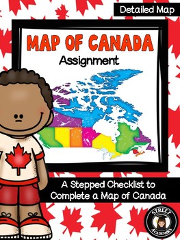
Map of Canada Assignment - Detailed Map
This is a minimal-prep assignment that you can simply photocopy and distribute to students now! The assignment is broken down into 10 steps and is perfect for an applied or academic classroom. The assignment includes a built-in checklist for students to use while completing their maps.
There are two versions of this assignment included in this download – one with and one without the post-it note annotation. There are also two rubrics to reflect both versions of this assignment. You can use the
Subjects:
Grades:
4th - 12th, Higher Education, Adult Education
Types:
What Country Is This? Short Geography, History, Economics Readings CCSS 6-8
Expand students' global knowledge with high-interest paragraphs that engage students with fascinating facts! No prep for bell work or many more uses. What you get:25 one-page handouts. Countries featured are those students may not be familiar with in Africa, Asia, Latin America, and Europe. See Preview for list.2-3 questions per passage that cover CCSStandards for SS/History. Main ideas, fact/opinion, using visual information and more. One concept covered is why some nations are so poor. 9
Subjects:
Grades:
6th - 8th, Adult Education
Types:
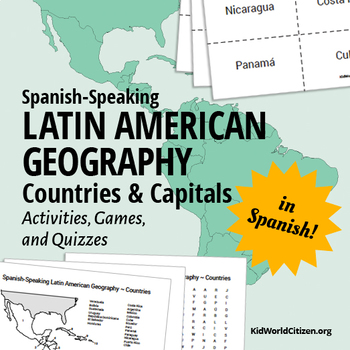
Latin American Countries and Capitals: Geography Activities and Games in Spanish
Latin American Geography for Kids IN SPANISH! Use these games, activities, and quizzes to teach your students the Spanish-speaking Latin American countries and capitals. I always use these at the beginning of the year with all levels of Spanish classes! It is so important for kids to be familiar with the countries were the Spanish language is spoken.
1) Label the map with Spanish-speaking Latin American countries. (with a word bank of countries in Spanish with accents, etc)
2) Label the map w
Subjects:
Grades:
6th - 12th, Adult Education
Types:
Layers of the Atmosphere Build an 8-foot Scaled-Down Model of our Atmosphere
Create an 8-foot-tall (2.4m), scaled-down model of our atmosphere and discover cool information about our atmosphere at the same time! Students will also learn a little history about humankind's ventures into our atmosphere.Includes Troposphere, Tropopause, Stratosphere, Stratopause, Mesosphere, Mesopause, Thermosphere, and Exosphere. No prep.The only way to get a true sense of atmospheric scale is with a model this big!Crosscutting concepts: scale, proportion, & quantity, systems & sy
Subjects:
Grades:
6th - 12th, Adult Education
Types:
CCSS:
Also included in: Ecology, Environmental Studies, and Earth Science Activities Bundle
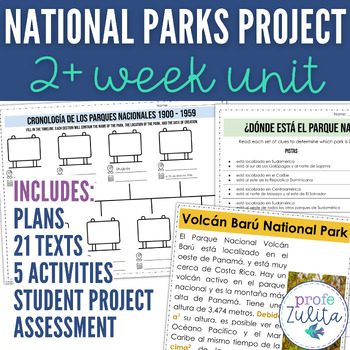
National Parks Spanish Speaking World Project Unit Readings + PBL Activities
Are you looking for an engaging Project Based Learning Unit for Spanish? This 13+ Day unit includes 21 readings about National Parks in Central and South America along with pre reading, during reading, and post reading activities to prep your students for a Spanish PBL project of planning a trip to a National Park. This Spanish Unit is designed around the National Parks of the Spanish Speaking World! This unit covers 1 National Park in each Spanish speaking country in Central, South America, the
Subjects:
Grades:
7th - 12th, Higher Education, Adult Education
Types:
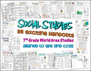
Bundle of 28 Worksheets for 7th Grade Social Studies GPS Georgia
This is a HUGE lot of fun and engaging handouts for students to use in reviewing key information. Included in this package are 28 individual activities, including puzzles, maps, fill-in-the-blank sections, word searches, matching, etc. Most of these items were created to help students review for the end of year test, so they cover a variety of topics and standards.
This is a great way to get your students excited about social studies. I use most of these resources as warm up and closing activi
Grades:
PreK - 12th, Higher Education, Adult Education, Staff
Types:
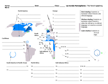
Monde Francophone World Map French-Speaking Countries
Overview: Printable map to label French-speaking countries. Includes answer key. Thirty-seven countries and/or territories listed. Objective: Identify French-speaking countries and territories by labeling a world map.Estimated Time: 10 to 30 minutes (depending on how the teacher would like to enrich it)Suggested/Possible Sequence:1. Students brainstorm or make a list of countries they already know. Teacher verifies student lists.2. Students then use textbooks or maps to identify the countries sh
Subjects:
Grades:
5th - 12th, Higher Education, Adult Education
Types:
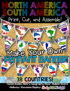
North America South America Classroom Decor Make Your Own Pennant Banner
North America South America Classroom Decor Make Your Own Pennant Banner
Grades K-12 social studies, history, geography, Model UN, global studies, world history
Celebrate our world! Teachers can decorate their classrooms, hallway, gymnasium, media center, or anywhere in their building. You'll get 38 pennants to choose from. Pick pennants that represent your student's heritage, ethnicities, backgrounds, ancestry.
They are colorful and awesome to look at. The countries pennant will bring enthu
Grades:
PreK - 12th, Higher Education, Adult Education, Staff
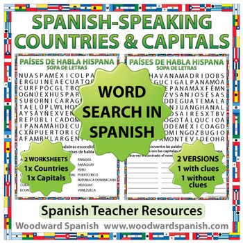
Spanish-speaking Countries and Capitals Word Search
Spanish-speaking Countries and Capitals Word Search
Word Search Worksheets in Spanish about the 21 Spanish-speaking countries and their capital cities.
One worksheet contains the following countries (in Spanish): Argentina, Bolivia, Chile, Colombia, Costa Rica, Cuba, Ecuador, El Salvador, España, Guatemala, Guinea Ecuatorial, Honduras, México, Nicaragua, Panamá, Paraguay, Perú, Puerto Rico, República Dominicana, Uruguay, Venezuela.
Another worksheet contains the following capital cities of th
Subjects:
Grades:
5th - 12th, Adult Education
Types:
Also included in: Spanish Bundle – Spanish-speaking Countries and Capitals
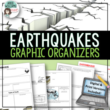
Earthquakes / Faulting Graphic Organizer | Print & Digital
Earthquakes / Faulting Graphic Organizer - A great way for students to organize information on earthquakes and faulting. Instead of asking students to take traditional notes, they fill in the graphic organizer - either as review or instead of standard question and answer in a textbook. Excellent for review or group work. Includes 4 pages of organizers and all answer keys!Also includes a link to a Google™ Slides version of the organizers so students can add text, images, color and more while wo
Subjects:
Grades:
8th - 10th, Higher Education, Adult Education
Also included in: Plate Tectonics / Earthquakes / Volcanoes Organizers | PRINT & DIGITAL
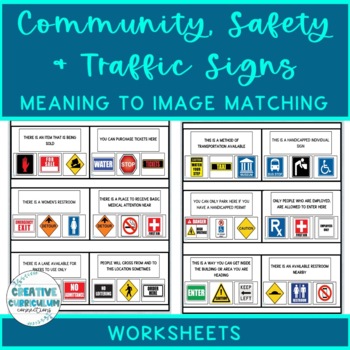
Community, Safety & Traffic Signs Sign Definition to Image Matching Worksheets
For this community instruction based lesson, students are presented with varying community, traffic, or safety signs visually/in word form. Students will work on their functional vocabulary skills by identifying the sign's name and image. Students are asked to review the provided sign meaning or definition and match it to its image, out of an array of three. Students will work on identifying sign based vocabulary words, reading signs, defining signs/understandings purpose and more!There are 15 w
Subjects:
Grades:
1st - 12th, Higher Education, Adult Education
Types:
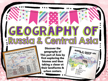
Russia & Central Asia Biome and Geography Hunt
Introduce your unit over RUSSIA with this mapping activity. Students use globes, atlases, and/or the internet to discover more about the geography of this region!
Countries included:
Russia
Kazakhstan
Uzbekistan
Kyrgyzstan
Tajikistan
Turkmenistan
Students create maps over:
-Biomes
-Geography (landforms, countries, bodies of water, urban centers)
**BUNDLE AND SAVE**
check out my bundled GEOGRAPHY MAPS in my TpT store!
SAVE MONEY, and buy ALL THE GEO. HUNTS here:
https://www.teacherspaytea
Subjects:
Grades:
3rd - 12th, Adult Education
Types:
Southwest Region Unit Activity Booklet or Interactive Notebook Lesson Worksheets
Southwest Region Unit Activity Booklet or Interactive Notebook Lesson WorksheetsThis Southwest region mini unit consists of 10 half page worksheets that students complete and assemble as a mini-book. The worksheets also be used as part of an interactive notebook about the Southwest region. Students staple the pages together once they have completed all of their information about the Southwest region.The pages include:A Southwest region cover pageStates and Capitals of the Southwest regionA map o
Grades:
2nd - 6th, Adult Education
Types:
Also included in: US Regions Unit Mini Booklets Worksheets All Five Regions Bundle
Europe Geography — Eastern & Western Europe Scavenger Hunt (Intro Activity)
This lesson is easy enough for 5th graders to understand yet works well with students up to grade 12. Modifications can be made as needed. Get the Scavenger Hunt Bundle and Save HereStudents will find this Eastern and Western Europe Scavenger Hunt activity fun and motivating, and it will encourage students to examine the physical, political, economic, and cultural characteristics of Eastern & Western Europe, along with the geographical themes. This is the perfect activity to introduce and be
Subjects:
Grades:
5th - 12th, Adult Education
Types:
Also included in: NEW! Geography Scavenger Hunt Bundle + 2 Freebies
Geography Pre-assessment/Post-assessment Beginning of Year (Easel Act. Included)
This 80+ question assessment is a great way to evaluate what your students know going into the school year, what they have learned during the first semester as well as what knowledge and skills they have gained by the end of the school year. Why waste precious time creating a thorough and effective test when it has already been done for you? Use this clean and well-put-together assessment over and over again throughout the school year to assess your students.Comes with questions, a student answe
Grades:
6th - 12th, Higher Education, Adult Education
Types:
Also included in: Build A Bundle for Georgianne B
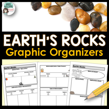
Rock Types Graphic Organizer - Igneous, Sedimentary and Metamorphic
Teaching the different types of rocks? These graphic organizers are a great way for students to learn the differences between igneous, sedimentary, and metamorphic rocks as well as their sub-categories. This resource includes 4 pages of graphic organizers that can be used with notes or while working through a PowerPoint, as review, or for group work. This resource also includes a set of review questions and answer keys.Covers Igneous (intrusive/extrusive), Sedimentary (mechanical/clastic, organ
Subjects:
Grades:
7th - 10th, Adult Education
Also included in: Rocks and Minerals - Types of Rocks, Rock Cycle, Minerals and More!
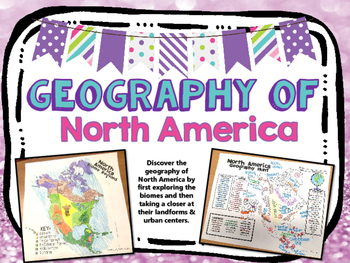
North America Biome and Geography Hunt
Introduce your unit over North America with this mapping activity. Students use globes, atlases, and/or the internet to discover more about the geography of this region!
Countries Included:
U.S.A.
Canada
Mexico
Bahamas
Dominican Rep.
Cuba
Haiti
Belize
Honduras
Nicaragua
Guatemala
El Salvador
Costa Rica
Panama
Greenland
Students create maps over:
-Biomes
-Geography (landforms, countries, bodies of water, urban centers)
**BUNDLE AND SAVE**
check out my bundled GEOGRAPHY MAPS in my TpT store!
Subjects:
Grades:
3rd - 12th, Adult Education
Types:
Showing 1-24 of 3,687 results


