TPT
Total:
$0.00
Selected
Grades

Subjects

Arts & Music
English Language Arts
Foreign Language
Holidays/Seasonal
Math
Science
Social Studies - History
Specialty
For All Subject Areas
94 results

7th grade Summer geography laboratories
Preview of Climate Change Activity Mapping Carbon Emissions NGSS MS-ESS3-5 ESS3-4
Climate Change Activity Mapping Carbon Emissions NGSS MS-ESS3-5 ESS3-4

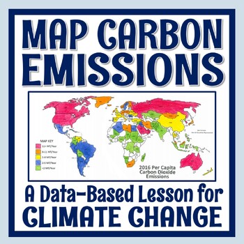
Students use real data to color-code a map of 68 countries based on their per capita carbon emissions. In this activity, students will:READ a 1-page article about greenhouse gases, carbon dioxide, what per capita means, and the activity directions. CONSTRUCT a World Map by attaching 2 provided pages (it's easy!).COLOR CODE countries on the map according to their per capita carbon emissions. ANSWER 11 analysis questions focusing on the greenhouse effect, sources of carbon emissions, and how de
Preview of Ocean Currents - Rescue Lab Activity

Ocean Currents - Rescue Lab Activity

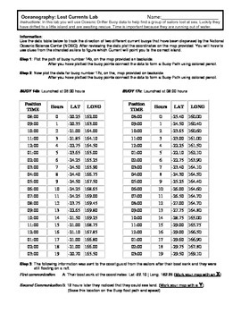
Ocean Currents - Rescue Lab Activity This is a fun little Latitude/Longitude Ocean Current activity. Students plot the path of 2 current buoys to determine the location of a lost ship crew in the Indian Ocean. This is a crossover science activity - Oceanography - Geography - Graphing. Usually takes between 30 - 40 minutes. ----------------------------------------------------------------------------- Other GES Ocean Activity Ocean Current Introduction
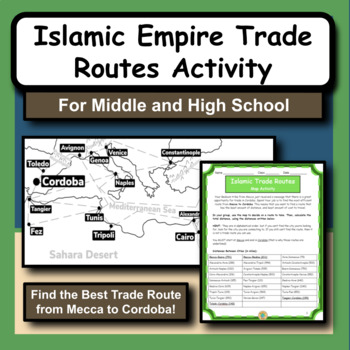
Preview of Islamic Empire Trade Routes Map Activity for Social Studies and History
Islamic Empire Trade Routes Map Activity for Social Studies and History

The Islamic Empire is arguably one of the most prominent and influential times of history in the Middle East. As we study the Islamic culture and the rise of the empire, we notice that geography has a huge role in many different aspects.This product gives students the opportunity to practice map and math skills as they try to figure out the best trade route to take from Mecca to Cordoba, Spain. Their goal is to spend the least amount of money possible. The provided maps have all the city locatio
Preview of 50 Social Studies Labs - Geography History Cultural Studies Economics Government
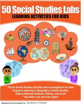
50 Social Studies Labs - Geography History Cultural Studies Economics Government

PREVIEW AVAILABLE!LIKE WHAT YOU SEE? CHECK OUT OTHER STEM RESOURCES IN MY SHOP!FROM THE CREATOR OF 50 STEM LABS & 50 MORE STEM LABS comes this collection of 50 Social Studies Activities for kids. Recommended for grades K to 6 and up! Each one has a snappy title, a brief set of instructions, recommended materials list, and space for notes. These are very adjustable for your classroom, home, or homeschool needs. Do projects for concepts like: Geography, Cultural Studies, Economics, History, G
Preview of Diet Coke And Mentos Geyser Experiment | Physical Changes STEM | Outdoor Science
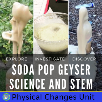
Diet Coke And Mentos Geyser Experiment | Physical Changes STEM | Outdoor Science

Uncover the secrets of Diet Coke/Mentos geysers with a complete hands-on unit. This is a great exploration for the end of the year and summer camp fun. Detailed directions help guide the teachers and students to a memorable scientific experience. Students will have a blast discovering physical changes and the properties of matter.Included in the Hands-On Exploration:Teacher Background InformationDetailed DirectionsExample PicturesNGSS Grade 4/5 Matter and Its InteractionsNGSS Middle-Level Struct
Preview of Mapping Earth & Landforms Unit Bundle | Printable, Digital & Editable Components
Mapping Earth & Landforms Unit Bundle | Printable, Digital & Editable Components

Save 40% by purchasing ALL my Mapping Earth teaching materials!Important Notes:• Download a FREE Unit Bundle to learn more about all my products.• Save $$$ with the Earth Science Complete Curriculum• Save $$$$ with the Integrated Science Complete Curriculum• Consider Daily Lessons as an economical alternative to this unit bundle (see below)• This product includes FREE downloads of ALL future Mapping Earth products.**********************************************************************************
Preview of Plate Tectonics & Boundaries PLOT real Earthquakes & Volcanoes DATA LAB
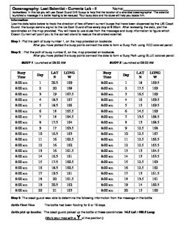
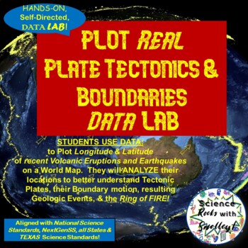
Plate Tectonics & Boundaries PLOT real Earthquakes & Volcanoes DATA LAB

This DATA LAB connects Plate Tectonics and Boundary motion to the ACTUAL Geologic Events they cause-- especially around the Ring of Fire, or Pacific Plate! Students can LABEL the Major PLATES on a World MAP (or Differentiate for ESL/Special Needs students by giving them the MAP with the Plates already labeled- several Included for YOU!) Then, PLOT 18 Latitude & Longitude Points of recent Earthquakes in one color and 18 significant Volcanic Eruptions in another color. They can then-- Color Co
Preview of Ocean Currents  - Lost Scientist  - Current Lab II
Ocean Currents - Lost Scientist - Current Lab II

Ocean Currents - Lost Scientist - Current Lab II Updated 5-5-16 This is a fun little Latitude/Longitude Ocean Current activity. Students plot the path of 2 current buoys to determine the location of a lost scientist in the Pacific Ocean. This is a crossover science activity - Oceanography - Geography - Graphing. Usually takes between 30 - 40 minutes. This activity is similar to "Ocean Currents - Rescue Lab Activity" -Seen Here-
Preview of Earthquake Coordinate Lab: Plot current earthquakes using latitude and longitude
Earthquake Coordinate Lab: Plot current earthquakes using latitude and longitude

Created by
Alyse Palumbo
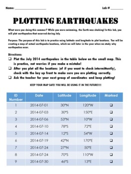
I am always looking for a latitude/longitude earthquake lab that has NEW data and can never find one... so I made one! Have your students plot real earthquake locations from July 2023. Coordinates are given in degrees, minutes and seconds. Use both, or just have students round to the nearest degree. Minutes and seconds are included in case you would like to print out a larger scale map of a specific location. Use this as a review of latitude and longitude, and as a way to purposefully plot data
Preview of Topographic Maps Lab Activity with play dough
Topographic Maps Lab Activity with play dough

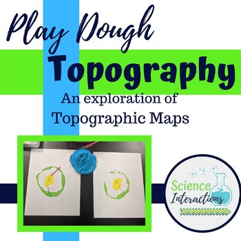
This is an hands-on exploration of topographic maps. Students build a mountain out of play dough, slice the mountain into layers, and use those layers to create a topographic map. This activity is very-engaging and students of all ability levels enjoy it. This lab is especially good for students who struggle with abstract thinking. This lab packet contains teacher demonstration instructions, a student sheet, answer sheet, and recipe for homemade dough.Please check out many of my products in acti
Preview of Land Use and The Water Cycle Virtual Lab
Land Use and The Water Cycle Virtual Lab

Created by
ScienceWithMsZ
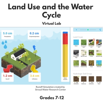
In this virtual lab, students will use the Runoff Simulation, created by Stroud Water Research Center, to determine how land cover and soil type can influence the movement of water. Students will first review the water cycle and the concept that when precipitation falls to the Earth's surface, it can then undergo three processes: 1) evapotranspiration 2) infiltration or 3) runoff. They will then use the simulation to make adjustments to land cover and soil type to better understand how these tw
Preview of Tectonic Plate Boundaries CONVERGENT DIVERGENT TRANSFORM Worksheets Webquest Lab
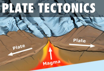
Tectonic Plate Boundaries CONVERGENT DIVERGENT TRANSFORM Worksheets Webquest Lab

Your students will learn about Earth's layers, different plate boundaries and explore how our planet's plates move and collide. This lesson plan has a PowerPoint Presentation, chart to fill out type worksheet, types of plate boundaries map identification activity, webquest, lab AND study guide! It's all in this resource! This is a super packed lesson plan with tons of resources to tap into. The lesson plan covers the following topic:•Review of the Layers of the Earth and Convection Currents•Typ
Preview of Watershed Delineation with Topographic Maps
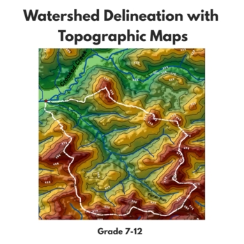
Watershed Delineation with Topographic Maps

Created by
ScienceWithMsZ
In this activity, students will learn to delineate watersheds using topographic maps. The activity starts with students answering questions from the USDA article titled "How to Read a Topographic Map and Delineate a Watershed." They will then use their knowledge from these questions to delineate the Fulton Run watershed, located in Indiana, Pennsylvania. There are two topographic maps included in the product - one for more advanced learners and one for less advanced learners. The map for less ad
Preview of Mining of the Canadian Shield Mini-Lab
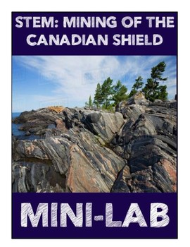
Mining of the Canadian Shield Mini-Lab

Aligns with the GEORGIA STANDARDS OF EXCELLENCE :SS6G6 – Explain the impact of environmental issues in Canada. b. Explain the causes and effects of the extraction of natural resources on the Canadian Shield (e.g., mining and logging).Students will need to have prior knowledge on the Canadian Shield and what it is. Using an M&M cookie, students will "mine" for different minerals found in the Canadian Shield. As each mineral is worth a different amount, so students become engaged and highly c
Preview of Mapping Earth Lab Stations Bundle | Printable, Digital & Editable
Mapping Earth Lab Stations Bundle | Printable, Digital & Editable

SAVE 30% by purchasing ALL my Mapping Earth Lab Stations Activities!About SNAPs Lab Stations ActivitiesSNAPs Lab Stations require students to use science, math, literacy, problem-solving and engineering skills. They are designed to enhance students' understanding of scientific concepts and help students apply scientific ideas. Each station activity promotes skills so to develop students into proficient and competent scientific thinkers.SNAPs lab activities have five components:• Science Skills S
Preview of NWS and NOAA Approved!  Forecasting: Severe Weather. You're the Weatherman
NWS and NOAA Approved! Forecasting: Severe Weather. You're the Weatherman

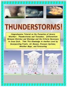
PROCEEDS BENEFIT "REACH INC."-EMPOWERING ADULTS WITH DISABILITIEShttp://www.reachinc.org-Southern Science Specialists - Chapel Hill, North Carolina-Severe Weather Forecasting: Learn How to Forecast Severe Weather With Real Maps, Data, and NWS Symbols.LOADED WITH COLORFUL IMAGES!Pairs great with the Air Masses and Thunderstorm PowerPoint found on TPT at the link below:CLICK HERE FOR POWERPOINTMore advanced severe weather lab manual and Skew-T tutorial found at the link below:CLICK HERE FOR LAB M
Preview of GPS in the Classroom - Complete Set of Lessons!
GPS in the Classroom - Complete Set of Lessons!

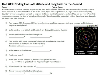
Want to teach your students about GPS, but don't know where to start? This lesson bundle is for you! Included in this package is a complete set of notes that explain in great detail the technical properties of GPS, and a series of activites that allow students from grades 4-12 explore GPS in fun and exciting ways that gets them out of the classroom and outside in nature. Students will learn about latitude and longitude, using waypoints, plotting courses, and using GPS in taking data samples. T
Preview of Nature Journal 5 Day Writing Activity
Nature Journal 5 Day Writing Activity

This resource is a five-day nature journal writing activity. This activity gets kids outside observing all of nature's wonders. It is also included in my Earth Day resource. Earth Day ResourceLook for these other related resources in my store:Science and Social Studies Word Wall BundleScience Word Wall and ActivitiesTropical Rainforest Reading Passage and Task Cards BundleTropical Rainforest Task CardsGlobes, Maps, Landforms and Continents BundleGlobes, Maps, Landforms, and Continents Activity C
Preview of Plate Boundaries Notes and Lab Sheet

Plate Boundaries Notes and Lab Sheet

This document accompanies my Plate Boundaries powerpoint. It's a basic introduction to the three types of plate boundaries (convergent, divergent, and transform). The packet begins with a map page that accompanies the map in the powerpoint for a Check for Understanding. Then there is a Milky Way Tectonics Lab Sheet and Exit Ticket. This works very well as a packet or can be broken up into separate parts based on preferred teaching style.
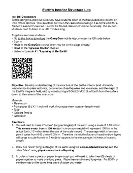
Preview of Interior of the Earth (Layers of the Earth) Activity Laboratory
Interior of the Earth (Layers of the Earth) Activity Laboratory

Created by
GeologyRxGuy
Student activity creating a model for Earth's interior structure. Activity takes 2-3 days and can be used for curricula in Earth Science, Physical Science, and Geology classes. You can easily modify this to fit your grade level!
Preview of Topographic Maps: Use a Model Landscape to Draw Contour Intervals on Your Map
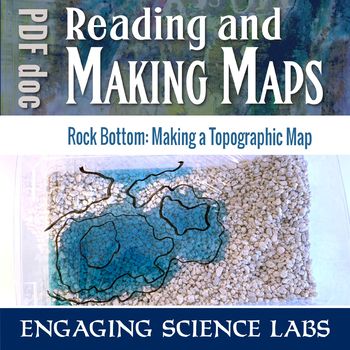
Topographic Maps: Use a Model Landscape to Draw Contour Intervals on Your Map

Quickly shape your own landscape and map its contour intervals. Make your own, accurate topographic maps of mountains, valleys, peninsulas, etc. Easy to reshape and redo and see how different maps correlate to different landscapes. Quicker than most topographical exercises and I love that kids can construct their own without help. Use this to learn and reinforce answers to questions such as:❑ How can we map terrain in three dimensions?❑ What do contour lines on maps show us?❑ What do the differe
Preview of Oceans:  Currents and Maps (Come EXPLORE Your World!)
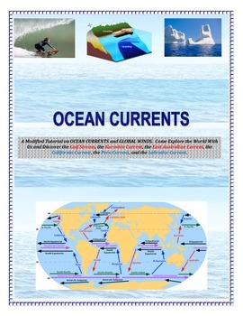
Oceans: Currents and Maps (Come EXPLORE Your World!)

INSERT YOUR NAME HERE! Magellan, Sir Francis Drake, John Cabot, Leif Eriksson, James Cook, Sir Walter Raleigh, Marco Polo, Vasco de Gama, and Columbus.This is a part of the complete ocean current tutorial/lab/activity found below:FULL VERSION CLICK HEREDiscover the Gulf Stream, the Kuroshio Current, the East Australian Current, the California Current, the Peru Current, and the Labrador Current.6 different mapping activities addressing similar content (ocean currents and global winds) in differe
Preview of Overfishing AKA "Tragedy of the Commons" - Science in the Environment Lab Series
Overfishing AKA "Tragedy of the Commons" - Science in the Environment Lab Series

Why do we have hunting and fishing catch regulations? Why does the government regulate logging and farming industries? The concept of overutilization or “the tragedy of the commons” is fundamental to our modern society. The purpose of this activity is to model resource management, and how regulations and private ownership make resource management possible. If you like the activity, be sure to rate it! This is part of a series of activites on Science in the Environment from Mr. Ripps. This wor
Preview of Time Zones Lab

Time Zones Lab

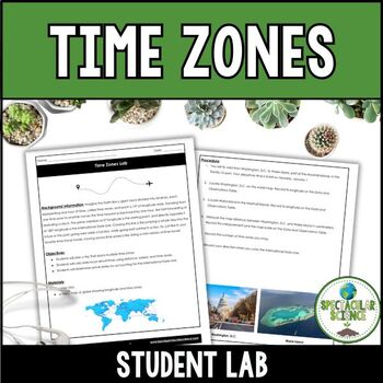
In this Time Zones Lab, students will embark on an exciting journey, planning a trip that takes them across various time zones. As they explore different regions of the world, they will encounter the complexities of time zone boundaries, which play a pivotal role in global travel and communication.Through engaging activities and real-world scenarios, students will learn how to calculate local arrival times based on the distance traveled, the mode of transportation, and the time zones crossed. Th
Showing 1-24 of 94 results

Discover Summer Teaching Resources | TPT

Uncover more about Summer teaching resources

Teach with Summer Printables from TPT

Summer break is finally here, and while students are excited to kick back and relax, teachers may be searching for fun summer activities to keep their students engaged and learning throughout the summer months in June, July, and August. Luckily, there are plenty of fun and educational resources available that can help keep students motivated and inspired, even when the weather is hot and the sun is shining. In this article, we will explore some of the best summer resources and printables for teachers and students, covering a range of subjects and activities to suit all ages and interests. So, whether you're a teacher looking for new ideas, or a student looking for a fun way to keep learning, read on to discover the best summer resources and printables available.

Ideas for Summer Fun & Learning

  1. Summer Reading Lists and Worksheets

One of the best ways to keep students engaged and learning throughout the summer is to encourage them to read. Reading helps to build vocabulary, comprehension, and critical thinking skills, and can be a fun and relaxing way to spend a lazy summer day. To help promote summer reading, TPT offers a variety of summer reading lists and worksheets for students of all ages. These lists typically include a variety of books in different genres and reading levels, along with discussion questions and activities to help students engage with the material.

  1. STEM Activities and Experiments

For students who love science and technology, there are plenty of STEM activities and experiments available that can be done at home or in the classroom. These activities can help students build skills in areas such as coding, robotics, and engineering, while also encouraging creativity and problem-solving. Some popular STEM activities for summer include building and launching rockets, creating homemade ice cream, and designing and building a solar-powered car.

  1. Art Projects and Crafts

Summer is a great time to get creative, and there are plenty of art projects and crafts that students can do to express themselves and build their skills. From painting and drawing to sewing and pottery, there are endless possibilities for creative expression. Some popular summer art projects include creating a nature journal, making a homemade birdhouse, and designing and creating a summer-themed t-shirt.

  1. Virtual Field Trips

While traditional field trips may not be possible during the summer months, virtual field trips offer a fun and educational alternative. Many museums, zoos, and other attractions offer virtual tours and exhibits that allow students to explore and learn about different topics from the comfort of their own homes. Some popular virtual field trips for summer include exploring the Great Barrier Reef, visiting the Louvre Museum in Paris, and taking a tour of the NASA Space Center.

  1. Summer Worksheets and Printables

For students who prefer more structured learning activities, there are plenty of summer worksheets and printables available that cover a range of subjects and topics. These worksheets can help students build skills in areas such as math, science, and language arts, while also providing a fun and engaging way to learn. Some popular summer worksheets and printables include word searches, crossword puzzles, and coloring pages.

  1. Coloring Pages

Other popular resources to explore are summer coloring pages. Easy to print and sure to keep your kids busy, coloring pages are an excellent way for children to express their creativity, unwind, and improve their fine motor skills. Teachers Pay Teachers offers an extensive selection of summer coloring pages featuring beach scenes, road trips, family outings, and more. These printables are suitable for children of all ages and can be a great addition to your summer routine. Your kids will enjoy spending hours coloring these delightful pages and creating their own masterpieces.

Get Started with Summer Resources from TPT

Summer break is a great time for students to relax and recharge, but it's also important to keep their minds active and engaged. With these top summer resources and printables for teachers and students, you can help keep your students motivated and inspired throughout the summer months. Whether you're promoting summer reading, offering STEM activities and experiments, or providing fun and creative art projects and crafts, there are plenty of ways to keep your students learning and growing all summer long. So, try out some of these fun and educational resources and see how they can make this summer your best one yet!

Frequently asked questions:

Are there free summer activities on TPT?

TPT offers many free summer printables as well as resources available for purchase. This includes individual resources as well as resource bundles. Be sure to explore your options and choose resources that fit your budget and needs.

What is an example of a summer printable on TPT?

There are many different types of summer time activities on TPT that are appropriate for little ones as well as for older kids. This includes resources like: Summer Escape Rooms, book report templates, summer reading logs, summer bingo, math-review packets, and many more. Perfect for sunny or rainy days, these activities will keep your students busy in their free time when they aren't playing with friends in the local pool.

How can I make sure my students stay engaged and motivated during the summer months?

Keeping students engaged and motivated when they are not in school can be a challenge, but there are a few things you can do to help. Encouraging summer reading, offering a variety of fun activities and projects, and providing positive feedback and encouragement can all help to keep students motivated and interested in learning throughout the summer.