80 results
Geography clip art microsofts
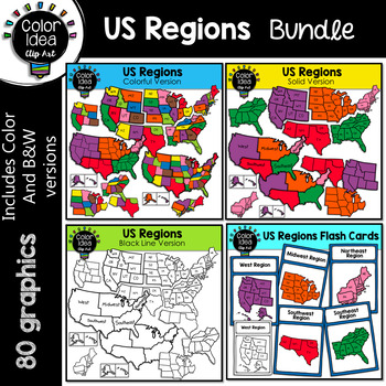
US Regions Bundle
This is a collection of 4 sets. 80 images, colored and black line version. Images saved at 300 dpi in png files.PLEASE NOTE: These are not exact maps, are graphical representation only.** Do not purchase this bundle if you already purchase my USA Maps - BUNDLE **Check out these related clipart sets:Map Skills Clip ArtMap PointersNeighborhood Map SkillsI also have quite a complete selection of clipart in the following bundle:Landforms BundleEarth Science - Geology Mega BundleEarth Science - Geolo
Grades:
3rd - 10th
The 5 Oceans - BUNDLE
Updated: November 16, 2022Introduce your students to the 5 oceans with this colorful bundle, including a PowerPoint lesson, worksheets, and map graphics.This bundle includes:The 5 Oceans - PowerPoint2 Ocean Worksheets32 Globe & Map Graphics
Grades:
K - 4th
Mini passport book
Kids can fill in their pretend passport template as they learn about the counties of the world. 1. America2. Amsterdam3. Argentina4. Australia5. Bahamas6. Barcelona7. Belgium 8. Berlin9. Bombay10. Brazil 11. Canada12. Cape town13. Chicago14. China15. Delphi16. Dubai17. Egypt18. England19. France20. Germany21. Hawaii22. Hong Kong23. India24. Istanbul25. Italia26. Japan27. Korea28. Las Vegas29. Lichtenstein 30. London31. London32. Los Angeles33. Machu Pichu 34. Mexico35. Netherlands 36. New York 3
Grades:
Not Grade Specific
Types:
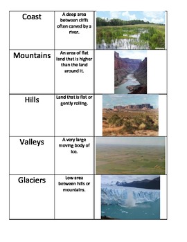
Landforms Picture Matching Activity TEKS 5.7B
This is a picture matching activity that can be used in notebooks or just as a matching activity. There is a picture, the name of landform, and a short definition for each that can all be matched.Please look for my Science Sort Bundle to purchase all my sorts at a discount.
Subjects:
Grades:
2nd - 5th
Types:
Also included in: Science Picture Sorts Bundle for grades 3-5
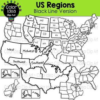
US Regions - Black Line Version
This set contains 24 images. BLACK LINE VERSION ONLY. Images saved at 300 dpi in png files.PLEASE NOTE: These are not exact maps, are graphical representation only.Check out these related clipart sets:Map Skills Clip ArtMap PointersNeighborhood Map SkillsI also have quite a complete selection of clipart in the following bundle:US Regions BundleLandforms BundleEarth Science - Geology Mega BundleEarth Science - Geology Mega Bundle 2☆ Click to follow me to get freebies and updates on new products!
Grades:
PreK - 12th, Adult Education, Staff
Also included in: US Regions Bundle
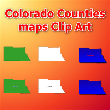
Maps of Colorado Counties Clip Art map Color, Black and White Commercial Use
Click Here>>> click here to subscribe to our storeMaps of Colorado Counties Clip Art map Color, Black and White Commercial UseThis comprehensive collection of clip art gives you the opportunity to discover and add engaging and informative visual elements to your projects. With a total of 384 clip arts, you'll receive 6 choices for each of the all counties in the state of Colorado. Each clip art is in PNG format with a transparent background, giving you the flexibility to easily integrat
Subjects:
Grades:
Not Grade Specific
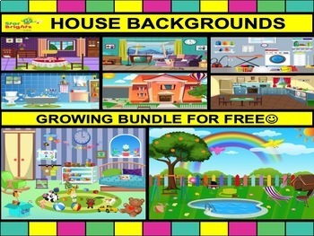
StarBrights - House Room Backgrounds Clipart Bundle 20 different in total
Developing learning material and designing is our passion so we only want the delivery the highest quality but at affordable prices. All files PNG 300dpi so you do not loose resolution when you resize the picture.Creative and colourful house backgrounds include the following: 1.Front of the house2.Dining room3.Garage4.Utility room5.Lounge6.Garden7.Bedroom8.Bathroom9.Kitchen This is a growing bundle to have at least 20 colour rooms very soon. There is more to be added next week . Please check mo
Grades:
Not Grade Specific
Travel the world!
Take your students to several different countries with these colorful pages. Each country represented includes a colorful map, page with several images specific to that country, so basic information about that country, and some printable color sheets. Use these slides alone or as conversation starters for your other social studies activities, to activate prior knowledge, learn about other countries, and learn about each other. Easily delete my Bitmoji for your own. For those not tech savvy, I've
Grades:
PreK - 3rd
Types:
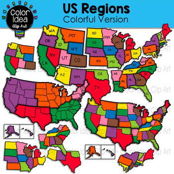
US Regions - Colorful Version
This set contains 23 images. COLORED VERSION ONLY. Images saved at 300 dpi in png files.PLEASE NOTE: These are not exact maps, are graphical representation only.Check out these related clipart sets:Map Skills Clip ArtMap PointersNeighborhood Map SkillsI also have quite a complete selection of clipart in the following bundles:US Regions BundleLandforms BundleEarth Science - Geology Mega BundleEarth Science - Geology Mega Bundle 2☆ Click to follow me to get freebies and updates on new products!☆ F
Grades:
PreK - 12th, Adult Education, Staff
Also included in: US Regions Bundle
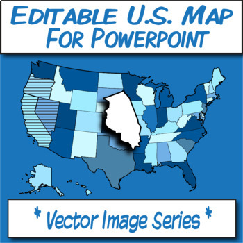
Editable U.S.A. Map Clipart for POWERPOINT **Vector Image Series**
**TRANSPARENT MAP CLIPART FOR POWERPOINT!**Have you ever wanted to use a map in powerpoint and be able to edit its qualities? Line-weight, color, drop-shadow? Need a perfect state shape in powerpoint? Here it is! This powerpoint includes 50, editable state shapes for you to work with. You won't find this on TpT elsewhere!This .PPTX contains three slides that contain editable U.S. state shapes, a U.S. outline map, and labeled (text-box) map for each state name.All the images were created in Adobe
Grades:
Not Grade Specific
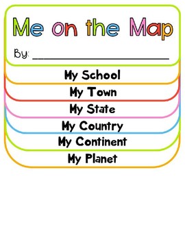
Me on the Map
Me on the Map activity booklet - This include My Planet, My Continent, My Country, My State, My Town and My School. On the My Town, you will add an image of your state. You will be able to move the circle and star to the location of your capital and town/city. I made this template for our First Grade teacher. She let each student make their own planet, then she took a picture of them with their hands in the air. She placed their planet in their hands and their feet on the very top of the Me on t
Subjects:
Grades:
Not Grade Specific
Types:
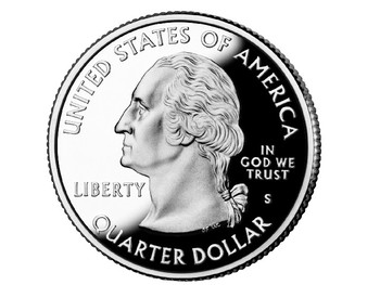
50 State Quarters Picture Pack
50 State Quarters - 50 pictures - good for projects, tracing, extra research etc
Subjects:
Grades:
Not Grade Specific
Types:
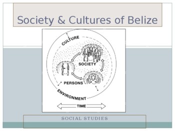
Society & Cultures of Belize
A society and culture of Belize power point built for face to face classroom and virtual discussions. This piece makes for close up understand of Belize's history and its cultural diversity to present day. Students will be able to asks questions and give feedback as you go along and will allow for a more interactive lesson with their focus on the topic at hand.
Grades:
4th - 12th, Higher Education, Adult Education, Staff
Types:
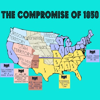
Compromise of 1850 Annotated Map - For Civil War Unit
Have a hard time getting your students to remember each of the provisions of the Compromise of 1850? Use this color-coded map! Visual cues will help student understand which areas were unorganized, which were pre-state territories, which were slave states and which were free. The provisions of the Compromise are color-coded and clearly delineated.
This image is 100% created by me, as I didn't feel any of the images currently free on the web really captured the information I wanted to relay t
Subjects:
Grades:
9th - 12th

Oklahoma Counties PowerPoint Images
Very basic PowerPoint of Oklahoma Counties, showing the following:
1. Blank map of Oklahoma, with county outlines shown.
2. Same map, but with small county labels.
3. Same map, with small labels, and counties are colored.
4. Same map, but with medium county labels.
5. Same map, with medium labels, and counties are colored.
6. Same map, but with large county labels.
7. Same map, with large labels, and counties are colored.
See preview file.
Please use these county maps in any way that you see
Grades:
Not Grade Specific
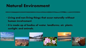
Natural Environments-Pictures of Water and Land Formations for Commercial Use.
PowerPoint that contains water and land formations and definitions for each.archbeachbuttecanyoncavegeyserhoodoosislandlakemarshmesamountainsoceanplainsplateau
Subjects:
Grades:
PreK - 6th
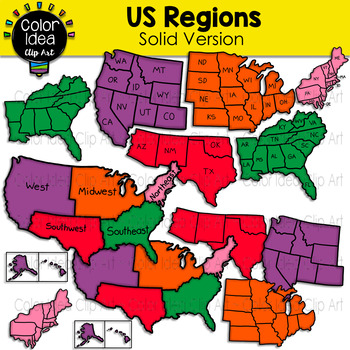
US Regions - Solid Version
This set contains 23 images. COLORED VERSION ONLY. Images saved at 300 dpi in png files.PLEASE NOTE: These are not exact maps, are graphical representation only.Check out these related clipart sets:Map Skills Clip ArtMap PointersNeighborhood Map SkillsI also have quite a complete selection of clipart in the following bundles:US Regions BundleLandforms BundleEarth Science - Geology Mega BundleEarth Science - Geology Mega Bundle 2☆ Click to follow me to get freebies and updates on new products!☆ F
Grades:
PreK - 12th, Adult Education, Staff
Also included in: US Regions Bundle
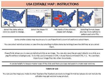
United States - Editable Map
Teachers and sellers can use this simple PPT slide file to create their own maps of the United States - perfect for showing different kinds of political, economic, or social information.Teachers are free to use the maps they create using this file in other products for sale on Teachers Pay Teachers.Teachers interested in other maps can find more resources on my page including a complete set of nations of the world maps available at the link below. I also have a free set of United States maps av
Grades:
Not Grade Specific
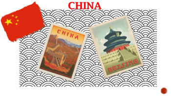
English Class Presentation - China for kids!
This presentation contains very interesting information about chinese culture aspects, such as chinese characters, food, sights etc. In addition, riddles and quiz will help you to make your english class more interesting for kids!
Subjects:
Grades:
PreK - 6th

Geography 28 High Quality Stock Images - Burj Khalifa in Dubai
Geography28 photos of the Burj Khalifa in Dubai. Pictures are of the building itself, the fountain at the base and the view from the top. These can be used in Power Points presentations as well as worksheets, quizzes, images for your bulleting board or wherever you would like.All of the photos are in JPG format and can be resized. They are ready to print or upload.DO YOU WANT TPT CREDITS? Simply provide feedback for this purchase and you will receive TPT credits. Also, your feedback will
Subjects:
Grades:
Not Grade Specific
Lesson 7
These lessons teach children some of the cities of Idaho. They are formatted in different game styles. Each lesson contains 1 page each of these games. The games are as follows: Picture match-up where you learn a little fact about a city of Idaho and then you match it up with the corresponding picture, the second game is multiple choice where you learn some facts about some Idaho cities and you pick the correct answer, the next game shows Idaho counties and you pick the two cities that belong in
Grades:
4th
Types:
Lesson 5
These lessons teach children some of the cities of Idaho. They are formatted in different game styles. Each lesson contains 1 page each of these games. The games are as follows: Picture match-up where you learn a little fact about a city of Idaho and then you match it up with the corresponding picture, the second game is multiple choice where you learn some facts about some Idaho cities and you pick the correct answer, the next game shows Idaho counties and you pick the two cities that belong in
Grades:
4th
Types:
Lesson 4
These lessons teach children some of the cities of Idaho. They are formatted in different game styles. Each lesson contains 1 page each of these games. The games are as follows: Picture match-up where you learn a little fact about a city of Idaho and then you match it up with the corresponding picture, the second game is multiple choice where you learn some facts about some Idaho cities and you pick the correct answer, the next game shows Idaho counties and you pick the two cities that belong in
Grades:
4th
Types:
Lesson 3
These lessons teach children some of the cities of Idaho. They are formatted in different game styles. Each lesson contains 1 page each of these games. The games are as follows: Picture match-up where you learn a little fact about a city of Idaho and then you match it up with the corresponding picture, the second game is multiple choice where you learn some facts about some Idaho cities and you pick the correct answer, the next game shows Idaho counties and you pick the two cities that belong in
Grades:
4th
Types:
Showing 1-24 of 80 results


