11 results
Higher education geography word walls
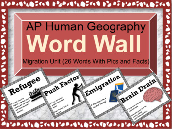
AP Human Geography Word Wall (Unit 2: Population & Migration)
Before you purchase this word wall, Consider purchasing all the units at one price for a Bundled Discount!!! (Get Access to all 7 Word Walls and Lifetime Updates) ULTIMATE WORD WALL BUNDLE (ALL UNITS)A lot of teachers know that word walls are extremely beneficial at helping out student retention before, during, and after a unit is being taught. Not only that, but teachers can point them out more frequently so students can increase their academic vocabulary. If you're teaching AP Human Geograph
Subjects:
Grades:
9th - 12th, Higher Education
Also included in: AP Human Geography Word Wall MEGA BUNDLE
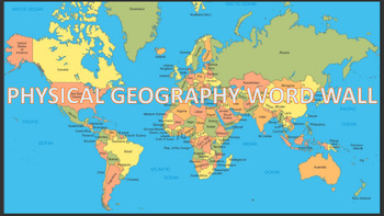
Social Studies Word Wall Bundle
Here is a huge 300 word wall bundle for you to print out, laminate, and hang it anywhere in your classroom. It covers essential key terms and vocabulary for any social studies content (US history, world geography, world history, government, and economics), that is taught in middle and high school. Content ranges from a variety of landforms, rivers, world events, American events, branches of government, economic systems, and so much more. Discount price included!
Grades:
6th - 12th, Higher Education
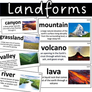
Landforms Vocabulary Cards Earth Science Grasslands , dunes, forest , desert
Landforms Vocab Flash CardsmountainvolcanolavaplateaumarshesglaciervalleyrivergulfOceanlakepondwetlandpeninsulaIsthmusislandhillplaintundrataigagrasslanddesertrainforesttemperate forestdunecanyoncavecliffwaterfallmesa
Grades:
1st - 12th, Higher Education
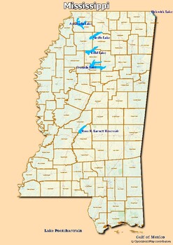
Map of major rivers and map of major lakes in the state of Mississippi, USA
Map of major rivers and map of major lakes in the state of Mississippi, USAThis material gives you two specific maps, one for rivers and one for lakes, which provide an engaging way to learn about geography.Rivers Map: This map shows the major rivers in Mississippi. Using a blank map, students can fill in the names of rivers on the blank map, developing their geography and mapping skills.Lakes Map: Discover the largest lakes in the state of Mississippi. Using this white map, students will be abl
Grades:
2nd - 12th, Higher Education, Adult Education
Types:
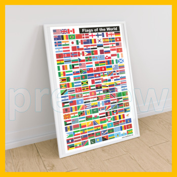
Flags of the World Posters, A2, A3, and A4 Size, Printable Educational Wall Art
Printable Educational Wall Art: Flags of the World Posters (193 COUNTRIES).YOUR ORDER WILL INCLUDE DIGITAL FILES IN THESE SIZES:☀ A2 (PNG + PDF) 420 x 594mm (300dpi).☀ A3 (PNG + PDF) 297 x 420mm (300dpi).☀ A4 (PNG + PDF) 210 x 297mm (300dpi).I really appreciate you purchasing my teaching resources and I hope you'll enjoy using them at home or in your classroom.Please FOLLOW ME HERE if you'd like to receive notifications when I upload new products and freebies.DOWNLOAD. PRINT. DONE!RATING AFTER D
Grades:
PreK - 12th, Higher Education, Adult Education, Staff
Types:

Economic Sectors / Business Classification Lesson
Students will learn about the 3 Economic Sectors used in Business or Economics. These are Primary Sector, Secondary Sector and Tertiary Sector. Students will learn how each sector contributes to the economic development of a country. By the end of the lesson students will perform individual classwork, and will identify and classify industries given in the attached exercise.
Subjects:
Grades:
9th - 12th, Higher Education, Adult Education, Staff
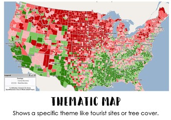
Types of Maps Display Posters
This printable poster pack includes 5 different types of maps, an explanation of them and a title. Simply print, laminate and display! Can be printed in A3 size, to make it easier to see for students.
Subjects:
Grades:
4th - 12th, Higher Education, Adult Education
Types:
How to Reference Posters
These colourful posters show students the formatting and give an example of how to reference. They are based on the Harvard style of referencing. Simply print, trim and laminate! Pro Tip: I stick mine to the pinbaord with velcro so students can pull them down and use them at their desks when they are stuck.
Grades:
5th - 12th, Higher Education, Adult Education
Types:
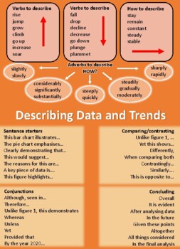
Data and trends VOCABULARY POSTER
This poster is thoughtfully designed to help assist your students with describing data and trends. It provides useful vocabulary for a variety of components. This can be used across many subjects and grade levels! Available in pdf format.
Subjects:
Grades:
6th - 12th, Higher Education
Types:
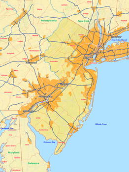
New Jersey map with cities township counties rivers roads labeled
New Jersey map with cities township counties rivers roads labeledThis download contains files that may be printed and copied or used digitally.___________________________________________________________________World City MapsBooksPinterestInstagramFacebookTikToK
Grades:
5th - 12th, Higher Education
Types:

*FREE* AP Human Geography Chapter 3 Word Wall
This word wall is based on Rubenstein's book The Cultural Landscape.Most important it is all the Key Terms for Chapter 3 (ALL 29!)The doc will have a link on it to the Google Slide Presentation with all 29 Key Terms of Chapter 3! All you have to do is click the link to make a copy of it to your Google Drive and then add to your Google Classroom!Word Walls are a great way of getting the vocabulary in one place!Also can be used with Distance Learning.
Grades:
9th - 12th, Higher Education, Adult Education
Types:
Showing 1-11 of 11 results


