63 results
Free 7th grade geography lectures
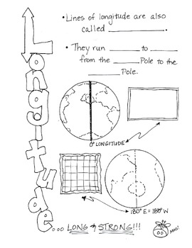
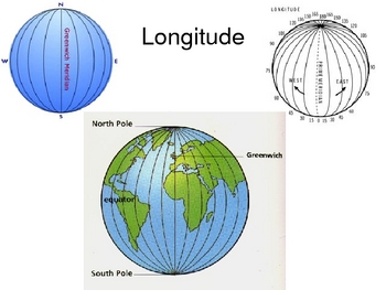
Cartoon Notes for Map Skills-Longitude
Visual notes for learning map skills...I call them 'Cartoon Notes!' These notes are a hit in my classroom, as they tie in visual learning with note-taking. I use these in my classroom to introduce, reinforce, and review with my students. Enjoy!
This is the page for teaching 'Longitude." Make sure you search for the page on 'Latitude' as well!
Subjects:
Grades:
3rd - 9th
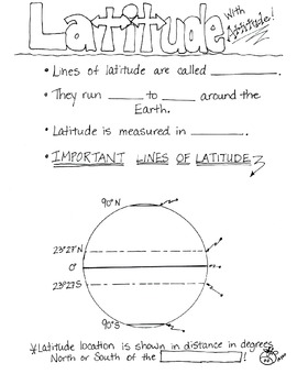
Cartoon Notes for Map Skills-Latitude
Visual notes for learning map skills...I call them 'Cartoon Notes!' These notes are a hit in my classroom, as they tie in visual learning with note-taking. I use these in my classroom to introduce, reinforce, and review with my students. Enjoy!
This is a page for teaching 'Latitude.' Please see the 'Longitude' page too!
Subjects:
Grades:
3rd - 8th
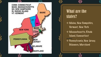
Northeast Region of United States Presentation FREEBIE
This product gives information about the Northeast Region of the United States, including maps, photographs, & information pertaining to each state of the region.
This presentation is a FREEBIE and if you like this product, please go to my "It's A Vaughnderful Classroom" to check out the whole bundle.
Included with the bundle is a presentation of each of the five regions including: the West, Midwest, Southeast, Southwest, and Northeast regions.
Grades:
2nd - 8th

American Colonies Power Point and Exam
This 12 slide Power Point on how the American Colonies were established includes colorful images and maps to support the text. Includes the reasons why Europe colonized America, information on the lost colony of Roanoke, Jamestown, and the major differences between the 3 colonial regions (New England, Middle, Southern). The last slide includes review questions for students' responses orally or in writing as a closure for the presentation. The review questions can also be used as a warm up for
Subjects:
Grades:
5th - 10th
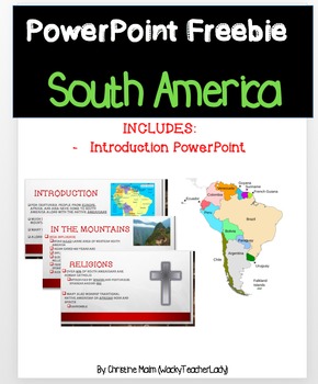
South America PowerPoint
This is the 13-slide PowerPoint portion of a larger product in my store. This product includes
* 13-slide PowerPoint on a brief introduction to South America
The PowerPoint includes the following topics..
- Native Americans
- Religion
- Language
- People in the Andes Mountains
- People in the Amazon Rain Forest
- Similarities of the culture in South America
Click the link to see the larger product that includes filler notes for the students to follow along with and a worksheet for after! Keys
Grades:
5th - 9th
Five Themes of Geography PowerPoint Presentation for Middle School
This FREE presentation is perfect for introducing the five themes of geography to upper elementary or middle school students.
If you like this presentation, be sure to check out my complete lesson on the five themes of geography,, including guided notes, vocabulary flashcards, and 3 pages of practice worksheets!
Five Themes of Geography COMPLETE Lesson
Subjects:
Grades:
5th - 9th
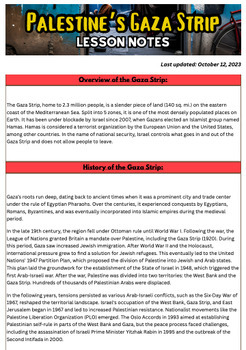
The Palestinian Israeli War in the Gaza Strip Handout UPDATED
Confused about what's happening in the Gaza Strip and Israel right now? This handout is perfect for understanding the complex history, the enduring blockade, and the shocking events of the 2023-24 conflict in the Gaza Strip.You and your students will gain valuable insights into the geopolitical complexities of the Gaza Strip.Key Sections:History of Palestine and the Gaza Strip: Uncover the historical significance of the Gaza Strip, from its ancient origins to modern times. Explore the impact of
Grades:
6th - 12th, Higher Education, Adult Education
Also included in: Israel and Palestine Conflict Activities and Lesson Bundle of Nine

Cribbs Latitude/Longitude Geography Lesson
This is a powerpoint lesson walking students through the cardinal and intermediate directions, then the oceans and continents, and finally explains how latitude and longitude work. The presentation is interactive and requires students to label a world map as well as work in groups. The maps used for the activity can be printed as slides off the powerpoint.
Subjects:
Grades:
3rd - 8th
Argentina - Global Studies - Leveled Reading, Activities, Slides & Digital INB
Global Studies content are geography deep dives in a country of the world. The content is written at three different reading levels for enrichment or remediation. From social media profiles to digital interactive books this is an all-in-one solution to bring students on a trip around the world. And any new creations for this event will be added to the bundle.In a Global Studies activity set you will receive:◈Google Slide Editable Presentation with Queued Videos◈Google Slide Interactive Book with
Grades:
K - 12th
Types:
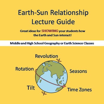
Earth-Sun Relationship Lecture Guide
Download this lecture guide to walk you through showing your students how the earth and sun interact to create day and night and seasons. The demonstration will address important concepts such as seasons, the rotation, revolution and tilt of the earth, and time zones!
Your students will be involved, and they may even get to squirt you in the face with water! (unless you want it to be the other way around...)
Looking for more? Add to your lesson with these products:
Earth-Sun Bundle- includes
Subjects:
Grades:
5th - 9th
Types:
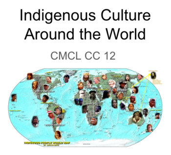
Indigenous cultures around the world (focus Canada + BC)
A very useful ppt bundle of lectures, activities, formative assessments, discussions... Up to 2-3 weeks of lessons on Indigenous cultures around the world Focus on Canadian Indigenous culture + BC Indigenous cultureSocial Studies Comparative Cultures grade 12 class for ELL learners Can be used across the social courses between grades 7-12
Grades:
7th - 12th
Types:
Also included in: Social Studies -Comparative Cultures Bundle Package 1 semester 12 weeks
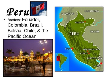
Western South America ppt
This is a brief and simple powerpoint focusing on the western countries of South America (Colombia, Ecuador, Peru, & Chile). I found the photos on various websites and do not claim any of them as my own. Some of the photos contain links or metadata that include more information about their subject.
Best used as an introduction to geographical study of the continent.
Subjects:
Grades:
2nd - 12th

Virtual Field Trip - Québec
This resource is a great way to transition your students into thinking about Francophonie on a global scale. Quebec is the premiere French province of Canada. From the influences of France and Canada, Quebec is a cultural mishmash of cultures, cuisines, and languages. This resource is 100% in French and is created by two French immersion teachers.
Subjects:
Grades:
3rd - 8th
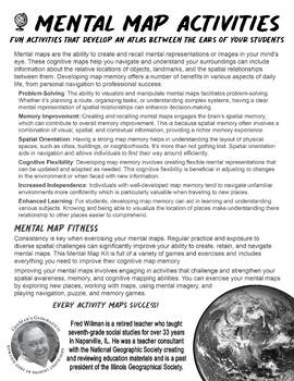
Benefits of Mental Map Exercises
Mental Map activities that develop an Atlas between the ears of your students.Developing map memory offers a number of benefits in various aspects of daily life, from personal navigation to professional success:Problem SolvingMemory ImprovementSpatial OrientationCognitive FlexibilityIncreased IndependenceEnhanced LearningEvery Activity Maps Success!

Landform Unit
Landform definitions with pictures. It is a power point that I use when I study our Landforms unit. I use this as an introduction before we do our landform booklets.
Subjects:
Grades:
5th - 9th
Introduction to Cartography World Regional Geography
Power Point presentation on the basics and history of cartography. Used for preparation for AP Human Geography. 29 slides and 2 types assessments are included. Created by Mike Dross
Grades:
4th - 12th, Higher Education, Adult Education
Ukraine - Global Studies - Leveled Reading, Activities, Slides & Digital INB
Global Studies content are geography deep dives in a country of the world. The content is written at three different reading levels for enrichment or remediation. From social media profiles to digital interactive books this is an all-in-one solution to bring students on a trip around the world. And any new creations for this event will be added to the bundle.In a Global Studies activity set you will receive:◈Google Slide Editable Presentation with Queued Videos◈Google Slide Interactive Book with
Subjects:
Grades:
K - 12th
Types:

Geography of Africa Google Slides
Easy to use Google Slides on Africa's physical geography.
Grades:
6th - 9th
Also included in: Africa Unit Bundle
Europe's Geography Google Slides
Easy to use Google Slides on Europe's physical geography.
Grades:
6th - 9th
Editable Geographic Tools Powerpoint
The presentation goes over basic geographic tools such as:-Globe-Types of MapsClimate MapPolitical MapEconomic MapThematic MapPhysical Map-Common map featuresMap TitleSymbolsMap Key-Aerial Photographs and Digital Images-DiagramsThe presentation provides a list of student "I can" statements for self-assessment❏ I can describe the job of a cartographer ❏ I can describe the positives and negatives of a globe ❏ I can choose the correct map or geographic tool to fit a certain purpose This presentatio
Subjects:
Grades:
4th - 8th
Basic Map Skills
This PowerPoint provides a brief overview of basic map skills needed for teaching geography. I use this powerpoint it as a quick review for my middle school students before we dive into studying geography.
Subjects:
Grades:
3rd - 8th
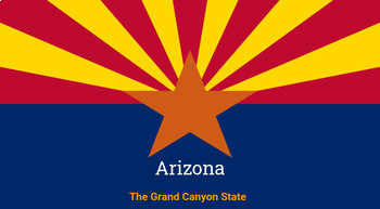
Arizona History Presentation
Students will discover a brief history and "biography" of Arizona through this presentation. Presentation includes: geography, political history, statehood, acquisition of land, role during the Civil War and Wild West, governmental officials, and more.
Grades:
6th - 9th
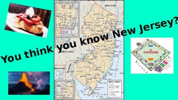
NEW JERSEY - fun facts/trivia!!
I created this for my YouTube channel (Speechie Educator)...Once downloaded and you pull up the PPT file, if you select Slide Show - start from beginning, it will play as a video. You or the students will need to read the statements aloud. You can pause it along the way to discuss the information! Enjoy!!
Grades:
3rd - 9th, Adult Education
Types:

Major Geographic Regions VA powerpoint
This power point includes detailed notes about the regions in Virginia. It includes vocabulary terms and SOL information. Ideally it is for 4th-7th grade history or used as a quick review for high school.
Grades:
4th - 7th
NGSS:
MS-ESS3-2
, MS-ESS3-1
Showing 1-24 of 63 results


