TPT
Total:
$0.00
Selected
Grades
29 results

8th grade social studies Common Core 5.G.A.2 resources
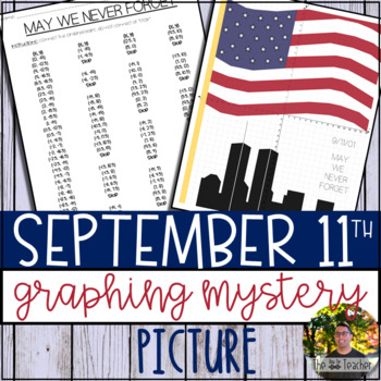
Preview of September 11th Graphing Mystery Picture
September 11th Graphing Mystery Picture

September 11th (9/11) can be a hard topic to discuss in class. With that said, it is necessary to educate our kiddos on this significant day in America’s history. Patriot Day, observed on September 11th, is meant to commemorate the lives of those we lost. I think it is also important to focus on the bravery shown on that day and how the country came together on the days that followed.This resource was created to provide a way for teachers to discuss September 11th in their mathematical lessons.
Preview of Mapping the Globe: Bundle

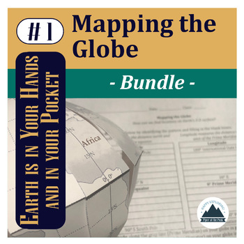
Mapping the Globe: Bundle

This bundle contains a PDF which includes an inspirational classroom poster, detailed lesson plan, student worksheet, teacher answer key, and teacher template for this step of Mapping the Globe.PLUS An editable Google Doc for students to fill in.AND Piper's Folding Globe Student TemplateYou can choose to print this file as a student handout (mainly the first page) or choose to assign it digitally for students to fill in electronically and place digital pictures of their mapped globe within the
Preview of Alabama Coordinate Graphing Picture 1st Quadrant & ALL 4 Quadrants
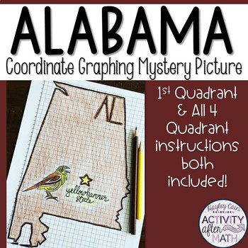
Alabama Coordinate Graphing Picture 1st Quadrant & ALL 4 Quadrants

Need a way to use math while learning about Alabama? Students will graph points on a coordinate plane and it creates an outline of the State of Alabama. There is also a star on the state Capital (Montgomery) and the state's abbreviation(AL). The clever title of "The Yellowhammer State" gives them a clue to what the picture will be. I have included Student Instructions for both Quadrant One ONLY and instructions that include ALL four Quadrants! This is a great way to differentiate for your lower-
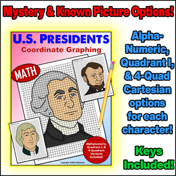
Preview of United States Presidents Day Coordinate Graph Mystery Pictures! Ordered Pairs!
United States Presidents Day Coordinate Graph Mystery Pictures! Ordered Pairs!

Alphanumeric, Quadrant I, and Full Cartesian Grid versions of each picture are included!Coordinate Plane Graphing can be fun, and the pictures students graph don’t have to be boring!Each character comes with blank coordinate planes and complete instructions to graph them.All of my coordinate graphs use whole numbers... No fractions or decimals to confuse the graphing!In this set, you will find 3 versions of the project for each President (Washington, Jefferson, & Lincoln):*For graphing begin
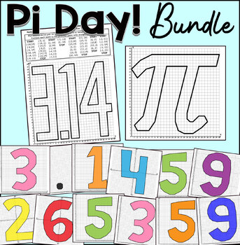
Preview of Pi Day Coordinate Graphing Mystery Pictures | Classroom Collaborative Poster
Pi Day Coordinate Graphing Mystery Pictures | Classroom Collaborative Poster

Practice plotting ordered pairs with this Pi Day coordinate graphing mystery pictures! Students enjoy completing and coloring these fun pictures.Choose from either the first quadrant (positive whole numbers) or the four quadrants (positive and negative whole numbers) worksheet.This coordinate graphing bundle includes the following mystery graphs:Pi Symbole3.140-9 DigitsThis product includes:Coordinates List.Answer Key With Lines.Graph PaperThis activity is great for math centers, fast finishers,
Preview of Northeast Region STATES Coordinate Graphing Pictures BUNDLE
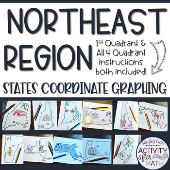
Northeast Region STATES Coordinate Graphing Pictures BUNDLE

NORTHEAST REGION HUGE BUNDLE Need a way to use math while learning about the different states in the Northeast Region? Students will graph points on a coordinate plane and it creates an outline of the State. There is also a star on the state Capital and the state's abbreviation. The clever titles of the state’s nickname gives them a clue to what the picture will be. CLICK HERE to SAVE with ALL 50 STATES BUNDLE★Want to know some tips to use these in ALL subjects? Click here to read my Blog Post !
Preview of Monopoly - SchoolOpoly Deluxe Edition with Instructional Video
Monopoly - SchoolOpoly Deluxe Edition with Instructional Video

This game design is formatted and sized to fit on top of the existing space on a traditional Monopoly board. Students change the prices of the properties, or leave them the standard of what they are in the traditional game. An excellent way to teach students about money management, economics and how to have a little fun learning about a game that war created in 1934. Enjoy! This Zip file includes: - An editable blank black and white cut outs for a board - Word Document - A blank black and wh
Preview of Midwest Region STATES Coordinate Graphing Pictures BUNDLE
Midwest Region STATES Coordinate Graphing Pictures BUNDLE

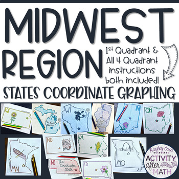
MIDWEST REGION HUGE BUNDLE Need a way to use math while learning about the different states in the Midwest Region? Students will graph points on a coordinate plane and it creates an outline of the State. There is also a star on the state Capital and the state's abbreviation. The clever titles of the state’s nickname gives them a clue to what the picture will be. CLICK HERE to SAVE with ALL 50 STATES BUNDLE★Want to know some tips to use these in ALL subjects? Click here to read my Blog Post !★I h
Preview of West Region STATES Coordinate Graphing Pictures BUNDLE

West Region STATES Coordinate Graphing Pictures BUNDLE
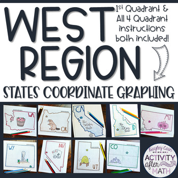
WEST REGION HUGE BUNDLE Need a way to use math while learning about the different states in the West Region? Students will graph points on a coordinate plane and it creates an outline of the State. There is also a star on the state Capital and the state's abbreviation. The clever titles of the state’s nickname gives them a clue to what the picture will be. CLICK HERE to SAVE with ALL 50 STATES BUNDLE★Want to know some tips to use these in ALL subjects? Click here to read my Blog Post !★I have in
Preview of Southeast Region STATES Coordinate Graphing Pictures BUNDLE

Southeast Region STATES Coordinate Graphing Pictures BUNDLE
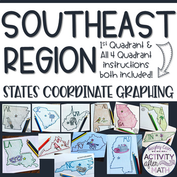
SOUTHEAST REGION HUGE BUNDLE Need a way to use math while learning about the different states in the Southeast Region? Students will graph points on a coordinate plane and it creates an outline of the State. There is also a star on the state Capital and the state's abbreviation. The clever titles of the state’s nickname gives them a clue to what the picture will be. CLICK HERE to SAVE with ALL 50 STATES BUNDLE★Want to know some tips to use these in ALL subjects? Click here to read my Blog Post !
Preview of Land of the Free Mystery Picture

Land of the Free Mystery Picture

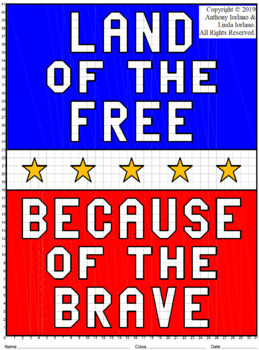
First Quadrant Only (Grid 31 x 41 Portrait) Uses fractional points with 1/2 [ex.: (4 1/2, 6) ] Uses 3 fractional points with 1/2 [ex.: (19 1/2, 26 1/2) ] This coordinate graphing project is fun for the student, makes a great bulletin board display and is ideal for reviewing coordinate graphing skills. Students will use their knowledge of coordinate graphing and ordered pairs to create a drawing of stars with the words “Land of the Free because of the Brave”. This will be created by plotting or
Preview of Mapping the Globe: Lesson Plan

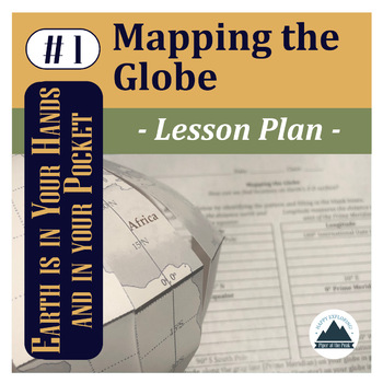
Mapping the Globe: Lesson Plan

This file contains a PDF which includes an inspirational classroom poster, detailed lesson plan with pictures, student worksheet, teacher answer key, and answer template for Mapping the Globe.*While you can use this lesson with other classroom globes or even flat maps, you may be interested in the Student Template: Piper's Folding Globe so students can add to this globe with other Mapping the... lessons throughout the semester while keeping it flat and safe in their binders between lessons.*The
Preview of Southwest Region STATES Coordinate Graphing Pictures BUNDLE
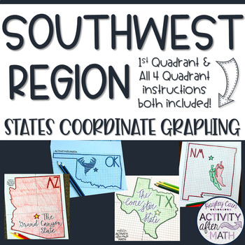
Southwest Region STATES Coordinate Graphing Pictures BUNDLE

SOUTHWEST REGION HUGE BUNDLE Need a way to use math while learning about the different states in the Southwest Region? Students will graph points on a coordinate plane and it creates an outline of the State. There is also a star on the state Capital and the state's abbreviation. The clever titles of the state’s nickname gives them a clue to what the picture will be. CLICK HERE to SAVE with ALL 50 STATES BUNDLE★Want to know some tips to use these in ALL subjects? Click here to read my Blog Post !
Preview of Vote Mystery Picture (with Donkey & Elephant)
Vote Mystery Picture (with Donkey & Elephant)

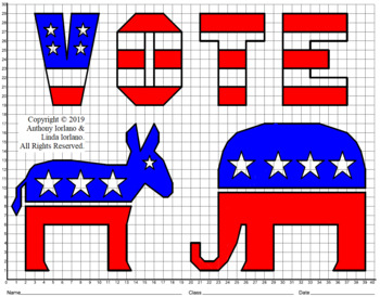
First Quadrant Only (Grid 40 x 30 Landscape) Uses fractional points with 1/2 [ex.: (4 1/2, 6) ] Uses 1 fractional point with 1/2 [ex.: (19 1/2, 26 1/2) ] This coordinate graphing project is fun for the student, makes a great bulletin board display and is ideal for reviewing coordinate graphing skills. Students will use their knowledge of coordinate graphing and ordered pairs to create a drawing of the donkey and elephant with the word “VOTE”. This will be created by plotting ordered pairs and
Preview of Mapping the Geosphere: Student Copy

Mapping the Geosphere: Student Copy

This file contains an editable Google Doc for students to fill in. It will guide them through their their second step in labeling their foldable globe- with the layers of the Earth and plate boundary types that create landforms around the world.For more detailed instructions on how to complete this step, check out Mapping the Geosphere: Lesson Plan (detailed teacher directions, teacher template, answer key, and inspirational classroom poster) or the Mapping the Geosphere: Bundle (lesson plan an
Preview of Mapping the Globe: Student Copy

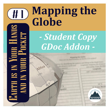
Mapping the Globe: Student Copy
This file contains an editable Google Doc for students to fill in. It will guide them through their their first step in labeling their foldable globe- with latitude and longitude that form the basis of our global coordinate system and continents.*While you can use this lesson with other classroom globes or even flat maps, you may be interested in the Student Template: Piper's Folding Globe so students can add to this globe with other Mapping the... lessons throughout the semester while keeping
Preview of Explore Glacier National Park with Traveling Miss T.
Explore Glacier National Park with Traveling Miss T.

Created by
Traveling Miss T
In this activity, students will practice identifying and plotting points in a coordinate plane - while learning geography! All coordinates accurately represent real locations around the world. All Math Maps come with additional extensions in math, art, geography, and writing. Don't forget to tag Miss T. in your adventures @travelingmisst #travelingmisst #mathmapsFor hundreds of Math Maps © visit my website www.travelingmisst.com
Preview of Explore National Parks with Traveling Miss T.
Explore National Parks with Traveling Miss T.

Created by
Traveling Miss T
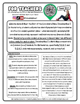
Hi teacher friends! My name is Natalie Teboul and I am the creator of Traveling Miss T.'s Math Maps ©. I work with local, state, and federal agencies to bring our public lands to students in classrooms for free with my innovative Math Maps. For hundreds of different Math Maps, check out my website at www.travelingmisst.com.I'm on TPT to ask all teachers to rally behind me and help me create systemic change! Please download this free map of our National Parks, have your students practice their co
Preview of Explore Denali National Park with Traveling Miss T.
Explore Denali National Park with Traveling Miss T.

Created by
Traveling Miss T
In this activity, students will practice identifying and plotting points in a coordinate plane - while learning geography! All coordinates accurately represent real locations around the world. All Math Maps come with additional extensions in math, art, geography, and writing. Don't forget to tag Miss T. in your adventures @travelingmisst #travelingmisst #mathmapsFor hundreds of Math Maps © visit my website www.travelingmisst.com
Preview of Explore Joshua Tree with Traveling Miss T.
Explore Joshua Tree with Traveling Miss T.

Created by
Traveling Miss T
In this activity, students will practice identifying and plotting points in a coordinate plane - while learning geography! All coordinates accurately represent real locations around the world. All Math Maps come with additional extensions in math, art, geography, and writing. Don't forget to tag Miss T. in your adventures @travelingmisst #travelingmisst #mathmapsFor hundreds of Math Maps © visit my website www.travelingmisst.com
Preview of Explore Yellowstone with Traveling Miss T.
Explore Yellowstone with Traveling Miss T.

Created by
Traveling Miss T
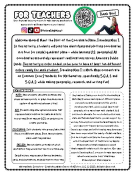
In this activity, students will practice identifying and plotting points in a coordinate plane - while learning geography! All coordinates accurately represent real locations around the world. All Math Maps come with additional extensions in math, art, geography, and writing. Don't forget to tag Miss T. in your adventures @travelingmisst #travelingmisst #mathmapsFor hundreds of Math Maps © visit my website www.travelingmisst.com
Preview of Explore Grand Teton with Traveling Miss T.
Explore Grand Teton with Traveling Miss T.

Created by
Traveling Miss T
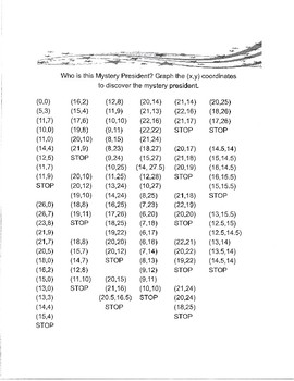
In this activity, students will practice identifying and plotting points in a coordinate plane - while learning geography! All coordinates accurately represent real locations around the world. All Math Maps come with additional extensions in math, art, geography, and writing. Don't forget to tag Miss T. in your adventures @travelingmisst #travelingmisst #mathmapsFor hundreds of Math Maps © visit my website www.travelingmisst.com
Preview of Who is This Mystery  President?  (Bush)
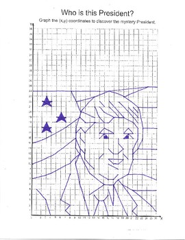
Who is This Mystery President? (Bush)

Plot the (x, y) coordinates to discover the mystery president.
Preview of Who is this Mystery President? (Trump)

Who is this Mystery President? (Trump)

Plot the (x, y) coordinates to discover the mystery president.
Showing 1-24 of 29 results

Find Social Studies - History resources | TPT

Importance of learning social studies

Social studies offers valuable insights into history, geography, and much more. Social studies captivates students by providing them with perspectives from the past, present, and future, allowing them to understand history and navigate current events. It enables them to appreciate how previous generations have shaped their present reality. In essence, social studies opens their eyes to the vastness of life beyond their immediate surroundings.

Benefits of learning social studies

Learning social studies offers many benefits to students in terms of helping them develop a holistic understanding of the world. Namely, it helps them:

  • Learn about the achievements, challenges, perspectives, traditions, and customs of different societies
  • Evaluate information, analyze evidence, and make informed judgments about complex social, economic, and political issues
  • Become active, responsible, and engaged citizens
  • Comprehend global issues such as human rights, environmental sustainability, and economic disparities

By teaching social studies, teachers can help students develop critical thinking skills, foster civic engagement, and promote social awareness and responsibility.

Teaching with social studies resources

On TPT, social studies resources come in various formats, from worksheets to interactive notebooks to units. They can be used to enhance learning, assess a student’s mastery of social studies concepts, or to reteach a tricky topic. With plenty of TPT resources at your fingertips, teaching and learning social studies will be so much easier.

Discover printable and digital social studies resources

If you’re a teacher or parent looking for printable or digital social studies resources, TPT has an extensive array of instructional materials for every learning need, topic, or grade level. Whether you’re teaching students about America’s democratic process, the legacy of Dr. Martin Luther King, Jr., how to read maps, or World War II, we’ve got you covered.

Social studies resources on TPT offer informative lessons, engaging texts, intriguing facts, interactive puzzles, and enjoyable trivia games. These grade-specific resources ensure that all students can access age-appropriate materials that stimulate their minds and enhance their creative thinking abilities.

For instance, first graders can explore worksheets on senses and emotions, followed by a coloring page featuring Harriet Tubman. Older students can test their knowledge with quizzes on statistics and capital cities, then delve into the history of the Underground Railroad through an informational sheet or enjoy a word search focused on civil rights leaders. With such a wide variety of subjects and topics covered, our social studies pages provide endless opportunities for students to explore the world in captivating ways.

Frequently asked questions about teaching social studies

What types of social studies lessons are available on TPT?

There are many different types of history resources sold by Sellers on TPT. Some popular social studies lessons include U.S. history, world history, ancient history, geography, civics, and government.

How do I find social studies lessons on TPT?

Educators can save time preparing history lessons with resources created by experienced teachers. Simply start a search for social studies resources on the TPT marketplace, and filter by grade level, price, and/or resource type to find materials that've been proven to work in classrooms like yours. No matter what you’re teaching, there are plenty of social studies lessons and activities sold by Sellers on TPT that are tailored to meet your students' skill levels.