36,356 results
9th grade geography resources under $5
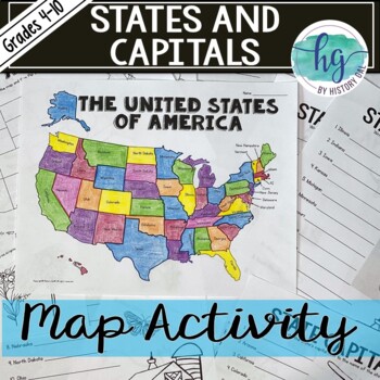
50 States and Capitals Map Activity with printable worksheets & digital map game
Do your students need to know the state capitals and the location of each state on a map? This engaging map set for the 50 states and their capitals will guide your students through labeling a blank map and learning the capitals. Print and digital options plus access to online self-checking map and flashcards let you easily customize the lesson to best fit the needs of your students. Students will label a blank map of the United States with the names of the 50 states and then record the capital
Subjects:
Grades:
4th - 10th
Types:
Also included in: American History Map Activities Bundle for U.S. History Units & Lessons
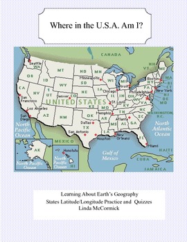
Latitude and Longitude Worksheets and Quizzes - U.S.A. Geography
This collection of worksheets and a printable map provide excellent lessons for learning latitude and longitude. • This package contains 9 pages. • A printable map with the necessary information to answer the questions regarding latitude and longitude.• Includes practice and two quizzes in the “Where Am I” format•Answer KeyThis lesson is google classroom ready.Please e-mail me with any questions about this resource or suggestions for future resources at: ljmccormick33@yahoo.com. If you are diss
Subjects:
Grades:
5th - 9th
Types:
Also included in: U.S.A. Geography- Bundle
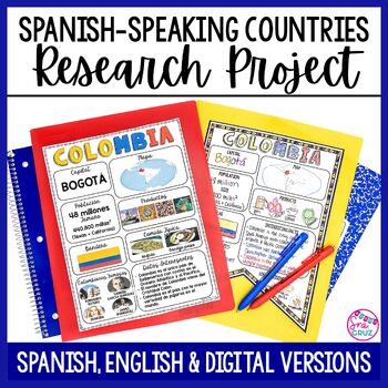
Spanish Speaking Countries Project Research a Country with Google Slides Digital
This Spanish-Speaking country project is an organized and efficient way for students to research Spanish-speaking countries. The templates are in both English and Spanish and can be completed digitally or handwritten. Includes digital templates for PowerPoint and Google Slides.*can easily be adapted for other languages, geography, or social studies classesThis project to create an infographic for a country includes:-Templates in 3 different designs-English templates-Spanish templates-Completed
Subjects:
Grades:
6th - 12th
Types:
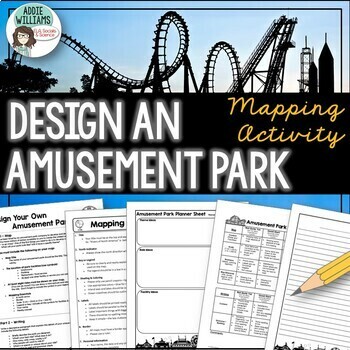
Map Skills Mapping - Design Your Own Amusement Park
Review the basics of mapping with this fun and engaging activity! Using map skills learned in class, students must design a map of their own amusement park and include mapping elements such as scale, a legend, symbols, and more! They must also write about and explain their "best" or most amazing ride. This activity has always been one of my students' favorite projects! It's a fun and unique way to wrap up a mapping unit or a fun project for social studies!I encourage the students to pick a them
Subjects:
Grades:
6th - 9th
Types:
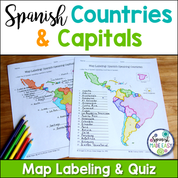
Spanish-Speaking Countries and Capitals Maps and Quiz
This is a map labeling activity and matching quiz over the 21 Spanish-speaking countries and capitals. Students will label and identify the 21 Spanish-speaking countries and capitals in Spanish. This is a great activity when reviewing Spanish-speaking countries and capitals or Spanish geography. Makes a great coloring page. Answer keys are included.
Countries included:
España, México, Costa Rica, El Salvador, Guatemala, Honduras, Nicaragua, Panamá, Cuba, La República Dominicana, Puerto Rico, Ar
Subjects:
Grades:
6th - 12th
Also included in: Spanish Countries and Capitals Geography Bundle
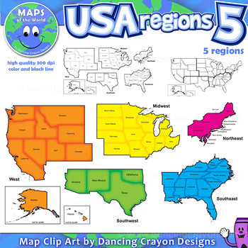
Regions of the USA: Five Regions - Map Clip Art
Regions of the USA: Five Regions - Map Clip Art
.............................................................................................
Please check the regions in this set before purchase. We offer a choice of THREE different US Region Map Sets:
USA divided into FOUR regions / NINE divisions (as set out by the United States Census Bureau)
USA divided into FOUR regions / TEN divisions (as taught in some states)
Please read on for more information about THIS region set:
............
Grades:
3rd - 12th, Staff
Also included in: Maps of the World Clip Art - MEGA-BUNDLE
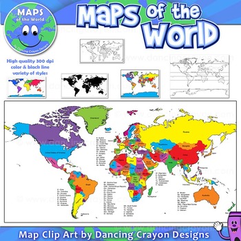
Maps of the World: Clip Art World Maps
Maps of the World: Clip Art World Maps
High quality color and black and white maps of the world.
This clipart map set contains the following commercial use graphics:
- Color maps of the world
- Black and white line art maps of the world
- Maps of the world with lines of latitude and without lines of latitude
- Maps of the world with larger countries labelled (color and black and white)
- Silhouette maps of the world
- A map of the world showing seven continents in color and black and white:
Grades:
3rd - 12th, Higher Education, Adult Education, Staff
Also included in: Maps of the World Clip Art - MEGA-BUNDLE
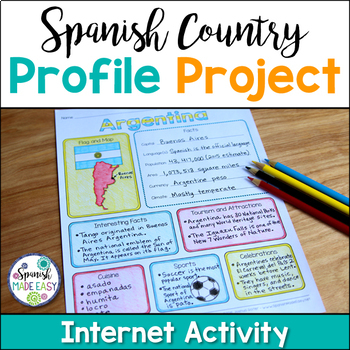
Spanish Country Profile Project
This is a country profile project over the 21 Spanish-speaking countries. Students will research important geographical and cultural facts about each country. This activity includes a blank country profile template, a template for each country, a list of Spanish-speaking countries, and a grading rubric in both English and Spanish. Research topics include: Countries flag, map, capital, language(s), population, area, currency, climate, interesting facts, tourism and attractions, cuisine, sports, a
Subjects:
Grades:
2nd - 12th
Types:
Also included in: Spanish Countries and Capitals Geography Bundle
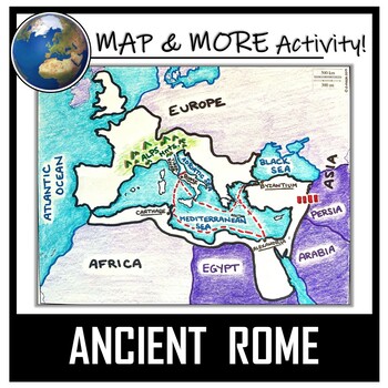
Ancient Rome Map Activity- Roman Empire (Label and Color!)
This Ancient Rome Map Coloring & Labeling Activity is a great resource to enhance your unit! Each student will make their own, personalized map of the Roman Empire, and learn about the geography and landmarks of the region. They will label and color their blank map, and answer follow-up questions related to the geography of Ancient Rome. A fun 'Make a Travel Brochure' project has also been added. It is a great way to connect this map activity to your lesson on Ancient Rome! A link to Goo
Grades:
4th - 11th
Types:
CCSS:
Also included in: Ancient Civilizations / World Maps BUNDLE- Color & Label Activities!
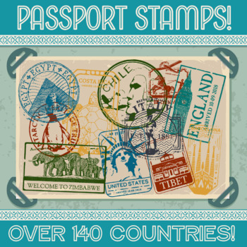
Passport Stamp Bundle - OVER 140 COUNTRIES!
Thanks for checking out my store!This updated product now contains stamps from over 140 countries!!! Let your students cut out their own and glue it into their passport, or print the stamps on sticker paper and hand them out as rewards for reaching certain goals. Whatever your methodology may be, I’m positive your kids will love it! Altogether this product contains over 300 PNG files, one color and one black & white for each country. This product comes with a LIFETIME update guarantee. As I
Subjects:
Grades:
1st - 9th
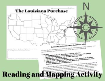
The Louisiana Purchase and Lewis & Clark Mapping Activity
This one day lesson will introduce students to the Louisiana Purchase while incorporating mapping and geography skills.Included in your purchase:1. Summary of Louisiana Purchase and Lewis & Clark expedition.2. Blank Map of the United States3. Directions for coloring and labeling map of the United States using current and historical place names related to the Lousiana Purchase and the Lewis & Clark Expedition.Note Some Additional Supplies Needed:--Colored Pencils--Map resources to help st
Grades:
6th - 10th
Types:
Also included in: Thomas Jefferson, The Louisiana Purchase and Lewis & Clark Lesson Bundle
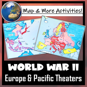
World War II: Map Coloring & Labeling Activities- Europe & Pacific Theaters!
This World War II Map Activity includes two map activities that include blank maps, student direction sheets, follow-up map tasks, and completed sample maps to use as reference. One map activity focuses on Axis Expansion in EUROPE and one on Axis Expansion in ASIA (The Pacific). They can be used with many different age groups, learning styles, and independently- great addition to your WWII unit!**Note: These maps focus on the peak of Axis power/control during WWII. Please see the completed ma
Grades:
5th - 10th
Also included in: US History / American History BIG BUNDLE of Resources! NO-PREP!
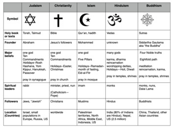
Compare World Religions Chart --Judaism, Christianity, Islam, Hinduism, Buddhism
This is a chart I use with my students to compare five major world religions-- Judaism, Christianity, Islam, Hinduism and Buddhism. It is meant to have the students learn the basics and be able to know the major aspects of all the religions. I included a blank copy and a completed version. In my social studies textbooks, there is quite a bit of info about each of these religions. This can also be done this as a group jigsaw activity. Feel free to edit it to suits your needs. Let me know if
Subjects:
Grades:
5th - 10th
Fun End of Year Activity - Travel Project - Plan a Trip!
This is the perfect project to do this year - especially before a break or just for fun! In this project, students will apply personal finance skills to plan a 3-day trip for themselves and a few friends. They must create a budget and plan three days' worth of food and activities. It is a whole lot of fun and they can have so much ownership and creativity. It works great to display Math, ELA, and Social Studies skills. They will have to research customs, and locations and add, multiply, and divi
Subjects:
Grades:
4th - 10th
Types:
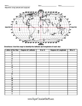
Latitude and Longitude Worksheet & Answer Key
This worksheet is an awesome way to teach Latitude and Longitude. The way that it is structured reinforces that Latitude measures North and South of the Equator, and that Longitude measures East and West of the Prime Meridian. This worksheet features a World Map with an Answer Key.
Subjects:
Grades:
3rd - 12th, Higher Education, Adult Education
Types:
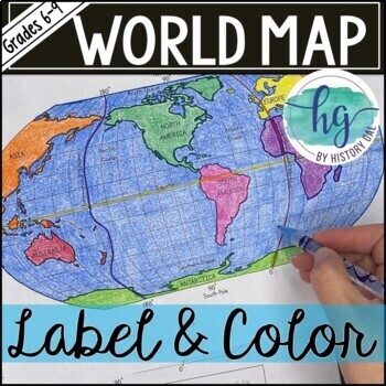
World Map Activity (Print and Digital)
Students will label 17 items on the world map including the continents, oceans, equator, prime meridian, international date line, North Pole and South Pole. Alternatively, students can just color on the coloring page version. What's included with the Printed Versions:*Blank World Map for students to label and color (1 page, uneditable pdf)*World Map Coloring Page (1 page, uneditable pdf)*Map Key (1 page, uneditable pdf)*Animated PowerPoint and Google Slides shows each location and is perfect fo
Subjects:
Grades:
6th - 10th
Types:
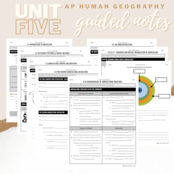
Unit 5: Student Guided Notes - AP Human Geography
Notes pages for CED topics 5.1-5.10 for Unit Five. *NOTE: THIS IS MISSING TOPICS 5.11 and 5.12*Use the guided notes to scaffold your Human Geography lectures or use the notes with my accompanying lecture slideshows! You can find slideshow lectures that correlate directly with EACH CED Topic for AP Human Geography Unit 5 here.Students can use as a study guide, you can assign for homework, or use with a self-guided lecture! You can assign this to be completed digitally for distance learning or pri
Grades:
9th - 12th
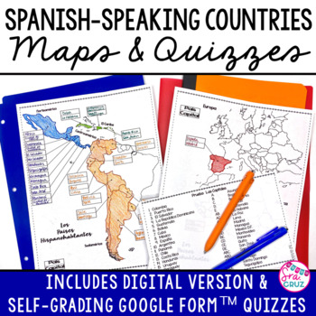
Spanish Speaking Countries and Capitals Maps and Quizzes Worksheet + DIGITAL
Spanish-Speaking Countries Maps and Quizzes - Included are blank maps of the Spanish-speaking countries for students to fill in, completed maps, a map quiz, and a matching capitals quiz. NEW: Now includes Google Slides™ version of the map for students to fill in digitally and self-checking Google Forms™ quizzes for the map and capitals quizzes.*Please see the thumbnails & preview for more details*Includes:✅ Blank Maps-One page map without Equatorial Guinea-Two page map with Equatorial Guinea
Subjects:
Grades:
6th - 12th
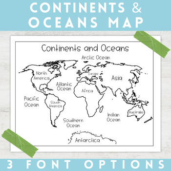
World Map Continents and Oceans | Black and White | Coloring Sheet
Enhance your minimalist classroom with these Black and White World Map with labeled Continents and Oceans!These black and white world map features each of the 7 continents and 5 oceans accurately labeled. These maps are great to print out, laminate, and hang up in a minimalist or neutral classroom. These maps are also great to print out and make copies for students to color! Please feel free to make copies of this resource for your students, or for your own kiddos.Updated 7/17/2022: There are no
Grades:
PreK - 9th
Types:
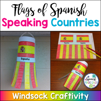
Flags of Spanish-Speaking Countries Windsock Craftivity
This is a coloring activity and windsock craft with the 21 flags of the Spanish-speaking world. Students will follow four simple steps to color, cut and glue these colorful windsock flags. Only five colors are needed: rojo, amarillo, verde, azul cielo, and azul (red, yellow, green, sky blue, and blue). This is a great activity when reviewing Spanish-speaking countries, Hispanic culture, holidays or colors. These windsock templates are available in both color and blackline. Makes a great decorati
Subjects:
Grades:
K - 10th
Also included in: Spanish-Speaking Countries, Capitals, and Nationalities Bundle
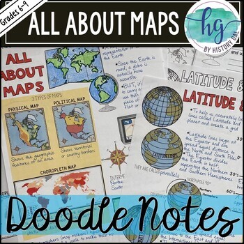
All About Maps Doodle Notes and Digital Guided Notes
This doodle notes set covers basic information about maps. It includes cardinal and intermediate directions, compass rose, scale, 3 types of maps (Physical, Political, and Choropleth), cartographer, map vs. globe, Latitude, Longitude, Equator (0 degrees), North Pole (90 degrees N), South Pole (90 degrees S), Northern Hemisphere, Southern Hemisphere, Prime Meridian (0 degrees), International Date Line (180 degrees), Eastern Hemisphere, Western Hemisphere. What's included with the printed Doodle N
Subjects:
Grades:
6th - 9th
Types:
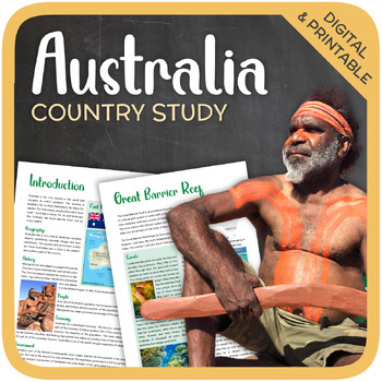
Australia (country study)
Let’s get to know Australia! This worksheet includes 21 pages with a great variety of activities and exercises about Australia. The materials have informative exercises about the things that Australia is famous for, such as the Great Barrier Reef, Aboriginals, Tasmania, the Sydney Opera House, and many other things! Word searches, puzzles and other kinds of activities are included to make it a fun and interesting class. GOOGLE SLIDES WITH PREMADE TEXTBOXES INCLUDED! Overview:Page 1-2: Introduct
Grades:
6th - 11th
Types:
Also included in: Top 10 Best-selling Units (Country Studies Bundle)
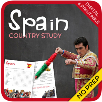
Spain (country study)
Let’s get to know Spain! This worksheet includes 23 pages with a great variety of activities and exercises about Spain. The materials have informative exercises about the things that Spain is famous for, such as Bullfighting, Catalonia, Sagrada Familia, Picasso, Tapas and many other things! Crosswords, word searches, puzzles and other kinds of activities are included to make it a fun and interesting class. GOOGLE SLIDES WITH PREMADE TEXTBOXES INCLUDED! Overview: Page 1-2: IntroductionPage 3-4:
Grades:
5th - 12th
Types:
Also included in: Top 10 Best-selling Units (Country Studies Bundle)
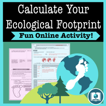
My Ecological Footprint: Fun Online Activity and Worksheet about Climate Change
Take your class to the computer lab for a fun and engaging activity! Students will use an interactive website to find out how their lifestyle determines their ecological footprint and impacts our planet. This activity is the first step in a fun lesson that spans two classes and gets your students learning about the environmental impact of the choices we make every day. This lesson fits perfectly into a unit or course about climate change, environmentalism, geography or world issues. There is lit
Subjects:
Grades:
9th - 12th
Types:
Also included in: Climate Change and Environmental Sustainability Bundle for High School
Showing 1-24 of 36,356 results


