794 results
9th grade geography resources on sale
Middle East Webquest
Students will gain basic knowledge about life in the Middle East by completing an internet based worksheet. The following topics are covered in this webquest:The geography of Middle EastThe modern history of the Middle EastThe people of the Middle EastThe webquest contains 50 questions and is a great introduction to a unit on Middle East. The webquest will take most students 30 to 50 minutes depending on age. An answer sheet is included for the teacher. Word and PDF versions are included. The i
Subjects:
Grades:
5th - 12th
Types:
Urbanization and Population Geography Webquest
Urbanization and Population Geography WebquestThis webquest uses a very student friendly website that covers the impact of human population growth on Earth. The website is filled with great facts and visuals! Please check out the website by clicking on the link below:Click here to view the website.The webquest contains 34 questions and is a great way to introduce a geography unit or to have your students go into more depth on population growth and modern cities. An answer sheet is included for
Subjects:
Grades:
6th - 12th
Types:
Israel-Palestine Conflict in Ten Minutes Video Worksheet
This video worksheet allows students learn about the origins and the continued conflict between Israel and Palestine. The video clip is only ten minutes long, but it is packed full of information that will keep your students engaged.This video worksheet works great as a “Do Now Activity” or as a complement to any lecture or lesson plan on current events, terrorism, or the Middle East. The worksheet helps students understand the current conflict in the Middle East. The video is great for visual l
Grades:
7th - 12th
Types:
Mapping the Dust Bowl and the Great Depression
This great mapping activity allows students to map the Dust Bowl, TVA, Hoover Dam and the 50 largest American cities in 1930. Just download the following two USA maps.Please download the modern USA map PDF athttp://bit.ly/3scOWC0 The modern USA Physical feature map PDF can be downloaded athttp://bit.ly/35qMjm8I suggest using an 11x17 piece of paper for the map but an 8x11 piece of paper will work. You can decide what USA map PDF will work best for your students.Depending on the age level of you
Grades:
4th - 12th
Types:
Ancient to Modern India Webquest
The Ancient to Modern India Webquest has 55 questions. An answer sheet is included for the teacher. Students will answer questions from the following great website.Click here to view the website.The following topics are covered in this webquest:Geography and Weather of IndiaThe Cities of Harappa and Mohenjo-DaroThe AryansThe Caste SystemHinduismBuddhismAshoka and the Mauryan EmpireMuslims in India/Mughul EmpireThe Europeans in India/British EmpireGandhiIndia Since IndependenceDepending on the gr
Subjects:
Grades:
4th - 9th
Types:
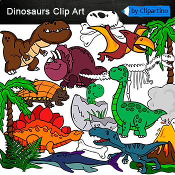
Dinosaurs Clip Art Commercial use
Cute Dinosaur Clip Art Commercial use/ Dino Clipart includes: fern * dino egg* volcano* Bones with skull Dinosaur* bone *dinosaur skeleton* ankylosaurus* apatosaurus* ichthyosaurus* pterodactyl* stegosaurus* triceratops* tyrannosaur* tyrannosaurus rex *tyrannosaurus rex.Download preview with free clipart inside license included!All18 png files transparent background+jpgand 17 png black-white coloring outlines files+jpgFor personal and small commercial use!!!! See more animals clipartDinosaurs of
Grades:
PreK - 12th, Higher Education, Adult Education, Staff
Texas Oil Industry History: Roughnecks and Spindletop Webquest
Texas Oil Industry History: Roughnecks and Spindletop WebquestStudents will learn about the Texas oil industry and roughnecks by completing a great internet-based worksheet. The Texas Oil Industry History: Roughnecks and Spindletop Webquest uses a very student friendly website that covers the Texas oil industry from the 1860s to the 1950s. Please check out the website by clicking on the link below:Click here to view the website.The following topics are covered in this webquest:Origins of the Te
Grades:
5th - 12th
Types:
Also included in: Texas History Webquest/Lesson Plan Collection
Caribbean History and Geography Webquest
The Caribbean History and Geography Webquest uses a great website that allows students to get a better understanding of basic history and geography of the Caribbean Islands. Click here to view the website.The webquest contains 44 questions and an answer sheet is included for the teacher. A QR code is included along with the traditional website link. The webquest takes most students at least 30 to 50 minutes to complete depending on their age. Feel free to modify this activity if needed to fit t
Grades:
5th - 9th
Types:
Also included in: Central America and Caribbean Webquest Collection
United States Landmarks Facts & Poster Set
If you are looking to improve your students skills in Geography here is the resource you need. I had so much fun researching these Landmarks and sparkle my skills also with the new facts on the most famous landmarks of the United States. Lots of information, but cool things you can use in class. Here is a set of Posters with their Fact Sheet. You can print it on card stock with double sided with the facts or separated to create your own activities for your students. The will have fun with ge
Grades:
PreK - 12th, Higher Education, Adult Education, Staff
Texas History: Cowboys and Cattle Drives Webquest
Texas History: Cowboys and Cattle Drives Webquest allows students to get a better understanding of cowboys and why cattle drives were so important after the Civil War. The webquest focuses on the development of cattle ranching in Texas from the 1690s to the early 1900s. The webquest is very easy to follow for students in grades 5-12. Click on the link below to visit the website used:Click here to view the website.The webquest contains 40 questions and an answer sheet is included for the teacher.
Grades:
5th - 12th
Types:
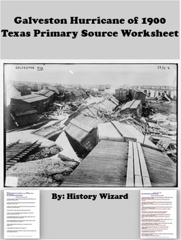
Galveston Hurricane of 1900 Texas Primary Source Worksheet
This worksheet allows students to use a primary source document to learn about the Galveston Hurricane of 1900. I use this worksheet to help students understand the worst natural disaster in American history.This activity is very easy to use. All you have to do is print off the primary source from the following website for classroom use or direct students to the website to answer the worksheet questions:http://eyewitnesstohistory.com/galveston.htmClick here to view the website.The primary source
Grades:
5th - 12th
Types:
Also included in: Texas History Webquest/Lesson Plan Collection
Silk Road in 5 Minutes Video Worksheet
This video worksheet allows students learn about the impact of trade and travel along the Silk Road. The video clip is only five minutes long, but it is packed full of information that will keep your students engaged.This video worksheet works great as a “Do Now Activity” or as a complement to any lecture or lesson plan on the Silk Road. The worksheet helps students understand how the Silk Road changed the world. The video is great for visual learners and helps break up class time so students ar
Grades:
4th - 12th
Types:
Also included in: Mongols and Mongol Empire Lesson Plan
Geography Webquest True Size of the World
Geography Webquest: True Size of the WorldThis webquest uses a very student friendly website that allows students to compare the true size of different countries. Students really enjoy this website and it helps them understand the true size of countries around the world. Please check out the website by clicking on the link below:Click here to view the website.Students will need to have a basic understanding of where countries and states are located to be able to compare sizes. Students just need
Subjects:
Grades:
6th - 12th
Types:
Donner Party Primary Source Worksheet
This worksheet allows students to use a primary source document to learn about the problems faced by the Donner Party when they became trapped near the summit of the Sierra Nevada Mountains. I use the worksheet to help students better understand the problems faced by settlers in the West during the 1800s.This activity is very easy to use. All you have to do is print off the primary source from the following website for classroom use or direct students to the website to answer the worksheet quest
Grades:
5th - 12th
Types:
Northern and Central Kingdoms and Empires of Africa Webquest
Students will gain basic knowledge about different civilizations Northern and Central Africa by completing an internet-based worksheet. The webquest uses the following great website to let students learn about five different kingdoms and empires of Northern and Central Africa. View the website below.
http://www.ducksters.com/history/africa/
The following African civilizations are covered in the webquest:
1. Kush/Nubia
2. Carthage
3. Aksum
4. Central Africa Kingdoms/Great Zimbabwe
5. Islamic Af
Subjects:
Grades:
6th - 12th
Types:
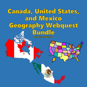
Canada, United States, and Mexico Webquest Bundle
This bundle will help you teach the geography and history of Canada, United States, and Mexico through using a bundle of three webquests. These three webquests are sure to improve any geography or history unit related to North America.Click here to view the website.Each webquest contains at least 20 questions and is a great way for students to learn more about the following topics related to Canada, United States, and Mexico:Important and Fun FactsGeographyPeople and CultureNatureGovernment and
Grades:
4th - 9th
Renaissance: Mapping the Italian City-States
This Renaissance mapping activity allows students to map the major cities, kingdoms, and key regions of Italy during the 1400s. You will need to download the Italy 1450 C.E. Map from the website below. https://1.cdn.edl.io/AzKiOxjjmiaMsoNuNKSkTwAN6drMIXFh2zx6wJ1SRVsR3zzn.pdfPlease print out page 19, which has the Italy 1450 C.E. Map, other blank history maps are included if you are interested. The teacher should project or give students access to the following website to help students complete t
Subjects:
Grades:
5th - 12th
Types:
Middle East Mapping Activity and Research Project (2 Lesson Plans)
This great mapping activity allows students to map the major physical and political locations within the Middle East. Just download the following blank map of the Middle East (Southwest Asia/North Africa).Please download the Middle East map PDF athttp://geoalliance.asu.edu/sites/default/files/maps/MidEast.pdfThe mapping activity will take at least 1 period. Students just follow simple instructions to complete the map. The mapping activity can be easily modified by the teacher to work with any a
Grades:
4th - 9th
Types:
Also included in: Islam and Islamic Empires Lesson Plan Collection Bundle
Erie Canal and Transportation Systems Webquest
Students will gain basic knowledge about the Erie Canal and other early 1800s transportation systems including roads, steamboats and railroads. The main focus of this webquest is the Erie Canal and the development of the steamboat by Robert Fulton. The webquest uses a very student friendly website that covers the impact of early industrialization on transportation systems in the United States. Please check out the website by clicking on the link below. Click here to view the website.The webquest
Grades:
4th - 9th
Types:

Early Finishers ACTIVITIES PUZZLES,History,Geography,Landmarks,Economics BUNDLE
Introducing the Ultimate Educational Resource Bundle! Packed with a diverse range of topics spanning subjects like History,Geography ,Social studies, Science, Reading, and Novel Study, as well as special occasions and holidays. Ideal for early finishers, morning exercises, writing prompts, vocabulary expansion, and much more. Elevate your teaching toolkit with this versatile collection designed to engage learners year-round!(100 % Digital Download)This resource is useful for:Vocabulary and
Grades:
3rd - 10th
Types:
Geography: Mapping South America, Central America, and Mexico
This great mapping activity allows students to map the major political and physical features of South America, Central America, and Mexico. Just download the following South America, Central America, and Mexico maps from the websites below.Please download the South America Map PDF athttp://geoalliance.asu.edu/sites/default/files/maps/S-AMER3.pdfPlease download the Central America Map PDF athttp://geoalliance.asu.edu/sites/default/files/maps/MID-AMER.pdfPlease download the Mexico map PDF at map P
Grades:
4th - 10th
Types:
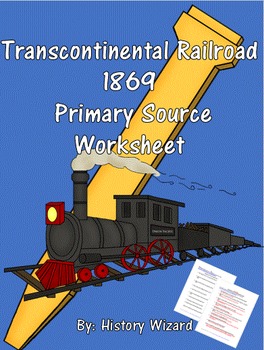
Transcontinental Railroad 1869 Primary Source Worksheet
This worksheet allows students to use a primary source document to learn about the completion of the Transcontinental Railroad in 1869This activity is very easy to use. All you have to do is print off the primary source from the following website for classroom use or direct students to the website to answer the worksheet questions.http://www.eyewitnesstohistory.com/goldenspike.htmClick here to view the website.The primary source document is labeled (Completing the Transcontinental Railroad, 1869
Grades:
5th - 12th
Types:
Also included in: United States History Primary Source Worksheet Bundle

Early America Primary Source Worksheet: Yellow Fever Attacks Philadelphia 1793
This worksheet allows students to use a primary source document to learn about the Yellow Fever epidemic in Philadelphia in 1793. I use this worksheet to help students understand the impact of disease on people throughout history.
This activity is very easy to use. All you have to do is print off the primary source from the following website for classroom use or direct students to the website to answer the worksheet questions:
http://www.eyewitnesstohistory.com/yellowfever.htm
Click here to vi
Grades:
5th - 12th
Types:
Also included in: United States History Primary Source Worksheet Bundle
Inuit PowerPoint: Native Americans and Survival in the Arctic
This PowerPoint is sure to promote discussion and interesting conversations in the classroom about the history and lifestyle of the Inuit people. This PowerPoint is a great intro to a unit on the Arctic, Inuit, or Native Americans in general. The 40 slides help students visualize the following topics:Tool use in the Arctic Arctic Clothing Transportation in the ArcticHunting in the ArcticHousing in the ArcticPlease check out my Native American lesson plans.Great Native American Lesson Plan Collec
Subjects:
Grades:
K - 12th
Showing 1-24 of 794 results


