113 results
Black History Month geography resources for Microsoft Excel

Regions of Texas Poster
This basic poster of the Regions of Texas is editable and can be scaled to fit whatever size you need. Directions for scaling the poster are included. This is a great resource for 4th and 7th grade Texas History classes or any Texas elementary classroom.
Grades:
K - 7th
Types:
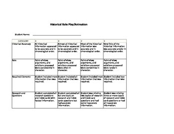
Historical Figures Rubric
Looking for a quick and way to grade any type of presentation on historical figures? This is your answer. This rubric contains categories such as required elements, historical facts, questions, roles, and research. It is editable so you can easily take out items that don't apply to your class or add in items that are important to you and your standards. Made for a third grade Focus class but can be altered and applied to any grade level.
Grades:
1st - 5th
Types:
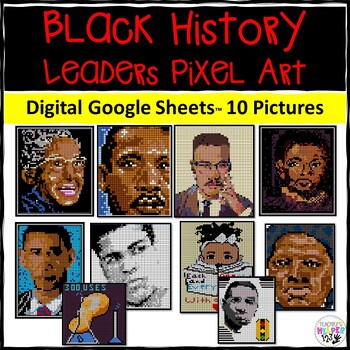
10 Pixel Art | Black History Leaders | Social Studies / History / Picture Art
This pixel art themed activity is perfect for learning about different black history leaders during the period of slavery, civil rights and current day. The students will answer the questions and a mystery picture will be revealed. This is perfect for historical research, learning about history of the past and as a group or class assignment.Included in this resource:-10 Pixel Activity pictures with different black history leaders including: Martin Luther King Jr., Rosa Parks, Harriett Tubman, Ga
Grades:
Not Grade Specific
Types:
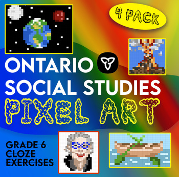
Ontario Grade 6 Social Studies Pixel Surprise Pack
4 cloze exercises explicitly linked to the grade 6 curriculum for social studies. Students fill in the correct answers on Google Sheets to reveal a surprise picture. Topics covered in this pack:Canada's fur tradeNGOs and CanadaChinese workers on the CPR, Chinese head tax and Chinese Exclusion ActNatural DisastersThe pack contains sheets for students and an answer key for teachers. Students receive letter spacing cues to indicate the length of the missing word. This resource was designed to match
Grades:
5th - 7th
Types:

Plan a Family Vacation--$5,000 Budget
Students will have fun with this real life budgeting lesson as they plan their very own family vacation. Students must budget for the family members that live in their household, and must stay with a $5,000 limit. There is a Presentation to discuss all the rules and an excel sheet to help with their totals. As they plan their trip students can create a PowerPoint or a Google Slide that documents their itinerary. The presentation needs to include all expenses and their total cost of the trip
Subjects:
Grades:
4th - 12th
Types:
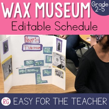
Wax Museum Schedule | Living Museum Project | Wax Museum Project
This living wax museum project is by far one of my favorite things about teaching 3rd grade. Truth be told this wax museum project can be used from 2nd grade all the way until 6th grade. Students take on the role of someone else, they dress up like an important historical figure and then they put on a show for their families and entire school It is a memory that is worth creating for your students! This is just one piece of the project (the letter to send to parents), but you can grab the bundle
Grades:
2nd - 5th
Also included in: Living Wax Museum Project
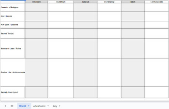
World Religion Comparison Chart
World Religion Comparison ChartFounder, God, # of Gods, Sacred of Text, Rules/Laws, Goal of Life, & Sacred SitesReligions: Islam, Christianity, Judaism, Hinduism, Confucianism, & BuddhismAnswer Key Included
Subjects:
Grades:
7th - 10th
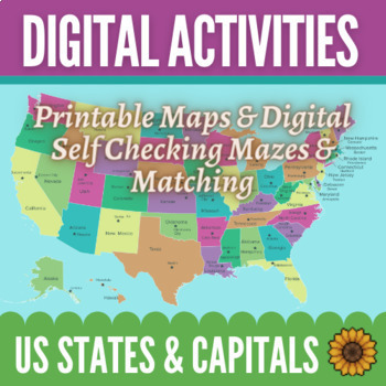
Learning Capital Cities of US by Regions Maps & Activities - Digital and Print
Make learning the states and their capitals easy and fun! This bundle includes 12 printable maps of the entire United States as well as maps of the regions by themselves. There are also 8 digital, self-correcting activities to help your students practice connecting the states with their capitals. Students love the colorful matching and maze activities to learn their capitals! You can use the maps in any way you would like. There are fully labeled maps as well as blank maps with stars in the loca
Subjects:
Grades:
4th - 6th
Types:
Global Trade Simulation - Teacher Mastersheet + National Wealth Spreadsheet
This file is the Trade Simulation master sheet that has all of the program data. The rules, scenarios and guiding principles for the simulation are all here. I have created them based on some of the realities of world systems so that the students can take part in an authentic learning experience. This will allow you to govern the world that is created in your classroom and oversee the economy that is created. In addition, you function as the World Bank so you need so this will be your guide rega
Grades:
6th - 12th
Types:
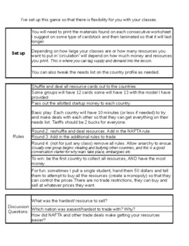
Economics Simulation
I use this activity in my 6th grade geography classes to help simulate trade between nations, trade barriers, and NAFTA. It's customizable to fit your needs and creativity. I suggest printing the materials on something like cardstock and laminating it, for durability through the day.***GSE STANDARDS***SS6E2 Give examples of how voluntary trade benefits buyers and sellers in Latin America. DOKIIIExplain how specialization encourages trade between countries.Compare and contrast different types of
Grades:
Not Grade Specific
Types:
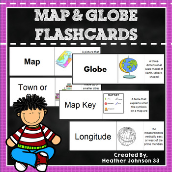
Map and Globe Flash Cards
Thirty-eight Map and Globe flash cards. These flash cards include words such as map, globe, atlas, longitude, latitude, map key, symbol, equator, hemisphere, island, cartographer, capitol, town/city, country, etc. Each definition has a picture (mostly bright and colorful) which makes it fun and helps visual learners. Kids can play memory, match the words/definition with a partner, use it as a center, or work independently. They are in an excel document and can be printed on cardstock or regular
Subjects:
Grades:
1st - 5th
Types:
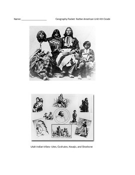
Native American Unit 4th Grade
This packet is focused on the Utah Core Curriculum for geography. It describes each main native american group that was based in Utah. There are questions after each lesson.
In order to print this correctly, you must open the file, then download it. This is an excel document. Once you download it, it will print correctly, and not cut off the pages. If you have questions, please e-mail me.
Subjects:
Grades:
3rd - 5th
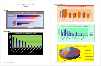
Continent Table Ver3 All Continents Full Pack Tech Lesson Plans&Mat.
A great way to learn about all the continents!
This lesson is in my Level 5 Curriculum Progression.
Recommended for Fifth through Twelfth Grade
Uses Microsoft Excel, but can be adapted for other spreadsheet software.
Summary of Creation: Students use the CIA World Factbook website to find information about all the countries of a specified continent and display the data in a table in an Excel spreadsheet.
Summary of Analysis: Using the table created in Continent Table Version 3 Creation or the
Grades:
5th - 12th
Types:
28 Black History Month SHORT Resources for WARM UPS, BELLRINGERS
Black history is American history. It is 28 days of honoring, remembering, and reflecting on the contributions of Black Americans, and it's a spotlight where their stories could be told without the harmful tropes and lenses that have been used to mis-tell their stories in the past.Can be used for bell-ringers or incorporated into lessons.
Grades:
Not Grade Specific
Types:
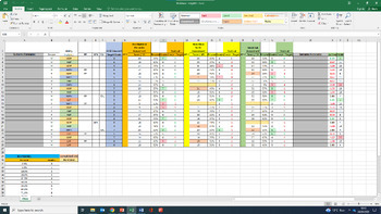
Excel Markbook Template
An Excel spreadsheet that can be used for any subject to easily input marks for assessments. The full spreadsheet is on my page.This sheet really saves me a lot of time, and could save you a lot of time too.Key features:Automatically works out percentage, grade, and residual (grade - target grade)Colour coded based on students in the top/bottom 10%Calculates average residual over multiple assessments.Ranks students from highest residual to lowest residual.Displays average residuals for males, fe
Subjects:
Grades:
Staff
Types:
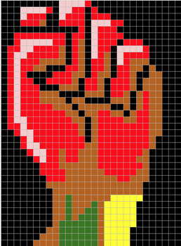
3rd Grade Black History Month (Pixel Art)
3.OA.C.7 - Fluently multiply and divide within 100, using strategies such as the relationship between multiplication and division.
Subjects:
Grades:
2nd - 4th
CCSS:

Viola Desmond BRICK REVEAL - Annuities (5 Versions, TVM Solver included)
As students solve annuities problems they will unlock more Lego bricks of the Viola Desmond portrait. The bricks appear like magic in the spreadsheet, motivating them to complete their work. Below each correctly answered question is a tally of the bricks revealed, should students wish to actually purchase physical bricks and build the picture!This is digital product (no physical toy bricks are included!) available in both Microsoft Excel format and Google Sheets format. Five different problem
Grades:
11th - 12th
Types:
CCSS:
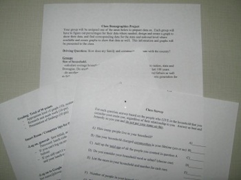
Demographics- compare your class the the U.S. Census!
This demographic project starts with a class survey which is used to collect census style data for the households represented in your class. The class is then divided into groups to research different demographic characteristics of their town, state and country using the U.S census data available online as well as the data collected form the class. The areas researched include employment, size of household, age, race and ethnicity and where we live and how we move. After researching and findi
Subjects:
Grades:
8th - 12th
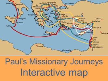
Interactive map of Paul's missionary journeys
Three maps (one on each page for each journey) by Kathy ApplebeeInteractive map of Paul's three missionary journeys in the book of Acts.Mouse over the red triangle next to the city and the corresponding scripture reference or summary will pop up.Sheet one contains map and questions for first tripSheet 2 contains map and questions for second journeySheet three contains Paul's third journey. Click tabs to open new map.Check out other geography productsWorld Geography: Human Impact Power PontMap o
Subjects:
Grades:
Not Grade Specific
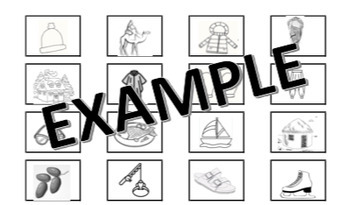
Sahara Desert Sorting
This activity is perfect when you're learning about how geographic location affects characteristics of people's lifestyles. INCLUDES GRAPHIC ORGANIZER TO SORT PICTURE CARDS INTO. The picture cards include clothing, food, housing, and activities for students to sort into Sahara Desert Region and Not Sahara Desert Region boxes. This is geared towards a collaborative piece, but can be used for an independent piece also.
Subjects:
Grades:
K
Types:
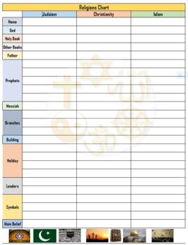
3 Religions of the Middle East Chart w/ Answers - Excel
Compare and contrast chart for Islam, Christianity and Judaism
Subjects:
Grades:
6th - 12th
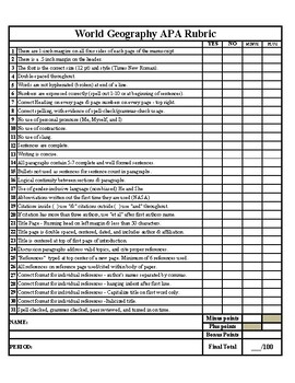
World Geography APA Research Paper Rubric
Are you a world geography teacher looking for a comprehensive and user-friendly APA research paper rubric to streamline the assessment process for your students' projects? Look no further! Our "World Geography APA Research Paper Rubric" is designed to help you evaluate and guide your students' research papers with ease.Key Features:Alignment with APA Guidelines: This rubric is meticulously crafted to align with the American Psychological Association (APA) formatting and citation style. It ensure
Grades:
8th - 12th, Higher Education, Adult Education
Also included in: APA Research Paper Template/Example Paper & APA Grading Rubric
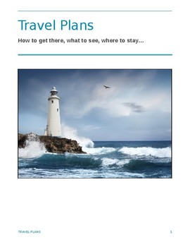
Travel Planner
Included: .pdf and .doc files, evaluation rubric, Excel spreadsheet. 8 pages, in 2 formats. This unit involves planning a vacation (or tour or trip or adventure) to a country of your choice, somewhere outside North America. Assume that you have two weeks and $5000 at your disposal. You can go wherever you like, but you can’t stay in all-inclusive resorts. You can travel at any time of the year. When you get to your destination you must go to at least two towns or cities and visit their most famo
Subjects:
Grades:
8th - 11th
Types:
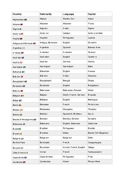
List of countries, nationalities, languages and capitals
Explore the World at Your Fingertips! Introducing the ultimate PDF guide: "Countries, Nationalities, Languages, and Capitals". Unlock a treasure trove of global knowledge with this comprehensive, ready-to-download PDF, designed for curious minds, travelers, students, and language enthusiasts. What's Inside: A curated list of countries from A to Z Nationalities and languages spoken in each country Capital cities of the world's nations Beautifully organized for quick reference
Grades:
Not Grade Specific
Types:
Showing 1-24 of 113 results


