7 results
9th grade geography resources for ActiveInspire Flipchart
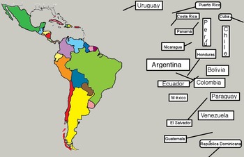
Latin American Countries and Capitals Interactive Promethean Board Activity
Países y capitales de Latinoamérica Interactive Promethean Board Activity by Lonnie Dai Zovi is an active board activity that gets students out of their seats as they learn and review the countries and their locations (moving the names to the country) and matching the capitals with their countries. The names of the countries are written in Spanish (with accents where needed). Of course the names are not that different so they are totally useable in an English speaking geography class. These
Subjects:
Grades:
4th - 10th
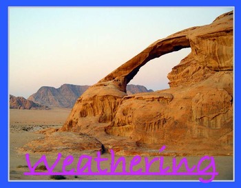
Weathering
Lesson about types of weathering. It includes how ice weathering, water weathering and wind weathering occur. It is interactive and has pictures and video links to engage all learning styles. A lesson the could prelude erosion. It has page notes to help the teacher with a suggested activity at the end.
Weathering by Mike Bailey is licensed under a Creative Commons Attribution 4.0 International License.
Subjects:
Grades:
2nd - 9th

Super Holidays Flipchart for Activ Board
This is a flipchart I have used for Christmas Around the World with my class. Each country has the following:
Map
Pictures
Current weather (click on the icon)
Facts-Santa, Cultural Figures, Foods, and traditions
**Please note, pictures are from google images and are linked to sites such as travel websites. Do not reproduce.
**Also it is important to stress that the information for each country is from research done from Santa Net, Travel websites for each country, personal narratives from teac
Grades:
1st - 10th
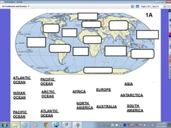

Geography - Mt. Everest foldable flipchart
This flipchart gives instructions and a visual model for the Mt. Everest foldable activity. Students will have to use outside sources to collect general information about Mt. Everest (Elevations, Cost, Sherpas, etc.). On the foldable itself, students will draw/attach several pictures, create a timeline, and draw the locations of the climbing camps, among other things.
Subjects:
Grades:
8th - 12th
Byzantine Empire: Geography of Constantinople Flipchart
Active Inspire flipchart on VA SOL.8a: "The student will apply social science skills to understand the Byzantine Empire and Eastern Europe from about 300 to 1000 a.d. (c.e.) by a) explaining the influence of geography on the establishment of Constantinople as the capital of the Eastern Roman Empire and describing the Byzantine Empire in time and place"Includes 3 Mapping Activities and 1 Fill-in-the-blank activity.
Subjects:
Grades:
8th - 10th
Types:
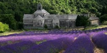
l'Abbaye Notre Dame de Senanque: Lavender Fields of France
This flipchart lesson contains 7 slides of information about the Abbaye Notre-Dame de Senanque, the beautiful location in Southern France where monks grow fields of purple lavender.
I use these short "mini-lessons" to warm up my French classes in the first 10-15 minutes of the day. Students love seeing the colorful pictures and discussing the oddities of French culture! :)
The lesson includes:
1. KEY VOCAB (at least 6 words): french--english translations
2. CULTURAL LESSON ON THE LOCATION (2
Subjects:
Grades:
7th - 12th, Higher Education, Adult Education
Showing 1-7 of 7 results

