Continents and Oceans World Maps Poster Digital & Printable Handouts+ Boom Cards
- Zip
- Easel Activity
Also included in
- Social Studies United States Geography BUNDLE is a growing set of supplementary resources for your Social Studies classroom. Get it now to save more! Earlier you get more you save. Students do not seem to feel very strongly in their attitudes toward social studies. Social Studies is not viewed as bePrice $24.05Original Price $26.72Save $2.67
- As part of ITD Science Membership, you get access to all CURRENT and FUTURE Science resources, uploaded here on TpT store for grades 3 - 5. This a growing bundle! I will update this bundle regularly to include any newly released free and paid resources in my store. Each time I add a new paid resourcPrice $130.45Original Price $144.94Save $14.49
- As part of ITD Science Membership, you get the access to all CURRENT and FUTURE Social Studies resources, uploaded here on theTpT store for grades 3 - 5. This isa growing bundle! I will update this bundle regularly to include any newly released free and paid resources in my store. Each time I add aPrice $152.32Original Price $217.60Save $65.28
- My TOP 5 SCIENCE Resources at 35% OFF - July 2022 is a bundle of my Top 5 best selling resources* in the Science category at 35% OFF. What a great way to save!*it doesn't count top-selling bundles. The top 5 resources might be different next month, so the content and the price of the bundle might chPrice $8.65Original Price $13.30Save $4.65
- My TOP 5 SOCIAL STUDIES Resources at 35% OFF - July 2022 is a bundle of my Top 5 best selling resources* in the Social Studies category at 35% OFF. What a great way to save!*it doesn't count top-selling bundles. The top 5 resources might be different next month, so the bundle's content and pricemighPrice $19.25Original Price $29.62Save $10.37
Description
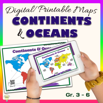
"Continents and Oceans" is a set of digital and printable world maps and the individual continent maps: Europe, Asia, Africa, Australia, North America, South America, and Antarctica maps. It is perfect for traditional classroom settings, 1:1 schools, or distance learning in your Science and/ or Social Studies classrooms.
These diverse maps are an excellent way to supplement your existing Science and/ or Social Studies curriculum. In no way it is intended or designed to replace it. It is about giving your classroom a great sense of personalization and encourage students' engagement.
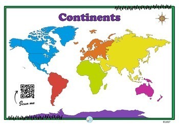
Now it also includes B&W version maps and updated interactive QR codes. The "Scan Me" QR code causes curiosity. QR code is linked to digital labeled posters, a fun way to interact and engage the learning daily.
Based on your curriculum, print the poster of your choice to help you reach your goal best and hang it on your classroom wall. Laminate it to extend life for usage. Are you in need of adding an interactive map in your digital classroom? Now, it includes the JPG version of each map, so you could easily insert it into a file or attach it in an email.
The PDF file (print only) is divided into sections:
- World Maps with the seven continents: Antarctica, Europe, Australia, Asia, North America, Africa, and South America.
- Maps with the individual seven continents: Antarctica, Europe, Australia, Asia, North America, Africa, and South America.
- World Maps with the five oceans: Indian, Pacific, Atlantic, Arctic, and Southern.
- World Maps with the four oceans: Indian, Pacific, Atlantic, and Arctic.
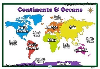
- World Maps with the seven continents: Antarctica, Europe, Australia, Asia, North America, Africa, South America, and the five oceans: Indian, Pacific, Atlantic, Arctic, and Southern.
- World Maps with the seven continents: Antarctica, Europe, Australia, Asia, North America, Africa, South America, and the four oceans: Indian, Pacific, Atlantic, and the Arctic.
- BONUS: Link to redeem the deck of digital cards to identify the continents on BoomLearning.com. Click here to Preview the deck.
Moreover, each section contains a teacher's guide. Hopefully, it will inspire you and provide some guidance on your educational journey.
IMPORTANT: QR Code Reader and Internet access are needed to engage the “Scan Me" QR code.
Also, NOTE: Digital Tasks Cards on BoomLearning.com are stored in the digital cloud. Therefore, they can't be printed. You and your students will also need the account on BoomLearning.com to redeem this deck of digital task cards. Click here to learn more -> Quick Start Guide for Teachers.
Thank you in advance for purchasing and/or downloading this file. Enjoy it! Feedback is always appreciated. Make sure you check the PREVIEW out before downloading/ or purchasing the product.
If there are some minor changes you would like to be made, please, let me know, and I will do my best to help you out.
Enthusiastically,
©2017
LEAVE FEEDBACK
Dear customer, to say that your feedback is powerful is an understatement. I hope you love it! If you do, would you consider posting an online review? This helps me to continue providing excellent products and helps potential buyers to make confident decisions. Thank you in advance for your review and for being a preferred customer.
You can submit feedback right away after the purchase or go to Buy -> My Purchases-> Free Downloads for a list of what you have downloaded for free in the past. Next to each title, you'll find a You can leave a review after downloading this resource button.
I ♥ FOLLOWERS
Be the first to know about my store discounts, free products, and product launches! Just click the green Follow Me star under my store name on this page or click the “Follow Me” star under Inspiring Teaching Design.
TERMS OF USE
© Inspiring Teaching Design. This product is my intellectual property. I own the resource while purchasing a license to use it in your classroom with your students only. It may not be posted on a public website or shared Drive where others can download it. You may reference the resource with credit, and a link is given. You may not translate and/or resell this resource.

