14 results
3rd grade geography lecture interactive whiteboards
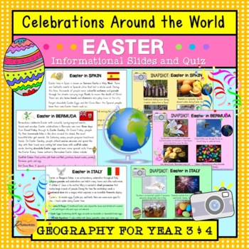
Celebrations Around The World: Easter
This resource introduces children to Easter traditions around the world in counties that include: Spain, Italy, Ethiopia, Bermuda, Australia, Germany and Greece. Learn about people celebrate Easter with their families, friends and communities through special events and traditional foods during this annual occasion. We have included plenty of photographs and amazing facts to engage your students! Additionally, we have included 10 multiple choice quiz questions to check their understanding. Wonder
Subjects:
Grades:
3rd - 4th
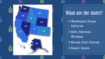
United States Regions Presentations Bundle
This product gives information about each region of the United States, including maps, photographs, & information pertaining to each state of each region. There are five presentation files included for each region along with descriptions of each state. If you like this product, please go to my "It's A Vaughnderful Classroom" to check out other creative products or download a FREEBIE of the Northeast region to preview.
Grades:
2nd - 7th
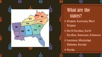
Southeast Region of the United States Presentation
This product gives information about the Southeast Region of the United States, including maps, photographs, & information pertaining to each state of the region. If you like this product, please go to my "It's A Vaughnderful Classroom" to check out the whole bundle and other creative products.In my store are presentations of each of the five regions including: the West, Midwest, Southeast, Southwest, and Northeast regions.
Grades:
2nd - 7th
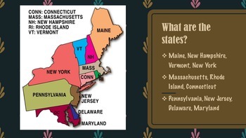
Northeast Region of United States Presentation FREEBIE
This product gives information about the Northeast Region of the United States, including maps, photographs, & information pertaining to each state of the region.
This presentation is a FREEBIE and if you like this product, please go to my "It's A Vaughnderful Classroom" to check out the whole bundle.
Included with the bundle is a presentation of each of the five regions including: the West, Midwest, Southeast, Southwest, and Northeast regions.
Grades:
2nd - 8th
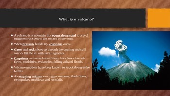
Volcanoes PowerPoint
Includes the following slides:
What is a volcano?
How are volcanoes formed?
What are the different stages of volcanoes?
Why do volcanoes erupt?
How many volcanoes are there?
What are the different types of volcanoes?
What is the difference between lava and magma?
Why does lava take a long time to cool down?
What is the largest active volcano?
What is the Ring of Fire?
Bill Nye the Science Guy Video: Volcanoes
Subjects:
Grades:
3rd - 6th
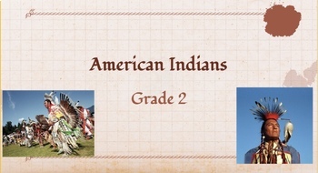
Native American Unit Slideshow_ Powhatan, Lakota, Pueblo
This slideshow features everything you need to teach the social studies unit about Native Americans then and today. Students will be learning about the three tribes, Powhatan, lakota, and pueblo and the similarities vs differences between them. This slideshow includes facts, pictures, videos, and extension activity suggestions.
Grades:
1st - 3rd
Earthquake PowerPoint
Includes the following slides:
What is an earthquake?
What causes an earthquake?
What is a fault?
What are plate tectonics?
What is a seismograph?
What is a tsunami?
What should you do before/during/after an earthquake?
Bill Nye the Science Guy: Earthquakes
Subjects:
Grades:
2nd - 6th
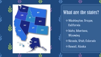
West Region of the United States Presentation
This product gives information about the West Region of the United States, including maps, photographs, & information pertaining to each state of the region. If you like this product, please go to my "It's A Vaughnderful Classroom" to check out the whole bundle and other creative products.In my store are presentations of each of the five regions including: the West, Midwest, Southeast, Southwest, and Northeast regions.
Grades:
2nd - 7th
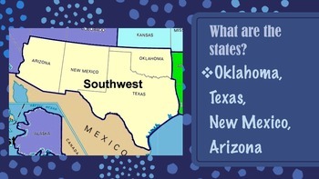
Southwest Region of the United States Presentation
This product gives information about the Southwest Region of the United States, including maps, photographs, & information pertaining to each state of the region. If you like this product, please go to my "It's A Vaughnderful Classroom" to check out the whole bundle and other creative products.In my store are presentations of each of the five regions including: the West, Midwest, Southeast, Southwest, and Northeast regions.
Grades:
2nd - 7th
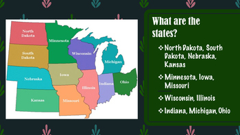
Midwest Region of the United States Presentation *UPDATED*
This product gives information about the Midwest Region of the United States, including maps, photographs, & information pertaining to each state of the region. If you like this product, please go to my "It's A Vaughnderful Classroom" to check out the whole bundle and other creative products.In my store are presentations of each of the five regions including: the West, Midwest, Southeast, Southwest, and Northeast regions.
Grades:
2nd - 7th

Social Studies: Major U.S. Rivers SmartBoard Lesson
This social studies SmartBoard Lesson is designed to use as a teaching tool to help guide your instruction as you teach about the Colorodo River, Rio Grande, Mississippi River, Ohio River, and the Hudson River. There are 8 slides in this lesson. It meets the Georgia Performance Standards (GPS) for 3rd grade social studies.
Subjects:
Grades:
2nd - 4th
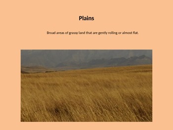
Landform and Waterway Powerpoint/ slideshow
This is a slideshow of different pictures and definitions of landforms and waterways.
Subjects:
Grades:
3rd - 5th
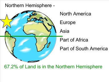
Physical Features of our Earth
Physical Features of our Earth including Equator, Hemispheres, Oceans, Continents, Prime Merediam, and Review questions.
Last 5 slides are review game questions.
Subjects:
Grades:
2nd - 6th
Locating Virginia Presentation
Defines relative location and has students locate Virginia on a map of the United States as well as locating the bordering states. This aligns with VA SOL VS.1 and VS.2.
Grades:
2nd - 5th
Showing 1-14 of 14 results


