30 results
Higher education geography resources for Montessori
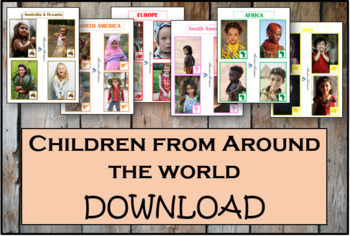
Children From Around The World - Montessori
As children work with these cards, they'll discover fascinating details about the lives and histories of people around the world. These Montessori-inspired children around the world cards will be a good fit to any classroom.This Montessori material is a part of peace education. The material consists of series of cards showing children of different nations, nationalities and races around the world. Each card contains a small map of the continent. There are 54 cards in the Download.
Subjects:
Grades:
PreK - 12th, Higher Education, Adult Education, Staff
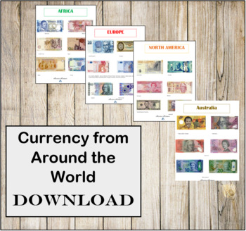
Currency from Around the World- Instant Download- Montessori
CURRENCY FROM AROUND THE WORLD INSTANT DOWNLOAD.There are 6 individual high resolution photos of different banknotes for countries around the world! This is a great addition to any Continent bag or Continent box. These photos are in regulations with the Department of Treasury for printing.
Subjects:
Grades:
PreK - 12th, Higher Education, Adult Education, Staff
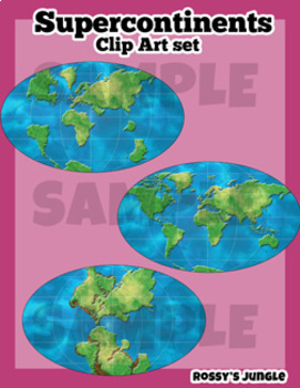
Supercontinents Clip Art Set
This is a set that includes the continents over time, detailed and suited for older students.Includes both color and line art PNG files.Perfect for projects about geology, paleontology, dinosaurs, Pangaea, continental drifts, etc. Detailed world maps:-1 permian- 1 triassic-1 jurassic-1 cretaceous-1 present day
Subjects:
Grades:
6th - 12th, Higher Education, Adult Education
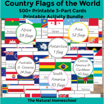
500+ Country Flags of the World Printable 3-Part Cards MEGA Bundle
This flags world pictures bundle includes 252 flags of the world! Of course, they are not all the flags of the world, but they are so many to learn and they offer a variety because they are from the 7 continents of the world.5 North America countries flags10 South America flags59 Africa flags 3-Part Cards61 Europe flags24 Australia and Oceania flags1 Antarctica flag40 Central America and Caribbean flags52 Asia flags, including Eurasia and the Middle East
Subjects:
Grades:
PreK - 12th, Higher Education, Adult Education
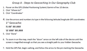
Step by Step Geocaching Template for Students
I recently wrote and received a grant to purchase Garmin eTex 10 GPS units for my Geography Club at my elementary school. This product is a template that I created with step by step instructions that shows students how to key in and use a GPS device to locate geocaches. Once you have the GPS coordinates of a hidden cache, you can type them into this template. Then your students can begin this global scavenger hunt. I have attached four different sheet with groups A, B, C, and D. You can cre
Subjects:
Grades:
4th - 12th, Higher Education, Adult Education
Types:
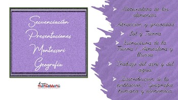
ESPAÑOL: Secuenciación Presentaciones Montessori Geografia
Esquemas de las Presentaciones de Geografia divididas en:Naturaleza de los elementosAtraccion y gravedadSol y TierraEstructura de la Tierra / Atmosfera y lluviaTrabajo del aire y del aguaDistribucion de la poblacion / Geografia humana y economica
Subjects:
Grades:
4th - 12th, Higher Education, Staff
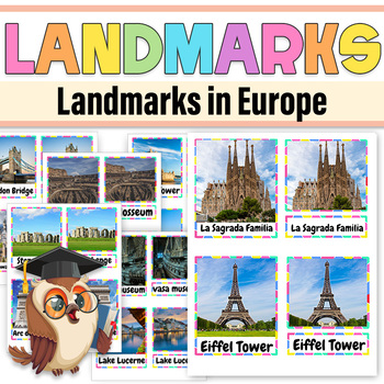
Landmarks in Europe 3 part Montessori cards | Landmarks in Europe
Explore the rich history and cultural heritage of Europe with our Landmarks in Europe 3-Part Montessori Cards.These meticulously crafted cards are an engaging and educational resource designed to introduce children to some of Europe's most iconic landmarks.These Montessori cards provide a unique opportunity for children to explore and appreciate the cultural diversity of Europe through its landmarks. Whether you're a Montessori educator or a parent interested in expanding your child's knowledge
Grades:
PreK - 3rd, Higher Education
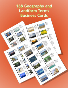
168 Geography and Landform Terms Business Cards
These business cards align with most state standards and Classical Conversations Challenge A program. Additionally, these cards include terms specifically related to Hawaii's geography features such as windward, lava tube, etc. (Please see list below for a full list of terms.)This set of cards are formatted business cards. These correspond with Avery 5371, 5911, 8371, 8471, and 8859. The business card sizes are 2”x 3.5”The first 3 pages (cover, table of contents, and instruction page) are lette
Subjects:
Grades:
K - 12th, Higher Education, Adult Education
Also included in: Geography Terms Classical Conversations Aligned Bundle
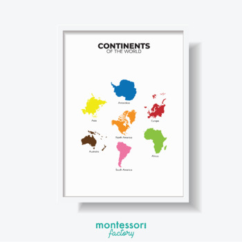
CONTINENTS OF THE WORLD Geography Wall Art Montessori Educational Poster Chart
Brighten up your kid's room/classroom with some inspirational wall art! Easy to use instant download, just print, and frame! You can print it at home (I recommend using good quality paper for a better result), or you can print it at your local/online print shop.Purchase... Instant Download... Print and Frame (=YOUR ORDER WILL INCLUDE 5 DIGITAL FILES IN COMMON SIZES.Included are 5 high-resolution images (300 dpi), ready for print.- Ratio A (4:5) file for printing 4"x5", 8"x10", 16"x20", 40x50cm.-
Subjects:
Grades:
PreK - 12th, Higher Education, Adult Education, Staff
Types:
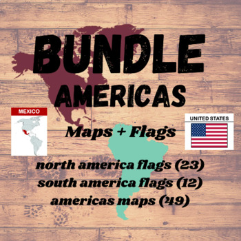
Americas MAPS & FLAGS BUNDLE | 84 Flash Cards | Geography Montessori
♥ Teach the maps and flags of AMERICAS Continent (North America + South America) using these Nomenclature Cards. Increase the mental ability of the kids with these Montessori Three part Cards ♥♥ Very high quality colorful map and flag pictures to help kids learn in a fun and easy way ♥♥ Includes complete set of 84 Nomenclature Cards of North & South American countries Flags and Maps. ♥» » » WHAT WILL YOU RECEIVE? « « «• 3 PDF File letter size (8.5 in x 11 in) with 4 cards per page -
Grades:
PreK - 12th, Higher Education
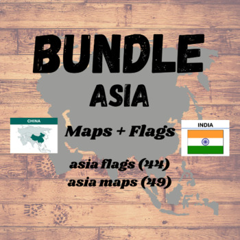
Asia MAPS & FLAGS BUNDLE | 93 Flash Cards | Geography Montessori
♥ Teach the maps and flags of Asia using these Nomenclature Cards. Increase the mental ability of the kids with these Montessori Three part Cards ♥♥ Very high quality colorful map and flag pictures to help kids learn in a fun and easy way ♥♥ Includes complete set of 93 Nomenclature Cards of Asian countries Flags and Maps. ♥» » » WHAT WILL YOU RECEIVE? « « «• 3 PDF File letter size (8.5 in x 11 in) with 4 cards per page - 1 Full Page MAP of ASIA labeled with country names - Asia Map
Grades:
PreK - 12th, Higher Education
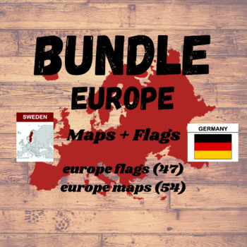
Europe MAPS & FLAGS BUNDLE | 101 Flash Cards | Geography Montessori
♥ Teach the maps and flags of Europe using these Nomenclature Cards. Increase the mental ability of the kids with these Montessori Three part Cards ♥♥ Very high quality colorful map and flag pictures to help kids learn in a fun and easy way ♥♥ Includes complete set of 101 Nomenclature Cards of European countries Flags and Maps. ♥» » » WHAT WILL YOU RECEIVE? « « «• 3 PDF File letter size (8.5 in x 11 in) with 4 cards per page - 1 Full Page MAP of EUROPE labeled with country names -
Grades:
PreK - 12th, Higher Education
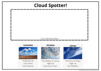
Cloud Spotting: Cloud Identifier Card PDF
Boost your science lessons with the Cloud Spotting Card, a useful tool for teachers, weather experts, and anyone interested in Cloud Spotting! This easy-to-use device makes it simple to identify and learn about different types of clouds, perfect for science and geography lessons. Other products you might like:⭐Sensory Activity Book: Independent Forest School Activities⭐Sound Map - Soundscape - Geography - Forest School & Nature Walks⭐Pre-Assessment First Grade & Anchor Chart Title Page f
Subjects:
Grades:
2nd - 6th, Higher Education
Types:
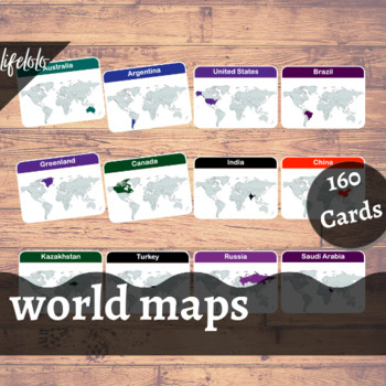
World Maps - 160 Flash Cards | Homeschooling | Montessori Geography
♥Teach the World Map of 160 countries using these Nomenclature Cards. Increase the mental ability of the kids with these Montessori Three part Cards ♥♥ Very high quality colorful map pictures to help kids learn in a fun and easy way ♥» » » WHAT WILL YOU RECEIVE? « « «• 4 PDF File letter size (8.5 in x 11 in) with 4 cards per page • Each card measures 5 in x 3.75 in.Just PRINT, LAMINATE (Optional) and CUT!DIGITAL FILE ONLY - Instant download. No item will be shipped.» » »Personal Use Only. No Co
Grades:
PreK - 12th, Higher Education
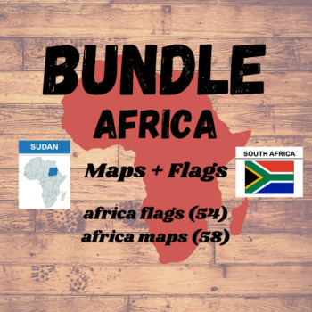
Africa MAPS & FLAGS BUNDLE | 112 Flash Cards | Geography Montessori
♥ Teach the maps and flags of Africa using these Nomenclature Cards. Increase the mental ability of the kids with these Montessori Three part Cards ♥♥ Very high quality colorful map and flag pictures to help kids learn in a fun and easy way ♥♥ Includes complete set of 112 Nomenclature Cards of African countries Flags and Maps. ♥» » » WHAT WILL YOU RECEIVE? « « «• 3 PDF File letter size (8.5 in x 11 in) with 4 cards per page - 1 Full Page MAP of AFRICA labeled with country names - A
Grades:
PreK - 12th, Higher Education
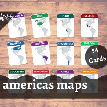
Americas Maps - 54 Flash Cards | Homeschooling | Montessori Geography
♥Teach the maps of North America & South America Continent using these Flash Cards. Increase the mental ability of the kids with these Montessori Three part Cards ♥♥ Very high quality colorful map pictures to help kids learn in a fun and easy way ♥♥ Includes 49 Nomenclature Cards (35 Countries + 14 Other Territories/Overseas Territories) ♥» » » WHAT WILL YOU RECEIVE? « « «• 1 PDF File letter size (8.5 in x 11 in) with 4 cards per page + 1 Full Page North America & South America Map with
Grades:
PreK - 12th, Higher Education
Also included in: Americas MAPS & FLAGS BUNDLE | 84 Flash Cards | Geography Montessori
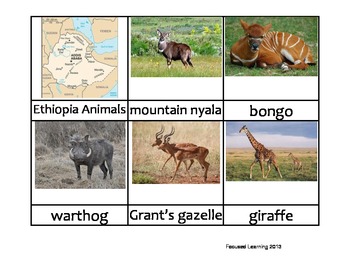
Nomenclature Cards - Animals - Africa - Ethiopia
3-part cards of animals in Ethiopia, Africa. Simply print, mount on cardstock and laminate. Use in lessons on Animals, Africa, Biomes, etc. Great literacy tool for reading children.
Subjects:
Grades:
PreK - 12th, Higher Education
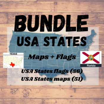
US States MAPS & FLAGS BUNDLE | 158 Flash Cards | Geography Montessori
♥ Teach the maps and flags of 50 States of United States using these Nomenclature Cards. Increase the mental ability of the kids with these Montessori Three part Cards ♥♥ Very high quality colorful map and flag pictures to help kids learn in a fun and easy way ♥♥ Includes complete set of 107 Nomenclature Cards of United States Flags and Maps. ♥» » » WHAT WILL YOU RECEIVE? « « «• 4 PDF File letter size (8.5 in x 11 in) with 4 cards per page - 1 Full Page USA Map - USA States Maps -
Grades:
PreK - 12th, Higher Education
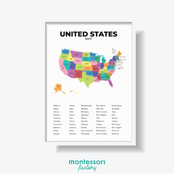
UNITED STATES MAP Geography Wall Art Montessori Educational Poster Chart
Brighten up your kid's room/classroom with some inspirational wall art! Easy to use instant download, just print, and frame! You can print it at home (I recommend using good quality paper for a better result), or you can print it at your local/online print shop.Purchase... Instant Download... Print and Frame (=YOUR ORDER WILL INCLUDE 5 DIGITAL FILES IN COMMON SIZES.Included are 5 high-resolution images (300 dpi), ready for print.- Ratio A (4:5) file for printing 4"x5", 8"x10", 16"x20", 40x50cm.-
Subjects:
Grades:
PreK - 12th, Higher Education, Adult Education, Staff
Types:
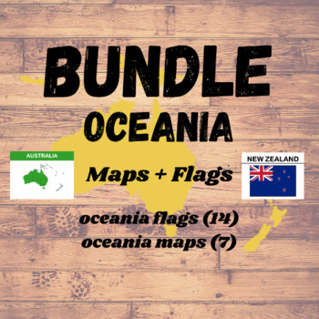
Oceania MAPS & FLAGS BUNDLE | 21 Flash Cards | Geography Montessori
♥ Teach the maps and flags of Oceania using these Nomenclature Cards. Increase the mental ability of the kids with these Montessori Three part Cards ♥♥ Very high quality colorful map and flag pictures to help kids learn in a fun and easy way ♥♥ Includes complete set of 21 Nomenclature Cards of Oceania countries Flags and Maps. ♥» » » WHAT WILL YOU RECEIVE? « « «• 2 PDF File letter size (8.5 in x 11 in) with 4 cards per page - Oceania Maps - 7 Cards (6 Countries + 1 Other Territories/Overs
Grades:
PreK - 12th, Higher Education
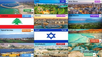
Israel Map Game, Yom Atzmaut, Israel Independence Day
For: Parshat Lech Lecha & Yom Atzmaut, Israel Independence DayGame:Israel MapPictorial City Labels Place velcro on the map's locations Place the other velcro on the back of the pictorial labels.Place each label in the correct location on the map of Israel.
Subjects:
Grades:
PreK - 12th, Higher Education, Adult Education, Staff
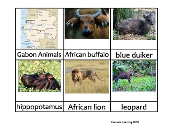
Nomenclature Cards - Animals - Africa - Gabon
3-part cards of animals in Gabon, Africa. Simply print, mount on cardstock and laminate. Use in lessons on Animals, Africa, Biomes, etc. Great literacy tool for reading children.
Subjects:
Grades:
PreK - 12th, Higher Education
Types:
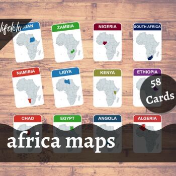
Africa Maps - 58 Flash Cards | Homeschooling | Montessori Geography
♥ Homeschool and Teach the map of African countries using these Flash Cards. Increase the mental ability of the kids with these Montessori Three part Cards ♥♥ Very high quality colorful map pictures to help kids learn in a fun and easy way ♥♥ Includes 58 Montessori cards (54 Countries + 4 Other Territories/Overseas Territories) ♥» » » WHAT WILL YOU RECEIVE? « « «• 1 PDF File letter size (8.5 in x 11 in) with 4 cards per page - 1 Full Page MAP of AFRICA labeled with country names -
Grades:
PreK - 12th, Higher Education
Also included in: Africa MAPS & FLAGS BUNDLE | 112 Flash Cards | Geography Montessori
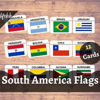
South America Flags - 12 Flash Cards | Homeschooling | Montessori Geography
♥ Teach the flags of South America countries using these Nomenclature Cards. Increase the mental ability of the kids with these Montessori Three part Cards ♥♥ Very high quality colorful flag pictures to help kids learn in a fun and easy way ♥♥ Includes 23 Montessori cards of the national flags of the countries of South America♥» » » WHAT WILL YOU RECEIVE? « « «• 1 PDF File letter size (8.5 in x 11 in) with 4 cards per page• Each card measures 5.00in x 4.00in.Just print, cut and they're ready to
Grades:
PreK - 12th, Higher Education
Showing 1-24 of 30 results


