35 results
7th grade critical thinking geography resources for Microsoft Publisher
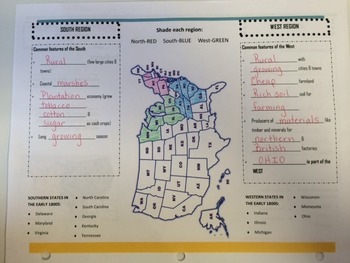
Early Regions of the United States
This brochure is used as a graphic organizer that the students complete and glue into their Social Studies interactive notebook. The organizer distinguishes between the main characteristics dividing the early regions of the United States into the North, South, and West.
Ohio's New Learning Standards Geography 11: The regions which became known as the North, South, and West of the United States developed in the early 1800s largely based on their physical environments and economics.
Grades:
3rd - 7th
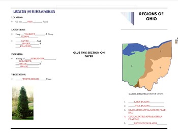
Regions of Ohio Graphic Organizer
This brochure featuring the Regions of Ohio is used as a graphic organizer and is glued into our Interactive Social Studies Notebooks. It covers the location, landforms, industry, vegetation, and major cities for each region. It accompanies a short smart board presentation.
Ohio's New Learning Standards Geography 10: The economic development of the United States continues to influence and be influenced by agriculture, industry, and natural resources in Ohio.
Subjects:
Grades:
3rd - 7th
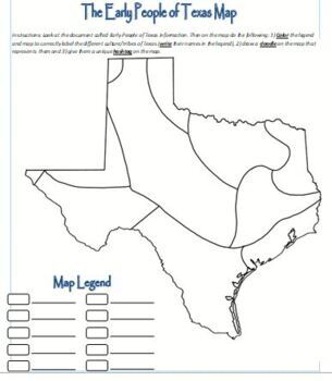
Map Activity - Texas Native Americans
Students color the map, create doodles and hashtags to better understand the Native Americans in early Texas.
Grades:
6th - 12th, Higher Education, Adult Education
Types:
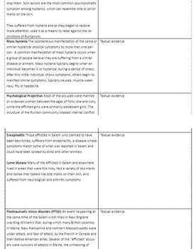
Salem Witch Trials - Medical Explanations for Hysteria
Short explanations of medical reasons that might have contributed to the hysteria that led to the Salem Witch Trials
In two column format with space for citing textual evidence from assigned readings/research.
Subjects:
Grades:
7th - 8th
Types:
CCSS:
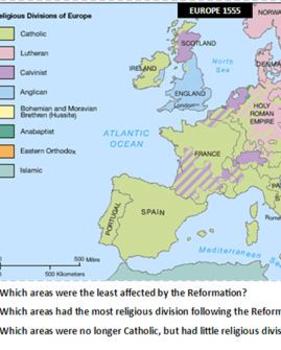
Maps as Text - Printing Press and Reformation
Includes 4 maps: modern Europe for reference; Europe prior to the Reformation; religious division in Europe following the Reformation; and the growth and locations of printing presses.
Questions ask students to analyze and infer, and to draw conclusions from the maps.
This should be printed in color--laminate for use year-to-year.
Grades:
7th - 9th
Types:
Brochure Template-Rome Italy-World History
brochure
template
Microsoft Publisher
3-fold brochure
pamphlet
activity
project
internet research
world history
English
Geography
Rome
Italy
coliseum
colosseum
roman colosseum
Roman coliseum
gladiator
vacation
homework
project
fun
craft
PI
c-scope
cscope
Texas
Coaching History
Grades:
5th - 12th
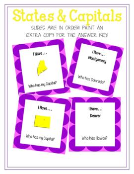
I have... Who has... States and Capitals
These I have...Who has... cards cover all 50 states and capitals. One card reads.... "I have... (then has a picture of a state)...Who has my capital?" the next card would read "I have... Austin... Who has Florida?" This game is meant to help the students learn their states and capitals as well as learning to recognize the states shape. There are 100 cards total and they all loop so you can start and stop wherever you would like. If you would like the master sheet that shows a picture of each
Grades:
4th - 8th
Types:

Where in the World Wednesday - Syria
Where in the World Wednesday is a quick way to assess prior knowledge, pique students’ interest in a new geographical location, teach note taking skills, encourage critical thinking, and have FUN while doing it.
There are ten clues ranging from languages spoken, ethnicities, products and exports, current events, sports, popular leaders, tourist attractions, historical events, government, and indigenous animals. There is also a lesson extension provided for the teacher.
Grades:
6th - 8th
Types:
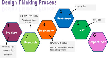
Makerspace Design Thinking Process Poster
Use this poster at your makerspace or during lessons that would support this type thinking process.
Subjects:
Grades:
3rd - 12th
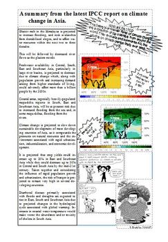
Asia & Climate Change
As part of a unit on China. Collated information from the IPCC report in 2007. Students analyse this, plus some political cartoons I found to talk about the links between climate change and Asia. This is a bit old now, so will be on permanent discount!If you really like this resource and want to support me a little more, please consider also buying me a 'coffee'! :) Asia & Climate Change by Kit Rackley is licensed under a Creative Commons Attribution-NonCommercial-ShareAlike 4.0 Internationa
Subjects:
Grades:
6th - 10th
Types:
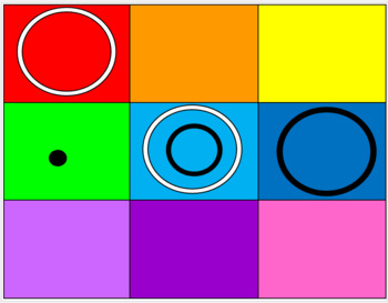
O-Trio Virtual Interactive games
O-Trio is a great game but this is Virtual O-Trio!!! An interactive game you can play during distance learning or telehealth. Up to three players. Advanced game for higher functioning individuals. Included link to a video for the rules to game.
Subjects:
Grades:
4th - 12th
Types:
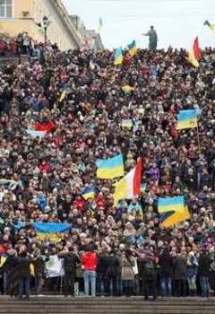
Where in the World Wednesday - Ukraine (Updated 03-09-2014)
Where in the World Wednesday is a quick way to assess prior knowledge, pique students' interest in a new geographical location, teach note taking skills, encourage critical thinking, and have FUN while doing it!
There are ten clues ranging from languages spoken, ethnic groups, products exported, current events, sports, popular leaders, historical events, government, and indigenous animals.
There is also a lesson extension provided for the teacher.
Subjects:
Grades:
6th - 8th
Where in the World Wednesday - Egypt
Where in the World Wednesday is a quick way to assess prior knowledge, pique students’ interest in a new geographical location, teach note taking skills, encourage critical thinking, and have FUN while doing it.
There are ten clues ranging from languages spoken, ethnicities, products and exports, current events, sports, popular leaders, tourist attractions, historical events, government, and indigenous animals. There is also a lesson extension provided for the teacher.
Grades:
6th - 8th
Types:
Where in the World Wednesday - Planet Earth
Where in the World Wednesday is a quick way to assess prior knowledge, pique students' interest in a new geographical location, teach note taking skills, enourage critical thinking, and have FUN while doing it.
Subjects:
Grades:
6th - 8th
Types:

Central America and the Caribbean Map - Blank with list
Map of Central America and the Caribbean with list of countries and major cities. Can be edited.
Grades:
5th - 12th
Types:
Where in the World Wednesday - Somalia (Djibouti - Bonus!)
This is a quick way to assess prior knowledge, pique students' interest in a new geographical location, teach note taking skills, encourage critical thinking, and have FUN while doing it.
Students are asked to listen and record ten clues and then determine where in the world they might be. The lesson includes ideas for tangible rewards and extension activities.
Subjects:
Grades:
6th - 7th
Types:
Where in the World - Japan
Where in the World is a quick way to assess prior knowledge, pique students' interest in a new geographical location, teach note taking skills, encourage critical thinking, and have FUN while doing it.There are ten clues ranging from languages spoken, ethnic groups, products exported, current events, sports, popular leaders, historical events, government, and indigenous animals.There is also a lesson extension provided for the teacher.
Subjects:
Grades:
5th - 9th
Where in the World Wednesday - India
Where in the World Wednesday is a quick way to assess prior knowledge, pique students' interest in a new geographical location, teach note taking skills, encourage critical thinking, and have FUN while doing it.
There are ten clues ranging from languges spoken, ethnicities, products that are exported, current events, sports, popular leaders, tourist attractions, historical events, government, and indigenous animals.
There is also a lesson extension provided for the teacher.
Grades:
6th - 8th
Types:

Brazil Scrapbook: Learning About Brazil!
This activity allows students to research Brazil and share their findings through a visual scrapbook. This activity is best used with access to the internet and/or a textbook that provides information about Brazil. Through 8 different learning activities/areas of research, students learn all about the culture and ways of life of those living in Brazil. It also allows students to compare the lives of Brazilians to the lives of Americans.
Grades:
5th - 8th

Acronym Banner South American countries
Want a way to help your students remember the order of the countries? This is a banner with an acronym to help remember the order of the South American countries that you can post in your classroom.
Subjects:
Grades:
6th - 9th
Where in the World Wednesday - South Korea
Where in the World Wednesday is a quick way to assess prior knowledge, pique students' interest in a new geographical location, teach note taking skills, encourage critical thinking, and have FUN while doing it.
There are ten clues ranging from languages spoken, ethnicities, products exported, current events, sports, popular leaders, tourist attractions, historical events, government and indigenous animals.
There is also a lesson extension provided for the teacher.
Grades:
6th - 8th
Types:

Lewis and Clark: Great Journey West Movie Guide
This is a movie guide to go with the movie Lewis and Clark: Great Journey West. You can view this movie on youtube.com for free at https://www.youtube.com/watch?v=lhW55nFJBP8. It takes 43 minutes and I use this in conjunction with a Lewis and Clark Expedition Map Exercise.
Subjects:
Grades:
6th - 9th
Types:

South America Map - Blank with list
Blank map of South America with a list of countries, major cities, and geographic features. Can be edited.
Grades:
5th - 12th
Types:
Beginning of the year Passport
This is a get to know the student activity that I have used with my 5th grade students. I have uploaded a publisher file to that you can edit for your own needs. I hope you enjoy!
Subjects:
Grades:
3rd - 12th
Types:
Showing 1-24 of 35 results

