TPT
Total:
$0.00
Selected
Grades
Formats

Subjects

Arts & Music
English Language Arts
Foreign Language
Holidays/Seasonal
Math
Science
Social Studies - History
Specialty
For All Subject Areas
197 results

6th grade social studies assessment images
Preview of Landforms Matching Worksheet

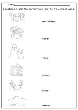
Landforms Matching Worksheet

Created by
L, M, N, O, Pink
My Landforms worksheet goes along with the Landform picture cards. After studying and learning about the cards, this is a great way to see if your students grasped the concept, a good formative assessment. Thank you to Scrappin Doodles for the adorable clipart.
Preview of Galileo Timeline 3rd Grade Wit and Wisdom
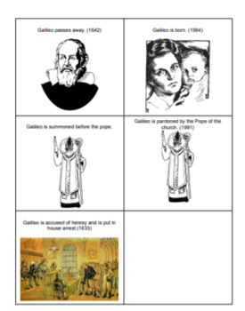
Galileo Timeline 3rd Grade Wit and Wisdom
This document contains photos with captions to aid students in creating a timeline for Galileo's life. This is part of Wit and Wisdom Module 2, lesson 4. This set of photos with captions will aid students in recreating his timeline as well as describing it. These photos may also be used for other studies around Galileo. Please see the list of what is included in the timeline below. This list correlates with the Wit and Wisdom curriculum. All graphics used with permission from www.openclipart.com
Preview of Blank Map of the 13 Colonies
Preview of Monthly Celebrations Bundle| Holidays| 8th, 9th,10th,11th,12th Grade|Fun History
Monthly Celebrations Bundle| Holidays| 8th, 9th,10th,11th,12th Grade|Fun History

This set of activities are great for a couple of days devoted to celebrate history! This bundle includes all available monthly mini projects. These activities can take 2-3 days depending on in class work time. Each mini project comes with detailed instructions, lists of topics where appropriate and includes a bonus file for the Women's History Month mini project. These are great for some small group research time or if you are in need of a quick activity for absences.Each mini project comes with
Preview of Jour de la Terre & l'époque humaine | Earth Day, Climate change
Jour de la Terre & l'époque humaine | Earth Day, Climate change

Created by
Fluent in French
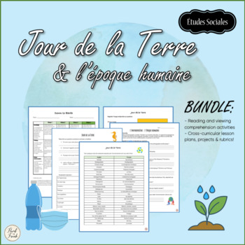
Jour de la Terre or Earth Day is April 22! Have you thought about what you would like to do with your students? This BUNDLE is full of cross-curricular lessons and projects en français! Using visual art, we can raise awareness about climate change, learn about what communities around the world are doing to live greener lives, and to make a difference in the world!Students will use digital media to make a poster, take photographs, and to watch films on human activities and their impacts on our pl
Preview of Digital By the Great Horn Spoon Novel Study Google Form Comprehension Bundle
Digital By the Great Horn Spoon Novel Study Google Form Comprehension Bundle

Created by
Primary Library
Test your students' comprehension and text understanding with these 10 question quizzes on By the Great Horn Spoon!Questions are thought-provoking and open-ended as well as text-based.Forms include sample answers and all questions are editable! This no-prep, digital resource works great for distance learning or with students in the classroom and it provides instant feedback to students!The forms can be pushed out to students to complete digitally or they can be printed out by clicking on the thr
Preview of Christmas Game Board

Christmas Game Board

Created by
Tanner Winters
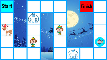
This game board could be used for any subject. Teams or players must answer a question correctly, roll one dice, and then move that many spaces. This board is Christmas themed:1. The elf moves the player to the next elf2. The second elf sends the player to the ice hole3. The first yeti takes the player back to the start4. The second yeti takes the player back to the first yeti5. The ice hole freezes the player for one/two turns6. The reindeer prevents players from being effected by the yeti and
Preview of Blank World Map - identify continents, oceans, equator and prime meridian
Preview of Southeast Region Blank Map - Label the States
Southeast Region Blank Map - Label the States

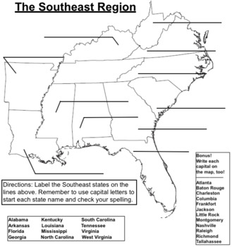
Use this blank map for practice or assessment of the 12 Southeast states. As a bonus, have students label the capitals as well.I have one map for each of the five regions listed on TpT: NE, SE, MW, SW, W.
Preview of 911 EMERGENCY NUMBER EMERGENCY-NON-EMERGENCY WORKSHEET
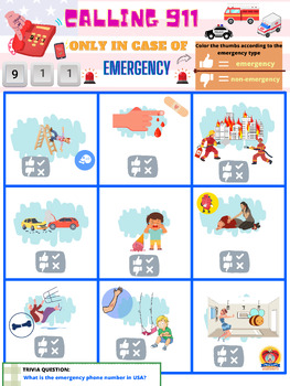
911 EMERGENCY NUMBER EMERGENCY-NON-EMERGENCY WORKSHEET

This worksheet will help your kids understand that the emergency number is a vital aspect of their safety education, promoting a safer community and empowering children to act responsibly in times of crisis. This worksheet contains eye-catching and appealing illustrations for the kids to differentiate an emergency and non-emergency situations. Life skills worksheet#teachersresources
Preview of The Bill of Rights Anchor Chart

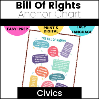
The Bill of Rights Anchor Chart

Have you ever found it difficult to teach the Bill of Rights in a way middle schoolers will understand?  Are all the old posters kinda boring? Middle school students are never too old for an Anchor Chart!! Then this is your solution!  Using this bright, colorful, and easy to interpret Bill of Rights Anchor Chart, your students will be able to learn the Bill of Rights in a way that speaks to them. Just download, print, and go! Or, use it as a poster in the classroom. Here's what you'll get:A
Preview of Safety Plan, crisis plan, school safety plan, student safety plan, suicide
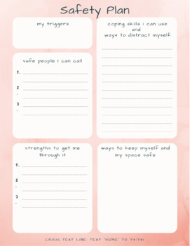
Safety Plan, crisis plan, school safety plan, student safety plan, suicide

As teachers or therapists, sometimes we encounter a student or client who is thinking about or engaging in a risky behavior. When this happens, it can feel overwhelming and urgent and we might not know what to do. This safety plan is available for digital download. Safety planning is a useful tool that can be used with students or clients to help them define their triggers, safe people they can reach out to, coping skills they can utilize, their strengths, ways to keep their space safe, and a c
Preview of Ancient Athens and Sparta

Ancient Athens and Sparta

Created by
The Daily Globe
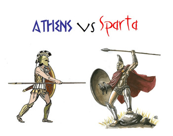
This is a comprehensive study of ancient Athens and Sparta. There is a Powerpoint for each of the two city-states, and also two graphic organizers to use during or after. There is a thorough chart where students can write notes about different categories such as government, education, daily life, along with an answer key. There is also a blank Venn-diagram included. Both graphic organizers can be used as group work or for assessment purposes. I have included an introduction to Greek city-st
Preview of PEEL Paragraph Sentence Starters

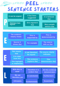
PEEL Paragraph Sentence Starters

Are you teaching PEEL in your classroom? Do your students struggle to get things started? This is the poster for you! It will guide students on how to begin each sentence, the point, the evidence, the explanation and the link. Great colours and accessible language!
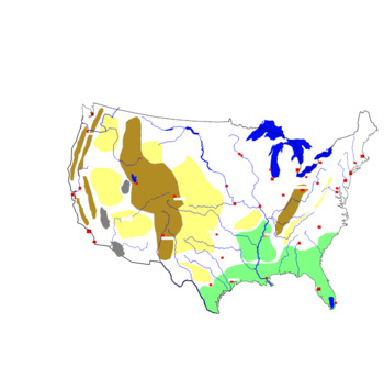
Preview of Blind map of the United States with rivers, cities and relief units
Blind map of the United States with rivers, cities and relief units

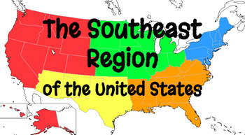
Blind map of the United States with rivers, cities and relief unitsStudents will need to complete this map with the correct names. They will complete the names of rivers, cities and relief units. They can also be helped by the school atlas with the map of the United States
Preview of Southeast Region Google Form Quiz Bundle
Southeast Region Google Form Quiz Bundle

In this bundle you will find the 25 question Google Form Southeast Region States & Postal Codes quiz. This form is the location and postal codes (abbreviations) for all the Southeast states. The 20 question All About the Southeast Google Form quiz is all the features of the Southeast Region, including Land/Water, Climate, Products/Natural Resources, Landmarks, and Culture sections are all covered in this Google form. Finally, the Southeast Region States & Capitals 12 question Google Form
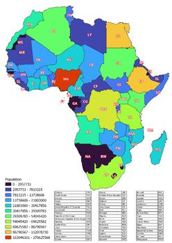
Preview of The Africa map classified by the number of inhabitants of the countries
The Africa map classified by the number of inhabitants of the countries

Created by
World city maps
The Africa map classified by the number of inhabitants of the countriesThis download contains files that may be printed and copied or used digitally.World City MapsBooksPinterestInstagramFacebookTikToK
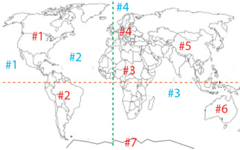
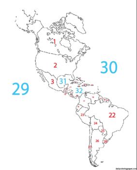
Preview of Blank Western Hemisphere Map with #'s for countries and major bodies of water
Blank Western Hemisphere Map with #'s for countries and major bodies of water

Created by
Jared St John
This map can be used as part of a digital assignment or can be used as an assessment where students have to identify the name of the place being identified by number.
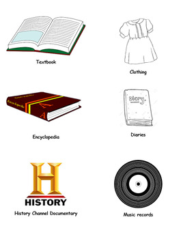
Preview of Primary vs Secondary Sources - Sorting Activity
Primary vs Secondary Sources - Sorting Activity

Hands on! Clip Art cutouts of a variety of different sources Historians use to study history! Reach your kinesthetic learners by cutting these out, giving them to students in groups, and having them sort between primary and secondary. Allow students to discuss, debate, disagree, and decide! This is a great follow-up for the day after students are introduced to the difference between primary and secondary sources.
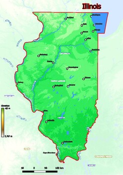
Preview of Physical map of Illinois with mountains, plains, bridges, rivers, lakes, mountai
Physical map of Illinois with mountains, plains, bridges, rivers, lakes, mountai

Created by
World city maps
Physical map of Illinois with mountains, plains, bridges, rivers, lakes, mountains, citiesThis download contains files that may be printed and copied or used digitally.World City MapsBooksPinterestInstagramFacebookTikToK
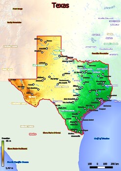
Preview of Physical map of Texas with mountains, plains, bridges, rivers, lakes, mountains,

Physical map of Texas with mountains, plains, bridges, rivers, lakes, mountains,

Created by
World city maps
Physical map of Texas with mountains, plains, bridges, rivers, lakes, mountains, citiesThis download contains files that may be printed and copied or used digitally.World City MapsBooksPinterestInstagramFacebookTikToK
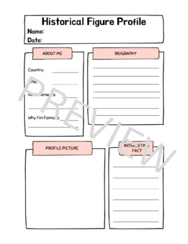
Preview of Historical Figure Profile

Historical Figure Profile

Created by
Clem's Classroom
Ever wanted to use Social Media templates in your classroom? Here is a great handout for little historians to learn more about historical figures!
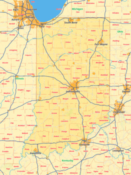
Preview of Indiana map with cities township counties rivers roads labeled
Indiana map with cities township counties rivers roads labeled

Created by
World city maps
Indiana map with cities township counties rivers roads labeledThis download contains files that may be printed and copied or used digitally.___________________________________________________________________World City MapsBooksPinterestInstagramFacebookTikToK
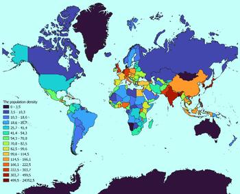
Preview of World map with countries classified by population density

World map with countries classified by population density

Created by
World city maps
World map with countries classified by population densityThis download contains files that may be printed and copied or used digitally.World City MapsBooksPinterestInstagramFacebookTikToK
Showing 1-24 of 197 results

Find Social Studies - History resources | TPT

Importance of learning social studies

Social studies offers valuable insights into history, geography, and much more. Social studies captivates students by providing them with perspectives from the past, present, and future, allowing them to understand history and navigate current events. It enables them to appreciate how previous generations have shaped their present reality. In essence, social studies opens their eyes to the vastness of life beyond their immediate surroundings.

Benefits of learning social studies

Learning social studies offers many benefits to students in terms of helping them develop a holistic understanding of the world. Namely, it helps them:

  • Learn about the achievements, challenges, perspectives, traditions, and customs of different societies
  • Evaluate information, analyze evidence, and make informed judgments about complex social, economic, and political issues
  • Become active, responsible, and engaged citizens
  • Comprehend global issues such as human rights, environmental sustainability, and economic disparities

By teaching social studies, teachers can help students develop critical thinking skills, foster civic engagement, and promote social awareness and responsibility.

Teaching with social studies resources

On TPT, social studies resources come in various formats, from worksheets to interactive notebooks to units. They can be used to enhance learning, assess a student’s mastery of social studies concepts, or to reteach a tricky topic. With plenty of TPT resources at your fingertips, teaching and learning social studies will be so much easier.

Discover printable and digital social studies resources

If you’re a teacher or parent looking for printable or digital social studies resources, TPT has an extensive array of instructional materials for every learning need, topic, or grade level. Whether you’re teaching students about America’s democratic process, the legacy of Dr. Martin Luther King, Jr., how to read maps, or World War II, we’ve got you covered.

Social studies resources on TPT offer informative lessons, engaging texts, intriguing facts, interactive puzzles, and enjoyable trivia games. These grade-specific resources ensure that all students can access age-appropriate materials that stimulate their minds and enhance their creative thinking abilities.

For instance, first graders can explore worksheets on senses and emotions, followed by a coloring page featuring Harriet Tubman. Older students can test their knowledge with quizzes on statistics and capital cities, then delve into the history of the Underground Railroad through an informational sheet or enjoy a word search focused on civil rights leaders. With such a wide variety of subjects and topics covered, our social studies pages provide endless opportunities for students to explore the world in captivating ways.

Frequently asked questions about teaching social studies

What types of social studies lessons are available on TPT?

There are many different types of history resources sold by Sellers on TPT. Some popular social studies lessons include U.S. history, world history, ancient history, geography, civics, and government.

How do I find social studies lessons on TPT?

Educators can save time preparing history lessons with resources created by experienced teachers. Simply start a search for social studies resources on the TPT marketplace, and filter by grade level, price, and/or resource type to find materials that've been proven to work in classrooms like yours. No matter what you’re teaching, there are plenty of social studies lessons and activities sold by Sellers on TPT that are tailored to meet your students' skill levels.