1,492 results
10th grade geography cultural activities under $5
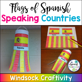
Flags of Spanish-Speaking Countries Windsock Craftivity
This is a coloring activity and windsock craft with the 21 flags of the Spanish-speaking world. Students will follow four simple steps to color, cut and glue these colorful windsock flags. Only five colors are needed: rojo, amarillo, verde, azul cielo, and azul (red, yellow, green, sky blue, and blue). This is a great activity when reviewing Spanish-speaking countries, Hispanic culture, holidays or colors. These windsock templates are available in both color and blackline. Makes a great decorati
Subjects:
Grades:
K - 10th
Also included in: Spanish-Speaking Countries, Capitals, and Nationalities Bundle
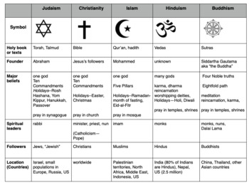
Compare World Religions Chart --Judaism, Christianity, Islam, Hinduism, Buddhism
This is a chart I use with my students to compare five major world religions-- Judaism, Christianity, Islam, Hinduism and Buddhism. It is meant to have the students learn the basics and be able to know the major aspects of all the religions. I included a blank copy and a completed version. In my social studies textbooks, there is quite a bit of info about each of these religions. This can also be done this as a group jigsaw activity. Feel free to edit it to suits your needs. Let me know if
Subjects:
Grades:
5th - 10th
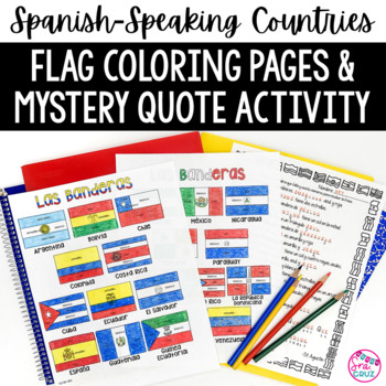
Spanish Speaking Countries Flags Worksheets Spanish Colors Coloring Pages
These coloring pages practice Spanish colors using flags of Spanish-speaking countries. Line versions of each flag have the color in Spanish for each section of the flag (rojo, blanco, azul, etc.) It also includes a mystery phrase activity in basic Spanish using clues about each flag. Ex. La bandera de Colombia es ___, azul, y roja. The answers help solve the secret phrase which is a quote about travel. The answer key for the mystery phrase page is included.These can be copied front and bac
Subjects:
Grades:
4th - 12th
Types:
Virtual Field Trip through East & Southeast Asia
Take your students through a virtual field trip through East and Southeast Asia!This includes 36 editable Google Slides that allow students to explore the culture, people, wildlife, and geography of Mongolia, China, Japan, Thailand, Singapore, and Indonesia. The virtual field trip includes lots of photos, fun facts, embedded videos, and embedded questions for students to answer. My students LOVE taking these virtual tours and always beg for more! It's a great way to help instill a greater apprec
Subjects:
Grades:
5th - 12th
Also included in: Virtual Field Trips Around the World BUNDLE
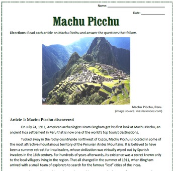
Machu Picchu: Reading, Activities, and Substitute Plan for Spanish Class
This is a reading passage about the history and facts of Machu Picchu. The reading includes three articles with questions and a crossword puzzle that follow.
This is a great reading to keep in your emergency sub plan file for your Spanish class. The reading is in English and includes a key. You can easily modify this for your class by only using some of the articles, rather than all three.
You can also check out my Machu Picchu puzzles pack that includes an additional crossword puzzle, a word
Subjects:
Grades:
7th - 12th
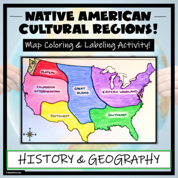
Native American Cultural Regions Map Activity- Label & Color Indigenous Regions!
Enhance your lesson on American indigenous groups with this Native American Regions Map Activity! Students will identify, label, and color seven Native American Regions- Eastern Woodland, Southeast, Great Plains, Southwest, Plateau, Northwest Coast, and California Intermountain. Directions for labeling and coloring is provided. A completed and colored map is provided for reference, but this map can be completed using a textbook or online resource as well. This is a creative and engaging way of s
Grades:
3rd - 10th
Also included in: US History / American History BIG BUNDLE of Resources! NO-PREP!
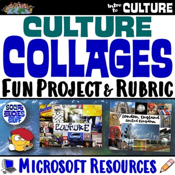
Create a Culture Collage Project with Rubric | Cultural Traits PBL | Microsoft
Create culture collages! This project challenges students to showcase a culture & its unique traits in a fun way. The activity can be adapted to a student’s own culture or any world culture. Directions, brainstorm charts, rubric & project examples are included! Choose whether students make digital or paper collages. Finished projects are always super creative! Print & interactive, digital versions of the materials are included. Made for traditional in-class learning or digital 1:1 cl
Grades:
3rd - 12th
Types:
CCSS:
Virtual Field Trip through Australia & Oceania
Take your students through a virtual field trip through Australia and Oceania!This includes 46 editable Google Slides that allow students to explore the culture, people, wildlife, and geography of Australia, New Zealand, Papua New Guinea, Fiji, and French Polynesia. The virtual field trip includes lots of photos, fun facts, embedded videos, and embedded questions for students to answer. My students LOVE taking these virtual tours and always beg for more! It's a great way to help instill a greate
Grades:
6th - 11th
Also included in: Virtual Field Trips Around the World BUNDLE
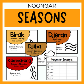
Noongar Australian Aboriginal Seasons Calendar & Worksheet - Nyoongar
✏️ Celebrate the rich cultural heritage of the Noongar Indigenous Aboriginal Australians with our Seasons Calendar & Worksheet! This comprehensive resource includes 7 display posters (with an alternate spelling of Nyoongar) and a worksheet to help students learn about the traditional Noongar seasons. With a link to the Indigenous Weather Map, this resource is an excellent tool to support teaching and learning about Indigenous culture and weather patterns. What's Included?7 Display Posters (+
Subjects:
Grades:
PreK - 12th
Also included in: Noongar Vocabulary Bundle | Aboriginal Language Resource
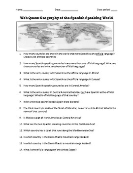
Web Quest: Geography of the Spanish-Speaking World (emergency sub plan)
This activity contains 40 questions in English written in a trivia format. It is excellent if you plan to have a substitute teacher as it will keep your students busy researching answers. The questions can also be useful to motivate class discussion. Includes answer key.
Subjects:
Grades:
5th - 12th, Higher Education, Adult Education
Virtual Field Trip through South Asia
Take your students through a virtual field trip through South Asia!This includes 37 editable PowerPoint Slides that allow students to explore the culture, people, wildlife, and geography of India, Pakistan, Nepal, and the Maldives.The virtual field trip includes lots of photos, fun facts, embedded videos, and embedded questions for students to answer.This includes a student worksheet to complete before, during, and after the virtual field trip.My students LOVE taking these virtual tours and alwa
Subjects:
Grades:
6th - 12th
Also included in: Virtual Field Trips Around the World BUNDLE
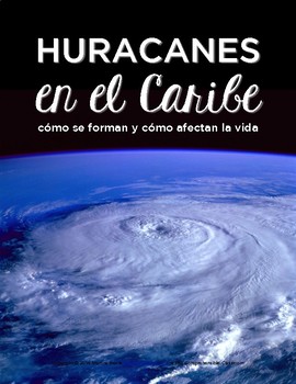
Huracanes en el Caribe - Readings and #authres in Spanish
Use this three day mini-unit to teach your students about hurricanes in the Caribbean: why is it that they occur so often in that region, and how do they affect Caribbean life? Students in late Spanish 1 will be able to understand all readings.The unit includes-a one page reading worksheet that includes a reading in Spanish to introduce students to the topic and can be used as an activity or an assessment-a 20 page reading slideshow in Spanish with pictures to further explore the topic-a class d
Subjects:
Grades:
7th - 11th
Types:
Also included in: SOMOS Spanish 1 Units 19-22 BUNDLE
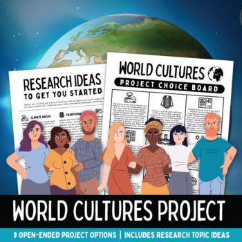
World Cultures Research Project with Choice Board and Research Topic Ideas
This student-centered project allows students to choose a culture and a research direction that interests them. Perfect for use in a middle or high school Social Studies, Geography, or World Cultures class!This resource includes a choice board with 9 project options, allowing students to research specific cultures within the guidelines of the prompt they choose. Prompts include:how climate affects culturetraditional garmentsworld languageslesser-visited countriesmoving to a new countryworld reli
Grades:
6th - 12th
Virtual Field Trip through the Middle East
Take your students through a virtual field trip through the Middle East!This includes 43 editable PowerPoint Slides that allow students to explore the culture, people, wildlife, and geography of Israel, Jordan, Saudi Arabia, and the United Arab Emirates (UAE).The virtual field trip includes lots of photos, fun facts, embedded videos, and embedded questions for students to answer.This includes a student worksheet to complete before, during, and after the virtual field trip.My students LOVE taking
Grades:
6th - 12th
Also included in: Virtual Field Trips Around the World BUNDLE
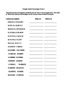
Google Earth Scavenger Hunt
This is a fairly straightforward Scavenger Hunt to use with Google Earth. Students simply type in the coordinates and record their findings. This is a fun thing to do if a student is done with their work early or for a fun Friday activity. This usually takes students about 30 mins to complete. Now comes with key!
If you do not have Google Earth installed, you can now download a free plug-in for Chrome here:
https://www.google.com/earth/explore/products/plugin.html
UPDATE: As Google begins
Grades:
6th - 12th
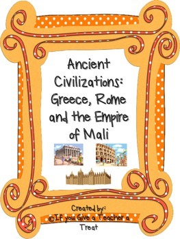
Ancient Civilizations: Greece, Rome and the Empire of Mali Pack
Not only is this pack full of ready made assessments and teaching tools, it also includes a Unit Plan with links to PowerPoints that will help you teach about the Ancient Civilizations of Greece, Rome and the Empire of Mali!! (not included in the preview)
This pack, that I created based on the VA 3rd grade SOLs, includes the following items:
-Ancient Greece Info Poster
-Ancient Greece Info (half page posters for notebooks- 2 per page)
-Ancient Rome Info Poster
-Ancient Rome Info (half page post
Subjects:
Grades:
3rd - 10th

Transcontinental Railroad Activity
This activity looks at the Transcontinental Railroad and how it shaped America and Americans including the contribution of the minority groups that helped build and expand America but were also displaced. This looks at the Chinese immigrant railroad workers and the Native Americans that the railroad line displaced. Three parts to this activity:Reading and Reflection QuestionsFoldable Hands on ActivityMapping Activity
Grades:
8th - 12th

Travel Brochure Research Project with Brochure Templates Project Based Learning
This Travel Brochure Project has differentiated options to best fit your students' needs. Brochure templates are included. Students will research specific facts about a popular world destination and create a travel brochure for it. This is great for helping all students access grade level content! This assignment will help students learn about different destinations around the world. TEACHERS LIKE YOU SAID…"This was such an engaging resource!!! I will definitely be using this in the future. Both
Grades:
8th - 10th
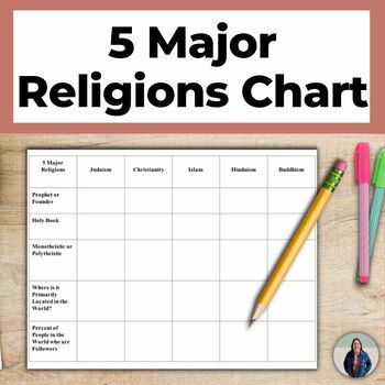
World Religions Chart for 5 Major Religions and Cultural Geography
This world religions chart helps teach students about the 5 major religions that are popular around the world. Students complete this chart & write descriptions of each of the 5 Major Religions (Islam, Buddhism, Christianity, Hinduism, Judaism). This is great for helping all students access grade level content!There are many options for how to use this chart. You can assign students to complete the chart using notes or the Internet, you can complete the chart as a whole class notes activity,
Subjects:
Grades:
8th - 11th
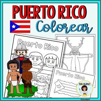
Puerto Rico
This is a .pdf file with 12 coloring pages. It include all pages shown on the preview. The images are:1. Puerto Rico cover coloring page2. Flag - La bandera3. Map - el mapa de Puerto Rico4. Flag in map form - bandera con la forma del mapa5. Race - nuestra raza6. Old San Juan "La garita"7. National flower "La maga" - Flor "La maga"8. Music instruments - instrumentos musicales9. National dance "La plena" dancers10. National dance " La bomba" dancers11. "Vejigante"12. "Vejigante" mask - máscara ve
Subjects:
Grades:
PreK - 12th
Also included in: Puerto Rico Coloring Bundle
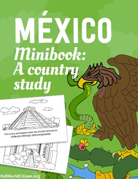
Mexico Minibook: A Country Study about Mexican Culture ~ in English
Finally a country study/lesson on Mexico culture that is both authentic and culturally accurate! Let's break the stereotypes of poncho and sombrero-wearing Mexicans, and teach kids about the real Mexico. In this Mexico Minibook, students will get a short, kid-appropriate introduction to our fascinating neighbor to the south, with gorgeous illustrations that appeal to all ages.
Mexico Minibook topics:
Map of Mexico in North America
Mexico flag
Intro to Geography
The Capital, Mexico City
A
Grades:
PreK - 10th
Virtual Field Trip through Eastern Europe
Take your students through a virtual field trip through Eastern Europe!This includes 40 editable PowerPoint Slides that allow students to explore the culture, people, wildlife, and geography of the Czech Republic, Hungary, Poland, and Russia.The virtual field trip includes lots of photos, fun facts, embedded videos, and embedded questions for students to answer.This includes a student worksheet to complete before, during, and after the virtual field trip.My students LOVE taking these virtual tou
Grades:
6th - 12th
Also included in: Virtual Field Trips Around the World BUNDLE
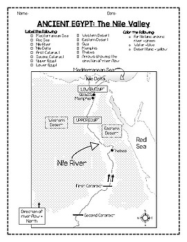
Labeling Ancient Egypt's Geography/Mapping Activity (with modifications!)
Gradual release option for labeling a map of Ancient Egypt. Great option to differentiate for students with special needs! Use the pages however you want!
Here is what's included and other ideas on how to use it:
Page 1 is a fully labeled map (to study or copy from). Page 2 is an unlabeled map with lines and boxes to label in (practice). Page 3 is a blank map with no 'clues' or organizers to help them label (could be used as final assessment).
What's on the map...
Label on the map:
-Nile Rive
Grades:
5th - 12th
Virtual Field Trip through Southern Europe
Take your students through a virtual field trip through Southern Europe!This includes 37 editable PowerPoint Slides that allow students to explore the culture, people, wildlife, and geography of Greece, Italy, Portugal, and Spain.The virtual field trip includes lots of photos, fun facts, embedded videos, and embedded questions for students to answer.This includes a student worksheet to complete before, during, and after the virtual field trip.My students LOVE taking these virtual tours and alway
Grades:
6th - 12th
Also included in: Virtual Field Trips Around the World BUNDLE
Showing 1-24 of 1,492 results


![Preview of Year 10 Biology (Australian Curriculum) [Workbook]](https://ecdn.teacherspayteachers.com/thumbitem/Year-10-Biology-Australian-Curriculum-Workbook--6442923-1646016135/large-6442923-1.jpg)
