78 results
7th grade geography pdfs by TpT sellers for TpT sellers
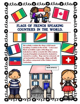
Les Pays Francophones du Monde Flag Project of French Speaking Countries
This activity contains the Flags of 28 French Speaking Countries in the world. Colour and Black and white copies of the flags are included as well as a master list of the names. A project template is included for students to research a country. Flags can be coloured, cut out and pasted on the page. Aligns well with the culture component of the Ontario French Curriculum. *Note this file was originally an Olympic Activity. If you already purchased it you can re-download the new file for free.
Subjects:
Grades:
3rd - 8th
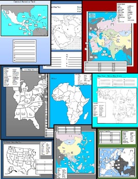
World Map Tests
12 World Map Tests included in this packet covering United States, Central America, South America, Western Europe, Central Europe, Middle East, and the Pacific Rim. This packet includes blank study maps, Tests, and Keys.
Grades:
5th - 12th, Higher Education, Adult Education
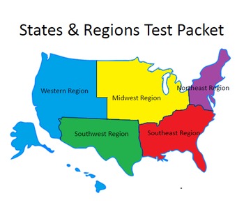
USA States & Regions Assessments / quizzes (25 assessments)
25 separate quizzes included. Maps showing each region in black and white & in color included. Outlines for each state included. Flags, nicknames, state capitals & state nicknames for each state are listed. Global perspective of the states shown with Alaska, Hawaii & the Lower 48 States shown in color and in their correct locations.Quizzes include: matching states with state flags & nicknames, listing regions, listing states, matching numbered states & regions, a crossword
Subjects:
Grades:
4th - 7th
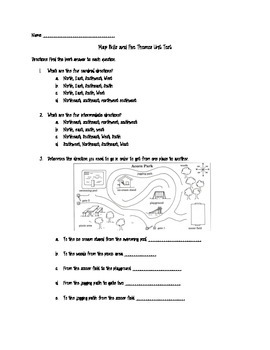
Map Skills and Five Themes of Geography Unit Test
This product is a comprehensive unit test covering map skills and five themes of geography. The map skills include using a compass rose to tell relative location, cardinal and intermediate directions, absolute location, types of maps, map scale, and map key. This product could work as a pretest or post-test!
Please feel free to leave feedback and thank you for visiting my shop!
Grades:
4th - 9th
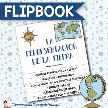
FLIPBOOK LA REPRESENTACIÓN DE LA TIERRA
FLIPBOOK para trabajar en Ciencias Sociales la representación de la Tierra.Incluye los siguientes apartados: ¿Cómo se representa la Tierra?Paralelos y meridianos.Localización en la superficie de la Tierra.Tipos de mapas.Elementos de un mapa.Escala gráfica y numérica. Incluye dibujos en blanco y negro para ser coloreados. Archivo PDF no editable.
Subjects:
Grades:
5th - 8th
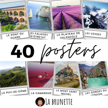
40 posters de décoration sur la France - 40 posters for display about France
40 incredible French sites to display in your classroom !Bring some cultural and colourful elements to your French classroom or MFL corridor with these 40 beautiful pictures of France. This resource includes :This resource includes 40 pictures (PDF format) of the best and most incredible cities, regions and landscapes to visit in France. Each PDF page has a picture in a frame and its name in a separate frame, below. Check the VIDEO PREVIEW to view ALL pictures ! These French touristic sites are
Subjects:
Grades:
PreK - 12th, Staff
Also included in: POSTERS MEGA BUNDLE - 280 PRINTABLE PAGES - France and Francophonie
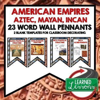
American Empires Aztec, Mayan, Incan Word Wall World History Word Wall Posters
American Empires Aztec, Mayan, Incan Word Wall Pennants (23 Words)Also Included In:World History MEGA BUNDLE Part 1World History Word Wall BUNDLE Part 1Aztec, Mayan, Incan BUNDLEIncluded:Includes 2 to a page banner pennant word wall. Print two or four to a page, cut, and decorate your room! 2 blanks for each unit have been included so you can decorate and label your board with the same background theme. Words Included: Maya Political StructureMaya Economic StructureMaya Religious StructureMaya S
Grades:
6th - 12th
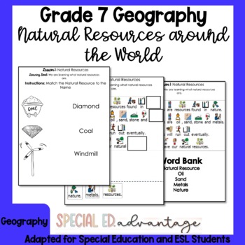
Ontario Grade 7 Geography Natural Resources Around The World for Special Ed ESL
Do you need Grade 7 Geography Natural Resoures Around the World (Use and Sustainability)- Geography Strand B content that is modified and differentiated for Special Education and ESL students with IEPs? This unit has minimal reading and heavy writing tasks and a lot of visuals and drawing tasks to support all your learners!This product is a great addition to your program that will support your English Language Learners & Special Education students.Included In This Package:Lesson 1: Natural R
Subjects:
Grades:
7th
Also included in: Full Year Bundle Grade 7 Ontario Geography for Special Education and ESL
Geography Classroom Posters
Enhance your geography unit with these colorful posters. This resource includes a total of 124 easy to use posters and can be used as a classroom resource or to supplement the books My Place in Space or Me on the Map! Simply print, laminate, and GO!Terms included in this set are:•planet•Mercury•Venus•Earth•Mars•Jupiter•Saturn•Uranus•continent•country•state (all fifty states included)•city•townLET'S CONNECT!InstagramFacebookTeachers Pay TeachersBlogDon't forget to earn TpT credits for future purc
Subjects:
Grades:
K - 8th

FLIPBOOK CAPAS DE LA ATMÓSFERA
Flipbook de las diferentes capas de la atmósfera:- Troposfera.- Estratosfera- Mesosfera- Termosfera.- Exosfera.- Espacio exterior. ARCHIVO PDF no editable. Fichas en blanco y negro para poderlas colorear.
Subjects:
Grades:
4th - 8th
GA 7th Grade Social Studies Review Escape Room
7th Social Studies GA StandardsUse this escape room to review various topics from the year including religious and ethnic groups, governments, economic systems, and geographic locations.
Grades:
6th - 8th

Early Humans Unit Interactive Notebook (PDF Printable Resource)
Early Humans Interactive Notebook Designed for Middle School Ancient Civilizations 6th Grade History Curriculum PDF Printable Version onlyNot Editable (Digital Versions Coming Soon) Includes: Early Humans Title Page BWEarly Humans Title Page ColorEarly Humans Inquiry Chart Early Humans Timeline BW SC Early Humans Timeline Key Color Early Humans Timeline Key BW Early Human Facts SCEarly Human Facts Key Hominid Migration Map SC Hominid Migration Map Key Color Paleolithic Age Vocab SCPaleolithic Ag
Grades:
6th - 8th

National Flag Flashcards Special Education Cards
National Flag Flashcards Special Education CardsDiscover the world with our National Flag Flashcards for kids! Each card features a flag and the country's name, making learning geography fun and easy. Perfect for young explorers eager to learn about different cultures and countries.Included in this product:43 National flag flashcards--------------------------------License Terms: Purchase grants a single teacher the right to use this product for personal classroom use. The license is non-transfer
Subjects:
Grades:
PreK - 9th
Geography Basics: Maps and Globes
Students will learn the similarities and differences between maps and globes. Students will be able to explain and label the part of a map. Students will understand how to locate places in the world and how distortion can affect maps and globes.
Great intro powerpoint.
Grades:
4th - 7th
Africa- Social Studies Daily Review
This product is intended to be used in a 7th grade GA Social Studies classroom. It acts as a weekly activity to review concepts during the unit on Africa. This product spans 6 weeks. Each week consists of Map it Monday, Take Me Back Tuesday, Write It Out Wednesday, Thinking Thursday, and Facts Friday. Teachers will need to display the Google slides in the classroom or through Google Classroom for students to be able to complete each section on the worksheet. Print 1 worksheet for the week. I use
Grades:
7th
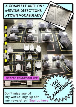
BUILD YOUR OWN IDEAL TOWN! AN ACTIVITY TO PRACTICE GIVING DIRECTIONS
A COMPLETE UNIT ON :GIVING DIRECTIONS & TOWN VOCABULARYFOR ENGLISH AND GEOGRAPHY CLASS AND FOR ESL TEACHING CLASSWhat you will have:*A full Lesson on Giving directions*15 Posters of the buildings in color*4 Poster of the vocabulary in English & Italian*1 Preposition of place poster***All the instruction and printable material to build your own town:**Shops and buildings labels**Shops and buildings in B&W**Shops and buildings in color**4 Labels for your town**The bases to keep your bu
Subjects:
Grades:
PreK - 12th, Higher Education, Adult Education
Street Sign Themed Bulletin Board Letters
These fun letters have a street sign theme. Use for all types of displays. All 26 alphabet letters are included in an uppercase font, as well as numerals 0-9 and punctuation. Letters are approximately 6 inches tall. Just print what you need and enjoy. Be sure to check out my other fun, themed letters in my store.
Subjects:
Grades:
PreK - 12th, Higher Education, Adult Education, Staff

Map of major rivers and map of major lakes in the state of New Hampshire, USA
Map of major rivers and map of major lakes in the state of New Hampshire, USAThis material gives you two specific maps, one for rivers and one for lakes, which provide an engaging way to learn about geography.Rivers Map: This map shows the major rivers in New Hampshire. Using a blank map, students can fill in the names of rivers on the blank map, developing their geography and mapping skills.Lakes Map: Discover the largest lakes in the state of New Hampshire. Using this white map, students will
Grades:
4th - 12th, Higher Education, Adult Education
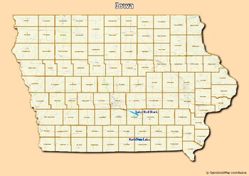
Map of major rivers and map of major lakes in the state of Iowa, USA
Map of major rivers and map of major lakes in the state of Iowa, USAThis material gives you two specific maps, one for rivers and one for lakes, which provide an engaging way to learn about geography.Rivers Map: This map shows the major rivers in Iowa. Using a blank map, students can fill in the names of rivers on the blank map, developing their geography and mapping skills.Lakes Map: Discover the largest lakes in the state of Iowa. Using this white map, students will be able to identify and mar
Grades:
4th - 12th, Higher Education, Adult Education
Middle East (SW Asia) Social Studies Weekly Review
This product is intended to be used in a 7th grade GA Social Studies classroom. It acts as a weekly activity to review concepts during the unit on the Middle East (SW Asia). This product spans 7 weeks. Each week consists of Map it Monday, Take Me Back Tuesday, Write It Out Wednesday, Thinking Thursday, and Facts Friday. Teachers will need to display the Google slides in the classroom or through Google Classroom for students to be able to complete each section on the worksheet. Print 1 worksh
Grades:
7th

Land and Water Features!
Teaching geography can often be a little dry and boring...so jazz up your lesson with a snazzy presentation! Slides include a picture, definition, and question to get your students thinking about where in our country some of these features are! And don't worry, I put answers to some of the questions in the presenter notes!Features included:Land Features•Mountains•Hills•Plains•Plateaus•Islands•PeninsulasWater Features•Lakes•Rivers•Tributaries•Gulfs•BaysThis document is a PDF. You can edit this
Grades:
K - 8th
Les facteurs d'établissement humaine - Grade 8 Geography {FRENCH}
During this inquiry-based activity, students will investigate factors that affect human settlement patterns. Using a set of photos provided, students will make inferences about why an individual might choose to stay and/or relocate from a community. Students are asked to reflect on how each situation illustrated might affect the quality of life of individuals. This activity includes opportunities for small group brainstorming, guided group discussion and collaborative note-taking.
Grades:
7th - 8th
Spanish Speaking countries Review Game
Perfect game to review Spanish speaking countries and their capitals!Have you ever played Mata Moscas? Students LOVE to play this game!This is a no prep and highly engaging game for students to review pretty much anything. This one in particular will help your students review Spanish speaking countries and their capitals while having a lot of fun! Take a look at the preview to get a better idea of the game. There are two different ways you can play: -Pair game: Pair up your students and print o
Subjects:
Grades:
4th - 12th
Also included in: Los paises hispanos MEGA BUNDLE Spanish Speaking countries
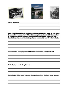
Erie Canal Activity Worksheets
Make studying the Erie Canal come alive for your youngsters. This handout offers pictures from years ago and now. Have your studies use their higher order of thinking skills in answering some questions comparing and contrasting then and now. Use collaborative grouping to encourage accountable talk!
Subjects:
Grades:
3rd - 9th
Showing 1-24 of 78 results


