8,580 results
Adult education Easter geography resources
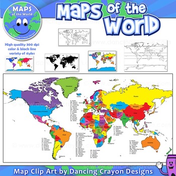
Maps of the World: Clip Art World Maps
Maps of the World: Clip Art World Maps
High quality color and black and white maps of the world.
This clipart map set contains the following commercial use graphics:
- Color maps of the world
- Black and white line art maps of the world
- Maps of the world with lines of latitude and without lines of latitude
- Maps of the world with larger countries labelled (color and black and white)
- Silhouette maps of the world
- A map of the world showing seven continents in color and black and white:
Grades:
3rd - 12th, Higher Education, Adult Education, Staff
Also included in: Maps of the World Clip Art - MEGA-BUNDLE
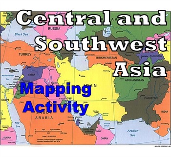
Central and Southwest Asia (Middle East) - Mapping Activity
Map Activity – Central and Southwest AsiaIn this activity, students must locate and identify the countries (and capital cities if so desired) of Central and Southwest (or Middle Eastern) Asia. When students are finished with this, time can be spent coloring in the various countries.Included in this package is a ready-to-copy blackline master map of Central and Southwest Asia along with a separate answer key.This product can also easily be used as a test or quiz.Preview file is available for down
Subjects:
Grades:
4th - 12th, Higher Education, Adult Education
Types:
Also included in: Map Activity Bundle
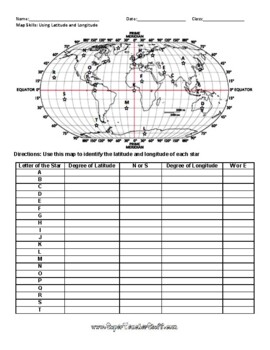
Latitude and Longitude Worksheet & Answer Key
This worksheet is an awesome way to teach Latitude and Longitude. The way that it is structured reinforces that Latitude measures North and South of the Equator, and that Longitude measures East and West of the Prime Meridian. This worksheet features a World Map with an Answer Key.
Subjects:
Grades:
3rd - 12th, Higher Education, Adult Education
Types:
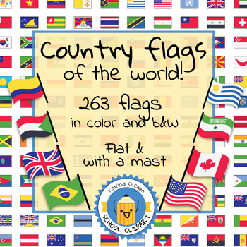
Country flags of the world: 263 Country flags - clip art bundle (1052 clips!)
Country flags of the world: 263 Country flags. HUGE clip art BUNDLE!
This clip art contains 263 flags, in 2 forms (flat and with mast) in color and black & white line art.
Contains all the flags of the countries of the world : 195 Countries.
Look at the complete list of flags by downloading the preview
A total of 1052 clips!
Included:
263 color flag (flat) clip art flag set- PNG format
263 B&W flag (flat) clip art set- PNG format
263 color flag (with mast) clip art set- PNG format
Grades:
PreK - 12th, Higher Education, Adult Education
European Vacation Project - Perfect for end of the Year! + Digital Resource
European Vacation Project is a fun way for World History students to sum up their European history by traveling to Europe! This is a wonderful project to end the year in World History class - one of my favorites! Students research a summer trip to Europe and present their fun to the class. You will need online access to computers, iPads etc. Students can use PowerPoint, Google slides or any other slideshow app. Rubric, PowerPoint introduction, and warm-up questions included.** Includes Google
Subjects:
Grades:
7th - 12th, Adult Education
Types:
Monster Mash:A Study of Mystical Monsters of The World (Geography Halloween)
Need a fun and engaging Halloween lesson and activity for 6th grade through high school? Why not take a look at monsters or cryptids throughout the world? Students will love this Halloween activity as they are already in the holiday mood and will learn about the beliefs, practices, values, and customs of other cultures around the world when looking at monsters and cryptids. Cryptids are animals/creatures that have been suggested to exist now and throughout history, but have or have not been pro
Subjects:
Grades:
6th - 12th, Adult Education
Also included in: BUNDLE FOR ALICE

End of the Year Escape Room "Escape Summer School" Summer Breakout
Please Follow so you know when new products come out!Escape the evil principal who wants to give everyone summer school. The only thing between you and ice cream rolling down your chin sitting by the pool are these puzzles. Use your knowledge and skills you learned this year to escape the school and start your summer...good luck! The set includes everything you need. If you have never done an escape room before full set up instructions and directions are included. The set utilizes a Google Form
Subjects:
Grades:
3rd - 6th, Higher Education, Adult Education, Staff
Types:
Also included in: Escape Room Bundle Growing Year Long Holiday and More Sets
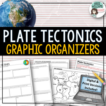
Plate Tectonics / Boundaries Graphic Organizers - PRINT & DIGITAL
Teaching about plate boundaries and plate tectonics? -These graphic organizers are a great way for students to review different plate boundaries, learn about the Theory of Plate tectonics and organize their notes /ideas. Excellent for review or for group work. Includes 3 graphic organizers to mix and match, a Review/Challenge Activity Summary Activity, Mapping Worksheet, and Extension / Lesson Ideas. Includes answer keys for the graphic organizers.This resource also includes a link to a digita
Subjects:
Grades:
7th - 10th, Adult Education
Types:
Also included in: Plate Tectonics / Earthquakes / Volcanoes Organizers | PRINT & DIGITAL
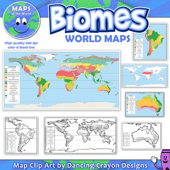
Biomes - Maps of the World and Continents Clip Art
Biomes World MapsHigh quality color and black and white maps of biome regions of the world. This clipart map set contains the following commercial use graphics:- Color maps of the world biome areas- Black and white line art maps of the world biome areas to color (with blank legend / key to also color)- Maps with and without the equator and geographic lines- Maps of continents showing biome regions- Maps of the world showing individual biome regions (for example: maps showing where the worlds tem
Grades:
3rd - 12th, Higher Education, Adult Education, Staff
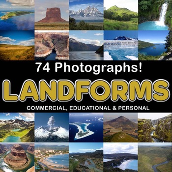
Photos Photographs LANDFORMS clip art
Photographs - Landforms. For sale are 74 beautiful, full color, high quality 300 dpi photographs for commercial, personal and educational use. No credit required to use these images, but it is always appreciated if you do! Why use clip art when you can use images of real objects? Every single image is available for you to use commercially in every one of your products. Buy with confidence! The thumbnail images are watermarked /cropped in the preview / thumbnails but the purchased photographs wil
Subjects:
Grades:
PreK - 12th, Higher Education, Adult Education
Also included in: Complete Photo Bundle
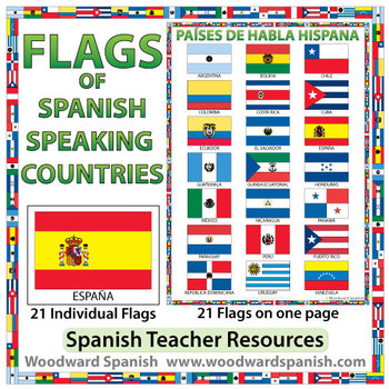
Flags of Spanish-speaking Countries
Flags of the 21 Spanish-speaking countries.
These flags are perfect for decorating the Spanish classroom. You may also want to laminate the flags and use them as large flashcards.
There are 21 individual flags of the following Spanish-speaking countries: Argentina, Bolivia, Chile, Colombia, Costa Rica, Cuba, Ecuador, El Salvador, España, Guatemala, Guinea Ecuatorial, Honduras, México, Nicaragua, Panamá, Paraguay, Perú, Puerto Rico, República Dominicana, Uruguay, Venezuela.
Each flag is on its
Subjects:
Grades:
1st - 12th, Adult Education
Also included in: Spanish Bundle – Spanish-speaking Countries and Capitals
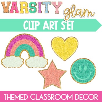
Smiley Face Patches Clip Art Varsity Glam Rainbow Heart Star
Please Follow so you know when new products come out!This Glitter Shape Clip Art resource is the perfect fit into your Varsity Glam, Rainbow Remix, or Groovy Brights themed classroom. This Varsity Glitter Letter Shape set features patches that look like real chenile and are in the shape of smiley faces, rainbows, hearts and stars! Get the retro vibes from the 70's 80's 90's look that you class and colleagues will love. Included: 32 color png (transparent background) images8 images of each shape
Subjects:
Grades:
PreK - 12th, Higher Education, Adult Education, Staff
Also included in: Clipart Bundle The Ultimate Blenderz Growing Bundle Clip Art
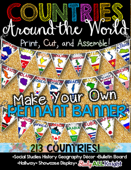
Countries Around the World Classroom Decor Make Your Own Pennant Banner
Worldwide Countries Classroom Decor Make Your Own Pennant BannerGrades K-12 social studies, history, geography, Model UN, global studies, world history Celebrate our world! Teachers can decorate their classrooms, hallway, gymnasium, media center, or anywhere in their building. You'll get 213 pennants to choose from. Pick pennants that represent your student's heritage, ethnicities, backgrounds, ancestry. They are colorful and awesome to look at. The countries pennant will bring enthusiasm and un
Grades:
PreK - 12th, Higher Education, Adult Education, Staff
Also included in: English Teacher Activities and Fun Bundle
Geography—World Religions: A Comparison Study on Judaism, Christianity, & Islam
An engaging and interesting comparison of the three great present-day monotheistic world religions: Judaism, Christianity, and Islam. (INCLUDES EASEL ACTIVITY)Bundle & Save Here World Religions BundleTHIS LESSON INCLUDES:World Religions Chart (Student Notes)World Religions Chart (Teacher Guide)Venn Diagram (Student Notes)Venn Diagram (Teacher Guide)Aesthetic & Interesting Informational Handouts on Judaism, Christianity, and IslamTeacher Instructions (Lesson detail Introduction and Proced
Grades:
5th - 12th, Higher Education, Adult Education
Also included in: Bundle for Katrina- World Religions
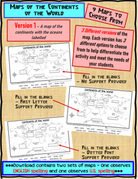
Maps of the Continents of the World For Students to Label and Colour/Color
This download contains 9 maps of the continents of the world (11 x 17 paper) to allow you differentiate your instruction to help meet needs of all students in your classroom as they learn to identify and locate the continents of the world. ***Please note that there are 2 sets of each of the 9 maps – one set observes English Spelling and one set observes U.S. spelling.***This download contains: 1. A map of the continents with the oceans labelled and the continents left blank for students to fill
Subjects:
Grades:
2nd - 7th, Adult Education
Types:
Planet Earth - All 11 Episodes Bundle - Worksheets & Keys - PDF & Digital
These Video Response Worksheets and Keys are based on the BBC documentary series "Planet Earth (Season 1)."(NOTE: These worksheets are based on the British version of Planet Earth [Season 1], narrated by David Attenborough. It uses the metric system and is, at the time of this posting, the version currently showing on Netflix and Amazon.)You will receive a zip file which contains a multi-episode bundle of all 11 Video Response Worksheets and Keys in PDF format and access to all 11 TpT Digital Ac
Subjects:
Grades:
5th - 12th, Adult Education
Types:
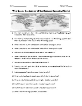
Web Quest: Geography of the Spanish-Speaking World (emergency sub plan)
This activity contains 40 questions in English written in a trivia format. It is excellent if you plan to have a substitute teacher as it will keep your students busy researching answers. The questions can also be useful to motivate class discussion. Includes answer key.
Subjects:
Grades:
5th - 12th, Higher Education, Adult Education
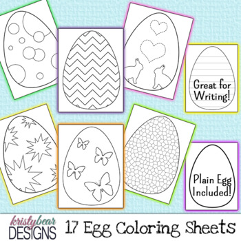
Easter Egg Coloring Pages {by kristybear Designs}
Easter egg coloring sheets are great for Spring. These Easter eggs fill an 8.5x11 piece of paper but you could easily fit 2 Easter eggs on one sheet! One of the Easter eggs has horizontal lines and could be used for various writing prompts and assignments. Chevron, quatrefoil, butterfly, and polka dot patterns are also included on the Easter eggs. Hang them or hide them around the room for some great Easter fun!File Type: JPG & PNGSize: 8.5x11Quantity: 17For personal or commercial use. (comm
Subjects:
Grades:
PreK - 12th, Higher Education, Adult Education, Staff
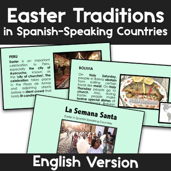
Slideshow | Easter in Spanish-Speaking Countries | La Semana Santa Las Pascuas
ENGLISH VERSION - From dancing skeletons to colorful carpet-adorned streets, Easter brings a wealth of different traditions throughout the Spanish-speaking world. With this slideshow*, your students will learn more about how the Holy Week is celebrated by Spanish-speakers in 15 different countries. This slideshow in English has 16 slides with pictures and maps to teach not only culture but also some geography! It also comes with questions to share thoughts and ideas as a class.Overview:Easter in
Subjects:
Grades:
K - 12th, Higher Education, Adult Education
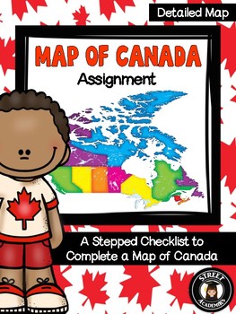
Map of Canada Assignment - Detailed Map
This is a minimal-prep assignment that you can simply photocopy and distribute to students now! The assignment is broken down into 10 steps and is perfect for an applied or academic classroom. The assignment includes a built-in checklist for students to use while completing their maps.
There are two versions of this assignment included in this download – one with and one without the post-it note annotation. There are also two rubrics to reflect both versions of this assignment. You can use the
Subjects:
Grades:
4th - 12th, Higher Education, Adult Education
Types:
What Country Is This? Short Geography, History, Economics Readings CCSS 6-8
Expand students' global knowledge with high-interest paragraphs that engage students with fascinating facts! No prep for bell work or many more uses. What you get:25 one-page handouts. Countries featured are those students may not be familiar with in Africa, Asia, Latin America, and Europe. See Preview for list.2-3 questions per passage that cover CCSStandards for SS/History. Main ideas, fact/opinion, using visual information and more. One concept covered is why some nations are so poor. 9
Subjects:
Grades:
6th - 8th, Adult Education
Types:
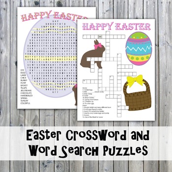
Easter Crossword Puzzle and Word Search
Easter Crossword Puzzle and Word Search
This Crossword Puzzle and Word Search would be a great classroom activity in celebration of Easter. Great for free time, after a test, during a class party or just as something fun to do.
You will receive 3 pdf's, 1 with the puzzles in Full Color, 1 with the puzzles in Black & White and 1 with the answer keys. All files are printable on 8.5" x 11" Letter size paper.
Terms of Use (TOU):
This item may be used for Personal Use only.
Thank you for v
Grades:
2nd - 12th, Adult Education
Types:
Bible Story Clip Art Bundle
This is a set includes Bible Scenery Clip Art, Women of the Bible Clip Art, Men of the Bible Clip Art and Biblical Icons Clip Art. 179 Pieces of Art!Perfect for worksheets and activities, TPT Sellers, bulletin boards and scrapbooks. Comes with a pdf of ideas of how to use the clip art.Color and Black and White, 300dpi, high resolution files for quality printing.png files with transparent backgrounds.PLEASE NOTE - If you plan to use this art on a product to sell please provide a credit link to Ka
Subjects:
Grades:
PreK - 12th, Higher Education, Adult Education, Staff
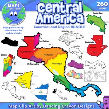
Maps of Central America: Clip Art Map BUNDLE
Maps of Central America: Clip Art Map BUNDLE
Map Collection: Central American Countries Bundle
VALUE-PACK: This is a money-saving bundle containing maps of the Central America region along with multiple maps of each country of Central America: Belize, Costa Rica, Honduras, Nicaragua, Panama, El Salvador, and Guatemala.
This clipart map set contains the following commercial use graphics:
- Color maps
- Black and white line art maps
- Silhouettes
- Maps of the world with individual count
Grades:
2nd - 12th, Higher Education, Adult Education, Staff
Showing 1-24 of 8,580 results


