Weather and Climate Activity - Interactive Science Project - Google Slides
- Google Drive™ folder

What educators are saying
Also included in
- Save 20% by purchasing this NGSS 6th grade science bundle! Resources include 6th grade science sketch notes for interactive notebooks, quizzes, slideshows, CER writing, and some hands-on activities. Included in this 6th grade science bundle:Printable Science Sketch NotesAir Mass MS ESS2-5 (notes, quPrice $127.88Original Price $159.85Save $31.97
Description
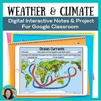
In this weather and climate interactive science activity using Google slides, students choose a city and research the location's weather and climate. Students are provided with videos and fill-in-the-blank slides as they complete this science project. Students will also create a model to show how unequal heating of the Earth impacts weather and climate. A completed sample, student template, editable rubric, answer key, and self-grading quiz are included.
Please click the PREVIEW to see what is included in this ready-to-use resource.
Middle school science students learn about the impact of atmospheric circulation and ocean currents on climate. NGSS MS-ESS2-6: Develop and use a model to describe how unequal heating and rotation of the Earth cause patterns of atmospheric and oceanic circulation that determine regional climates.
Video preview of this weather and climate science resource on Youtube: Click Here
This weather and climate science resource includes:
- 30+ slides with videos and interactive weather and climate activities
- A sample of a completed weather and climate digital science project
- Weather and climate student project template
- Editable project rubric
- Answer Key
- Weather and climate self Grading Quiz on Google forms
I LOVE MY FOLLOWERS!
Click on the green ★ to follow my store and get notifications about new resources and freebies!
Thank you for visiting my store! Happy Teaching!
Let's Connect!
Mrs. Proton Priest on Instagram
Mrs. Proton Priest on Facebook
Mrs. Proton Priest on Pinterest
WOULD YOU LIKE TO EARN FREE PRODUCTS?
To earn TPT credits to use on future purchases:
Go to your My Purchases page. Beside each purchase, you'll see a Provide Feedback button. Leave a rating and leave a short comment on the product. You can check your credit balance on your TpT Credit Balance page. Apply credits towards future TpT purchases in my store, or any TpT store.
*********************************************************************************************
Copyright © Ginny Priest, Mrs. Proton Priest. All rights reserved by the author. This product is to be used by the original downloader only. Copying for more than one teacher, classroom, department, school, or school system is prohibited.


