128 results
Latin images under $5
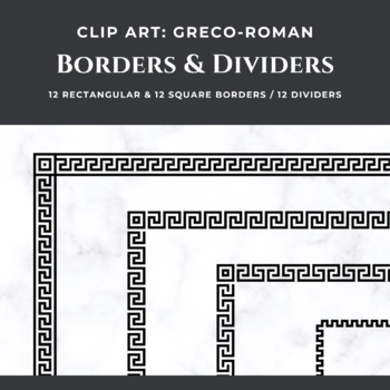
CLIP ART. Greek/Roman Borders and Dividers (36 Images)
These Greek and Roman clip art elements are perfect for use in any literature, ancient history, or Latin class. THIS SET CONTAINS:◆ 12 black Greco-Roman rectangular borders◆ 12 black Greco-Roman square borders◆ 12 black Greco-Roman dividersAll files are in .PNG format with a transparent background.RELATED PRODUCTS◆ FREE Cambridge Latin Course Stage 12 Bookmarks◆ Daily Latin Vocabulary Quiz BUNDLE - CLC Units 1-4◆ Daily Latin Vocabulary Quizzes - CLC Unit 1◆ Daily Lati
Subjects:
Grades:
1st - 12th, Staff
Types:
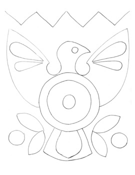
Yarn Art Template
Template for a study on Central American Latin Art History, specifically Huichol yarn art. Glue yarn in circular patterns to fill each shape.
Subjects:
Grades:
1st - 8th
Types:
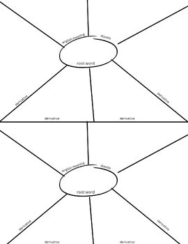
Root Word Spider Template
Help students learn Greek and Latin root words with this downloadable "spider" template.
Subjects:
Grades:
5th - 9th
Types:
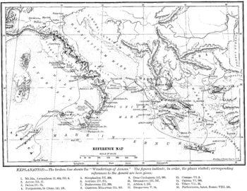
Wanderings of Aeneas Map
A map of Aeneas' wanderings through the Mediterranean from Troy to Italy as described by Vergil / Virgil in his Aeneid.
All images carry the Creative Commons Attribution-NonCommercial-ShareAlike 4.0 International License. That means that, upon the purchase of these images, you are free to share them, i.e. copy and redistribute the material in any medium or format or adapt them, i.e. remix, transform, and build upon them. But this sharing and adapting cannot be applied to any commercial use of t
Subjects:
Grades:
3rd - 12th, Higher Education, Adult Education
Types:
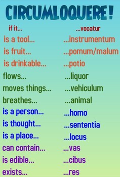
Circumlocute! Support Poster
Based on John Kuhner's list of helpful ways to circumlocute, this resource helps learners stay in the target language by providing topical terms when you don't know the word for the specific item you're talking about. It is great for providing large-picture linguistic support. This works well both as a handout and as a larger-sized wall poster.
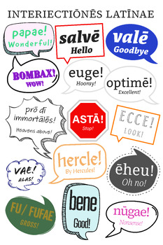
Latin Interjections Poster
This poster shows speech bubbles with Latin interjections and greetings, such as "bombax!" (Wow!), "papae!" (Wonderful!), "hercle!" (By Hercules!) and more. English meanings, generally corresponding to Cambridge Latin, are in the speech bubbles in smaller letters. These words are generally from classical Latin and have macrons.I tinkered with this extensively to make it as readable as possible. Elsewhere in my store I also have a version that omits the title "INTERIECTIŌNĒS LATĪNAE" (Latin Inter
Subjects:
Grades:
Not Grade Specific
Types:
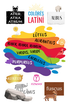
Latin Colors Poster (Colores Latini)
This poster shows the Latin words for different colors, with splashes of paint and helpful illustrations, such as a black cat, a blue whale, and an orange. It's great all ages, and for a Latin classroom or an art room at a school where Latin is taught. I have one in my classroom and in our art classroom where I teach one large Latin class, and the art teachers were happy to have it, which was a good sign to me about the design quality. It prints nicely. Latin words for colors don't perfectly map
Subjects:
Grades:
Not Grade Specific
Types:
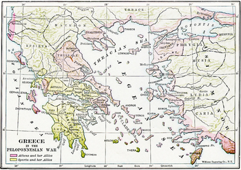
Map of Ancient Greece during the Peloponnesian Wars
A detailed map in color of ancient Greece and the Ionian Peninsula (Turkey) during the Peloponnesian Wars, detailing which cities were allied with Athens and which with Sparta. A high quality .jpg, 600 dpi, and at least 10" x 10" in size, which makes it suitable for printing as well as projecting (unlike many images available on the net).
All images carry the Creative Commons Attribution-NonCommercial-ShareAlike 4.0 International License. That means that, upon the purchase of these images, you
Subjects:
Grades:
3rd - 12th, Higher Education, Adult Education
Types:
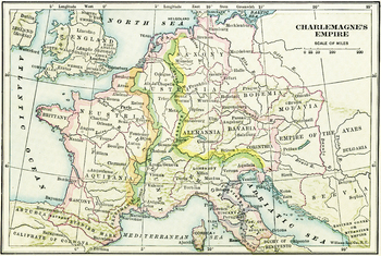
Map of Charlemagne's Empire
A map of Charlemagne's Empire. The first Holy Roman Emperor, crowned by the Pope in 800, Charlemagne united Europe during a mini-Renaissance, spearheaded by his court scholar Einhard. A high quality .jpg, 600 dpi, and at least 10" x 10" in size, which makes it suitable for printing as well as projecting (unlike many images available on the net).
All images carry the Creative Commons Attribution-NonCommercial-ShareAlike 4.0 International License. That means that, upon the purchase of these image
Subjects:
Grades:
3rd - 12th, Higher Education, Adult Education
Types:
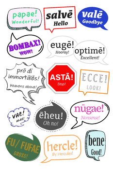
Latin Sayings Poster
This poster shows speech bubbles with Latin interjections and greetings, such as "bombax!" (Wow!), "papae!" (Wonderful!), "hercle!" (By Hercules!) and more. English meanings, generally corresponding to Cambridge Latin, are in the speech bubbles in smaller letters. I tinkered with this extensively to make it as readable as possible. I have a version with the title "INTERIECTIŌNĒS LATĪNAE" (Latin Interjections) at the top, but this one just has the speech bubbles. These came out of my study of Lat
Subjects:
Grades:
Not Grade Specific
Types:
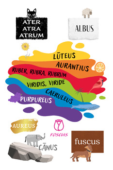
Latin Colors Poster
This poster shows the Latin words for different colors, with splashes of paint and helpful illustrations, such as a black cat, a blue whale, and an orange. It's great all ages, and for a Latin classroom or an art room at a school where Latin is taught. I have one in my classroom and in our art classroom where I teach one large Latin class, and the art teachers were happy to have it, which was a good sign to me about the design quality. It prints nicely.Latin words for colors don't perfectly map
Subjects:
Grades:
Not Grade Specific
Types:
CLIPART MARIACHI "VIVA MEXICO"
CLIPART EN PNG. A COLOR Y LINEAS PARA COLOREAR-3 PERSONAJES-3 INSTRUMENTOS MUSICALES- LETRERO VIVA MEXICO
Subjects:
Grades:
Not Grade Specific
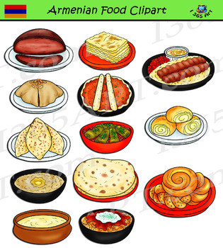
Armenian Food Clipart
Armenian Food - meals and dishes clipart in both color and black and white versions of each graphic! This set contain 26 clip art files for you to educate your students are create a menu of foods from Armenia! Food included in this set are Manti, Lula kebab, Khash, Boerag and much more.There are 13 full color and 14 black and white graphics, giving you 26 files in all. Each file is approximately 300 DPI and in transparent PNG format. Files will be downloaded in a zip folder file. The zip file co
Subjects:
Grades:
PreK - 12th
Also included in: European Food Clipart Bundle #2
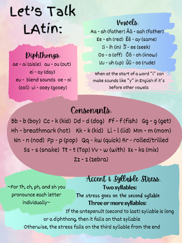
Latin Pronunciation Poster
This poster provides a comprehensive guide to pronouncing Latin. Students may hesitate to participate in class because they don't feel confident in their abilities to speak accurately in Latin. This poster will help students feel more confident speaking out loud in Latin. The different colored sections also allow teachers or students to quickly indicate where on the poster they are referencing.
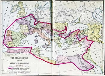
Color Map of the Roman Empire from Augustus to Diocletian
A color map of the Mediterranean with the border of the Roman Empire during both Augustus' and Diocletian's reign is clearly delineated. A high quality .jpg, 600 dpi, and at least 10" x 10" in size, which makes it suitable for printing as well as projecting (unlike many images available on the net).
All images carry the Creative Commons Attribution-NonCommercial-ShareAlike 4.0 International License. That means that, upon the purchase of these images, you are free to share them, i.e. copy and re
Subjects:
Grades:
3rd - 12th, Higher Education, Adult Education
Types:
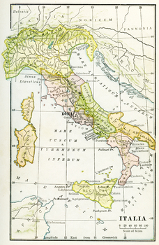
Color Map of Ancient Italy
A color map of Ancient Italy with labels in Latin and Rome labeled prominently. A high quality .jpg, 600 dpi, and at least 10" x 10" in size, which makes it suitable for printing as well as projecting (unlike many images available on the net).
All images carry the Creative Commons Attribution-NonCommercial-ShareAlike 4.0 International License. That means that, upon the purchase of these images, you are free to share them, i.e. copy and redistribute the material in any medium or format or adapt
Subjects:
Grades:
3rd - 12th, Higher Education, Adult Education
Types:
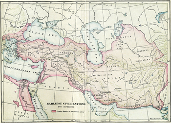
Earliest Civilizations Map
A map of the Near East, showing the earliest civilizations of the west, with the Persian Empire highlighted. Bactria, Assyria, Mesopotamia, and others are shown. A high quality .jpg, 600 dpi, and at least 10" x 10" in size, which makes it suitable for printing as well as projecting (unlike many images available on the net).
All images carry the Creative Commons Attribution-NonCommercial-ShareAlike 4.0 International License. That means that, upon the purchase of these images, you are free to sha
Subjects:
Grades:
3rd - 12th, Higher Education, Adult Education
Types:
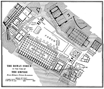
Roman Forum in the Time of the Empire Plan
A detailed plan of the Roman Forum during the Empire, including in it the Basilica Julia, the Rostra, the Basilica Aemilia, the Curia, and the temples at the northwestern corner, among others. A high quality .jpg, 600 dpi, and at least 10" x 10" in size, which makes it suitable for printing as well as projecting (unlike many images available on the net).
All images carry the Creative Commons Attribution-NonCommercial-ShareAlike 4.0 International License. That means that, upon the purchase of th
Subjects:
Grades:
3rd - 12th, Higher Education, Adult Education
Types:
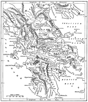
Map of Ancient Greece
A detailed map of ancient Greece. A high quality .jpg, 600 dpi, and at least 10" x 10" in size, which makes it suitable for printing as well as projecting (unlike many images available on the net).
All images carry the Creative Commons Attribution-NonCommercial-ShareAlike 4.0 International License. That means that, upon the purchase of these images, you are free to share them, i.e. copy and redistribute the material in any medium or format or adapt them, i.e. remix, transform, and build upon th
Subjects:
Grades:
3rd - 12th, Higher Education, Adult Education
Types:
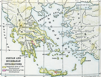
Civilizations of Crete and Mycenae Map
A map of the ancient Aegean, highlighting the Mycenean and Minoan civilizations, centered at Mycenae and Crete, home of Agamemnon, Minos, the Minotaur, Daedalus, etc.. A high quality .jpg, 600 dpi, and at least 10" x 10" in size, which makes it suitable for printing as well as projecting (unlike many images available on the net).
All images carry the Creative Commons Attribution-NonCommercial-ShareAlike 4.0 International License. That means that, upon the purchase of these images, you are free
Subjects:
Grades:
3rd - 12th, Higher Education, Adult Education
Types:

Sirius Black wanted poster in Latin | Harry Potter inspired classroom decor
Harry Potter-inspired "Have you seen this Wizard?" Sirius Black Wanted poster remixed in Latin. Vidistine tu hunc magum???This poster offers a fun way to incorporate more Latin into your classroom decor, creating a Latin environment that is both language-rich and visually interesting! It also targets that wonky 2nd person perfect ending that students often forget and includes some imperatives, including a good example of nōlī + imperative. Do not attempt to use magic against this man!. File incl
Subjects:
Grades:
Not Grade Specific
Types:
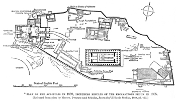
Plan of ancient Athens' Acropolis
A plan of ancient Athens' acropolis, including the Parthenon, the Erectheum, the Propylea, and the museum.
All images carry the Creative Commons Attribution-NonCommercial-ShareAlike 4.0 International License. That means that, upon the purchase of these images, you are free to share them, i.e. copy and redistribute the material in any medium or format or adapt them, i.e. remix, transform, and build upon them. But this sharing and adapting cannot be applied to any commercial use of the images.
F
Subjects:
Grades:
3rd - 12th, Higher Education, Adult Education
Types:
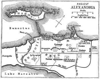
Map / Plan of Ancient Alexandria
A map of the ancient Egyptian city of Alexandria, home to the most famous library in the ancient world. A high quality .jpg, 600 dpi, and at least 10" x 10" in size, which makes it suitable for printing as well as projecting (unlike many images available on the net).
All images carry the Creative Commons Attribution-NonCommercial-ShareAlike 4.0 International License. That means that, upon the purchase of these images, you are free to share them, i.e. copy and redistribute the material in any me
Subjects:
Grades:
3rd - 12th, Higher Education, Adult Education
Types:
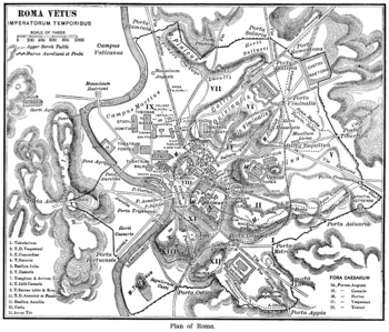
A Keyed Map of Ancient Rome during the Time of the Emperors
A detailed map of Imperial Rome, with 18 buildings identified by key, and the regions of the ancient city identified. A high quality .jpg, 600 dpi, and at least 10" x 10" in size, which makes it suitable for printing as well as projecting (unlike many images available on the net).All images carry the Creative Commons Attribution-NonCommercial-ShareAlike 4.0 International License. That means that, upon the purchase of these images, you are free to share them, i.e. copy and redistribute the materi
Subjects:
Grades:
3rd - 12th, Higher Education, Adult Education
Types:
Showing 1-24 of 128 results

