
USA Regions Activity FREEBIE | States and Capitals Project | Worksheets


- PDF
Also included in
 Save 50% on all the resources in this MEGA HISTORY BUNDLE! This HUGE collection includes over 150 resources including my top-selling USA Capitals and Abbreviations Interactive Notebook, World and American History Brochure Projects, Historical Figure Research Brochure Projects, Major War Posters, USAPrice $248.00Original Price $495.75Save $247.75
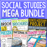
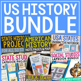 This bundle includes a huge variety of activities that will keep students engaged all year long! These projects work perfectly together as your students learn about the United States of America and dig into their own state history. At the end of the year, they'll end up with three keepsake projectsPrice $32.50Original Price $64.50Save $32.00
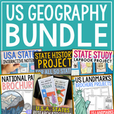 This bundle includes 9 United States geography resources (plus 3 freebies). You'll find tons of activities to use all year long. Perfect for differentiating with different levels and ages.Resources Included:State Capitals Lapbook ProjectState Research ProjectState History Notebook Journal (for All 5Price $29.50Original Price $61.00Save $31.50
Description
This FREE resource is a stand-alone project that can be turned into a FULL WEEK worth of activities. You'll find 5 region activity pages and capitals/abbreviation resource sheets and note pages. Plus, I've included a thorough teacher's guide giving you plenty of suggestions on how to turn this into one awesome mini-unit!
These maps are also located in my customized state history projects. You'll find 86 student activities organized in 8 modules for easy lesson planning. This complete notebook unit is the perfect companion to your annual state studies. Your students will use the internet to research a variety of topics to include: economics, government, geography, politics, current events, higher education, weather, historical figures, Native Americans, state symbols and icons, historic timeline, state flag, Westward Expansion, the Civil War, and the Industrial Revolution.
FIND YOUR COMPREHENSIVE CUSTOMIZED STATE PROJECT:
Use these state research projects as an all-year resource or as a condensed unit! Mix and match the different sections according to your specific classroom needs.
Each state notebook journal has been developed as a crossover lesson of language arts and social studies. History teachers will find this very useful in incorporating writing across the curriculum! English teachers will find this as a fun way to add relevant history to lessons on research methods. You’ll find writing prompts, poetry activities, letter writing, news research, and a few creative pages to keep your artistic students engaged!
Many of the pages are specific to your individual state, while others make for easy tie-ins from the national to state level (i.e. How did the Civil War/Industrial Revolution/Westward Expansion affect your state?)
How to organize: Have your students bring in either a folder with brads or a thin three-ring binder. Reserve a space on your shelves for easy reach all year long. These pages can also be shrunk down to use as interactive notebook inserts.
In this unit you will find:
Teacher’s Guide
Research Log
Map It (Landmarks & Waterways)
City Search Map
Region Map (with Abbreviation & Capitals)
Poems (Limerick & Personification)
Literary Elements Terms & Example Sheet (to Accompany Poetry Activities)
Local Recipe Sheet
Create a State-Themed Stamp
State Government Figures (Governor, US Senators, US Representative, Adjutant General, State Fire Marshal)
Republicans vs. Democrats Venn Diagram
State Politics (Term Lengths, Political Affiliation, Political Majority vs. Minority)
Letter to Government Official
State Military Forces
Interview with Historic Figure
Create a Magazine Cover
Headlines of the Day
State Economy (Tax Collection, Debt vs. Revenue, Annual Spending)
Average Household Finances (of State Residents)
Top Employers
Agriculture Products
Guest Speaker Questions and Student Fill-In Sheet
Tourism Through the Seasons
An Overnight Getaway in My Town (Calculate Costs)
Oldest University in My State
Average State Weather
A Closer Look (State Symbols, Population, Bordering States, Most populated City)
Who’s Who Historical Figures
State Historical Timeline
Native Americans
State Flag Analysis
State Song Analysis
Westward Expansion Timeline (Louisiana Purchase, Oregon Trail, The Homestead Act, Lewis and Clark Expedition, The Pony Express, Transcontinental Railroad)
The Civil War
Industrial Revolution Inventions
Terms of Use Copyright © Project Based Learning with Elle Madison. All rights reserved by author. This product is to be used by the original downloader only. Copying for more than one teacher, classroom, department, school, or school system is prohibited. This product may not be distributed or displayed digitally for public view. Failure to comply is a copyright infringement and a violation of the Digital Millennium Copyright Act (DMCA). Clipart and elements found in this JPEG are copyrighted and cannot be extracted and used outside of this file without permission or license. Intended for classroom and personal use ONLY.
Tags:
Alabama, Alaska, Arizona, Arkansas, California, Connecticut, Colorado, Delaware, Florida, Georgia, Hawaii, Idaho, Illinois, Indiana, Iowa, Kansas, Kentucky, Louisiana, Maine, Maryland, Massachusetts, Michigan, Minnesota, Mississippi, Missouri, Montana, Nebraska, Nevada, new Hampshire, New Jersey, New Mexico, New York, North Carolina, North Dakota, Ohio, Oklahoma, Oregon, Pennsylvania, Rhode Island, South Carolina, South Dakota, Tennessee, Texas, Utah, Vermont, Virginia, Washington, West Virginia, Wisconsin, Wyoming, geography, social studies, US history, state history, government, economics, elementary, middle school, high school, homeschool, special education, emergency substitute lesson, week long lesson, complete unit, interactive notebook, project, lap book, lapbook, state map, bundle, USA, United States of America, President, maps, capitals, capitols, postal abbreviations, Southwest region, northeast region, western region, west, midwest region, south region
