Tectonic Plates, Earthquakes & Volcanoes Review | Printable, Digital & Easel
- Zip
- Google Apps™
- Easel Activity

Also included in
- Bundle and save 50% by purchasing all my Earth Science review sorts and activities!NO-PREP resources to review HIGH-YIELD topics in science! My science review sorts help students develop mastery of science concepts, review difficult concepts and avert common misconceptions and misunderstandings. EacPrice $37.50Original Price $75.00Save $37.50
- SAVE more than 50% by purchasing ALL my review sorts and activities!IMPORTANT NOTE• This is a GROWING bundle. • This product includes FREE downloads of ALL FUTURE science review sorts• Life Science review sorts are being added to this bundle - CHECK MY PROGRESS• The price of this bundle will increasPrice $97.00Original Price $285.00Save $188.00
- Save 40% by purchasing ALL my Plate Tectonics teaching materials!Important Notes:• Download a FREE Unit Bundle to learn more about all my products.• Save $$$ with the Earth Science Complete Curriculum• Save $$$$ with the Integrated Science Complete Curriculum• Consider Daily Lessons as an economicalPrice $70.80Original Price $118.00Save $47.20
Description
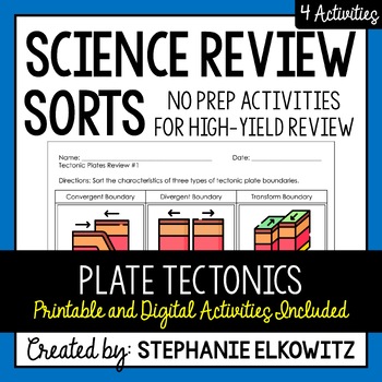
A NO-PREP resource to review HIGH-YIELD topics in science! My science review sorts help students develop mastery of science concepts, review difficult concepts and avert common misconceptions and misunderstandings.
Each individual review sort will target a specific topic. By doing so, students focus their attention and effort on advancing their understanding of scientific ideas and concepts related to that topic.
Important Notes:
• Download a FREE High-Yield Review Activity
• Save $$$ with the Earth Science Complete Curriculum
• Save $$$$ with the Integrated Science Complete Curriculum
*********************************************************************************************************
Target Topic: Tectonic Plates, Earthquakes & Volcanoes
Review #1: Tectonic Plate Boundaries
Review #2: Plate Boundary Landforms
Review #3: Volcanoes
Review #4: Earthquakes
What's included in this download?
• Four review sorts
• Printable and digital (fillable slides) versions
• Editable Self-Grading Google Form
• Self-Grading Easel Activity
• Answer Key
How to Use this Product:
• Review before Assessment
• INB Output Page
• Science Centers
• Fast Finishers
• Intervention
*********************************************************************************************************
This resource includes modified files that facilitate online - distance learning:
• Fillable slides designed to work with Google Slides and Microsoft PowerPoint
• Self-Grading Google Forms. Google Classrooms are not required.
Important Notes about Fillable Slides:
• Fillable Slides CANNOT be edited. Text boxes and cards can be manipulated.
• Fillable Slides work in both Microsoft PowerPoint and Google Slides.
All Digital resources can be shared via platforms that are password-protected or accessible only to students.
*********************************************************************************************************
NGSS Alignment
• This resource supports NGSS 4-ESS2-2, MS-ESS2-2, MS-ESS2-3 and MS-ESS3-2.
TERMS OF USE
• All rights reserved by Stephanie Elkowitz.
• This product is to be used by the original purchaser only.
• Intended for classroom and personal use only.
• Copying for more than one teacher, classroom, department, school, or school system is prohibited.
• This product may not be distributed or displayed digitally for public view.
• Failure to comply is a copyright infringement and a violation of the Digital Millennium Copyright Act (DMCA).


