Simple Topographic and Contour Maps Worksheet Mount St. Helens
Flying Colors Science
4.8k Followers
Grade Levels
6th - 8th
Subjects
Resource Type
Standards
NGSSMS-ESS2-3
NGSSMS-ESS3-2
NGSSMS-ESS2-2
NGSSMS-ESS2-1
Formats Included
- PDF
- Easel Activity
Pages
1 page
Flying Colors Science
4.8k Followers
Easel Activity Included
This resource includes a ready-to-use interactive activity students can complete on any device. Easel by TPT is free to use! Learn more.
What educators are saying
We had such fun with this resource! It kept students engaged and required very little prep. I've purchased several products from this teacher and they have all been wonderful!
I showed a quick video of Mt. St. Helens erupting before we started this activity. Student were more engaged when they could see something in real life instead of always just talking about it. They were engaged to see how the mountain looked before and after the eruption. Excellent activity!
Also included in
- Never search for "something to do tomorrow" ever again! This bundle contains PRINT AND GO lessons, NO PREP activities, LOW PREP labs, and ENGAGING articles to supplement and thoroughly enhance an Earth and space science course. Every included resource is easy to implement, standards-based, and high-Price $399.99Original Price $649.02Save $249.03
Description
Earth's Changing Surface: Practice reading contour maps with a REAL LIFE volcano example! Supports NGSS Earth Science MS-ESS3-2 and MS-ESS2-2.
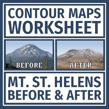
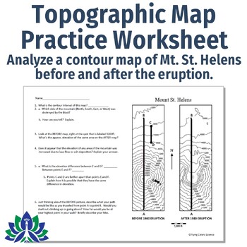
In this activity, students are given a topographic map of Mt. St. Helens BEFORE and AFTER it erupted. Students analyze the maps for contour intervals, elevation, and how the volcano changed the topography of the mountain.
This document has some companion resources:
Teacher Notes:
- ANSWER KEY INCLUDED.
- Please note: This resource is not editable.
- Save $$ with our Plate Tectonics ACTIVITIES BUNDLE!
⭐⭐⭐ Click here to get 5 FREE EARTH & SPACE SCIENCE lessons! ⭐⭐⭐
Total Pages
1 page
Answer Key
Included
Teaching Duration
N/A
Report this resource to TPT
Reported resources will be reviewed by our team. Report this resource to let us know if this resource violates TPT’s content guidelines.
Standards
to see state-specific standards (only available in the US).
NGSSMS-ESS2-3
Analyze and interpret data on the distribution of fossils and rocks, continental shapes, and seafloor structures to provide evidence of the past plate motions. Examples of data include similarities of rock and fossil types on different continents, the shapes of the continents (including continental shelves), and the locations of ocean structures (such as ridges, fracture zones, and trenches). Paleomagnetic anomalies in oceanic and continental crust are not assessed.
NGSSMS-ESS3-2
Analyze and interpret data on natural hazards to forecast future catastrophic events and inform the development of technologies to mitigate their effects. Emphasis is on how some natural hazards, such as volcanic eruptions and severe weather, are preceded by phenomena that allow for reliable predictions, but others, such as earthquakes, occur suddenly and with no notice, and thus are not yet predictable. Examples of natural hazards can be taken from interior processes (such as earthquakes and volcanic eruptions), surface processes (such as mass wasting and tsunamis), or severe weather events (such as hurricanes, tornadoes, and floods). Examples of data can include the locations, magnitudes, and frequencies of the natural hazards. Examples of technologies can be global (such as satellite systems to monitor hurricanes or forest fires) or local (such as building basements in tornado-prone regions or reservoirs to mitigate droughts).
NGSSMS-ESS2-2
Construct an explanation based on evidence for how geoscience processes have changed Earth’s surface at varying time and spatial scales. Emphasis is on how processes change Earth’s surface at time and spatial scales that can be large (such as slow plate motions or the uplift of large mountain ranges) or small (such as rapid landslides or microscopic geochemical reactions), and how many geoscience processes (such as earthquakes, volcanoes, and meteor impacts) usually behave gradually but are punctuated by catastrophic events. Examples of geoscience processes include surface weathering and deposition by the movements of water, ice, and wind. Emphasis is on geoscience processes that shape local geographic features, where appropriate.
NGSSMS-ESS2-1
Develop a model to describe the cycling of Earth’s materials and the flow of energy that drives this process. Emphasis is on the processes of melting, crystallization, weathering, deformation, and sedimentation, which act together to form minerals and rocks through the cycling of Earth’s materials. Assessment does not include the identification and naming of minerals.


