
Pirate Map Skills: Grid Coordinates, Cardinal & Ordinal Directions, Symbols


- PDF
- Easel Activity
What educators are saying
Also included in
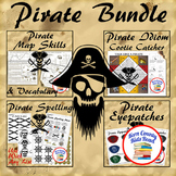 Ahoy Captain! Engage your crew with this adventurous thematic pack all about pirates. It includes: coordinate grid graphing and geography map skills, pirate vocabulary crossword puzzle, nautical idioms and phrases cootie catcher for figurative language learning, a pirate-themed spelling menu with prPrice $5.48Original Price $6.85Save $1.37
Description
Teach and strengthen coordinate grid math, geography mapping skills like map symbols and cardinal and ordinal directions with a compass rose, and new vocabulary with these pirate themed printable worksheets. These are fun mini-lesson activities for Talk Like A Pirate Day on September 19th or if you have a pirates themed unit. Cardinal directions and coordinate grid mapping are important introductory skills to mastering latitude and longitude map skills and being able to use an atlas. Coordinate grid mapping is an excellent introduction to first quadrant graphing math.
Students will practice using a lettered and numbered grid to find coordinates and interpret a legend and compass rose. They will create their own map, legend, and compass rose and exchange them with another student to practice finding grid coordinates again. As students read a swashbuckling fill-in-the-blank story starring him/her as a pirate captain, they will practice cardinal and ordinal directions and use of a compass rose as their route is traced around an island. Finally, students practice context clues to learn pirate and nautical domain specific vocabulary while reading the story. Vocabulary words are defined for them in a crossword puzzle. Two options are available to differentiate the crossword puzzle- one with a word bank and one that features pirate jokes instead of the word bank (students use the story to find the vocabulary words for the crossword). Teaching suggestions and answer keys are included with the printable worksheets. All student copies are designed in black and white for economical printing and photocopying.
Other suggested resources:
Pirate Idiom Cootie Catcher with Nautical Sayings and Phrases
Pirate Spelling Menu with Bonus Printables
Hawai'ian Islands Mapping Research Skills Unit - Differentiated
Customer Tips:
Be the first to know about my new discounts, freebies and product launches:
Click on the star next to my store logo on my store's homepage to become a follower and receive updates about my store.
Get TPT credit to use towards future purchases:
Please go to your My Purchases page (you may need to login). Next to each purchase is a Provide Feedback button -- click it and you will be taken to a page where you can provide a quick rating and short comment for the product. TPT gives you credits you can use to lower the cost of your future purchases each time you leave feedback on paid purchases!
