
Oceania (Australia | Pacific Islands) Map Activity and Lesson Plan


- PDF
What educators are saying
Also included in
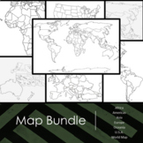 Includes outlined maps of all continents and countries for students to complete. On the backside of each map there is a list of major items that students should be able to identify and label on the map, including but not limited to:Key with compassBodies of waterMajor land formsCountriesTerritoriesMPrice $15.00Original Price $19.25Save $4.25
Description
Includes outlined map of Oceania for students to complete. On the backside of the map there is a list of major items that students should be able to identify and label on the map including, but not limited to:
- Key with compass
- Bodies of water
- Countries
- Territories
- 3 regions of Oceania (Melanesia, Micronesia, & Polynesia [with Hawaii!])
I have also included my lesson plan for how I use this in my classroom, including Bell Work, introduction of the map and a list of important physical / political features I show my students. This lesson plan can (and has) easily be used for sub days. Also includes my completed example map for students to have an idea of how to layer the different features.
Links to other maps:
- World Maps Bundle
- Americas (North and South) Map
- Africa and Southwest Asia Map
- Asia Map
- Europe Map
- Oceania (Australia and Pacific Islands) Map
- United States of Americas and Territories Map
- World Continents and Major Physical Features
______________________________________________
If you like this product, please follow me and leave a review.
Leave feedback and receive TPT credit
Did you know you can get TPT credits by leaving feedback on products? Submit feedback at the time of purchase or go to My Purchases for a list of what you have previously purchased. Next to the product title is a “Leave Feedback” button. Click and leave a rating and comment to receive your credits. Then you can use your TPT credits to purchase future resources for your classroom!
Follow World Wanderer
