Map Skills US REGIONS CONTINENTS & OCEANS Google Slides & EASEL
- PDF
- Google Apps™
- Easel Activity
- Easel Assessment

What educators are saying
Also included in
- Are you a 2nd or 3rd grade teacher looking for an exciting way to teach and review map skills & geography? This interactive bundle includes both Google Slides and Boom Cards, so there are plenty of activities to keep them entertained. They’ll learn all about landforms, the equator, the prime merPrice $21.75Original Price $31.75Save $10.00
Description
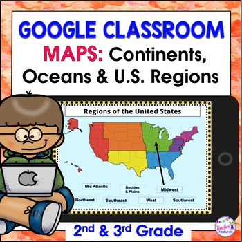
Review map skills, 7 continents, identify world oceans & U.S. Regions: Northeast, Southeast, Midwest, Southwest & West using Google Slides. Interactive activities are great for all levels of learning. Use this with your smart board or for individual devices. Includes an Easel Activity! (33 Google Slides, 21 EASEL pages & 60 EASEL Questions)
The Google Slide Access link contains 33 slides and 60 Question Easel Assessment:
- Continent slides: with labels, without labels & drag the labels (6 pages)
- Oceans of the World slides (1 page)
- Individual Continent Fact Sheets (7 pages)
- Regions of the U.S slides (3 pages)
- Name the U.S. States in each region: with & without labels (14 pages)
- Name the Great Lakes: with & without labels (2 pages)
*Students type in the text boxes or drag the answers to the correct spots.
★★★ This resource has an Easel Activity already created for students to input their responses in answer boxes and to use other tools to draw and highlight. It is an Interactive layer over the original pdf. Click here to learn more about TpT’s digital activities. You can even edit the digital overlay or use it as is. After purchasing this resource, click the red Open in Easel button.
★★★ This resource has an Easel Assessment already created for students to input responses.
★ BUNDLE & SAVE WITH MAP SKILLS AND GEOGRAPHY RESOURCES
*This product can be used with a smart board, tablet, iPad, Chromebook, Netbook, laptop, or a desktop computer.
* Google Drive has an option to print if you need to print a hardcopy of student’s work.
©Teacher Features
Here are some other items you may be interested in:
★ BACK TO SCHOOL ACTIVITIES ELA BUNDLE
★ Google Classroom Activities ELA & MATH Bundle For GOOGLE CLASSROOM
★ MAIN IDEAS & KEY DETAILS FOR GOOGLE CLASSROOM
★ BOOK REPORTS FOR GOOGLE DRIVE & GOOGLE CLASSROOM
★ RESEARCH ANY TOPIC FOR GOOGLE DRIVE & GOOGLE CLASSROOM


