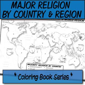
Major Religion by Country & Region Map/Charts **Coloring Book Series**
- Jpeg
Also included in
- *THEMATIC HISTORY & GEOGRAPHY MAP GROWING BUNDLE*This is a collection of my thematic geography and history coloring book maps in one place. Maps are ready for teachers to print off and use in the classroom. The benefit of buying now is that future maps to this bundle are then free to you, and itPrice $64.53Original Price $71.70Save $7.17
- You asked for it, and I made it!This is a growing bundle of all of my UNIT 3 materials for AP Human Geography that covers CULTURAL PATTERNS & PROCESSES. I'm constantly making new materials so you will need to check back for new content once in awhile to update your download. **Please take note tPrice $28.30Original Price $31.45Save $3.15
Description
**Geography Coloring Book Series**
Guide your lecture notes with these printable coloring book pages of the majority of practiced world religions by country and region. These are great for printing multiples and cutting for student interactive notebooks as minis. These are particularly great for AP Human Geography, any geography course, religion, cultural studies, or anthropology course.
The format is .PNG to allow for you to paste and stretch in Word. I've found that .3'' margins (all sides) is the farthest most standard printers will allow. Set these in your Word page setup before printing your doc.
You can print this on a poster printer for a small group activity, use in lecture, or have these available on a rack for cathartic purposes once students are waiting for the bell to ring.
This item was created using open-source maps, Adobe Illustrator, and Autodesk Sketchbook by the Human Imprint. I used the Rubenstein 12th edition maps for reference, though the outline maps were created by myself. This took 5 hours to complete. The data for this map is the most composite, but from 2012.
This coloring book series is inspired by the Wynn Kapit Geography Coloring Book, that hasn't been updated since 2003. It's provided many hours of geography inspiration for myself and I hope to spread the same.
$$ Any earnings from the sale of my maps helps to pay for professional illustrations that I have made for my online illustrated comic text about Human Geography. $$
Let me know if I can make this better!
Copyright HumanImprint 2019
All works are meant for the purpose of the classroom and personal use. Downloaded materials are not meant to be redistributed via social media or in shared file folders (i.e. Dropbox, Google Drive, etc.), aside from those that are shared with students (i.e. Schoology, Google Classroom, or other closed LMS). Please do not post any of my downloaded illustrations to publicly viewable websites where others can download, including publicly viewable websites meant for students.
Thank you.


