
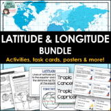
Latitude and Longitude Task Cards - World, US, and Canadian Capital Cities


- PDF
What educators are saying
Also included in
 Latitude and Longitude - Everything you need to teach and practice latitude and longitude skills! 1. Latitude & Longitude Reference Sheets and Activities - reference sheets, worksheets and activities to teach students how to find a spot on the globe using latitude and longitude. Includes answPrice $9.99Original Price $12.73Save $2.74
Description
LATITUDE & LONGITUDE - Three sets of task cards to help students practice finding locations with a set of latitude and longitude coordinates. Using gnomes as a theme (thinking of gnomes who have traveled the world and sent home notes) each task card is written like a postcard.
Set 1 - students are given a set of coordinates and must locate the world capital city. (12 cards)
Set 2 - students are given a world capital city and must figure out the latitude and longitude of the city. (12 cards)
Set 3a & 3b - Includes an American and Canadian version - students are given a state or province and must determine both the capital and the city's latitude and longitude. (US version - 12 cards) (Canadian version - 14 cards - includes all provinces, territories, and Ottawa)
Includes student data sheets, answer keys, and A USA MAP and CANADA MAP ONLY. There are free WORLD maps available online.
*Please note - This activity works best using a standard school atlas - the larger pages, use of color, and clear text are much more helpful than a photocopied world map. I did not include a World map.
**Please note this is also part of my Latitude and Longitude Bundle!
Check out more mapping and geography activities by clicking the links below—>
Latitude & Longitude Vocabulary Posters & Word Wall
Latitude & Longitude Reference Sheets and Activities
Design Your Own Amusement Park - Mapping Project
Social studies, mapping skills, capital cities, maps, Addie Williams, Addie Education
