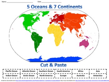
Label the 7 Continents & 5 Oceans
Crayons 2 Careers
55 Followers
Grade Levels
3rd - 9th
Subjects
Resource Type
Standards
CCSSRI.3.7
CCSSRH.6-8.10
CCSSRH.9-10.10
Formats Included
- PDF
Pages
2 pages
Crayons 2 Careers
55 Followers
What educators are saying
My students loved to use this activity. They were engaged in the classroom, and it was easy for me to use it.
Description
Label the 7 Continents & 5 Oceans Cut and Paste Worksheet
Keywords: Geography, World Map, Globe, Worksheets, Tasks, Cards, Craft, Centers, Stations, Student Practice, Review, RTI, Intervention, Special Education,Kayla George, Modifications, Accommodations
Created using the Common Core Standards and TEKS
Terms
Copyright © educationunplugged. All rights reserved by author. This product is to be used by the original downloader only. Copying for more than one teacher, classroom, department, school, or school system is prohibited. This product may not be distributed or displayed digitally for public view. Failure to comply is a copyright infringement and a violation of the Digital Millennium Copyright Act (DMCA). Clipart and elements found in this PDF are copyrighted and cannot be extracted and used outside of this file without permission or license. Intended for classroom and personal use ONLY. See product file for clip art credits.
The Common Core Standards were written and developed by The National Governors Association Center for Best Practices and Council of Chief State School Officers. © Copyright 2010. National Governors Association Center for Best Practices and Council of Chief State School Officers. All rights reserved.
Total Pages
2 pages
Answer Key
Included
Teaching Duration
30 minutes
Last updated Nov 19th, 2013
Report this resource to TPT
Reported resources will be reviewed by our team. Report this resource to let us know if this resource violates TPT’s content guidelines.
Standards
to see state-specific standards (only available in the US).
CCSSRI.3.7
Use information gained from illustrations (e.g., maps, photographs) and the words in a text to demonstrate understanding of the text (e.g., where, when, why, and how key events occur).
CCSSRH.6-8.10
By the end of grade 8, read and comprehend history/social studies texts in the grades 6–8 text complexity band independently and proficiently.
CCSSRH.9-10.10
By the end of grade 10, read and comprehend history/social studies texts in the grades 9–10 text complexity band independently and proficiently.


