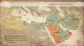
Islamic Expansion Map Clip Art Set {Messare Clips and Design}
Messare Clips and Design
1.4k Followers
Grade Levels
PreK - 12th, Higher Education, Adult Education, Homeschool, Staff
Subjects
Resource Type
Formats Included
- Zip
Pages
18 pages
Messare Clips and Design
1.4k Followers
Description
Islamic Expansion Map Clip Art Set contains 18 individual high resolution graphics (2000px images).
This includes label variations for the included maps:
Version 1: Includes military campaign arrows
Version 2: Military campaign arrows removed
Version 3: The maps keep the major city labels but no other markings.
There is one region map with no labels (Black and White)
A sample of most images viewable in the thumbnails and proofs.
This map is designed to depict:
The Islamic world under Muhammad, 622-632
The territory added by the first four Caliphs, 632-661
and the territory added by Umayyad Caliphs, 661-750
The map depicts major military campaign that began from Mecca and Medina.
One color map in this set depicts the modern borders as they relate to the Islamic expansion to allow visualization of the geography.
Email me direct at:
MessareClipsandDesign@gmail.com
See related set:
Click to view the Maps of the Mediterranean!
Click to view the Maps of Europe!
Click to view the Maps of the Africa!
Click to view the Maps of the Middle East!
Stay connected:
MCD on Facebook
MCD on Pintrest
MCD Clip Art TERMS OF USE.
Total Pages
18 pages
Answer Key
N/A
Teaching Duration
N/A
Report this resource to TPT
Reported resources will be reviewed by our team. Report this resource to let us know if this resource violates TPT’s content guidelines.


