
Geography of East Asia Map Practice Activities | Print and Digital | Google


- Google Drive™ folder

What educators are saying
Also included in
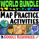 End the cycle of bored students copying from books to label maps! Your classes will think critically with these engaging practice activities. First, they answer geography questions by analyzing various physical & political maps covering 11 different world regions. Then, a drag & drop challenPrice $55.00Original Price $60.50Save $5.50
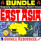 An engaging BUNDLE of resources exploring East Asia! The guided lessons are FUN for students & the 5-E teaching model is easy for you to use! Print & interactive, digital versions of the materials are included. Made for traditional in-class learning or digital 1:1 classrooms. Everything youPrice $53.00Original Price $58.00Save $5.00
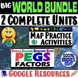 This BUNDLE includes 2 UNITS that will enrich your World Geography and Cultures curriculum all-year long! The lessons are ENGAGING for students & the guided teaching model is EASY for you to use!Examine various world regions by completing map challenges and exploring their PEGS factors (PoliticaPrice $128.00Original Price $140.50Save $12.50
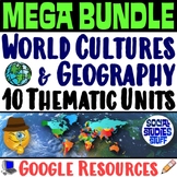 This MEGA BUNDLE includes 10 UNITS to build and enrich your World Geography and Cultures curriculum! The lessons are ENGAGING for students & the guided teaching model is EASY for you to use! The practice activities challenge your classes to think critically while mastering core concepts. Each rePrice $350.00Original Price $380.50Save $30.50
 This fun, low-prep, 6-week enrichment course curriculum includes a pacing calendar and all lesson materials to make your teacher-life easy! Everything you need is included! The World Map1. Where in the World? Mental Map Lesson2. What am I? Mapping Activity3. Torn World Map Project4. Evaluate: StudyPrice $65.00Original Price $70.00Save $5.00
Description
End the cycle of bored students copying from books to label maps! Your classes think critically with these digital, interactive, geography activities. First, students answer questions about East Asia by analyzing various physical & political maps of the region. Then, a drag & drop challenge assesses their learning of the locations. This resource also includes a printable worksheet that takes labeling maps to the next level! They create a map using only absolute & relative location clues. Easy-to-follow directions make these activities a fun way to integrate mapping into your curriculum! Your purchase has print & interactive, digital versions of the materials. Made for traditional in-class learning or digital 1:1 classrooms. Everything you need is included!
Your Purchase Includes Google Resources:
- 5 Digital, Interactive Map Activities
- Printable Map Worksheet
- "Where is it?" Clues Worksheet
- Answer Keys
- Teacher Reference Guide
Locations Covered:
- China, Japan, Taiwan, Mongolia, North Korea, South Korea, Russia, Hong Kong, Mongolian Plateau, Gobi Desert, Taklimakan Desert, North China Plain, Sea of Japan, South China Sea, East China Sea, Yellow Sea, Yangtze River, Xi River, Yellow River, Pacific Ocean, Kunlun Mountains, Altay Mountains, Manchurian Plain, Korean Peninsula, Himalaya
Aligned with Social Studies Standards: CCSS, TEKS, ELPS, and NCSS
Microsoft versions of the resources are also available in my store:
Geography of East Asia Map Practice Activities | Print and Digital | Microsoft
Follow My Store!
- Click “follow me” under Social Studies Stuff on the top of the page. You will be the first to know when I post new products & throw sales.
Click the link below to find more unique & fun lessons! Thank you!
