Geography - The World in Spatial Terms (Map Skills)
The Learning Store
488 Followers
Grade Levels
1st - 2nd
Subjects
Resource Type
Formats Included
- PDF
Pages
264 pages
The Learning Store
488 Followers
What educators are saying
This is a solid unit to introduce students to how their communities change over time. It was a perfect way to prepare my class to meet our SS standards.
Social Studies is not mu strongest area. But this unit helps me to provide valuable information to my kiddos. The activities and posters great and it was nice that the maps were provided in both colored and black and white options.
Description
This two week unit teaches children to understand the world in spatial terms using maps, globes, foldables, and many engaging activities – several are differentiated.
This unit includes:
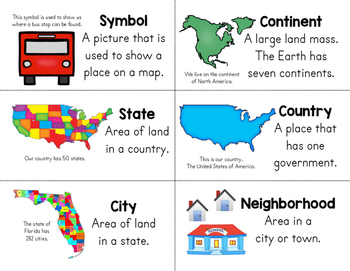
Vocabulary Cards – Color and Black & White
KWL Chart
Color, Cut, & Create Booklets (differentiated)
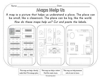
Maps Help Us – Identify & Explain (differentiated)
Different Kinds of Maps - Read & Write
Different Kinds of Maps – Foldable
Parts of a Map – Instructional Posters
Map Skills – Color & Draw by Instructions
Practice Using a Compass Rose (differentiated)
A Map of My School – Create and Label
Water and Land – Color to Label
Compare & Contrast Maps & Globes – Venn Diagram
How To Use Maps & Globes – Writing Foldable
Features of a Globe – Posters & Labeling Activity
The World Map – Posters & Labeling Activity
Regions of the USA – Coloring by Instruction
Physical Features – Posters & Labeling
Climate – Foldable
Sequencing Size Activity (one for each state)
Where In the World Am I? – Foldable (one for each state)
*Posters are in color and black & white
Standards addressed in this unit:
-describe a map as a representation of a space, such as the classroom, the school, the neighborhood, town, city, state, country, or world
-identify key elements (compass rose, title, key with symbols) of maps and globes
-identify cardinal directions (north, east, south, west) and apply them to maps
-construct a basic map using key elements including cardinal directions and map symbols
-create and use simple maps such as maps of the home, classroom, school, and community
-identify a variety of physical features using a map and globe
-define and give examples of a continent, mountain, river, lake, and ocean
-define and locate the North and South Poles and the equator
-locate on a map the student's local community, state, the Atlantic Ocean, Pacific Ocean, the Great Lakes, and the Gulf of Mexico.
-describe how location, weather, and physical environment affect the way people live in our community
Like my store on Facebook for notifications of FREEBIES and GIVEAWAYS!
The Learning Store Facebook Page
Do you want to earn credit toward your next purchase on TpT? After downloading, come back to leave a review. I have placed a link on the second page of the unit to make it quick and easy for you ;)
Make sure to click the little green star at the top of the page to follow my store for updates on new products and freebies!
Other products in my store you might like:
Civics and Government
Economics: Goods/Services, Wants/Needs, Making Choices, Saving/Spending
Consonant, Vowel, and Phonics Practice
Back to School Book Bundle
FREE Patriot Day
FREE Wants and Needs
FREE Halloween Activity Pack
Chronological Thinking
Primary Sources
Library Skills
FREE St. Patrick’s Day Activity Pack
Total Pages
264 pages
Answer Key
Included
Teaching Duration
2 Weeks
Report this resource to TPT
Reported resources will be reviewed by our team. Report this resource to let us know if this resource violates TPT’s content guidelines.


