
Europe Geography, History, Governments, Economies, and Cultures Presentation


Middle School History and Geography
4.3k Followers
Grade Levels
5th - 8th
Resource Type
Standards
CCSSRH.6-8.7
Formats Included
- Zip
- Google Apps™
Pages
48 pages
Middle School History and Geography
4.3k Followers

Includes Google Apps™
The Teacher-Author indicated this resource includes assets from Google Workspace (e.g. docs, slides, etc.).
Also included in
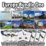 This Europe bundle covers Western Europe and includes the following products:Europe PresentationEurope WorksheetBelgium PresentationBelgium WorksheetFrance PresentationFrance WorksheetIreland PresentationIreland WorksheetNetherlands PresentationNetherlands WorksheetPortugal PresentationPortugal WorkPrice $15.00Original Price $30.00Save $15.00
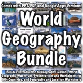 This bundle includes over 100 world geography products. Several products that follow a similar format to products in the bundle are available for free if you want to check them out, including:Introduction to World Geography PresentationIntroduction to World Geography WorksheetUnited States GeographyPrice $135.00Original Price $270.00Save $135.00
Description
This Europe presentation (in PowerPoint and Google Slides) has 48 slides and provides an overview of Europe's geography, history, governments, economies, and cultures.
Includes:
- Geography: 20 slides
- History of Europe: 7 slides
- European governments: 5 slides
- Flag (European Union): 1 slide
- European economies: 4 slides
- European cultures: 5 slides
- Miscellaneous: 5 slides
A worksheet that can be used with this presentation can be found here: Europe Worksheet.
A link to download a version formatted for Google Slides is included.
This presentation can be used with the free "Introduction to World Geography" presentation in my store. I try to keep each slide informative and concise.
Related products:
- Europe Bundle One - Western Europe
- Europe Bundle Two - Central and Eastern Europe
- Europe Bundle Three - Northern Europe
- Africa Bundle
- Asia Bundle
- North America Bundle
- Oceania/Antarctica Bundle
- South America Bundle
- World Geography Bundle
- Europe Presentation
- Europe Worksheet
- Austria Presentation
- Austria Worksheet
- Belgium Presentation
- Belgium Worksheet
- Denmark Presentation
- Denmark Worksheet
- Finland Presentation
- Finland Worksheet
- France Presentation
- France Worksheet
- Germany Presentation
- Germany Worksheet
- Greece Presentation
- Greece Worksheet
- Hungary Presentation
- Hungary Worksheet
- Iceland Presentation
- Iceland Worksheet
- Ireland Presentation
- Ireland Worksheet
- Italy Presentation
- Italy Worksheet
- Netherlands Presentation
- Netherlands Worksheet
- Norway Presentation
- Norway Worksheet
- Poland Presentation
- Poland Worksheet
- Portugal Presentation
- Portugal Worksheet
- Russia Presentation
- Russia Worksheet
- Spain Presentation
- Spain Worksheet
- Sweden Presentation
- Sweden Worksheet
- Switzerland Presentation
- Switzerland Worksheet
- Ukraine Presentation
- Ukraine Worksheet
- The United Kingdom Presentation
- The United Kingdom Worksheet
Total Pages
48 pages
Answer Key
N/A
Teaching Duration
N/A
Report this resource to TPT
Reported resources will be reviewed by our team. Report this resource to let us know if this resource violates TPT’s content guidelines.
Standards
to see state-specific standards (only available in the US).
CCSSRH.6-8.7
Integrate visual information (e.g., in charts, graphs, photographs, videos, or maps) with other information in print and digital texts.
Reviews
Questions & Answers
4.3k Followers
