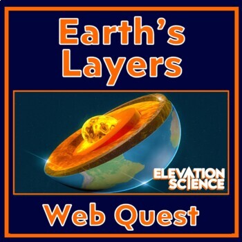
Earth's Layers Activity Earth's Interior Webquest with Google Docs Version
Elevation Science
638 Followers
Grade Levels
6th - 9th
Subjects
Resource Type
Standards
CCSSRST.6-8.4
CCSSRST.6-8.7
NGSSMS-ESS2-3
NGSSHS-ESS2-3
NGSSHS-ESS2-1
Formats Included
- PDF
- Google Apps™
- Webquests
Pages
4 pages
Elevation Science
638 Followers

Includes Google Apps™
The Teacher-Author indicated this resource includes assets from Google Workspace (e.g. docs, slides, etc.).
What educators are saying
This was a great resource! My students were able to work through it on their own, for the most part. It was engaging and educational!
This was the perfect activity to accompany my geology unit. I wanted an additional resource, and this fit the bill.
Description
GOOGLE DOCS and PRINT VERSION INCLUDED! This Earth's layers activity is a self-guided lesson that covers the crust, mantle, and core.
The worksheet provides a structured format for students to get the most out of several different websites and online images.
In this activity, students will:
- Label a diagram of Earth's layers
- Understand the differences between oceanic and continental crust
- Learn about lithospheric tectonic plates and the asthenosphere
- Get an introduction to plate boundary types
- Interpret graphs and maps on crust depth, earthquakes, and tectonic plates
- Answer questions about a brief video
- Discover the most recent earthquakes of Earth's crust
- Answer follow-up analysis questions
Teacher Notes:
- Answer key included.
- Please note that this resource is not editable.
- Link to the Google Docs version is provided in the downloadable PDF.
You May Also Be Interested In:
Please consider clicking HERE to follow Elevation Science on TPT!
Total Pages
4 pages
Answer Key
Included
Teaching Duration
N/A
Report this resource to TPT
Reported resources will be reviewed by our team. Report this resource to let us know if this resource violates TPT’s content guidelines.
Standards
to see state-specific standards (only available in the US).
CCSSRST.6-8.4
Determine the meaning of symbols, key terms, and other domain-specific words and phrases as they are used in a specific scientific or technical context relevant to grades 6–8 texts and topics.
CCSSRST.6-8.7
Integrate quantitative or technical information expressed in words in a text with a version of that information expressed visually (e.g., in a flowchart, diagram, model, graph, or table).
NGSSMS-ESS2-3
Analyze and interpret data on the distribution of fossils and rocks, continental shapes, and seafloor structures to provide evidence of the past plate motions. Examples of data include similarities of rock and fossil types on different continents, the shapes of the continents (including continental shelves), and the locations of ocean structures (such as ridges, fracture zones, and trenches). Paleomagnetic anomalies in oceanic and continental crust are not assessed.
NGSSHS-ESS2-3
Develop a model based on evidence of Earth’s interior to describe the cycling of matter by thermal convection. Emphasis is on both a one-dimensional model of Earth, with radial layers determined by density, and a three-dimensional model, which is controlled by mantle convection and the resulting plate tectonics. Examples of evidence include maps of Earth’s three-dimensional structure obtained from seismic waves, records of the rate of change of Earth’s magnetic field (as constraints on convection in the outer core), and identification of the composition of Earth’s layers from high-pressure laboratory experiments.
NGSSHS-ESS2-1
Develop a model to illustrate how Earth’s internal and surface processes operate at different spatial and temporal scales to form continental and ocean-floor features. Emphasis is on how the appearance of land features (such as mountains, valleys, and plateaus) and sea-floor features (such as trenches, ridges, and seamounts) are a result of both constructive forces (such as volcanism, tectonic uplift, and orogeny) and destructive mechanisms (such as weathering, mass wasting, and coastal erosion). Assessment does not include memorization of the details of the formation of specific geographic features of Earth’s surface.


