
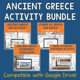
Ancient Greece Map Activity for PDF and Google Drive | Geography Activity


- Google Drive™ folder
- Internet Activities

What educators are saying
Also included in
 These interactive Ancient Greece Activities are the perfect supplement to your textbook or your existing school curriculum about Ancient Greece! This bundle includes several engaging and no-prep activities from our complete Ancient Greece unit bundle that will excite your students and add some variePrice $10.50Original Price $14.00Save $3.50
 Ready to plan out your entire Ancient Greece unit with one click? This Ancient Greece Unit Bundle has absolutely EVERYTHING you need to teach about Ancient Greece, whether you are a new teacher starting from scratch, a teaching veteran looking to mix things up, or someone who wants to both engage thPrice $65.97Original Price $92.50Save $26.53
 This epic collection of Ancient Civilizations resources will provide you with a whole semester’s worth of lesson plans and engaging activities at our biggest discount of 40% off! Packed with word walls, vocabulary practice, slideshows, bell ringers, printable timelines, unit tests, printable activitPrice $184.97Original Price $305.00Save $120.03
Description
This printable and digital Ancient Greece Map Activity goes beyond a traditional mapping activity and involves inquiry and higher-order thinking! In this engaging geography activity, students are given a list of 15 different geographical locations from Ancient Greece, and they must first sort them into different categories. These categories include city-states, islands, mountains, and more.
After students have sorted the locations, they will place them on a map, either by labeling them on the paper-based map or using the moveable tiles on the digital map. Students will then use their maps to answer the following question: "How might natural barriers, like mountains or bodies of water, have contributed to the development of different cultures throughout the city-states of Ancient Greece? List at least 3 ideas."
This Ancient Greece Geography Activity includes the following components:
- Teacher Guide (PDF)
- Printable Map Activity (2 pages, PDF)
- Digital Map Activity (Google Slideshow with 4 slides and editable text)
- Answer Keys for both versions of the activity
Please note that to complete this activity, students will need to look up the locations using websites (like Google Maps or Google Earth), a textbook, or some other printed maps. Answer keys are included for both the printable and digital versions of the activity.
Locations Included in this Activity: Troy, Aegean Sea, Sparta, Corinth, Pindus Mountains, Ionian Sea, Crete, Athens, Rhodes, Mount Olympus, Delphi, Mycenae, Knossos, Thebes, and the Mediterranean Sea.
Upon completing your purchase, you will click on the green button that says Add to Google Drive. Then, you will be able to find this resource in the TpT Purchases folder of your Google Drive account! If you have any technical issues, reach out to us at mrandmrssocialstudies@gmail.com or contact TPT.
Are you looking for more resources about Ancient Greece? You might like some of these:
- Ancient Greece Unit Activity Bundle (Save over 30%)
- Ancient Greece Word Wall
- Ancient Greece Vocabulary Activities for Google Drive
- Ancient Greece Unit Introduction Activity
- Ancient Greece Map Activity for PDF and Google Drive
- Minoans and Mycenaeans Inquiry Activity
- Ancient Greece Government Simulation and Slideshow
- Athens vs Sparta Statistics Sorting Activity
- Athens and Sparta Rap Battle for PDF and Google Drive
- Greek Mythology Google Slideshow and Printable Flashcards
- Greek Mythology Instagram Activity for Google Slides
- Greek Mythology Worksheet for Early Finishers
- Ancient Greece Leaders and Philosophers Job Fair
- Ancient Greece Worksheet for Early Finishers
