
Ancient Greece Map Activity- Label and Color!


- PDF
What educators are saying
Also included in
 This maps bundle offers a creative way to learn about the geography of the Ancient World! Each student will make their own, personalized maps of different global civilizations, and enhance their knowledge of each region. They will label and color their blank maps, and answer follow-up questions relPrice $9.99Original Price $16.03Save $6.04
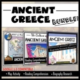 This Ancient Greece bundle is engaging, student-centered, and will provide your class with the perfect overview of early Greece! It can be used for end-of-year review, to supplement your in-depth lesson, or to enhance your students' independent learning skills. Used collectively and in its entirety,Price $5.19Original Price $6.47Save $1.28
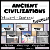 Student-Centered, Google Compatible, and requires NO PREP- great for Distance Learning! This bundle provides an overview of SIX Ancient Civilizations- China, India, Rome, Greece, Egypt, and Mesopotamia. You will receive three different resources per civilization. All resources are aligned with cuPrice $27.00Original Price $38.82Save $11.82
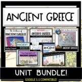 This bundle offers SIX different resources on Ancient Greece and provides a variety of styles of teaching, learning and assessment activities. This bundle is great for distance learners, to supplement deeper lessons on Ancient Greece and to provide students with multi-dimensional ways of learning. APrice $9.00Original Price $11.66Save $2.66
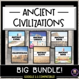 Printable, Google Classroom compatible, differentiated, and created to make your lesson planning easier! The civilizations that this bundle is centered around are: Mesopotamia, Ancient Egypt, Ancient India, Ancient China, Ancient Greece, and Ancient Rome. Students will adapt to the uniformity of tPrice $49.95Original Price $76.46Save $26.51
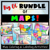 Humans love coloring- tap into your students' interests and apply it to your Social Studies and Geography lessons! 21 different map activities are available and cross many different social studies topics- like American History or Ancient Civilizations. All maps are completely student-centered andPrice $27.99Original Price $37.89Save $9.90
Description
This Ancient Greece Map Coloring & Labeling Activity is a great resource to enhance your unit! Each student will make their own, personalized map of the Greek Empire, and learn about the geography and landmarks of the region. They will label and color their blank map, and answer follow-up questions related to the geography of Ancient Greece. Included is a 'Travel Brochure' project. It is a great way to connect this map activity to your lesson on Ancient Greece! In addition, this activity has Google 1:1 capability.
Included:
- Two Blank Maps (one with color in surrounding areas, one totally blank)
- Map Directions (with suggested colors to use)
- Five engaging follow-up questions
- A completed, colored map to use as a guide
- A fun concluding project- Make a Travel Brochure!
- A link to Google compatible pages
Want more student-centered resources on Ancient Greece? Try this Reading Comprehension Activity - OR - this entire Student-Centered Bundle that includes this map!
Thanks, and please provide feedback! Simply go to "My Purchases" in your account, find this resource, and click the text to provide feedback! Benefits? You get TpT $$ to use toward future purchases, and I get info. that is helpful for potential buyers. It's a win-win!
Check out these other MAP Resources!
