All US Regions Interactive Notebook Bundle
MrsLeFave
2.1k Followers
Description
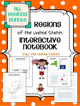
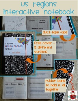
Save 20% when you buy the bundle of all five regions! This product includes interactive notebook pages for the five regions of the United States. When cut out, papers are sized to fit in a composition notebook that has been cut in half. All five regions together will almost fill a 100 page composition notebook when both sides of each page are used. Papers could also be used in a full composition notebook or spiral notebook two per page. Use all the interactive notebook pages for students to create a comprehensive resource about the United States, or use just the ones that you need to complement your social studies curriculum. Please note that the pages provide a place for students to record their learning, and are not a full unit in themselves.
The bundle also includes a bonus file with alternate pages (black & white only) to use if your curriculum divides the country into seven regions (Mid-Atlantic, Midwest, Northeast, Rockies & Plains, Southeast, Southwest, and West) instead of five. This bonus file also includes blank versions of some of the other pages from the regions. Please let me know if your curriculum divides the regions differently.
For each of the five regions, there are blank versions for students to use in both color and black & white options. The filled-in, color version is intended for teachers to create a model of the interactive notebook which can also be used as an answer key with fast facts and possible state information. Please note that answers may vary for state information based upon the curriculum in your classroom. Also, the question/connection box and the flap books are not filled-in on any version.
Most pages can be simply cut out, glued in, and then filled in. Due to the size of the product, the amount of cutting and folding has been kept to a minimum. Each region includes the following interactive notebook pages (191 total for all five regions):
• Title page for students to illustrate
• List of Contents (only use if you are using all the pages included)
• States & Capitals map
• Products & Resources flap book
• Landmarks & Physical Features flap book
• Life in the region flip book (leisure, climate, and culture)
• 2 pages for facts and information about each state in the region, these include illustrations of the state outline, state flag, state bird, and state flower (these pages are in a consistent format to increase student independence)
• Pages for 9 or more different stops in each region (Northeast: West Quoddy Head, Mount Washington, Plymouth, Boston Common, Erie Canal, New York City, Ellis Island, Hershey, Independence Hall, Nation’s Capital / Southeast: Everglades, Cape Canaveral, Jamestown, Appalachia, Memphis, New Orleans, Gulf of Mexico, Natchez, Montgomery / Midwest: St. Louis, Farm State of Iowa, Dodge City, Mount Rushmore, Soo Locks, Detroit, O'Hare Airport, Wrigley Field, and Mall of America / Southwest: Monument Valley, Four Corners, Phoenix, Hoover Dam, Grand Canyon, copper mining, Carlsbad Caverns, El Paso & Ciudad Juarez, San Antonio, Austin, Trail of Tears, Guthrie / West: Lolo Pass, Yellowstone National Park, Leadville, Hollywood, Central Valley, Columbia River Gorge, Tacoma, Anchorage, Honolulu)
• Essential Questions page(s) for the region as a whole
States included in each region are listed below:
Northeast: Connecticut, Delaware, Maine, Maryland, Massachusetts, New Hampshire, New Jersey, New York, Pennsylvania, Rhode Island, and Vermont
Southeast: Alabama, Arkansas, Florida, Georgia, Kentucky, Louisiana, Mississippi, North Carolina, South Carolina, Tennessee, Virginia, West Virginia
Midwest: Illinois, Indiana, Iowa, Kansas, Michigan, Minnesota, Missouri, Nebraska, North Dakota, Ohio, South Dakota, Wisconsin
Southwest: Arizona, New Mexico, Oklahoma, Texas
West: Alaska, California, Colorado, Hawaii, Idaho, Montana, Nevada, Oregon, Utah, Washington, Wyoming
Free cover - 3 different versions in color and black & white:
FREE US Regions Interactive Notebook Covers
To view individual previews of each region included in the bundle, please visit those product pages:
US Northeast Region Interactive Notebook
US Southeast Region Interactive Notebook
US Midwest Region Interactive Notebook
US Southwest Region Interactive Notebook
US West Region Interactive Notebook
Do not buy the individual regions if you purchase the bundle! They are the same as what is included in the bundle. If you buy 4 of my individual Region Interactive Notebook products, please email me with your TpT username and date of purchase. I will then send you the rest of what is included in the full bundle.
Please check out the preview to ensure that the product will meet your expectations – note that the preview file includes images of all pages of the blank, black & white version. Individual region product previews also include images of the filled-in, color version. If you have any questions or comments, please contact me at MrsLeFave@gmail.com. Please visit my TpT store for additional products, or follow me on Pinterest.
Thank you!
Mrs. LeFave
Total Pages
Answer Key
N/A
Teaching Duration
N/A
Report this resource to TPT
Reported resources will be reviewed by our team. Report this resource to let us know if this resource violates TPT’s content guidelines.


