
Africa Worksheet


Middle School History and Geography
4.3k Followers
Grade Levels
5th - 8th
Subjects
Resource Type
Standards
CCSSRH.6-8.7
Formats Included
- Zip
- Google Apps™
- Easel Activity
Pages
1 page
Middle School History and Geography
4.3k Followers

Includes Google Apps™
The Teacher-Author indicated this resource includes assets from Google Workspace (e.g. docs, slides, etc.).
Easel Activity Included
This resource includes a ready-to-use interactive activity students can complete on any device. Easel by TPT is free to use! Learn more.
Also included in
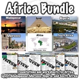 This Africa bundle includes the following products:Africa PresentationAfrica WorksheetEgypt PresentationEgypt WorksheetMadagascar PresentationMadagascar WorksheetMorocco PresentationMorocco WorksheetNigeria PresentationNigeria WorksheetSouth Africa PresentationSouth Africa WorksheetPDFs, PowerPointsPrice $16.00Original Price $24.00Save $8.00
 This bundle includes over 100 world geography products. Several products that follow a similar format to products in the bundle are available for free if you want to check them out, including:Introduction to World Geography PresentationIntroduction to World Geography WorksheetUnited States GeographyPrice $135.00Original Price $270.00Save $135.00
Description
This Africa worksheet contains 21 questions and a short response for students to share something about Africa they found interesting.
The worksheet was designed to go along with a presentation that can be found here: Africa PowerPoint, but it can be used separately as well.
A link to download a version formatted for Google Slides is also included.
Related products:
You may also like:
Total Pages
1 page
Answer Key
Included
Teaching Duration
N/A
Report this resource to TPT
Reported resources will be reviewed by our team. Report this resource to let us know if this resource violates TPT’s content guidelines.
Standards
to see state-specific standards (only available in the US).
CCSSRH.6-8.7
Integrate visual information (e.g., in charts, graphs, photographs, videos, or maps) with other information in print and digital texts.
Reviews
Questions & Answers
4.3k Followers
