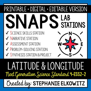
4-ESS2-2 Latitude and Longitude Lab Activity | Printable, Digital & Editable
- Zip
- Google Apps™

Also included in
- SAVE 50% by purchasing ALL my Earth Science Lab Stations Activities!About this ProductSNAPs Lab Stations Activities require students to use science, math, literacy, problem-solving and engineering skills. They are designed to enhance students' understanding of scientific concepts and help students aPrice $217.00Original Price $434.00Save $217.00
- SAVE MORE THAN 50% by purchasing ALL my Earth, Life, Physical & Nature of Science Lab Stations Activities!About this ProductSNAPs Lab Stations Activities require students to use science, math, literacy, problem-solving and engineering skills. They are designed to enhance students' understandingPrice $500.00Original Price $1631.00Save $1131.00
- SAVE 30% by purchasing ALL my Mapping Earth Lab Stations Activities!About SNAPs Lab Stations ActivitiesSNAPs Lab Stations require students to use science, math, literacy, problem-solving and engineering skills. They are designed to enhance students' understanding of scientific concepts and help studPrice $14.70Original Price $21.00Save $6.30
- Save 40% by purchasing ALL my Mapping Earth teaching materials!Important Notes:• Download a FREE Unit Bundle to learn more about all my products.• Save $$$ with the Earth Science Complete Curriculum• Save $$$$ with the Integrated Science Complete Curriculum• Consider Daily Lessons as an economical aPrice $45.30Original Price $75.50Save $30.20
- SAVE 30% by purchasing ALL my NGSS Aligned Fourth Grade SNAPs Lab Stations Activities!About this ProductSNAPs Lab Stations Activities require students to use science, math, literacy, problem-solving and engineering skills. They are designed to enhance students' understanding of scientific concepts aPrice $112.70Original Price $161.00Save $48.30
- About this Product• This resource includes NGSS Aligned lessons and SNAPs labs for 4th Grade• This bundle includes the MOST ESSENTIAL lessons and labs to align your classroom to NGSS• Some activities are not aligned to 4th Grade NGSS but are included for completeness (*)• The activities work in clasPrice $213.75Original Price $427.50Save $213.75
Description
About SNAPs Lab Stations Activities
SNAPs Lab Stations Activities require students to use science, math, literacy, problem-solving and engineering skills. They are designed to enhance students' understanding of scientific concepts and help students apply scientific ideas to the real world. Each station activity promotes skills so to develop students into proficient and competent scientific thinkers.
SNAPs lab activities have five components:
• Science Skills Station to develop science skill proficiency
• Narrative Station to build science literacy
• Assessment Station to evaluate learning and understanding
• Problem-Solving Station to foster engineering design
• Synthesis Station and Project to inspire higher-order learning
Important Notes:
• Download the FREE SNAPs Setup Guide for best practices, signage and editable rubrics
• Download a FREE SNAPs Lab Stations Activity to learn more about my SNAPs labs
• Save $$ with the NGSS Science Lab Stations Bundle ($500 for 200+ labs)
• Save $$$ with the Earth Science Complete Curriculum
• Save $$$$ with the Integrated Science Complete Curriculum
*********************************************************************************************************
DIGITAL LABORATORY – DISTANCE LEARNING & DIGITAL CLASSROOMS
• This lab is offered in a digital format to support digital classrooms & distance learning.
• The digital lab activity is designed to work with Google Slides and Microsoft PowerPoint
• The digital lab activity CANNOT be edited. However:
- Students can manipulate text boxes
- Students can create tables, graphs and diagrams
- Students can insert images and drawings
GOOGLE FORM ASSESSMENT STATION
• The assessment station is offered as a self-grading Google Form.
• Questions are all short answer and are 100% editable.
• Suggestions for use are included in the download.
DISTANCE LEARNING COMPATIBILITY
SNAPs lab activities are rated for their ease with distance – independent learning. Refer to the preview for more information about how well this laboratory works in a fully digital classroom and with distance learning.
*********************************************************************************************************
EDITABLE DOCUMENTS
This download includes an editable word document (docx file) of all lab components:
• Pre-Lab and Post-Lab Activities
• The Lab Overview
• Lab Station Activities and Questions
• Directed Synthesis Project (when applicable)
Important Notes:
• Diagrams, illustrations, tables and graphs essential to lab activities are included
• Illustrative clipart is NOT included
• Editable documents and rubrics are included with the FREE SNAPs Setup Guide
Editable files allow you to:
• Edit the scope of the activities so to suit your students’ needs
• Edit the materials required based on resource availability
• Create single-period “mini-labs” using activities at the individual skills stations
*********************************************************************************************************
The activities at each station in this lab are detailed below.
Latitude and Longitude Lab Stations Activity Learning Objectives:
1. Identify important lines of latitude and longitude on a map.
2. Determine the latitude and longitude of a place on a map.
3. Use a scale to find the distance between locations on a map.
Science Skills Station
Students will use maps to determine the latitude and longitude of locations in a region. They will use maps to determine the distance between specific places on a map using a scale.
Narrative Station
Students will read an informational text about important lines of latitude and longitude. They will draw the lines on a world map to demonstrate where they are located relative to each other and major regions of the world.
Assessment Station
At this station, students will answer questions about key terms and ideas relating to latitude, longitude and mapping Earth. Students must employ lower, mid and higher order thinking skills to answer these questions.
Problem-Solving Station
Students will create a coordinate system on a map to help navigate a route between multiple places. Students will use the coordinate system to plan the route. They will use a scale to determine the distance traveled along that route and approximate how long the journey will take.
Synthesis Station
Students will compose a CER (claim-evidence-reasoning) report to summarize the lab. Students are provided the claim statement and must support the claim with observations, data and other information gathered in the lab. Students will explain how the evidence supports the claim using scientific reasoning.
Synthesis Project
Students will have a choice of 11 projects. Refer to the SNAPs Lab Stations Best Practices and Setup Guide for directions and suggestions on how to conduct the project.
This download includes:
• A pre-lab assignment and post-lab reflection
• Directions and questions for each lab station
• Student recording sheets
• Teacher Key
Additional Materials Required:
1 Set of Colored Pencils
5 Rulers
A folding, physical map (of any state or country)
NEXT GENERATION SCIENCE STANDARDS
This laboratory satisfies NGSS 4-ESS2-2. It combines the three dimensions of science learning - science and engineering practices, disciplinary core ideas and crosscutting concepts - to meet the standard. This lab also makes interdisciplinary connections to STEM, Math CCSS and ELA CCSS to build the appropriate skills.
TERMS OF USE
• All rights reserved by Stephanie Elkowitz.
• This product is to be used by the original purchaser only.
• Intended for classroom and personal use only.
• Copying for more than one teacher, classroom, department, school, or school system is prohibited.
• This product may not be distributed or displayed digitally for public view.
• Failure to comply is a copyright infringement and a violation of the Digital Millennium Copyright Act (DMCA).

