
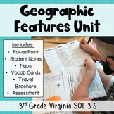
3rd Grade Geography - Label Continent Maps with Geographic Features - SOL 3.6


- Zip
What educators are saying
Also included in
 Get all of my third grade geography resources in one bundle and save money! This geography unit is aligned to VA SOL 3.6. You will get everything you need to rock this unit, including a PowerPoint presentation, student notes, maps, vocabulary matching cards, a travel brochure project, and a traditioPrice $15.25Original Price $17.00Save $1.75
Description
Need maps that focus on third grade Virginia standards? Look no further! These printable and digital maps focus exclusively on the geographic features third graders in Virginia need to know in North America, South America, Europe, Asia, and Africa. Use these maps for instruction, whole group practice, student notes, or assessment. Keep reading to get all the details!
Printable Maps: Students will follow the directions on each page to add geographic features to the maps. For example, "Draw a blue line to form the Nile River". Shrink down the pages and students can glue them into interactive notebooks! All students need is crayons, markers, or colored pencils to complete the maps.
Digital Maps:
- The first version of maps closely mimics the printable version so the teacher can model where landforms go and students can follow along with their own papers
- The second version of maps is intended for whole group practice. It features a key (rather than a checklist) and students will use the drawing tool in powerpoint to draw or color in bodies of water and deserts. Students can click and drag the triangles from the Map Legend to form mountains on the map.
Geographic Features Included:
- North America: Appalachian Mountains, Rocky Mountains, Great Lakes, Mississippi River, Rio Grande
- South America: Andes Mountains, Amazon Rainforest, Amazon River
- Europe: Alps Mountains, Mediterranean Sea, Italian Peninsula
- Asia: Gobi Desert, Himalaya Mountains,
- Africa: Atlas Mountains, Sahara Desert, Nile River
Check out my FREE sample of the North America map here.
**The map of Europe includes neighboring continents to help students better visualize the boundaries of the Mediterranean Sea and see how it is "intercontinental".
If you are looking for more SOL 3.6 resources, check out my SOL 3.6 Geographic Features Powerpoint and Notes
TERMS OF USE - © VA SOL Superstars
This item is a paid digital download from my TpT store
https://www.teacherspayteachers.com/Store/Va-Sol-Superstars
As such, it is for use in one classroom only. This item is also bound by copyright laws. Redistributing, editing, selling, or posting this item (or any part thereof) on the Internet are all strictly prohibited without first gaining permission from the author. Violations are subject to the penalties of the Digital Millennium Copyright Act. Please contact me if you wish to be granted special permissions!
