
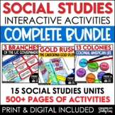
13 Colonies Map and Activities | Colonial America Unit | DIGITAL & PRINTABLE


- Zip
- Google Apps™

What educators are saying
Also included in
 Social Studies Class will be your students' favorite time of the day with this popular, engaging bundle of activities, including foldables, timelines, mini books, bulletin boards, and more! The hands-on units in this bundle will help your students learn and understand the events and concepts of AmerPrice $59.95Original Price $79.00Save $19.05
Description
Your students will love learning about the 13 Colonies maps and geography with this interactive packet. These hands-on activities, like maps, foldables, bulletin board, and more, will help your students learn and understand the geography and regions of Colonial America!
Click the PREVIEW above to see everything included in this resource!
This resource includes both a printable version AND a digital version. The digital version is on Google Slides and is perfect for distance learning, independent work, centers, and more!
The hands-on, engaging packet has 4 components:
• Mini Maps for Notebooks: Includes maps of 13 American Colonies, Southern Colonies, Middle Colonies, New England Colonies.
• Interactive Notebook Foldables: Printable foldables for each of 13 colonies can be used for student note-taking and learning the duties of each job.
• Interactive Notebook Sorting Activity: Students will enjoy creating and using this activity right in their notebooks and will master the geography of the 13 Colonies in no time!
• Large Interactive Bulletin Board: Includes bulletin board header, maps, 13 colonies labels, answer key, and photo directions. Use the pieces to create a bulletin board or classroom activity to help students master classifying the 13 colonies according to New England, Middle, or Southern regions.
The packet also includes a teacher-direction sheet with photo examples of the projects in use in the classroom. It is very clear and easy-to-use; basically just print and go! My students loved these activities; I think yours will, too!
You may also be interested in these other easy to use Social Studies units:
Maps, Continents, and Landforms
Colonial America - Jobs and Trades
The Civil War - Events Leading to the War
Elections and the Voting Process
Don't forget that leaving feedback earns you points toward FREE TPT purchases. I love that feedback!
Also, FOLLOW ME and be notified when new products are uploaded. New products are always 50% off for the first 24 hours they are posted. It pays to follow me!
As always, please contact me with any questions!
Thank you so much,
Shelly Rees
